Thursday 18 August 2011

Vuelta a España 2011- the first 19 stages previewed

Vuelta a España - 2011 Index
Stage Guides

Stage 3: Petrer - Totana (22nd August)

Stage 7: Almadén - Talavera de la Reina (26th August)


Stage 8: Talavera de la Reina - San Lorenzo de El Escorial (27th August)


Stage 9: Villacastin - La Covatilla (28th August)


Stage 10: Salamanca-Salamanca (29th August)


Stage 11: Verin - Mazaneda Ski Station (31st August)


Stage 12: Ponteareas - Pontevedra (1st September)


Stage 13: Sarria - Ponferrada (2nd September)


Stage 14: Astorga - La Farrapona (3rd September)


Stage 15: Aviles - Alto de l'Angliru (4th September)


Stage 16: La Olmeda - Haro (6th September)


Stage 17: Faustino V (Oion/Oyón)Peña Cabarga (7th September)

Stage 18: Solares - Noja (8th September)


Stage 19: Noja - Bilbao (9th September)


Stage 20: Bilbao - Gasteiz (Vitoria) (10th September)


Stage 21: Jamara Circuit - Madrid (11th September)


"Without doubt the most thorough Tour de France Stage 17 Preview..." (Dolomedia) (We'll try to do the same for the Vuelta, too - JO)

Vuelta a España - Stage 12 Preview

Corpus Christi, Ponteareas.
Stage Map: click here
Stage Profile: click here
More Previews: click here

Stage 12 is a transition, really, designed to get the Vuelta from one set of mountains to the ones climbed tomorrow in a more interesting way than loading them all onto the team buses and driving up the motorway. As this is the Vuelta, and the organisers seem to have deliberately made sure there aren't any easy stages, there are two fair-sized Category 3 climbs and four little uncategorised hills between 150-200m stirred into the mix too. All in all, it's a race for the puncheurs - too hilly for the flat-out rockets, while the grimpeurs will be saving their legs for tomorrow's mighty Cat 1 Puerto de Ancares - or even for a domestique who feels strong enough whilst his team captain concentrates on getting through unscathed. Whatever happens, expect an early breakaway; probably one composed of little-known riders keen to reveal themselves as the grimpeurs of years to come.

Castro de Trona, ancient defenses
Ponteareas is acting as a stage town for the second time; it hosted the start of Stage 16 in 1987, won by Frenchman Dominique Arnaud. It was the birthplace of Delio Rodriguez (1916-1994), whose record of 39 Vuelta stage wins set between 1936 and 1950 remains the all-time record. His younger brother Emilio (1923-1984), also born in the town, was a successful rider too, winning the mountains classifications in the Vuelta and several other races; as was Alvaro Pino in 1956, winner of five Vuelta stages. This is a town with cycling in its blood, so expect a party atmosphere - and if there's one thing Ponteareanos know how to do, it's celebrate: the annual Corpus Christi fiesta, in which they use millions of flowers to carpet entire streets and squares, has been officially declared to be of International Tourist Interest by the Spanish Ministry of Industry. Nearby is the Castro de Trona, the remains of an ancient defensive construction or village. Some of the rocks forming the remains are carved with mysterious petroglyphs. There is also a medieval bridge, believed to be the source of the town's name.

Pena dos Namorados, the Rock of Love, Pontaereas: huge
boulders each weighing many tonnes stacked atop one
another (presumably by glacial action). Or giants -
you never know.
The neutral zone begins on the Rúa de la Esperanza, a wide and modern thoroughfare with tall, airy buildings running along both sides. It runs sourth-east to the Plaza de Bullagal, turns right - potential for fuel spillages/puntures here - along the Av. de Constitucion and joins the Rúa de Concha Brey, running contiguously south-east past the Town Hall to a roundabout where a tight left turn sends the peloton along the Av. de Galicia towards the Rúa Real. The Rúa Real is also the N-120, which the riders will travel along after turning left at the roundabout. Three speed humps lead to another roundabout where they go straight through, coming immediately afterwards to a bridge over the Rio Tea - the bridge is wide and unlikely to create any issues, but the location is beautiful and not to be missed. Looking left, down the slow, shallow river, the medieval bridge can just be seen. The road is straight and wide, running past A Lomba, Areas, Gandara and Peso before reaching Rocha, where the real race begins after 4.8km.

The races continues along the same road, which remains poker-straight except for a sweeping left and steep (but mercifully short) climb into a wooded section between Periero and Confurco, reading 170m just before the peloton pass across a fly-over above the A-52 and begin to descend towards Cans. The rocks protruding between the trees on the hillsides above the village, at first glance natural, are the remains of fortifications dating back to the days of the . Turning west around woodland, the N-120 reaches Porriño which, just 7.2km into the race, marks the first of the day's intermediate sprints along the Calle Sequieras and Rua de Antonio Palacios - both are straight, but both have several speed humps. At the end is a sharp left at a roundabout to join the N-550 running south.
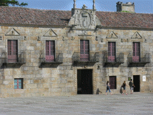
Porrino Town Hall.
The town is famous for the marshland directly to the south, which has brought added fortune to the area since, being an important resting point for migratory birds and reputedly one of the richest ecosystems anywhere in Europe, it attracts ornithologists and naturalists from far afield. Porriño was the scene of a small but very effective revolution of sorts in 377 CE: after a farmer and his family had been slaughtered by the local king, Ghrovary el Pueril (so-called because he took the throne aged 17) in return for failing to pay the punitive taxes he had levelled upon them, a band of around a hundred villagers decided it was time to act. They were soon joined by 400 commoners from the surrounding villages and, en masse, stormed the king's fortress and put him to death, thus ensuring that the nobility would thereafter treat them with respect. The town's name is believed by some to be derived - perhaps a little too circuitously for some others - from the Latin version of the king's nickname, puerīlis. Today, the town's wealth is based largely on industry and especially on the mining of pink granite - one of the nearby mines claiming to be the largest source of the material in the world. Local stone was used to construct Porriño's remarkable town hall which, rather than following the classical style shared by almost all other Spanish town halls, looks like a combination of elements taken from St. Pancras Station and Hogwarts Castle. The architect - Antonio Palacios, born here in 1872 - used a similar grand Gothic style at Madrid's Palacio de Comunicaciones, though on a scale magnitudes larger.

The road continues south, never quite making it into open countryside though the buildings become more widely spaced for a while, until it eventually meets the A-55 which has been running parallel to the right for the last few kilometres just south of Eidos. At a roundabout, the N-550 becomes the PO-510, a road heavily used by the trucks ferrying granite from the mine just to the east to the ships waiting at the ports to take it off to China, which has become by far the largest market for granito rosa Porriño, and other nations around the world; meaning that the road may prove to be hazardous due to diesel spillage - the fuel being as invisible as it is slippery on a road surface. It is, needless to say, far from the most pleasing landscape along the 2011 parcours, so it's a good thing for us that the route soon turns east and enters an area of oaks, green fields and pretty - if not especially interesting - villages; most of which just come into contact with one another, giving the distinct impression that we're really in a very large, very sparse city rather than travelling between independent communities.

After 23.1km, the peloton come to a roundabout in between Salvaterra de Miño and O Castillo and turn left onto the PO-403, now heading north. The road continues to Abelleira, encountering nothing with obvious potential to form a hazard. At Angoares is Igrexa Parroquial de San Pedro de Angoares, a church of unusually English Perpendicular appearance. It's tiny but somehow imposing and looks as though it'd have made a very grand cathedral had it have been built to a scale perhaps 30 times greater. In no time at all, the race reaches Ponteareas for a second time and passes through town back to the roundabout near the medieval bridge we saw earlier, travelling straight across and onto the PO-254 heading north-east and, 41.3km from the start, to Balneario de Mondariz. We enter along the Calle de la Constitución with its Z-bend, then turn an easy left onto the Calle Ramón Peinador which sweeps around the northern edge of town before turning south to join the Calle de Octubre leading out. There are numerous speed humps along the way.

A short way to the south from Mondariz is the Castillo
do Sobroso, dating to the 10th Century but occupying
the site of a prehistoric fort. Having been abandoned in
the 18th Century, it fell into disrepair until it was bought
by the Conde de Torrecedeira in 1923, who carried out
restorations at at his own expense until his death in 1967.
It has since passed into local government ownership and
is now open to the public.
Balneario de Mondariz has been a popular spa resort since Roman times, many traces of their presence having been discovered in the vicinity. Oddly, despite their appreciation of natural beauty and cleanliness insisted upon by their faith, the Moors didn't make their presence felt here and have left little trace, leaving the town almost forgotten until its rediscovery by the nobility from the late 13th Century. The modern town dates from the late 19th and early 20th Centuries, when there was a craze for spas and the health benefits their waters are said to bring. The most impressive building is undoubtedly the vast Palacio del Agua, a grand hotel dating to 1893. The exterior remains much as it was then, while the interior has been much modernised so that the hotel can offer everything that the sort of people who like to pay enormous sums for supplemental health therapies and beauty treatments consider necessary during a holiday.

Cyclists and other proles who require nothing more than a sink in which to wash out sweaty clothing and plenty of food during a holiday leave the town via a through-arch bridge and soon come to Mondariz where a short and narrow connecting road leads to a sharp left onto the PO-252. Having passed a large industrial site,  the road narrows to pass across a tall stone bridge before climbing towards Quintans and A Portelsa da Bouza, villages immediately west and east. The Category 3 climb of Alto de Moscoso begins 1.4km after the villages, throwing in a woodland hairpin for good measure shortly afterwards, even though the terrain isn't at all steep yet - though it does become so for a short section a little further on when it climbs a wooded slope and enters a sharp left bend which, with the trees depositing leaves onto the road, might be hazardously slippery. By the time we reach A Rua, there are superb views across the Val de Tea, which the riders won't see as they're going in the opposite direction, then the route progresses along the side of a steep slope, dropping hundreds of metres to the left and rising hundreds of metres to the right. It's a very beautiful section, easily making up for the one south of Porriño earlier. The summit, at 400m, is reached just after we pass through As Xunqueiras on a forested hill. Immediately afterwards, we descend into Moscoso.

At a junction, we turn left onto the PO-250 - not, as the road book has it, the PO-252 which ends here. This road is much wider and heads south-west, descending through beautiful countryside until it reaches Amoedo, 62km from the start of the race. The road, also known as the Carretera Redondela de Pazos, is wide and smooth and descends fairly rapidly without dangerous bends, encouraging very high speeds - until Quintana, where a very tight right-left-left combination will take a few millimetres of rubber off the brake blocks.

Redondela
We enter Redondela along the Calle de Xóan Manuel Pereira, leading us to the Plaza Ribadavia. The riders turn right at the first exit after the river (which passes underneath the Plaza) to enter the Calle Alfonso XII, which is narrow for a while before opening out into a riverside park and joining the Rúa José Antonio, which merges into the Calle General Rubin. At the end, the peloton turns right and joins the Carretera de La Coruna Tui, also known as the N-550 and, in less than a kilometre, the Av. Santa Maria. A little over 2km later, we join the PO-2901 heading for Viso and beginning to climb once again. There are two 19th Century stone and iron viaducts in the locale, the Viaducto de Madrid and Viaducto de Pontevedra. When the first of these was declared unsafe for use following completion in 1876, Pedro Floriani - one of the men responsible for its construction - climbed up it and attempted suicide by leaping off. His bid failed, leaving him paralysed for the rest of him life. Today, it is disused - the Viaducto de Pontevedra, meanwhile, is still in use.

We pass through Viso and its attractive little square, only slightly marred by some ugly 1970s houses, continuing along the PO-2901 which is now heading east to Alxán. When the road meets the PO-2908, the peloton turns left, coming presently to a roundabout where they turn sharp right to pass onto the PO-244. After 4.6km, having covered 81km from the start of the race, they reach the feeding station and the beginning of the Cat 3 climb of Alto Ponte Caldeas. Silvoso comes a short way on, the road remaining wide and smooth all the way without difficult bends all the way to the summit 88.2km from the start at 320m just past Roca. There is one of those ridiculously pretty, crystal clear streams running along the bottom of the shallow valley to the left. Roca, incidentally, being one of those tiny villages where almost all of the young people leave as soon as they possibly can, has many picturesque ruins; set off perfectly by the beautiful surroundings. It's always sad to see what must have once been a vibrant community in its death throes, but Roca is doing it in an extremely aesthetically-pleasing way. The descent is not challenging and ends at a T-junction where we turn left into Ponte Caldeas.

The bridge into the town stands high above the lazy, weedy water and, being wide, should cause no problems. The PO-532 running through to the west looks simple too, with little in the way of street furniture. Ponte Caldeas' name is believed to derive from an ancient bridge - the Ponte - and the hot sulphurous springs in the area, from the Latin caldas, scalding. Having left the Ponte Caldeas behind, the peloton reaches a roundabout near the village of Cunas and passes straight across it to find Tourón after a little under 3km. It clips the very northern tip of Buchabad, then passes a huge second-hand car dealership and repair shop - hence, possibility of fuel spillages on the road - before it travels on to Vilarchan, where a peculiar stone hórreo can be seen from the road. The stone legs supporting it some way off the ground reveal it to be a granary, but it's an unusually ornate one, looking distinctly like it belongs in a graveyard.

Igrexa de Peregrina, Pontevedra
We swing north to avoid A Reigosa, a large industrial complex home to several distribution points which will again increase the likelihood of diesel spillages, the west around an open-cast mine. Soon, the peloton reaches a crossroads and turns left, passing by various villages as it approaches Pontevedra along the Av. de Marco. There are two roundabouts immediately south of the city - at the second, having crossed a fly-over, the peloton turn right onto a narrower slip road and proceed to a third roundabout where they turn right again onto the Carretera Coruña-Tui. The Carretera becomes the Av. de Vigo, an urban street, and leads to left turn at a roundabout to access the Av. Fernandez Ladreda heading west. There are ten raised speed humps along its length and two roundabouts, making it quite a technical section. At the second roundabout, we turn right into the Calle General Rubin before turning left onto Av. Reina Victoria which initially narrows between buildings before opening out into a wide thoroughfare. Having reached a roundabout - site of Pontevedra's own answer to Manhattan's Flatiron Building which, though singularly unattractive, blocks the bullring from our sight - the parcours turns right and runs along the Rua de Alameda and takes a sharp left halfway along for the Rue de Echegaray. We pass straight over another roundabout and the road becomes the PO-308 on the other side, then carries across the Puente Barca bridge. Just to the right, still sticking out of the water, are the pylons of the old bridge.

Old stones at Combarro. The building on the
right is a horreo, a type of granary.
The bridge leads to yet another roundabout where the peloton turn left onto the Av. Barca, soon coming to a second roundabout and a left turn to join the Av. de Andurique - they're both easy corners - and continue along the PO-308 as it passes by Albar and through O Convento en route to Seara do Rio and another roundabout, going straight across. Having passed through Seca, the road follows the coastline for a while; passing by some modern sculptures that owe more than a few thanks to the megaliths erected by our Neolithic forebears. Very soon, it reaches Combarro and the peloton have to deal with a number of pedestrian crossings and speed humps before two bends lead to the harbour. Though the sleek, white yachts give the little town a modern appearance, it's actually of some antiquity as is revealed by some of the old stone buildings along the seafront.

Leaving the harbour behind, the road once again makes its way along the coast and passes through many small villages, mostly joined together to form a long, thin strip; then reaches Sanxenxo 124.4km from the start. There are many speed humps, but try to take your eyes off the racing as we pass the Nuevo Templo, a rather odd modern church with a many-tiered roof that makes it look a little like a Chinese temple as designed by Frank Lloyd Wright. The road becomes the PO-504 as it passes a roundabout at the edge of the town and carries us north-west through more villages, wide and undemanding except for a few speed humps, then ends at a T-junction on the PO-550 where we turn right. This road is flatter, straighter and even less technical than the last, forming what is very much a transitional stage - the views as we cross the bridge near Cambados coming as something of a relief. The second intermediate sprint takes place along the Av. de Galicia in the town.

Sights from Cambados
Cambados is famous for its wine, called Albariño but nicknamed the Wine of the Sea as the salty and acidic local terroir make it especially suited to seafood - something else associated with the town, with the local shellfish being highly valued by gastronomes. We follow the PO-550 as it curves to the east and runs along the Estrada de Ribadumia. After a roundabout, it changes name to the PO-300; then we turn right 90 degrees onto the Estrada de Covas de los Lobos at Vilariño and come presently to Bouciña and Covas. A short way to the south-east is the Puente Barrantes, a wide modern bridge leading onward to A Escusa and a T-junction with the PO-9305 where we turn sharply left and then right almost immediately afterwards to join the Av. Rosalía de Castro or PO-9402. Having passed under an underpass beneath the AG-41we arrive at Meis San Martino, heading north-east to go back under the same road, which becomes twistier as we approach Meis. Reaching a roundabout at O Mosterio, we turn right onto the PO-300, past Meis and continue to the PO-531 where we turn right once again. The road is wide and easy, passing under the E-1 motorway a few times on the way to Devesa where the peloton turn left to join the PO-225. The road narrows slightly as it crosses a bridge just past the junction, the again as it rounds a bend and comes to the N-550.

At the junction, the race turns right opposite the Restaurante Corinto - potentially quite a hazardous bend, being very busy and thus having a likelihood of fuel spills and/or puncture-causing detritus from vehicle collisions - bringing the peloton back onto the Carretera Coruña a Tui for the final run back into Pontevedra. At a large roundabout they take the left exit to join the Av. de Santiago de Compostela, a wide and largely straight avenue leading to the grand Puente Santiago across the Rio Lerez. To the left can be seen the new Puente de los Tirantes, absolutely unique and perhaps the most beautiful bridge constructed in Europe during the last century. On the opposite bank we reach the Av. Buenos Aires and turn left, then right at a roundabout to join the Calle de José Malvar Figueroa before a tight left to the Calle del Doctor Laureiro Crespo. The finish comes after 167.3km on the Av. de Lugo.

Puente de los Tirantes. The single tower rises from a roundabout south of the bridge.
Local legend states that Pontevedra was founded by none other than Teucer, half-brother of Ajax and nephew of King Priam, one of the Greek heroes at Troy - the town hall still bears a carved plaque with a poem making such a claim. Legends don't necessarily need to be true, of course, which is fortunate as this one has been dispelled by archaeologists who can find no trace of a settlement of any size here prior to the 1st Century BCE. The Romans built a bridge - still in use, though reconstructed in medieval times - and made it an important city, which it remained into the Middle Ages. By the 15th Century it had become one of Galicia's economic and cultural centres, the shipyards generating vast wealth and building, among others, Columbus' Santa Maria. 


Convento de San Francisco
However, in the following centuries the port began to silt up and the ship building industry failed, taking much of the city's wealth with it. Galicia as a whole entered a period of decline as the rest of Spain entered the Renaissance, the population falling due to plague and skirmishes among noble families. By the 18th Century, it was less than half what it had been three centuries previously. By 1800, it was a provincial dead-end town, locals supporting themselves by fishing and farming, often at near-subsistence level. The turn-around came towards the end of the first quarter of the century when, having drawn up new boundaries for the provinces, the Spanish chose Pontevedra to be developed as a new regional administrative centre. As such, it gained a rail station, reconnecting it to the outside world from which it had been cut off once the harbour became unusable; and the economic and cultural recovery could really begin. By the middle of the 18th Century, Pontevedra became the hub of nascent attempts to revive the Galician language which had been all but replaced by Spanish - the world's first modern book in Galician, "A Gaita Gallega," was published here in 1853. As many as a third of the population can speak it today.

Praza de Lena
Despite starting the 20th Century with enormous potential to do well, cultural and industrial progress ground to a near halt during Franco's regime, though some new industries were established during the 1960s - most of them subsequently shut down due to the terrible environmental and health damage they caused. The city waited for freedom, and began to flourish once again following the advent of democracy in 1977. New buildings were constructed, bringing health and vibrancy back to the economy. During the 1990s, the city gained its first university which now attracts students from all corners of Spain and further afield, allowing the city to benefit still further from a multicultural society.

Among the multitude of sights, Pontevedra offers the Praza da Leña with its attractive mixture of buildings of varying ages; the Puente de los Tirantes; the Convento de San Francisco and the Museo Provincial de Pontevedra which houses a collection consisting of more than 16,000 works of art.

Predictions: Continuing our long history of successful stage winner predictions - we've got one right so far this year, and that one was so obviously going to be won by Rodriguez - we're going to point the finger of doom at Sylvain Chavanel today. Why? With no high mountains nor challenging climbs along the 167.3km parcours, this is the ideal sort of stage for a strong breakaway to whack up the tempo and build up a big gap between themselves and the main group. Of course, most of them will find the going gets too tough towards the end and fall back down the road to the peloton - or even the grupetto; but Chavanel is not as most riders and can keep going...and going...and going, right to the end.

Weather: Rain! Some people who watch the Vuelta are a bit surprised that it rains in Spain, but it does - and as we'll be spending a fair bit of our time on the plain today it's going to mainly rain on the race; or the first half of it at any rate, because it ought to lighten and clear up for the last 80km. Oh well. At least it'll be cool: highs of 20C are going to feel blissfully pleasant when compared to the hellish 35C+ temperatures recorded in the first few stages. In fact, we may even see riders reaching for jackets as the roll over the tops of the two Cat 3s - the predicted 16/17C up there can feel really quite chilly during a descent when wind-chill becomes a factor. You like echelons? Well, tomorrow could be a good opportunity to see them - crosswinds all the way will vary between light to moderate, almost certainly encouraging riders to adopt the tactic during those long low altitude sections.

More 2011 Previews: click here

Ghost Bikes

Some readers will be aware that, when not writing about cycling and attempting to control our four ferrets, I've also been setting up a very loosely-organised group here in Cambridge with the aim of creating some ghost bike memorials around the city, both to commemorate our fallen friends and to increase awareness of cyclists among drivers and the need to ride safely among cyclists.

Recently, I was contacted by a journalist from the Cambridge News paper, wanting to an article on ghost bikes and the group. Initially, since the group is at present a blog, a Facebook page and a few people showing interest, I was reluctant; but agreed in the hope of spreading the word.

The article was published today and can be read here. My thoughts upon it are here.

Tuesday 16 August 2011

Vuelta a España - Stage 11 Preview

Stage 11 finishes at 1750m above sea level in the
Manzaneda ski resort.
Stage Map: click here
Stage Profile: click here
More Previews: click here

Let's hope all the riders got plenty of relaxation and visits to the masseur during yesterday's rest day, because Stage 11 is a killer - there's a 450m climb in the first 15km, which ought to put paid to the first few breakaway attempts unless an elite pack of climbers fancy giving it a go, then it's up and down all the way to a flat 15km starting at the 107k point and then, from 138km, it's a Category Especial (the Vuelta's version of Hors Categorie) up the forbidding slopes of Montaña Manzaneda with gradients approaching 11% in places. It's a demanding parcours in other ways, too - no more of those long and straight sections we saw in Stages 9 and 10, this one wiggles about all over the place. It's just possible that today will allow us our first glimpse of the rider who'll be wearing the Red Jersey for the celebrations in Madrid.

Castillo de Monterrey.
Situated right on the Portuguese border, Verin, the start town, is famous worldwide for the water which bubbles up from various springs in the locale; water that supposedly offers a range of benefits to human health in addition the usual "stops you dying of dehydration" benefits linked to consumption of normal water and which attracts visitors from far and wide. It's also the location of an especially fine castle, the Castillo de Monterrey, about which the town formed and became one of the richest communities in the province of Orense. It's more a fortified citadel than a castle, including within its walls a small town (abandoned in the 19th Century) complete with a hospital and a monastery - nowadays, it contains a parador, a type of luxury hotel very popular among those who can afford it (ie, not amateur cycling journalists). Many also visit for the Carnival, which has retained its medieval flavour and remains untouched by the more boisterous Latin American-style partying that has changed most Spanish fiestas so much.

Cigarrones festival in Verin.
The neutral zone begins just south of the town's heart on the Av. Portugal near the Patio del Colegio María Inmaculada with its gleaming modern buildings, then changes onto the Carretera Cabreiroá via the Calle As Tuelas leading north to the Calle Constitución which in turn finishes back on the Av. Portugal, a short way from the start. The peloton travels the short distance to the end of the road, turns right onto the Av. Luis Espada and then right again onto the Calle de la Diputación and left onto the Calle Hermanos Moreno before reaching the technical right turn to join the Calle de Espido which ends with a 180 degree bend to reach the Calle de la Canella Cega. The road leaves the town and comes to a left corner onto the Calle San Antón, leading past Verin's curious Mercado Municipal which looks like a modern retake on one of those Viking longhouses with a roof built to the same plan as an upturned longship. An easy right puts them on the Calle de San Rosendo. The Vuelta road book seems to have forgotten to include details of how the race then gets to the Av. de Castilla - it has to be said that Vuelta route details are sometimes a bit poor when compared to those of the Tour de France - but the most obvious method would be by turning left at the roundabout at the end of the Calle de San Rosendo, then right almost immediately right to join the Calle de San Pedro which leads directly to the right road heading north-east towards Fumaces. The first climb begins as soon as Verin is left behind and the neutral zone ends just after a wide bend on the N-525, 9.5km having been ridden thus far.

Fumaces, while giving the impression of having been a far more populous and bustling place in days gone by, is a rather decrepit sort of place with crumbling old buildings and inhabitants in similar shape - making it quite a likable sort of place, all in all, and worth a brief visit in passing. The road just scrapes the southern edge, but if you blink you'll miss it. The climb, a Category 3, ends 0.6km later but the road continues to rise gently towards the next villages, A Trepa followed by San Cristovo, which the book doesn't mention at all. Soon, the race reaches Ventas da Barreira, the informal name of As Vendas da Barreira. This is another village in a state of serious decline - whereas the N-525 once brought visitors, they and their money now pass by on the A-52 motorway which cuts the village in two, the eastern half connected by a bridge. The population is aging, the average age increasing every year as the young people leave to find work and more exciting lives elsewhere, and it looks as though the little community will be no more within a few decades. There is a strange stone cross near the end of the village: on one side of it, as expected, is Christ; on the other, standing rather than crucified, a queen dressed in a long cloak and crown.

A Gudina's church.
The route crosses the A-52 on a second bridge a kilometre later before passing just to the north of Navallo, then begins to climb the uncategorised (and thus point-free) Alto de Herosa featuring an undemanding 150m ascent in 8km. After some wide S-shaped stretches alongside the motorway, it enters a straight part and comes to A Gudiña after 31.8km. This village exists in two parts - the first is little more than a series of houses and businesses that have grown up along the road, some of them attractive enough, the second is the main part and houses the unusual church which, though of typically Spanish design overall, somehow looks strangely megalithic with its large grey stones. Many other structures in the village are built along similar lines meaning that while the village is poor - visitors may still see carts pulled by oxen here, though tractors are more common - it achieves an imposing look. Near the end of the village, the peloton turns a sharp and possibly slippery left to join the OU-533 as it heads north.

The road is twisty, but the bends are all gentle for the first few kilometres and should cause no problems. Very soon, it enters a much greener region and begins to descend quite rapidly - the bends here are tighter and the combination of more technical parcours, wind-blown leaves and high speed could lead to crashes, especially if it's raining. A couple of tiny villages pass by, O Castro to the east and then Pradocabalos to the west. Soon, a river can be seen flowing to the left and becoming noticeably wider as the peloton moves along the road. As the race crosses a bridge, there are excellent views to some rich red cliffs.

Iberian Wolves. It would be fantastic to see one,
but we won't.
As the parcours passes San Cibrao das Viñas to the east, the river on the other side of the road is 100m wide and it becomes apparent that it's flowing into a lake - in fact, this is the southern arm of the artificial Embalse de Bao, considered small by Spanish standards at a mere 256 square kilometres. This an area where there are many fine old oaks, making the narrow lanes, green fields and little cottages look as though they belong in England rather than Spain. The wildlife, meanwhile, is a little different to that of England: this is one of the very last places where the Iberian Wolf survives, though the chances of ever seeing one are miniscule. The church is small and has a squat tower, surprising since almost 4,500 people live within the municipality it serves.

Having rounded a right-hand bend, the road passes into a wooded section with superb views across part of the lake just to the north. It comes out at the Puente Bibey bridge which stretches 100m over the water to Viana Do Bolo, situated 51.5km from the start. Viana is largely agricultural, with several of the farms providing only enough food for the families that run them - however, many people in the area make a living through the sale of chestnuts which are exported throughout Europe, an industry which has fortunately survived the forest fires that have ravaged the area in recent years. Others work in the nearby hydroelectricity plants. The village has a long history, having been the site of a pre-Roman fort of which no trace remains at ground level, and numerous Roman artifacts have been discovered both coincidentally and during organised archaeological expeditions in the area. It's very much a village to get lost within, with ancient streets winding this way and that between a jumble of rustic hovels and very fine houses - one of the best is the Casa del Curas with a beautiful glazed gallery high up on one side, no doubt the scene of many pleasant afternoons spent watching life in the town. The castle keep dates to the 9th Century when it was built to protect against Moorish attack - it now houses a museum of ethnography and has an extensive collection of artifacts revealing the day-to-day lives of people in the area. Each year, during the Carnival, the town holds Domingo Gordo, "Fat Sunday," a huge feast attended by more than 3,000 people.

The race passes through town along the Traversia Nicolas Tenorio, Rua da Libertade and Calle Libertade, exiting on the OU-533 and beginning the Category 2 Alto Da Gonza. The next village is Mourisca, where the peloton turns right onto the much narrower OU-951 and presently reaches the stage's first hairpin bend. The parcours continues to climb, reaching the 1130m summit 61km from the start. The riders turn a 90 degree left and the top and descend towards Castromao, turning left just before reaching the village and joining the OU-804 which heads east towards the Embalse del Prada.

Casa Do Bailarin
(for more pictures and information, click here)
When within 150m of the shore, the road turns south and passes through a series of four bends which have the potential to be slippery and hazardous. It turns to the east, straightens out for a while and then deviates left to pass along a bridge leading into A Veiga. As they enter the town, the riders will need to negotiate a roundabout with an enormous boulder planted in the centre, pointing to the sky like an ancient menhir. Soon they come to a stone cross, depicting Christ being offered a goblet of wine by a small child - an event I don't recall ever reading about, but my knowledge of the bits of the Bible coming after the Old Testament is admittedly slight. The road becomes the OU-856 at this point and passes through the town leading north. The route misses Casa Do Bailarin, but the camera operators are very unlikely to miss the opportunity for a few shots of this remarkable house which looks to have been created by the combined efforts of Antoni Gaudi and several billion barnacles. On closer inspection, it turns out the entire structure is encrusted with tiny pebbles, bits of colourful tiles, bottles, shells, tiny sculptures of all sorts of things and anything bright that whoever it was that decided to decorate the house in such a way could lay his or her hands upon. Strangely, the house is little-known outside A Veiga and locals are always a little surprised whenever a tourist asks for directions to it - it could very easily attract many people were it better known.

The race passes by Casdenodres before arriving at Castromarigo, a village split into three separate parts among the trees. North of the village, the road enters a forest and takes a sharp bend after around 150m, descending as it does so and thus raising the likelihood of hazardous conditions. Another tight bend just north of Candeda - where we'll hopefully get to see the tiny chapel - should be less dangerous as the peloton will be climbing again, reaching 1000m above seal level shortly before they pass Meda. Another tight forest hairpin lies a short way ahead, pointing the route towards a 70m high outcrop which affords excellent views across the lake. The parcours turns a very tight right hand corner just before Prada, joining the OU-121 and coming to the feeding station. Prada dates back to at least the tenth century when it was mentioned as a parish in diocese records, but today is almost a ghost town except for during the summer weekends when the rich outsiders who have bought up the homes come to visit. It seems a shame when a village suffers this fate, but does at least mean that it'll be preserved as the attractive and interesting place it is and that those locals who remain will continue to receive injections of money from outside - it might not be real life, but it's better than the slow death endured by Ventas da Barreira. There are many old cottages in the village, some perhaps not quite as pretty as the others, a few of which have strange patterns carved onto their ancient stones; the Santuario del Cristo de la Ascensión with its outdoor pulpit used in the days when the church sometimes attracted more worshippers than would fit within is an interesting building.

The road leads north-east, on high ground with excellent views into the 300m deep valley to the left, then veers east to pass along the edge of a forestry plantation. There are some tight bends on the other side, not quite hairpins but just sufficiently demanding to require some skill, then the peloton rides out into open, rolling countryside - where, should it be windy, there'll be no shelter. Another tight bend leads into trees and past an abandoned hut dug into the bank at the side of the road, almost consumed by the woodland surrounding it. Coming after less than a kilometre are three descending hairpins - the first two are very steep, dropping about 20m. The road narrows considerably here, about 1.5km from Santigoso.

A surviving part of the Order of Malta's complex in
O Barco de Valdeorras.
The road is straight and not technical as it travels through the heart of the village, descending as it heads north to a tight left towards a trickier section featuring five bends, a hairpin and another five bends as it makes its way along and down a steep slope line with deep gulleys. At the bottom is Villoria, 105k from the start; the peloton passes along the Rua de Portela and Av. Elena Quiroga to the OU-536 and the bridge crossing to the opposite side of the river to O Barco de Valdeorras, by far the largest town we've seen in a long time. The town has a lot of history, remains dating to the time of Europe's first human inhabitants having been found in nearby caves, and it was important to the Romans who began the mining industry which still forms the largest sector of the local economy. During the Middle Ages, it became a regional administrative centre and gained several stately homes of which some still stand. The Sovereign Military Hospitaller Order of St. John of Jerusalem of Rhodes and Malta built a complex in the town, some of it remains. The 17th Century Pazo del Castro and nearby remains of a 13th Century castle should also be seen.

However, this is not a dusty backwater full of crumbling old buildings - as a modern, vibrant town, O Barco de Valdeorras has some very good modern buildings including a rather Bauhaus-like town hall. Another good example of modern architecture can be seen when the peloton turns left off the bridge and, after a short stretch along the Antigua Estrada, reaches the Edificio de Esquina which resembles a shorter, wide version of Manhattan's famous Flatiron Building. They turn left again here, passing along the Av. de Marcelino Suárez and beginning the first intermediate sprint running along the Av. Galicia - straight, flat and untechnical, so presumably an ideal place for the sprint specialists to bag the points. The Avenida ends at a roundabout and the race moves onto the N-120 as it heads west to Villamartin de Valdeorras.

Villamartin de Valdeorras, despite having much of interest,
relies of mining rather than tourism and as such remains
undeveloped.
Villamartin, despite its selection of stately aristocratic houses and historic structures, continues to base its economy on mining rather than tourism and as such remains very much an industrial town; undeveloped and very real. However, it would be worthy of a short visit, partly because of that gritty realism and partly for the stately homes, Los Pazos de Arcos being a good example of the latter. On the eastern edge of the town, the race turns right onto the much narrower Calle Miguel de Cervantes to pass through town and join the N-536a running west towards San Miguel de Outeiro, another one of those villages offering much interest to those who seek a warts-and-all experience of life as lived by the majority of poor Spaniards away from the tourist traps. The road becomes the OU-603 here, following the river for a hile before turning off towards A Rúa. Unlike the rest of Galicia, with its mild maritime climate, A Rúa experiences enormous variations in temperature - since 2006, the lowest recorded has been  -7C and the highest 43C: ideal conditions for the growing of good quality vines, viticulture being the most profitable industry in the area. However, the excellent road links to nearby cities and beyond has led to it gradually becoming a popular tourist base and chalets are being built on the hillsides. The presence of a natural lake roughly 750m wide immediately on the south of the town may well encourage the development of a watersports centre in the near future, too. The peloton enters the town along the Calle Campo Grande which, roughly halfway through, changes name to be the Calle del Progreso and features four raised speed humps and then becomes the OU-533, where the next climb begins.

The riders cross the river using a wide, modern bridge; but to the left can be seen the Roman bridge, much repaired over the years so that while it probably doesn't constitute a particularly good example of Roman architecture anymore, it has an aesthetically-pleasing collection of arches in various styles and shapes from wide and Classical to pointy and Gothic. A little further on, the road veers south along a short river inlet - on the opposite bank is a rocky stack, the top of which is inhabited each year by storks. Having passed through Freixido de Abaxio and onto the OU-636, the second intermediate sprint begins. After 130km from the start, the race reaches Larouco; another village that won't make it into any books of stately homes but with plenty of interesting cottages, some of them apparently much-expanded over the centuries to form large, slightly chaotic-looking homes. The 565m Cat 3 summit of Alto de Ermida comes 3.1km later after two wide and undemanding hairpins. This section of the descent, though steep in parts, should cause no problems unless it's wet as the hairpins are all wide - the only obvious potential hazard is a 90 degree left onto a narrow bridge, forming a bottleneck which will be approached at high speed, and a similar corner on the other side. It's a very beautiful spot, so let's hope the riders get through smoothly and the camera operators concentrate on filming the bridge and surrounding landscape instead.

Inglesia de San Salvador, Sobrado.
The next hairpin is much tighter and made more hazardous by an unsurfaced track joining the road at the apex, a place where there is likely to be grit, mud and dust on the road's surface. Some way on, the peloton reaches a granite roadside fountain and turns through a very sharp left onto the OU-0701 - another point which may prove dangerous - reaching Mendoia (and not, as the road book has it, Mendola) shortly afterwards. Once through the village and past its attractive cottages built of undressed and unmortared stone, the peloton approaches Sobrado and passes by the Pazo de Barbeirón; a large and, if we're honest, quite ugly stately home which is now a hotel. The 12th Century Iglesia de San Salvador within the village is much more attractive.

The road forms an almost perfect three-quarter-circle loop then a left-hand hairpin. A wide 90 degree left, 1km from Sobrado, begins the stage's last climb - and it's the big one, the Especial Category ascent to 1750m. Before getting to the mountain, the race needs to pass through Manzaneda - a simple process via the Calle de la Cabarca and Calle del Reiguero. It's an unexpectedly pretty place after so many dull villages along this stage, a place of stone arches and spires added to buildings without apparent reason. Just over a kilometre outside town, there's a right corner onto the Carretera a Paradela which enters a Z-bend and begins to climb more rapidly, passing by Paradela de Abaixo before reaching a junction. Straight ahead leads into Paradela, right - the direction for the peloton - leads further up the mountain, reaching 1100m less than a kilometre further on. The road follows a 1km loop, featuring the steepest part of the climb with a 10.5% gradient about a large expanse almost free of vegetation, and soon reaches Cabeza de Manzaneda at the bottom of the piste, 162km from the start and 5km from the end. After 0.4km, they turn left and onto the final road to the summit, arriving at 1750m through five hairpins.

In recent years, Manzaneda has spent much time, money and
effort developing summer attractions - among them, the vast
Bike Park with XC, DH and even North Shore-style Freeride
trails. It is, of course, also very popular among road cyclists!
The Manzaneda ski resort is the only example in Galicia, with a history of skiing dating back to the 1930s when an intrepid band of enthusiasts trekked into what was then a very remote part of Europe. Finding the combination of beautiful scenery, range of slopes and forest very much to their liking, they recommended the location to others and an organised resort - albeit on a far smaller scale than today - soon grew up. Things really took off in the late 1960s and early 70s after the 10th Winter Olympics in Grenoble and cheaper flights saw the sport's popularity explode. Investment totalling 70 million pesetas in 1972 permitted the construction of a lift, new chalets and other facilities, making the resort even more famous. A series of warm winters with little snowfall proved disastrous in the 1980s and forced the management company to pull out but the Xunto de Galicia took up the reins and, taking some big risks, tentatively continued to develop the resort - fortunately, the gamble paid off and soon became profitable. Since the mid 1990s, they have also developed summer sports around the resort, with a a particular emphasis on cycling; the pistes doubling up as ideal mountain bike trails and bringing much-needed year-round income to the region. It now hosts a series of leisure facilities, including indoor climbing walls, karting track and a swimming pool; as well a choice of restaurants - Os Arandos is especially well-reviewed - and nightlife. Despite having a nightclub and several bars, it has concentrated on providing a family-friendly service sometimes lacking in other resorts and the pistes, ranging from yellow to black, suit skiers of all abilities and ages.

Pistes make superb mountain bike trails in summer.
Predicitions: Definitely a climbing specialist, but who? The obvious choice once again is Joaquin Rodriguez, but the other climbers aren't going to be too keen on letting him keep on having everything his own way, so we can expect a few of them to go all out and try to keep him in check today. The most likely challengers are Daniel Martin and Chris Sørensen - but Bradley Wiggins is always an outside chance.

Weather: Things may chance during the rest day, but at present it looks like we'll see the first rain of the 2011 Vuelta during Stage 11 - it's predicted all the way through the first half and then again towards the finish line, which isn't going to be welcome at all with all those climbs and descents. Temperatures will be much lower as a result, fluctuating between 16 and 18C during the first half, climbing to 22C in the lowlands before the final climb and dropping gradually as altitude increases to the finish - right down to a distinctly chilly 11C at the summit. Gentle tailwinds are predicted over the first half, then gentle headwinds for the second half just as the riders are becoming tired.

More Previews: click here


Sunday 14 August 2011

Vuelta a España - Stage 10 Preview

Stage Map: click here
Stage Profile: click here
More Stage Previews: click here

The last stage before the rest day, Stage 10 is the 2011 Vuelta a España's only individual team trial and takes place on a parcours running south from the grand university city of Salamanca down to the little village of Torre Zapata and back up again, a clockwise loop of 47km ending slightly north of the start. The Vuelta road book describes it as "completely flat," but it's not - there are no leg-breakers today, but a 165m climb during the first 22km is sufficient to make the going considerably more difficult for some of the TT specialists, a few of whom are known for their dislike of any sort of ascent. With all the climbing coming early on and a long descent to follow, this looks set to be a very fast course indeed - possibly even fast enough to bring new Vuelta records.

Salamanca
The University dates from 1218, making it the oldest in Spain and the third oldest in the Western world - only Bologna (1088) and Oxford (1096) are older. The 30,000 students provide the largest slice of the city's annual income; many of them coming from overseas, paying to attend and coincidentally bringing with them the benefits of a diverse multicultural society.

The 15th Century Torre del Clavero, all that
remains of a fortified home once built by the
de Sotomayor family - whom we encountered
previously at Herrera in Stage 7.
Salamanca has Celtic origins, having been established around a fortress constructed by the Vaccaei, a fierce tribe known for their deadly skill in battle (their name is believed to derive from vacos, a word meaning "killer") and their egalitarian society in which food and wealth was equally distributed, a system which to our ears sounds like some radical ideal. It then passed into Roman hands, with Hannibal laying siege in the 3rd Century BCE - they left us with the wide and picturesque 1st Century CE bridge, still in everyday use. With the decline of the Empire it came under the control of the Alans; this presumably being the period that the city became an episcopal see, presumably because there are no records of the establishment of the see but documents dating from the Visigothic period that followed the Alans mention its existence.

The city surrendered to the Moors in 712, but was unable to enjoy the benefits of their science, culture and society as the region became the centre of ongoing battles between Muslim and Christian forces which left it a depopulated backwater. In fact, it could very easily have become just another of the once great cities that now exist as forgotten villages throughout Spain had it not have been chosen as a suitable new home for a group of Christians looking to resettle the area after their victory against Abd al-Rahman III in the Battle of Simancas, which saw the Duero region return to Christian control. More organised Christian resettlements took place under Alfonso VI of Castile and Raymond of Burgundy in 1085 and 1102. However, it was Alfonso IX of León's Royal Charter of 1218 allowing the formation of the University that really jump-started Salamanca's new lease of life - it quickly attracted scholars from across Europe, rapidly becoming one of the world's foremost centres of academia.

The Baroque New Cathedral.
The medieval period saw the University - and the city - reach new heights, being instrumental in the establishment of the basics of modern law guaranteeing the rights to freedom of thought, freedom to own property, corporeal being and freedom of religion. These modern beliefs are reflected in the response when Spain's Jewish population were expelled in 1492 - rather than taking over the Jewish Quarter and destroying the synagogue, the city fenced it off and used it to raise rabbits but otherwise preserved intact in the hope of the Jews being permitted to return, becoming known as la Barrio del Conejal after the rabbits until modern times. The 17th Century was difficult, the entire kingdom of Castile becoming decadent under ineffectual leadership, but Salamanca as a whole returned to its earlier dynamism in the following century when the New Cathedral and several other fine structures were built. Large parts of the city suffered serious damage caused by the French cannons during the Battle of Salamanca in 1812 - but the French didn't have it all their own way, ultimately losing the battle to the Anglo-Portuguese forces led by Wellington and were forced out of Andalusia for good.

The Romanesque/Gothic Old Cathedral.
There is, needless to say, a very great deal to be seen in Salamanca; but sights definitely not to be missed include La Clerecía, home of the Pontifical University, a building that was expanded after the Jesuits who originally built it spread a rumour among the local population that treasure was hidden in a building already occupying the land they required, causing them to tear it apart as they searched and making the land available; the Convento de las Agustinas e Iglesia de la Purísima with a dome that collapsed during construction and was rebuilt in 1675; both Cathedrals; the Palacio de Monterrey, the Huerto de Calixto y Melibea, a garden where remains of the Roman defensive city walls can be seen; La Plaza Mayor, site of many of Salamanca's finest buildings; many of the University buildings and especially the Main Facade; the 15th Century Casa de las Conchas which served for a while as the University's prison; the 16th Century Casa de las Muertes, the House of the Dead, named after the carved skulls used to decorate the structure (sadly, most of them have weathered badly and no longer look like skulls, though some have been recarved) and which, unsurprisingly, is said to bear a curse stating that anyone who lives within will soon die - a legend that could have led to the house falling into an irreparable condition since for many years nobody would dare to enter it; Casa Lis, the Museum of Art Nouveau and Art Deco and, for students, the little stone frog atop a carved skull adorning the University's main building - legend has it that all scholars who see it will be successful in their studies.

Typical landscape south of Salamanca.
The start ramp will be erected on the Av. Saavedra y Fajardo, pointing south towards Stage 9's finish town Béjar and very close to the Roman bridge and Casa Lis. The first section climbs only a few metres and is straight so expect some very fast starts as the riders make their way towards the first roundabout, taking a wide route around the large central island and continuing straight on out of the city. A fly-over carries them across the A-66 motorway - look out for the enormous bull silhouette on a ride nearby - presently arriving at El Ventorro, more a loose collection of buildings than a village. Another fly-over leads back across the A-66 shortly before Orejudos.

Crossing the motorway once more, the riders come to Mozárbez located 11km from the start; believed to be the site of an ancient fort and famous for the large numbers of scorpions which seem to find the little village a desirable place to live. At Montellano, they turn a sharp and potentially slippery right turn onto the narrower DSA-206 heading south-west and passing into an area with more trees than previously. The parcours leads through Cuatro Calzadas, one of those unattractive hamlets consisting of houses strung out along the road and little else, the attractive meandering stream on the other side of the road being far more pleasant to look at.

The road is long and mostly straight, the only bends being gentle and undemanding curves - an ideal time trial road, in fact, which will encourage high speeds and get the riders to the stage's southernmost point at Torre Zapata rapidly. The village has little to offer, meaning the difficult and very tight turn onto the DSA-207 may prove the most exciting thing to have happened there in some time: if it isn't host to at least one crash, we'll be surprised. From this point, the riders are heading back towards Salamanca.

Main Facade, University of Salamanca.
Once again the road is almost straight, though it turns a 90 degree left corner upon arrival at Morille and a similarly tight right around 200m later. Morille was famous in times gone by for its millstones, the production and sale of which made it a reasonably wealthy place. Nowadays, it exists primarily on income generated by tourism, especially ecotourism, and is a popular base for cycle touring and hiking. Though small - the permanent population is less than 300 people - it has some good buildings, pretty cottages and a fine collection of sculpture on public display. Once the village is passed, the road becomes mostly straight again for some way apart from the sweeping bend among trees. Just to the west is a tiny village of large houses known as La Regañada, a name that translates as The Scolding.

The DSA-207 ends a short way further on with a right turn at the junction with the DSA-204 which comes 30.5km into the stage - a junction that, being surrounded by dry fields, is another potential hazard due to slippery dust, puncture-causing stones and mud and diesel deposited on the road surface by farm vehicles. This road is even straighter, hardly deviating at all until a pair of Z-bends right at the end when it joins DSA-210 at a simple junction where the riders won't even need to apply their brakes. A bridge carries them over a stream just east of Aldeagallega, then a few more bridges pass by on the way to Porquerizos and, a short way further on, the CL-512 leading into Aldeatejada 41km from the start, then to a large roundabout junction with the A-66.

La Plaza Mayor.
Having got past the roundabout - it's quicker to travel around to the right - they come to another, where the line to the left is quicker, then continue north into the city until they reach a crossroads. Here they turn a sharp right onto the Carretera de Fregeneda and cross the river via the Roman Bridge. The surface is cobbled, but the stones are small and flat, hence should cause no problems unless wet in which case they may prove very slippery. This section of the river, with tree-covered islands, is especially beautiful. At the far end, they turn right onto the Paseo del Rector Esperabé (also known as the Paseo del Doctor Esperabé) and then left after 140m onto the Calle San Pueblo leading north into Salamanca's heart. After 0.8km, the arrive at La Plaza Mayor and the end of the stage.

Predictions: It's a time trial and Fabian Cancellara is in it. It's not rocket surgery.

Weather: A bit hotter than it has been for the last few days with temperatures ranging from 27-29C expected along the whole route. Winds will be light but variable as the route's direction alters, changing from headwinds and crosswinds during the first half to crosswinds and very welcome tailwinds as the riders head back to Salamanca. No rain is expected anywhere on the route.

More Stage Previews: click here