Showing posts with label time trial. Show all posts

Thursday, 2 August 2012

Olympics Time Trials Photos

Every British fan - and a fair few from elsewhere, such is the Olympic spirit and her popularity - wanted to see Emma Pooley take a gold medal, but those who have followed her career knew that she was absolutely right when she said the parcours was not right for her: she's a tiny, lightweight climber able to do well in a hilly TT, while this one was flat. Nevertheless, 6th (+1'02.88") was a very respectable result. Fellow Brit Lizzie Armitstead was 10th (+1'51.42").
Olga Zabelinskaya was tenth from the 24 riders to leave the start ramp, but set a superb time of 37'57.45" to lead the event in its early stages. It would be beaten - but by only two riders, earning the 32-year-old Russian a second bronze medal to add to the one she won in the Road Race. "This is the greatest achievement of my career," she said.
South Africa's Ashleigh Moolman was fourth down the ramp and recorded the slowest time, 4'48.75". The fact that she had to ride at a blisteringly fast pace to do so is indication of the extremely high levels of performance and competition found at the upper levels of women's cycling - easily equal to men's cycling.
Tatiana Antoshina (Russia) was the sixth rider to go and recorded the 12th best time, 2'37.67" behind the winner.
Ellen van Dijk (Netherlands), National TT Champion in 2007, took 8th place with a time 1'18.26" slower than the winner.
Marianne Vos had a most uncharacteristic off-day, coming 16th overall and 3'05" behind overall winner Armstrong. Her immediate reaction after the race was a vow never to ride a time trial ever again, which immediately resulted in countless fans telling that these occasional indications that she is in fact human after all, rather than a cycling cyborg sent from the future to show us all how a race should be ridden, are one of the things that make us all love her so much. And anyway, Vos had already stood on 40 podiums so far this year - so who cares about this one race, in a discipline she freely confesses is far from her speciality?
American 38-year-old defending champion Kristin Armstrong's gold medal-winning time of 37'34.82" is a superb reminder that female athletes remain competitive in endurance sports for longer than their male counterparts - and that, therefore, being 35+ is absolutely no reason whatsoever for a woman not to take up cycling at any level (Armstrong was diagnosed with osteoarthritis in 2001, too). Her performance was without doubt the highlight of the race and, many will argue, surpassed that of men's winner Bradley Wiggins: 1.51" ahead at the first time check, she just kept on getting faster and faster - by the second check she was 4.89" ahead and she ended up beating Cyclopunk favourite Judith Arndt by 15.47". She was accompanied on the podium by her son Lucas William, who will be two in September.
The USA's Amber Neben was the 7th from last to go and also finished in 7th place, recording a time 1'10.35" slower than Armstrong.
Shara Gillow (Australia) was 14th to go and finished in 13th place, 2'50.21" behind Armstrong.
Fabian Cancellara (Switzerland), defending champion and, in the opinion of many, the greatest male time trial rider of all time, was something of an unknown quantity in this race. At his best, Cancellara is one of the most impressive sights cycling has to offer, but it's no secret that the quadruple fracture to the collarbone at the Ronde van Vlaanderen earlier this year and a nasty crash in the Road Race on Sunday have not left him with the greatest form of his career. Yet still he rode a tough race and came seventh, 2'14.17" slower than Bradley Wiggins, before collapsing in obvious agony after crossing the finish line.
Tony Martin (Germany) is current World TT Champion, but like Cancellara has struggled to regain his usual form after an accident earlier this year (he was hit by a car whilst on a training ride and sustained numerous injuries). His silver medal and time just 42" slower than Wiggins is proof of just how good he is.
The man himself: Bradley Wiggins. Only a week and a half since his historic Tour de France victory, Wiggo came, saw and conquered with a recorded time of 50'39.54" - another boost for cycling in Britain, where it's now more popular than in France if the crowds that gathered to see him are anything to go on. "[He] was unbeatable today," Tony Martin said after the race. 6.8 million people in Britain watched Wiggo win on TV compared to the "mere" 5.5 million who watched Team GB in the football: cycling is our new national sport.
Assan Basayev (Kazakhstan) was 7th off the ramp and finished 7th from last with a time 6'01.23" slower than Wiggins. It was notable that all riders, regardless of the nation they represent, were treated to enormous cheers around the entire parcours; Britain is in love with cycling, not just Wiggo.
The enormously popular Fumiyuki Beppu was the only Japanese rider in the TT and one of only two in the Road Race - and, of course, one of the very few to have made a name for himself in cycling's European heartlands. He recorded the 24th fastest time, 5'01.10" slower than Wiggins.
All photos are copyright of Chris Davies Photography and used here with permission. For Davies' extremely generous reuse terms and more photos from the Women's TT click here, for the men click here.

Friday, 4 May 2012

Giro d'Italia Stage 1


It really doesn't yet seem very long since the start of the current cycling season and the Flanders Classics feel as though they started just a week or so ago. Yet, somehow, it's already early May - and that means it's time for the first of those three pivotal points about which the cycling fan's year revolves: the legend that is the Giro d'Italia.


This year, the 103-year-old race makes a sortie far beyond Italy's borders and deep into the North, the opening three stages being hosted in Denmark. Stage 1 is an 8.7km individual time trial, serving as time trials do to exhibit each rider on his own in front of the crowds and allowing us to have a look at who has form, who plans on peaking for the Tour de France and who simply left the new season training until too late and doesn't have a hope. Of course, in any Grand Tour there is always a high possibility that any rider to start Stage 1 will not finish Stage 21: the finish line in three weeks and 3,503.9km away - anything could happen during that time, and a very great deal will.

Nevertheless, this is our opportunity to narrow the field down to fifteen men who - if fortune is on their side - could win. Twitter is the place to discuss the race (#Giro) in the meantime.

Saturday, 7 April 2012

News Digest 07.04.12

Energiewacht Tour Stages 4a and 4b - Tour of the Basque Country Stage 6

Energiewacht Tour 2012 Stages 4a and 4b
Stage 4a - click to enlarge
(image credit: Energiwacht Tour)
Stage 4a (Saturday 7th) both starts and ends at Winsum, a town sometimes termed the treasure of the north according to the Tour website - with two traditional Dutch mills and what is reputed to be The Netherlands' oldest pub (Der Gouden Karper) set among quintessentially Dutch countryside.

The parcours leaves Winsom to the north, travelling up to Baflo and then taking a long, fast loop west and south-west to Mensingeweer. Next, it heads east along a road called the Wildeveldseweg (which must sound fantastic in a Dutch accent). Just visible to the south-west from this point is Ezinge, the oldest continually-inhabited village in the country.

The terp at Ezinge, the Netherland's oldest village
(image credit: Ruben Binnendijk CC BY-SA 3.0)
Long before the ancient tribes who would become the Dutch worked out how to drain the boggy landscape, they would create artificial islands upon which to live (now known as terps and, since drainage, resembling low hills) - the example at Ezinge is still evident and is now occupied by the village's 13th Century church. During the early 20th Century, worked who dug peat for fuel began finding strange objects that were obviously of great age in the area, soon attracting the attention of archaeologists who found many more - including Roman artifacts and part of a sword almost identical to another dicovered at the Sutton Hoo ship burial in Great Britain. By dating the objects, they determined that people have lived in Ezinge since at least 600BCE, making it among the oldest continually-inhabited villages anywhere in Europe. The riders will complete five laps of the route, which should allow Ezinge to be seen even if there is early morning mist, bringing them up to a total of 76.6km.

Stage 4b, the team time trial, takes place on Saturday afternoon and covers 26.5km, beginning at Veendam some way off to the south-east from 4a. After beginning in the centre of the town on JG Pinksterstraat (53° 6'19.91"N 6°52'27.74"E), the teams pass through the streets and cross the canal, then the N33 motorway as they head into the flat fields. A route made up of fast straights punctuated with 25 bends and corners will make for a fast stage, but one in which a slower rider could very easily be dropped off the back of the squad and never find her way back. When they arrive at Oude Pekela, they follow Feiko Clockstraat into town, then turn left to arrive at the finish on Raadhuislaan (53° 6'17.39"N 7° 0'24.65"E).

Stage 4b - click to enlarge
(image credit: Energiwacht Tour)
Marianne Vos has pointed out that Stage 4b is likely to prove the pivotal point in the campaign of any rider - including herself - who hopes to win this race, because a race leader's General Classification advantage can very rapidly be wiped out by a slow team. For fans and rivals, this is our first opportunity to see how well the Rabobank Women's team, which was formed with the express intention of supporting Vos, performs under team time trial race conditions; making this stage one of the most important races so far this season.


Cyclopunk's prediction: GreenEDGE take the stage, but with an insufficient advantage to knock Marianne off the top spot in the GC

Weather: The riders face a chilly start to the day - it's currently only 4C at Baflo, and with a northerly wind of 25kph it feels more like -2C, possibly -4C in exposed places. At present, it's raining lightly - it should dry up later, but further showers are likely. Veendam looks set to be similar, though afternoon temperatures of 7C will at least feel above freezing though not by much, perhaps 3C.

As ever, the best way to get information during the race is by following the official Twitter @ewacttour, hashtag #EWT12 and @richiesteege. Local TV RTL7 is broadcasting a short highlights show daily: Stage 4a will be shown at 14:45 BST (+1 hour for local time/CEST), Stage 4b will be shown along with Stage 5 tomorrow at the same time.

Stage 1 (video) / 2 / 3 / 4a / 4b / 5 / Guide / Video Vault

Vuelta Ciclista al Pais Vasco
Stage 6 - click to enlarge
(image credit: Diario Vasco) 
Far away to the south, the Tour of the Basque Country enters its sixth and final stage (final stage? Seriously? How did that happened already?!). It's an 18.9km individual time trial and the only stage in this race without mountains, though there are two small hills to take the edge off top speeds.

By the looks of things, it's going to be a a very interesting stage, too: a look at the General Classification reveals numerous riders who could win overall simply by winning today - the top 17 riders are all within a minute of one another. Climbers Joaquin Rodriguez (currently 1st in GC, Katusha) and Samuel Sanchez (currently 2nd, Euskaltel-Euskadi) have got some serious work to do today, not just if either one of them would like to win this year but simply in order to finish in the top 10.

So you're racing Tony Martin in an
individual time trial? Good luck with
that one, chaps.
(image credit: Petit Brun CC BY-SA 2.0)
Will they do it? Hard to say. The riders currently in the top positions are, unsurprisingly, almost all climbers; but there are some good all-rounders seeded among them - Michele Scarponi (5th, Lampre-ISD), Ryder Hesjedal (8th, Garmin-Barracuda), Chris Horner (10th, RadioShack-Nissan). Most dangerous of all, however, is Tony Martin of Omega Pharma-QuickStep. 56" is a big gap to make up, but Martin is the man who took the World Time Trial Championship from Fabian Cancellara. If anyone can do it, Martin's your man.

Weather: More rain. Worse still, it'll come as scattered showers, so some riders may have enjoy a dry course while others have to tackle it wet - which can make all the difference and lose the race. Currently, the temperature in Onati is a chilly 6C, which probably feels more like 0C with the 17kph westerly wind. It should warm up to around 12C this afternoon and, since the wind will change to south-west (coming over land rather than sea) it'll feel like 12C too.


Euskal Irrati Telebista provide a free and legal stream of the race each day from 14:15 (BST - add 1h for CEST).


Tour of the Basque Country: 1 (video) / 2 (video) / 3 (video) / 4 (video) / 5 / 6

Wednesday, 26 October 2011

National Hill Climb Championships this Sunday!

We're now well into the British Hill Climb season, and all over the nation cyclists are pitting themselves, their machines and their tortured calf muscles against some of the most challenging roads in the country. If you've never been to a hill climb event before but harbour a wish to return to simpler days of cycling before television and multi-million pound sponsorship contracts, these smaller-scale events may be precisely what you're looking for. Run in most cases by local clubs, they work on an individual time trial format with riders setting off alone at one-minute intervals and aiming to complete the course in as short a time as possible. This ensures that, rather than the "hours of standing around for a minute of excitement" as experienced at stage races, spectators are able to watch riders for a period of time corresponding to the number of entries - in this case, with 150 names on the startlist, some 2.5 hours with the first rider setting off at 11:01 (remember the clock change the night before).

Sunday the 30th of October brings the highlight of the hill climber's calendar with the National Championships, this year being held in the Long Hill course. Known to the local cycling club as J9/13, the 7.145km (4.44 miles) route is set among some of the most beautiful scenery Derbyshire's Peak District has to offer and has an average gradient of 1:31 or 31% - however, the course profile below shows that some sections are considerably steeper with ramps in several sections including a very steep one shortly before 5250m and another close to the finish.

Course profile - click for larger view

Course Details

Timing begins at a postbox (53°19'7.20"N 1°59'11.25"W) on the left and around 15m past the Mevril Road junction, 28m from the Vaughn Road junction on the same side, heading south away from Whaley Bridge on Buxton Road (the A5004), then heads uphill through trees to a medium left bend 319m after the start. A straight section follows until a tighter left bend 611m from the start - the trees are thicker here, making the bend potentially slippery due to leaves and moss on the road surface if it's been windy or raining. Punctures will also be more likely in such a situation.

The Shady Oak, Fernilee
Having rounded the bend, the riders begin Long Hill and come to another medium left 928m from the start and a sweeping right 150m later. The road is much more exposed here and could be subject to wind. The Shady Oak public house is on the left, 1555m from the start (53°18'30.97"N 1°58'37.92"W), at which point the gradient becomes more challenging. There are more trees lining the road as it passes through Fernilee, then trees on the right-hand side after 2518m - from the left, the road becomes very exposed here and can be treacherous if the wind is blowing from the east. The extreme right of the road offers slight relief as the wind blows upward over the thick forest, but riders taking this option will be at great risk of puncturing. A sweeping left bend then leads into a right almost tight enough to be considered a hairpin 2905m from the start, then the riders pass Fernilee Reservoir on the right with no shelter to either side and arrive shortly at the halfway point.

Now 300m above sea level, the race enters an exposed section running along a hillside. In places, the terrain rises very steeply on the left, leading to a possibility of mud on the road - however, this section is straight and shouldn't cause problems except for the potential for punctures due to small stones in the mud. If it's windy and blowing from the east, this section can provide shelter; if it's blowing from the west, it can be very difficult. There is a medium 90 degree left-hand bend 3729m from the start, a short way past the lay-by on the right, then a pair of "rumble strip" traffic calming devices before a sweeping right bend 4079m from the start.

Having rounded the bend, the riders begin a long straight of some 1020m with only a very slight bend towards the far end - however, this section is the most exposed along the entire parcours and can be very challenging in wind. Another rumble strip in the left carriageway warns riders of the tight 90 degree left a few metres ahead: a challenging bend due to a dirt track leading off to the right (hence dust, mud and stones on the road) and, just around the apex, a stand of what appear to be hawthorn trees - as the road layout will tend to push riders towards that side, this is likely to be another puncture blackspot.

Fernilee Reservoir
(image credit: PMurph CC BY-SA 3.0)
Another straight section of around 487m follows, described by local cyclists as tending to be sheltered from prevailing winds, and leads to a tight 130 degree right. Just ahead, a tall tree can be seen standing alone on the right-hand side of the road, marking a tight 90 degree left 5981m from the start followed by an easier right 120m later. After 6307m from the start, the road is once again lined with woodland on both sides which may once again cause punctures and slippery conditions.

After emerging from the woodland, riders come to another 90 degree right 81m later followed by a gentler left 277m later. The route then enters a final straight section of 217m before coming to a lay-by (53°16'28.61"N 1°57'11.56"W), where a car and officials will be stationed to record final times. Riders will continue past them and the right-hand corner for Goyt's Lane a short way beyond to the next lay-by where a van will be waiting to take them back to the race HQ located in the Whaley Bridge Bowling Club (53°19'33.86"N 1°59'5.33"W). Prizes will be awarded here after the event.

Recommended spectating points

The grassy banks near the start (53°19'7.01"N 1°59'10.94"W), though crowds are likely to be largest here due to residents of the nearby housing estates coming out to watch. Current British women's champion Lyn Hamel (HerbalLife-Wheelbase) will set out at 12:40; current men's champion Dan Fleeman is not participating, leaving 2008 champion Matt Clinton as favourite - he'll set out at 13:30.

The large lay-by at the first bend (53°18'57.05"N 1°59'17.96"W). While maps show that there is lots of parking here, expect it to be full on the day unless you arrive early.

Wasteland area shortly before The Shady Oak (53°18'37.35"N 1°58'44.92"W).

The Shady Oak public house and its car park (53°18'30.47"N 1°58'37.20"W) - offers excellent views in both directions along the road and over the Goyt Valley in addition to a selection of real ales, Peroni lager and excellent food. What better way to enjoy the race? Once again, don't expect there to be much space in the car park.

Grassy bank on the right, just past The Shady Oak (53°18'22.68"N 1°58'36.48"W). Excellent views up and down the road, potentially a very good spot for photography.

All points along the moorland section between 53°17'44.54"N 1°58'30.31"W and 53°16'51.30"N 1°57'8.53"W. Be aware that this section is 300m+ above sea level and very exposed for much of its length, so be sure to take warm, wind and water proof clothing. Hats, gloves, thermoses of tea and hipflasks of whisky (ideally Laphroaig) are also recommended.

The final section between 53°16'47.59"N 1°57'3.68"W and 53°16'28.59"N 1°57'11.85"W. There is plenty of room around the finish for spectators without crowding the timing car and officials.

Thursday, 13 October 2011

Lynn Hamel hopeful for Lancs Hill Climb Championships

Lynn Hamel will be hoping to defend her previous
record-beating time on the Rawson's Rake.
(image from North Devon Farms)
The Lancashire Hill Climb Championships will take place in the historic market town of Ramsbottom on Sunday this week. With a prize fund totaling just under £2000, the event has attracted 76 riders including British Hill Climb Champion Lynn Hamel. Located less than 20km from the centre of Manchester, the event is likely to generate a welcome injection of money into the town's economy with large numbers of spectators coming from across the North West and beyond.

Hamel also holds the 3'12" women's record time over the famously steep course which begins outside the library on Carr Street (53°38'56.53"N 2°19'9.54"W), heading north-west to a left corner onto Tanners Street before coming to the infamous and brutal L812 course, also known as The (or Rawson's) Rake - a hill which, with a maximum gradient as high as 25%, is steeper than any climb in the Tour de France or even the Vuelta a Espana's notorious Alto de l'Angliru. Having passed by the churchyard at the top, the course reaches the finish line outside Exeter Cottage on Chapel Lane (53°38'47.64"N 2°19'45.42"W). The difficulty of the route is made plain by the fact that despite being just 866m long, the record time is 2'14" - anyone able to beat that record will be awarded £400.

People who have not previously attended a hill climbing event tend to assume that with such short courses the racing will be uninteresting. However, due to our lack of the long climbs to be found on the European mainland, British hill climbing has traditionally sought out extremely hard climbs in order to make races as challenging as their longer counterparts abroad. This, combined with the regular departure times of riders, in fact makes for an intense and exciting form of cycling with enough going on for even those with no appreciation of cycling in general to remain interested for longer than tends to be the case - it's a good and, better still, cheap day out for a family and an ideal way to spend an October Sunday.

Tuesday, 20 September 2011

Copenhagen TT course

Rådhuspladsen - the start of all this year's races
(© Karri Huhtanen CC2.0)
All time trials begin and end at the Rådhuspladsen, Copenhagen's City Hall Square (55°40'37.32"N 12°34'4.66"E). However, the course varies depending on grouping with the Elite Men competing two laps of the route set out below; the Under-23 Men completing two laps of a shorter 17.6km course broadly similar to this one; Elite Women and Junior Men completing two laps and Junior Women one lap of a 13.9km course again based on this one. Maps of each course can be seen here.

The riders then set out north-west along the Hans Christian Andersen Boulevard, the busiest street in the city with several bus-stops thus leading to the possibility of diesel spills on the road surface - however, the Danes are famous for their clean towns and cities, so the road will in all likelihood have been well-scrubbed shortly prior to each race. One particularly tricky spot for this reason will be the medium right turn at the north-western corner of Ørtedparken to join Øster Farimagsgade. Ørtedsparken, a public park, occupies the site of a military complex decommissioned in the latter half of the 19th Century, the defensive moat now forming part of the park's lake, and is named after Hans Christian Ørsted - the first scientist to notice that electrical current creates a magnetic field.

Ørtedsparken (public domain image)
The road is straight, wide and flat; as such, it's unlikely to cause any problems over the 0.73km section leading to the Botanisk Have gardens. Once past the extensive glasshouse, a very slight deviation to the left leads to Copenhagen's oldest cemetery to remain in use, Holmens Kirkegård which contains among many graves belonging to famous occupants that of the artist Heinrich Hansen. At the end, when the lake on the left comes into view, a slight left leads for approximately 48m along Dag Hammarskjolds Allé to a tighter right onto Classensgade (55°41'47.04"N 12°34'49.71"E) - this is another section where diesel spills are a potential hazard. Classensgade, though considerably narrower than Hans Christian Andersen Blvd. or Øster Farimagsgade is nevertheless easily wide enough for a peloton, never mind a single time trialer, along its entire dead straight 0.69km stretch.

A 90 degree left at the end carries the riders out onto the left-hand lane of Strandboulevarden (55°41'57.27"N 12°35'24.74"E) - anyone who attempts to take the corner too fast will be at risk of running straight into the central reservation which, since it has trees, could be a race-ending crash. Also, being another main route with several bus-stops, spilled diesel again poses a risk, as could the several pedestrian crossings along the way as the painted sections can become slippery when wet. With the exception of a very slight kink in the middle just past what was until very recently the Danmarks Designskole (it's since moved and merged with the School of Architecture), the road is straight for 1.18km. It then curves left, with riders again needing to be cautious to avoid the central reservation, and continues for a further 0.42m to a tight right-hander into the left lane of Østerbrogade (55°42'42.67"N 12°34'39.03"E).

Looking north along Osterbrogade from the Trianglen. The
riders will join the road more than a kilometre further along
(© Leif Jørgensen CC1.2)
As Copenhagen's premier retail location, Østerbrogade has several bus-stops and will receive many truck deliveries each day. It is, as unfortunately tends to be the case with all shopping streets around the world these days, is studded with the usual purveyors of McGreaseburgers - the wrappers of which are surprisingly lethal if caught beneath a a wheel; however, other than the bend at the end leading to the Ryvangs Allé, it's completely straight for the full 0.82km length, reducing the hazard for mush of the section. They follow the road for 1.88km, crossing a fly-over after 1.33km, then arrive at an intersection. Passing through takes them onto Gersonsvej.

After another straight section, this time of 0.87km, the route arrives at another intersection and crosses straight over and into a slight left followed by a gentle right. The road turns straight for 0.24km, then turns a medium-tight right onto Bregnegaardsvej. This leads into a sweeping left 0.14km later, followed by another straight 0.94km heading into the Charlottenlund Slottspark, starting at the Forstbotansk Have (forest park) on the right. The section lasts for approximately 0.49km after the Viggo Rothes Vej, then the riders turn right onto Jægersborg Allé.

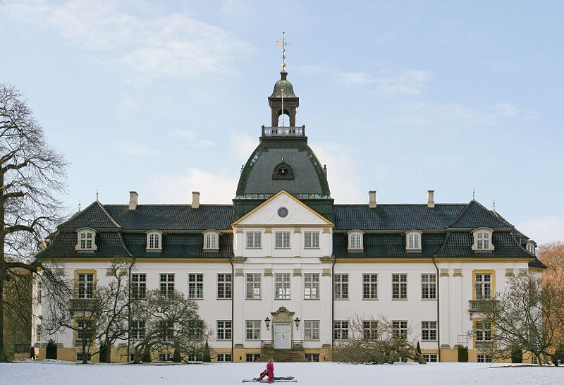
Charlottenlund Palace (© Henrik Jessen CC3.0)
From road level, the first good look at Charlottenlund Palace comes after 0.25km as the road follows a gentle curve left. Named after Charlotte Amalie, sister of Christian VI, it was originally constructed in the Baroque style but remodelled in the French Renaissance style around a decade after it became home to Crown Prince Frederick - later to become Frederick VIII - and his bride Lovisa Josefina Eugenia of Sweden adopted it as their home (Lovisa sounds to have been rather a likable character - permitted to be herself by her remarkably liberal father Charles XV of Sweden rather than being trained to do what she was expected to do, she became a bit of tomboy and got up to all sorts of things that young ladies were not supposed to engage themselves with, for example - shock, horror - swimming. Her mother, though on the whole considering it important to behave as ladies should, was also a fan of the sport and between the two of them they made it a fashionable and acceptable thing for women to do, thus opening the way for women of their time to become involved not just in swimming but a range of other sports too). Though she was, a little surprisingly, very strict with her own children, she had little time for court and formalities; those who met her describing her as being funny, friendly and easy to get along with. She created a number of charities aimed at improving the lives of various groups in society and enjoyed enormous popularity among the public.

Jacobson's influence spread far beyond Denmark. This, his
building for St. Catherine's College, is in Oxford.
 (© Bbacambridge CC2.5)
Charlottenlund, a town in its own right, has become one of the most affluent suburbs of Copenhagen and boasts many mansions and great buildings including several by the notable architect Arne Jacobson in the Danish Modernist style and considered of international importance. Having been influenced whilst still a student by the great Swiss architect Le Corbusier, Jacobson later traveled to Germany where he was exposed to the revolutionary work of Gropius, van der Rohe and the Bauhaus; incorporating their rationalist design philosophy into his own work. In 1929, he won first place in a competition to design the House of the Future, the design then being realised in full scale at the Forum København - which, incidentally, was also home to a six day annual bike race for the first few years of its history. The House was an immediate a enormous success, firmly establishing its designer as the architect to go to for an ultra-modern house. However, his considerable talents didn't stop with architecture - he designed a wide range of furniture including four items that have became among the most iconic of the 20th Century: the Ant, Model 3107, Egg and Swan chairs, all heralded in the 1950s as perfect amalgamations of functionality and aesthetics and - as unlicensed copies at least - still available to this day when Jacobson, who had to flee by rowing boat to Sweden to escape deportation to a concentration camp under the Nazis due to his Jewish roots, is alongside the Finn Alvar Aalto widely considered to be one of the people responsible for forming the overall look of the last century.

Øregård Museum (© Henrik Jessen CC3.0)
After gentle left and right bends potentially made slippery by fallen leaves, the road heads straight for 0.46km until it reaches a 90 degree right turn onto Strandvejen by the Akvarium (55°44'54.56"N 12°35'14.13"E). To the left is Charlottenlund Fort, a coastal battery constructed during the 1880s to protect the northern sea approaches to Copenhagen. The road continues, straight but for a few unchallenging and gentle bends, for 2.6km south to a 90 degree right turn onto Ehlersvej. 1.23km before the turn is the Øregård Museum in the Hellerup district, housing a collection of more than 3000 paintings depicting Copenhagen and its environs and housed in a neoclassical mansion built in the early 19th Century by a rich merchant. Hellerup is also home to the headquarters of Saxobank. To the left as the riders approach the turn is a harbour and huge business park, home to the Tuborg brewery.

0.33km later, they take the easy left turn back onto the Ryvangs Allé, taking the left lane so as to avoid cyclists further down the start list heading in the opposite direction. After 1.3km, they turn probably the most dangerous corner on the parcours, an extremely tight left to enter Svanemøllevej. The road seems unusually wide for a residential street, the reason for this being that it was constructed to relieve heavy traffic on the nearby Strandvejen and, in the past, carried trams as well as cars and time trial bicycles. A very affluent area, each house is unique with some deserving special note: Number 3 was deliberately destroyed by an explosion during the Nazi occupation and was subsequently be a modern villa built in 1961 and Number 14 has a large hidden basement built underneath a normal, unconcealed basement, complete with a tunnel leading to a second section hidden below the garden. It's not known who built it, but it can be reliably dated to the Nazi occupation and evidence suggests it was used to covertly hide Jewish citizens until they could be transported to safety in Sweden. Several others are currently occupied by foreign embassies.

The entrance to Strandboulevarden from Osterbrogade.
Note the trees in the centre - extreme caution will be
required to avoid hitting them if it's as wet as it is in
this photograph (© Leif Jørgensen CC3.0)
Vangehusvej is 0.29km from the corner, with the riders turning right onto it. They then turn right again after 0.11km onto Strandvejen., one of Denmark's oldest roads and which heads in the opposite direction for 38km to Helsingør - better known to we English speakers as Elsinore, site of Hamlet's castle. Reaching the bridge over the railway 0.4km later, the riders pass onto Østerbrogade and once again remain in the left lane so as to avoid oncoming riders, doing the same 0.73km later after the tight right turn into Strandboulevarden.

Having traveled the opposite way around the same bend as earlier, they change after 1.4km to the right lane and join with Kristianiagade as it continues south, then south-west for 0.49km to a tricky left turn by the Østerport Station onto Oslo Plads before passing onto Grønningen. To the left is the 17th Century Kastellet (55°41'30.41"N 12°35'39.76"E), the best-preserved fortified citadel in Northern Europe.
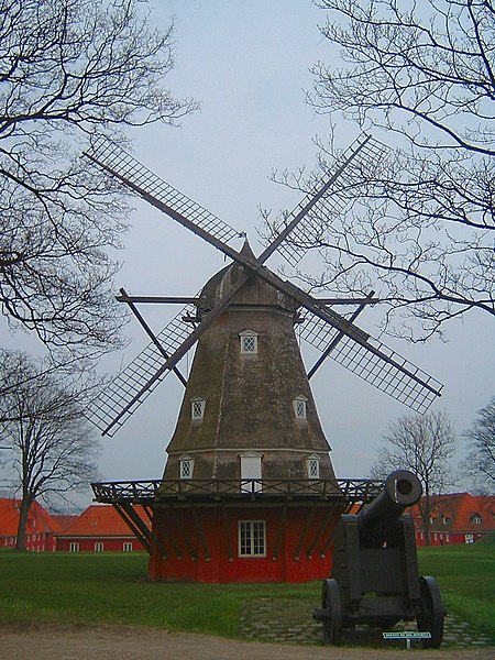
Being higher than the surrounding areas, the
ramparts were the ideal place to position
windmills. This one still stands inside the
Kastellets (CC1.0)
With a history beginning in 1626, during the reign of Christian IV who was unable to realise his full plans for the site when finances ran out, the first noticeable thing about the Kastellet is its striking pentagram shape, not dissimilar to the fort at Briançon we saw right back in July during Stage 18 of the Tour de France, a design intended to to provide 360 degree cover of the surrounding area and to leave no point or corner along the defensive walls unprotected. The second thing that those tourists who are paying attention notice is that the castle reveals Copenhagen was not always the content, happy and democratic place that it is today: the design is carefully laid out so as to be every bit as effective at protecting its occupants from the city as it is at protecting the city from sea-borne attack - all that would be required would be to turn the guns and point them in the opposite direction for any civil unrest to be rapidly quelled long before it could develop into revolution. Building began again under Frederick III (hence the official name Citadellet Frederikshavn), Christian's successor, who employed the notable Dutch military architect Henrik Ruse to develop the site.

Copenhagen's fortifications in 1728 (public domain image)
Ruse, having seen much active service in a number of different armies, had written a respected book on the subject of fortifications and whilst carrying out research had visited numerous ancient and modern defensive sites throughout Europe; distilling what he observed and learned down into a highly effective new set of techniques. The Kastallet's dual purpose as defender and oppressor was evidently not lost on locals, for Ruse received a number of death threats during his stay in Copenhagen. He was also charged with extending and developing the city's walls, leaving it with some of the most efficient, effective and up-to-date defenses anywhere in the world by the end of the 17th Century. However, military technology moved on rapidly and within less than a century suspicions began to arise that the walls wouldn't be up to the task of protecting against modern warfare. This proved to be the case in 1807 when they proved to be utterly useless in preventing the British - who feared Napoleon might invade Denmark and use the castle and navy to block British access to the Baltic Sea - from bombarding the city, destroying almost a third of its buildings and killing some 2000 civilians. The decision to decommission the fortifications was made in 1842 after two years of studies and deliberations - however, little happened other than attempts to strengthen some sections due to the Schleswig War of 1848. Today, the only remaining parts are the Kastellet and a section lying partially in a public park and partially in the unique Freetown Christiania.

View from the top of the Marmorkirken, across Amalienborg
Slotsplads and towards the Opera House (public domain image)
Having reached the end of Grønningen, the route turns left onto the much narrower Esplanaden ending with a very tight right after 0.22km onto Amaliegade, once the site of the city's General Hospital. After 0.41km, they arrive at Amalienborg Slotsplads, the Palace Square with a palace occupying each of the four corners. Once of Europe's finest public spaces, the Square offers excellent views north-west to the Marmorkirken (Marble Church) and south-east to the modern Opera House - a view the riders will be able to appreciate as they turn left and head in that direction between the easternmost palaces before turning right onto Toldbodgade; a turn that could prove extremely hazardous in the wet due to the slippery stripes of a pedestrian crossing sufficiently wide as to be unavoidable when exiting the Square.

Continuing south-west for 0.46km, the route arrives at Nyhavnsbroen Bridge and crosses onto Holbergsgade before keeping left around a bend 0.18km later to join Cort Adelers Gade as it leads south-west along the edge of the docks. After 0.31m, they arrive at a left turn onto Christian IV's Broen, bringing them onto Slotsholm, originally a a collection of tiny islets and, from 1167, Bishop Absalom's castle; the construction of which is traditionally cited as the beginning of Copenhagen. They then pass under a fly-over onto Christian's Brygge before a right turn 34m later for Slotsholmengade, following the street for 0.28km and turning left into Rigsdagsgarden alongside the Christiansborg Palace shortly before it becomes Tøjhusgade (55°40'34.05"N 12°34'51.39"E).

Christiansborg Palace, built on the site of Bishop
Absalom's castle (© Eimoberg CC2.0)
The Palace houses the Folketing (pariament), Prime Minister's office and Supreme Court, thus making it the only building in the world to house all three branches of government (executive, legislative and judicial). The current building dates from the early 20th Century; having been constructed on the site of an earlier palace begun in 1803 - when completed 25 years later, King Frederick VI decided it wasn't up to his exacting standards and declined to move in, using it solely for entertaining guests. His successor, Frederick VII, lived in the palace for 11 years, leaving in 1863. 21 years later, all but a few sections were destroyed by fire. Prior to 1803, the same site was occupied by the original Palace; upon which construction began in 1733 - it too was eventually destroyed by fire just 61 years later. Before the first Palace, Copenhagen Castle stood here; as it had done since a few years after the original occupant, Absalom's castle, was destroyed at the hands of the Hanseatic League in 1369. Remodeled and modernised in the 1720s by Frederick VI, bad engineering meant that the newly-strengthened walls cracked under their own weight; leading to demolition in 1731 to free up space for the first Palace. Remains of Absalom's castle were unearthed during excavation work to create the foundations of the new Palace and are open to the public.

Having come to the end of Tøjhusgade, the riders cross Prinsens Broen and enter Ny Kongensgade; crossing Vester Voldgade and arriving at Hans Christian Andersen Blvd. after 0.26km. They turn right, once again taking care to avoid diesel patches, then enter the final section to the finish line at the City Hall 23.2km from the start.

Sunday, 28 August 2011

Vuelta a España - Stage 10 Preview

Stage Map: click here
Stage Profile: click here
More Stage Previews: click here

The last stage before the rest day, Stage 10 is the 2011 Vuelta a España's only individual team trial and takes place on a parcours running south from the grand university city of Salamanca down to the little village of Torre Zapata and back up again, a clockwise loop of 47km ending slightly north of the start. The Vuelta road book describes it as "completely flat," but it's not - there are no leg-breakers today, but a 165m climb during the first 22km is sufficient to make the going considerably more difficult for some of the TT specialists, a few of whom are known for their dislike of any sort of ascent. With all the climbing coming early on and a long descent to follow, this looks set to be a very fast course indeed - possibly even fast enough to bring new Vuelta records.

Salamanca
The University dates from 1218, making it the oldest in Spain and the third oldest in the Western world - only Bologna (1088) and Oxford (1096) are older. The 30,000 students provide the largest slice of the city's annual income; many of them coming from overseas, paying to attend and coincidentally bringing with them the benefits of a diverse multicultural society.

The 15th Century Torre del Clavero, all that
remains of a fortified home once built by the
de Sotomayor family - whom we encountered
previously at Herrera in Stage 7.
Salamanca has Celtic origins, having been established around a fortress constructed by the Vaccaei, a fierce tribe known for their deadly skill in battle (their name is believed to derive from vacos, a word meaning "killer") and their egalitarian society in which food and wealth was equally distributed, a system which to our ears sounds like some radical ideal. It then passed into Roman hands, with Hannibal laying siege in the 3rd Century BCE - they left us with the wide and picturesque 1st Century CE bridge, still in everyday use. With the decline of the Empire it came under the control of the Alans; this presumably being the period that the city became an episcopal see, presumably because there are no records of the establishment of the see but documents dating from the Visigothic period that followed the Alans mention its existence.

The city surrendered to the Moors in 712, but was unable to enjoy the benefits of their science, culture and society as the region became the centre of ongoing battles between Muslim and Christian forces which left it a depopulated backwater. In fact, it could very easily have become just another of the once great cities that now exist as forgotten villages throughout Spain had it not have been chosen as a suitable new home for a group of Christians looking to resettle the area after their victory against Abd al-Rahman III in the Battle of Simancas, which saw the Duero region return to Christian control. More organised Christian resettlements took place under Alfonso VI of Castile and Raymond of Burgundy in 1085 and 1102. However, it was Alfonso IX of León's Royal Charter of 1218 allowing the formation of the University that really jump-started Salamanca's new lease of life - it quickly attracted scholars from across Europe, rapidly becoming one of the world's foremost centres of academia.

The Baroque New Cathedral.
The medieval period saw the University - and the city - reach new heights, being instrumental in the establishment of the basics of modern law guaranteeing the rights to freedom of thought, freedom to own property, corporeal being and freedom of religion. These modern beliefs are reflected in the response when Spain's Jewish population were expelled in 1492 - rather than taking over the Jewish Quarter and destroying the synagogue, the city fenced it off and used it to raise rabbits but otherwise preserved intact in the hope of the Jews being permitted to return, becoming known as la Barrio del Conejal after the rabbits until modern times. The 17th Century was difficult, the entire kingdom of Castile becoming decadent under ineffectual leadership, but Salamanca as a whole returned to its earlier dynamism in the following century when the New Cathedral and several other fine structures were built. Large parts of the city suffered serious damage caused by the French cannons during the Battle of Salamanca in 1812 - but the French didn't have it all their own way, ultimately losing the battle to the Anglo-Portuguese forces led by Wellington and were forced out of Andalusia for good.

The Romanesque/Gothic Old Cathedral.
There is, needless to say, a very great deal to be seen in Salamanca; but sights definitely not to be missed include La Clerecía, home of the Pontifical University, a building that was expanded after the Jesuits who originally built it spread a rumour among the local population that treasure was hidden in a building already occupying the land they required, causing them to tear it apart as they searched and making the land available; the Convento de las Agustinas e Iglesia de la Purísima with a dome that collapsed during construction and was rebuilt in 1675; both Cathedrals; the Palacio de Monterrey, the Huerto de Calixto y Melibea, a garden where remains of the Roman defensive city walls can be seen; La Plaza Mayor, site of many of Salamanca's finest buildings; many of the University buildings and especially the Main Facade; the 15th Century Casa de las Conchas which served for a while as the University's prison; the 16th Century Casa de las Muertes, the House of the Dead, named after the carved skulls used to decorate the structure (sadly, most of them have weathered badly and no longer look like skulls, though some have been recarved) and which, unsurprisingly, is said to bear a curse stating that anyone who lives within will soon die - a legend that could have led to the house falling into an irreparable condition since for many years nobody would dare to enter it; Casa Lis, the Museum of Art Nouveau and Art Deco and, for students, the little stone frog atop a carved skull adorning the University's main building - legend has it that all scholars who see it will be successful in their studies.

Typical landscape south of Salamanca.
The start ramp will be erected on the Av. Saavedra y Fajardo, pointing south towards Stage 9's finish town Béjar and very close to the Roman bridge and Casa Lis. The first section climbs only a few metres and is straight so expect some very fast starts as the riders make their way towards the first roundabout, taking a wide route around the large central island and continuing straight on out of the city. A fly-over carries them across the A-66 motorway - look out for the enormous bull silhouette on a ride nearby - presently arriving at El Ventorro, more a loose collection of buildings than a village. Another fly-over leads back across the A-66 shortly before Orejudos.

Crossing the motorway once more, the riders come to Mozárbez located 11km from the start; believed to be the site of an ancient fort and famous for the large numbers of scorpions which seem to find the little village a desirable place to live. At Montellano, they turn a sharp and potentially slippery right turn onto the narrower DSA-206 heading south-west and passing into an area with more trees than previously. The parcours leads through Cuatro Calzadas, one of those unattractive hamlets consisting of houses strung out along the road and little else, the attractive meandering stream on the other side of the road being far more pleasant to look at.

The road is long and mostly straight, the only bends being gentle and undemanding curves - an ideal time trial road, in fact, which will encourage high speeds and get the riders to the stage's southernmost point at Torre Zapata rapidly. The village has little to offer, meaning the difficult and very tight turn onto the DSA-207 may prove the most exciting thing to have happened there in some time: if it isn't host to at least one crash, we'll be surprised. From this point, the riders are heading back towards Salamanca.

Main Facade, University of Salamanca.
Once again the road is almost straight, though it turns a 90 degree left corner upon arrival at Morille and a similarly tight right around 200m later. Morille was famous in times gone by for its millstones, the production and sale of which made it a reasonably wealthy place. Nowadays, it exists primarily on income generated by tourism, especially ecotourism, and is a popular base for cycle touring and hiking. Though small - the permanent population is less than 300 people - it has some good buildings, pretty cottages and a fine collection of sculpture on public display. Once the village is passed, the road becomes mostly straight again for some way apart from the sweeping bend among trees. Just to the west is a tiny village of large houses known as La Regañada, a name that translates as The Scolding.

The DSA-207 ends a short way further on with a right turn at the junction with the DSA-204 which comes 30.5km into the stage - a junction that, being surrounded by dry fields, is another potential hazard due to slippery dust, puncture-causing stones and mud and diesel deposited on the road surface by farm vehicles. This road is even straighter, hardly deviating at all until a pair of Z-bends right at the end when it joins DSA-210 at a simple junction where the riders won't even need to apply their brakes. A bridge carries them over a stream just east of Aldeagallega, then a few more bridges pass by on the way to Porquerizos and, a short way further on, the CL-512 leading into Aldeatejada 41km from the start, then to a large roundabout junction with the A-66.

La Plaza Mayor.
Having got past the roundabout - it's quicker to travel around to the right - they come to another, where the line to the left is quicker, then continue north into the city until they reach a crossroads. Here they turn a sharp right onto the Carretera de Fregeneda and cross the river via the Roman Bridge. The surface is cobbled, but the stones are small and flat, hence should cause no problems unless wet in which case they may prove very slippery. This section of the river, with tree-covered islands, is especially beautiful. At the far end, they turn right onto the Paseo del Rector Esperabé (also known as the Paseo del Doctor Esperabé) and then left after 140m onto the Calle San Pueblo leading north into Salamanca's heart. After 0.8km, the arrive at La Plaza Mayor and the end of the stage.

Predictions: It's a time trial and Fabian Cancellara is in it. It's not rocket surgery.

Weather: A bit hotter than it has been for the last few days with temperatures ranging from 27-29C expected along the whole route. Winds will be light but variable as the route's direction alters, changing from headwinds and crosswinds during the first half to crosswinds and very welcome tailwinds as the riders head back to Salamanca. No rain is expected anywhere on the route.

More Stage Previews: click here

Sunday, 14 August 2011

Vuelta a España - Stage 10 Preview

Stage Map: click here
Stage Profile: click here
More Stage Previews: click here

The last stage before the rest day, Stage 10 is the 2011 Vuelta a España's only individual team trial and takes place on a parcours running south from the grand university city of Salamanca down to the little village of Torre Zapata and back up again, a clockwise loop of 47km ending slightly north of the start. The Vuelta road book describes it as "completely flat," but it's not - there are no leg-breakers today, but a 165m climb during the first 22km is sufficient to make the going considerably more difficult for some of the TT specialists, a few of whom are known for their dislike of any sort of ascent. With all the climbing coming early on and a long descent to follow, this looks set to be a very fast course indeed - possibly even fast enough to bring new Vuelta records.

Salamanca
The University dates from 1218, making it the oldest in Spain and the third oldest in the Western world - only Bologna (1088) and Oxford (1096) are older. The 30,000 students provide the largest slice of the city's annual income; many of them coming from overseas, paying to attend and coincidentally bringing with them the benefits of a diverse multicultural society.

The 15th Century Torre del Clavero, all that
remains of a fortified home once built by the
de Sotomayor family - whom we encountered
previously at Herrera in Stage 7.
Salamanca has Celtic origins, having been established around a fortress constructed by the Vaccaei, a fierce tribe known for their deadly skill in battle (their name is believed to derive from vacos, a word meaning "killer") and their egalitarian society in which food and wealth was equally distributed, a system which to our ears sounds like some radical ideal. It then passed into Roman hands, with Hannibal laying siege in the 3rd Century BCE - they left us with the wide and picturesque 1st Century CE bridge, still in everyday use. With the decline of the Empire it came under the control of the Alans; this presumably being the period that the city became an episcopal see, presumably because there are no records of the establishment of the see but documents dating from the Visigothic period that followed the Alans mention its existence.

The city surrendered to the Moors in 712, but was unable to enjoy the benefits of their science, culture and society as the region became the centre of ongoing battles between Muslim and Christian forces which left it a depopulated backwater. In fact, it could very easily have become just another of the once great cities that now exist as forgotten villages throughout Spain had it not have been chosen as a suitable new home for a group of Christians looking to resettle the area after their victory against Abd al-Rahman III in the Battle of Simancas, which saw the Duero region return to Christian control. More organised Christian resettlements took place under Alfonso VI of Castile and Raymond of Burgundy in 1085 and 1102. However, it was Alfonso IX of León's Royal Charter of 1218 allowing the formation of the University that really jump-started Salamanca's new lease of life - it quickly attracted scholars from across Europe, rapidly becoming one of the world's foremost centres of academia.

The Baroque New Cathedral.
The medieval period saw the University - and the city - reach new heights, being instrumental in the establishment of the basics of modern law guaranteeing the rights to freedom of thought, freedom to own property, corporeal being and freedom of religion. These modern beliefs are reflected in the response when Spain's Jewish population were expelled in 1492 - rather than taking over the Jewish Quarter and destroying the synagogue, the city fenced it off and used it to raise rabbits but otherwise preserved intact in the hope of the Jews being permitted to return, becoming known as la Barrio del Conejal after the rabbits until modern times. The 17th Century was difficult, the entire kingdom of Castile becoming decadent under ineffectual leadership, but Salamanca as a whole returned to its earlier dynamism in the following century when the New Cathedral and several other fine structures were built. Large parts of the city suffered serious damage caused by the French cannons during the Battle of Salamanca in 1812 - but the French didn't have it all their own way, ultimately losing the battle to the Anglo-Portuguese forces led by Wellington and were forced out of Andalusia for good.

The Romanesque/Gothic Old Cathedral.
There is, needless to say, a very great deal to be seen in Salamanca; but sights definitely not to be missed include La Clerecía, home of the Pontifical University, a building that was expanded after the Jesuits who originally built it spread a rumour among the local population that treasure was hidden in a building already occupying the land they required, causing them to tear it apart as they searched and making the land available; the Convento de las Agustinas e Iglesia de la Purísima with a dome that collapsed during construction and was rebuilt in 1675; both Cathedrals; the Palacio de Monterrey, the Huerto de Calixto y Melibea, a garden where remains of the Roman defensive city walls can be seen; La Plaza Mayor, site of many of Salamanca's finest buildings; many of the University buildings and especially the Main Facade; the 15th Century Casa de las Conchas which served for a while as the University's prison; the 16th Century Casa de las Muertes, the House of the Dead, named after the carved skulls used to decorate the structure (sadly, most of them have weathered badly and no longer look like skulls, though some have been recarved) and which, unsurprisingly, is said to bear a curse stating that anyone who lives within will soon die - a legend that could have led to the house falling into an irreparable condition since for many years nobody would dare to enter it; Casa Lis, the Museum of Art Nouveau and Art Deco and, for students, the little stone frog atop a carved skull adorning the University's main building - legend has it that all scholars who see it will be successful in their studies.

Typical landscape south of Salamanca.
The start ramp will be erected on the Av. Saavedra y Fajardo, pointing south towards Stage 9's finish town Béjar and very close to the Roman bridge and Casa Lis. The first section climbs only a few metres and is straight so expect some very fast starts as the riders make their way towards the first roundabout, taking a wide route around the large central island and continuing straight on out of the city. A fly-over carries them across the A-66 motorway - look out for the enormous bull silhouette on a ride nearby - presently arriving at El Ventorro, more a loose collection of buildings than a village. Another fly-over leads back across the A-66 shortly before Orejudos.

Crossing the motorway once more, the riders come to Mozárbez located 11km from the start; believed to be the site of an ancient fort and famous for the large numbers of scorpions which seem to find the little village a desirable place to live. At Montellano, they turn a sharp and potentially slippery right turn onto the narrower DSA-206 heading south-west and passing into an area with more trees than previously. The parcours leads through Cuatro Calzadas, one of those unattractive hamlets consisting of houses strung out along the road and little else, the attractive meandering stream on the other side of the road being far more pleasant to look at.

The road is long and mostly straight, the only bends being gentle and undemanding curves - an ideal time trial road, in fact, which will encourage high speeds and get the riders to the stage's southernmost point at Torre Zapata rapidly. The village has little to offer, meaning the difficult and very tight turn onto the DSA-207 may prove the most exciting thing to have happened there in some time: if it isn't host to at least one crash, we'll be surprised. From this point, the riders are heading back towards Salamanca.

Main Facade, University of Salamanca.
Once again the road is almost straight, though it turns a 90 degree left corner upon arrival at Morille and a similarly tight right around 200m later. Morille was famous in times gone by for its millstones, the production and sale of which made it a reasonably wealthy place. Nowadays, it exists primarily on income generated by tourism, especially ecotourism, and is a popular base for cycle touring and hiking. Though small - the permanent population is less than 300 people - it has some good buildings, pretty cottages and a fine collection of sculpture on public display. Once the village is passed, the road becomes mostly straight again for some way apart from the sweeping bend among trees. Just to the west is a tiny village of large houses known as La Regañada, a name that translates as The Scolding.

The DSA-207 ends a short way further on with a right turn at the junction with the DSA-204 which comes 30.5km into the stage - a junction that, being surrounded by dry fields, is another potential hazard due to slippery dust, puncture-causing stones and mud and diesel deposited on the road surface by farm vehicles. This road is even straighter, hardly deviating at all until a pair of Z-bends right at the end when it joins DSA-210 at a simple junction where the riders won't even need to apply their brakes. A bridge carries them over a stream just east of Aldeagallega, then a few more bridges pass by on the way to Porquerizos and, a short way further on, the CL-512 leading into Aldeatejada 41km from the start, then to a large roundabout junction with the A-66.

La Plaza Mayor.
Having got past the roundabout - it's quicker to travel around to the right - they come to another, where the line to the left is quicker, then continue north into the city until they reach a crossroads. Here they turn a sharp right onto the Carretera de Fregeneda and cross the river via the Roman Bridge. The surface is cobbled, but the stones are small and flat, hence should cause no problems unless wet in which case they may prove very slippery. This section of the river, with tree-covered islands, is especially beautiful. At the far end, they turn right onto the Paseo del Rector Esperabé (also known as the Paseo del Doctor Esperabé) and then left after 140m onto the Calle San Pueblo leading north into Salamanca's heart. After 0.8km, the arrive at La Plaza Mayor and the end of the stage.

Predictions: It's a time trial and Fabian Cancellara is in it. It's not rocket surgery.

Weather: A bit hotter than it has been for the last few days with temperatures ranging from 27-29C expected along the whole route. Winds will be light but variable as the route's direction alters, changing from headwinds and crosswinds during the first half to crosswinds and very welcome tailwinds as the riders head back to Salamanca. No rain is expected anywhere on the route.

More Stage Previews: click here