
 |
| Corpus Christi, Ponteareas. |
Stage Profile: click here
More Previews: click here
Stage 12 is a transition, really, designed to get the Vuelta from one set of mountains to the ones climbed tomorrow in a more interesting way than loading them all onto the team buses and driving up the motorway. As this is the Vuelta, and the organisers seem to have deliberately made sure there aren't any easy stages, there are two fair-sized Category 3 climbs and four little uncategorised hills between 150-200m stirred into the mix too. All in all, it's a race for the puncheurs - too hilly for the flat-out rockets, while the grimpeurs will be saving their legs for tomorrow's mighty Cat 1 Puerto de Ancares - or even for a domestique who feels strong enough whilst his team captain concentrates on getting through unscathed. Whatever happens, expect an early breakaway; probably one composed of little-known riders keen to reveal themselves as the grimpeurs of years to come.
 |
| Castro de Trona, ancient defenses |
 |
| Pena dos Namorados, the Rock of Love, Pontaereas: huge boulders each weighing many tonnes stacked atop one another (presumably by glacial action). Or giants - you never know. |
The races continues along the same road, which remains poker-straight except for a sweeping left and steep (but mercifully short) climb into a wooded section between Periero and Confurco, reading 170m just before the peloton pass across a fly-over above the A-52 and begin to descend towards Cans. The rocks protruding between the trees on the hillsides above the village, at first glance natural, are the remains of fortifications dating back to the days of the . Turning west around woodland, the N-120 reaches Porriño which, just 7.2km into the race, marks the first of the day's intermediate sprints along the Calle Sequieras and Rua de Antonio Palacios - both are straight, but both have several speed humps. At the end is a sharp left at a roundabout to join the N-550 running south.
 |
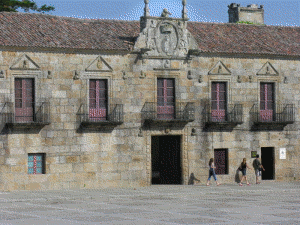
| Porrino Town Hall. |
The road continues south, never quite making it into open countryside though the buildings become more widely spaced for a while, until it eventually meets the A-55 which has been running parallel to the right for the last few kilometres just south of Eidos. At a roundabout, the N-550 becomes the PO-510, a road heavily used by the trucks ferrying granite from the mine just to the east to the ships waiting at the ports to take it off to China, which has become by far the largest market for granito rosa Porriño, and other nations around the world; meaning that the road may prove to be hazardous due to diesel spillage - the fuel being as invisible as it is slippery on a road surface. It is, needless to say, far from the most pleasing landscape along the 2011 parcours, so it's a good thing for us that the route soon turns east and enters an area of oaks, green fields and pretty - if not especially interesting - villages; most of which just come into contact with one another, giving the distinct impression that we're really in a very large, very sparse city rather than travelling between independent communities.
After 23.1km, the peloton come to a roundabout in between Salvaterra de Miño and O Castillo and turn left onto the PO-403, now heading north. The road continues to Abelleira, encountering nothing with obvious potential to form a hazard. At Angoares is Igrexa Parroquial de San Pedro de Angoares, a church of unusually English Perpendicular appearance. It's tiny but somehow imposing and looks as though it'd have made a very grand cathedral had it have been built to a scale perhaps 30 times greater. In no time at all, the race reaches Ponteareas for a second time and passes through town back to the roundabout near the medieval bridge we saw earlier, travelling straight across and onto the PO-254 heading north-east and, 41.3km from the start, to Balneario de Mondariz. We enter along the Calle de la Constitución with its Z-bend, then turn an easy left onto the Calle Ramón Peinador which sweeps around the northern edge of town before turning south to join the Calle de Octubre leading out. There are numerous speed humps along the way.
 |
| A short way to the south from Mondariz is the Castillo do Sobroso, dating to the 10th Century but occupying the site of a prehistoric fort. Having been abandoned in the 18th Century, it fell into disrepair until it was bought by the Conde de Torrecedeira in 1923, who carried out restorations at at his own expense until his death in 1967. It has since passed into local government ownership and is now open to the public. |
Cyclists and other proles who require nothing more than a sink in which to wash out sweaty clothing and plenty of food during a holiday leave the town via a through-arch bridge and soon come to Mondariz where a short and narrow connecting road leads to a sharp left onto the PO-252. Having passed a large industrial site, the road narrows to pass across a tall stone bridge before climbing towards Quintans and A Portelsa da Bouza, villages immediately west and east. The Category 3 climb of Alto de Moscoso begins 1.4km after the villages, throwing in a woodland hairpin for good measure shortly afterwards, even though the terrain isn't at all steep yet - though it does become so for a short section a little further on when it climbs a wooded slope and enters a sharp left bend which, with the trees depositing leaves onto the road, might be hazardously slippery. By the time we reach A Rua, there are superb views across the Val de Tea, which the riders won't see as they're going in the opposite direction, then the route progresses along the side of a steep slope, dropping hundreds of metres to the left and rising hundreds of metres to the right. It's a very beautiful section, easily making up for the one south of Porriño earlier. The summit, at 400m, is reached just after we pass through As Xunqueiras on a forested hill. Immediately afterwards, we descend into Moscoso.
At a junction, we turn left onto the PO-250 - not, as the road book has it, the PO-252 which ends here. This road is much wider and heads south-west, descending through beautiful countryside until it reaches Amoedo, 62km from the start of the race. The road, also known as the Carretera Redondela de Pazos, is wide and smooth and descends fairly rapidly without dangerous bends, encouraging very high speeds - until Quintana, where a very tight right-left-left combination will take a few millimetres of rubber off the brake blocks.
 |
| Redondela |
We pass through Viso and its attractive little square, only slightly marred by some ugly 1970s houses, continuing along the PO-2901 which is now heading east to Alxán. When the road meets the PO-2908, the peloton turns left, coming presently to a roundabout where they turn sharp right to pass onto the PO-244. After 4.6km, having covered 81km from the start of the race, they reach the feeding station and the beginning of the Cat 3 climb of Alto Ponte Caldeas. Silvoso comes a short way on, the road remaining wide and smooth all the way without difficult bends all the way to the summit 88.2km from the start at 320m just past Roca. There is one of those ridiculously pretty, crystal clear streams running along the bottom of the shallow valley to the left. Roca, incidentally, being one of those tiny villages where almost all of the young people leave as soon as they possibly can, has many picturesque ruins; set off perfectly by the beautiful surroundings. It's always sad to see what must have once been a vibrant community in its death throes, but Roca is doing it in an extremely aesthetically-pleasing way. The descent is not challenging and ends at a T-junction where we turn left into Ponte Caldeas.
The bridge into the town stands high above the lazy, weedy water and, being wide, should cause no problems. The PO-532 running through to the west looks simple too, with little in the way of street furniture. Ponte Caldeas' name is believed to derive from an ancient bridge - the Ponte - and the hot sulphurous springs in the area, from the Latin caldas, scalding. Having left the Ponte Caldeas behind, the peloton reaches a roundabout near the village of Cunas and passes straight across it to find Tourón after a little under 3km. It clips the very northern tip of Buchabad, then passes a huge second-hand car dealership and repair shop - hence, possibility of fuel spillages on the road - before it travels on to Vilarchan, where a peculiar stone hórreo can be seen from the road. The stone legs supporting it some way off the ground reveal it to be a granary, but it's an unusually ornate one, looking distinctly like it belongs in a graveyard.
 |
| Igrexa de Peregrina, Pontevedra |
 |
| Old stones at Combarro. The building on the right is a horreo, a type of granary. |
Leaving the harbour behind, the road once again makes its way along the coast and passes through many small villages, mostly joined together to form a long, thin strip; then reaches Sanxenxo 124.4km from the start. There are many speed humps, but try to take your eyes off the racing as we pass the Nuevo Templo, a rather odd modern church with a many-tiered roof that makes it look a little like a Chinese temple as designed by Frank Lloyd Wright. The road becomes the PO-504 as it passes a roundabout at the edge of the town and carries us north-west through more villages, wide and undemanding except for a few speed humps, then ends at a T-junction on the PO-550 where we turn right. This road is flatter, straighter and even less technical than the last, forming what is very much a transitional stage - the views as we cross the bridge near Cambados coming as something of a relief. The second intermediate sprint takes place along the Av. de Galicia in the town.
 |
| Sights from Cambados |
At the junction, the race turns right opposite the Restaurante Corinto - potentially quite a hazardous bend, being very busy and thus having a likelihood of fuel spills and/or puncture-causing detritus from vehicle collisions - bringing the peloton back onto the Carretera Coruña a Tui for the final run back into Pontevedra. At a large roundabout they take the left exit to join the Av. de Santiago de Compostela, a wide and largely straight avenue leading to the grand Puente Santiago across the Rio Lerez. To the left can be seen the new Puente de los Tirantes, absolutely unique and perhaps the most beautiful bridge constructed in Europe during the last century. On the opposite bank we reach the Av. Buenos Aires and turn left, then right at a roundabout to join the Calle de José Malvar Figueroa before a tight left to the Calle del Doctor Laureiro Crespo. The finish comes after 167.3km on the Av. de Lugo.
 |
| Puente de los Tirantes. The single tower rises from a roundabout south of the bridge. |
 |
| Convento de San Francisco |
 |
| Praza de Lena |
Among the multitude of sights, Pontevedra offers the Praza da Leña with its attractive mixture of buildings of varying ages; the Puente de los Tirantes; the Convento de San Francisco and the Museo Provincial de Pontevedra which houses a collection consisting of more than 16,000 works of art.
Predictions: Continuing our long history of successful stage winner predictions - we've got one right so far this year, and that one was so obviously going to be won by Rodriguez - we're going to point the finger of doom at Sylvain Chavanel today. Why? With no high mountains nor challenging climbs along the 167.3km parcours, this is the ideal sort of stage for a strong breakaway to whack up the tempo and build up a big gap between themselves and the main group. Of course, most of them will find the going gets too tough towards the end and fall back down the road to the peloton - or even the grupetto; but Chavanel is not as most riders and can keep going...and going...and going, right to the end.
Weather: Rain! Some people who watch the Vuelta are a bit surprised that it rains in Spain, but it does - and as we'll be spending a fair bit of our time on the plain today it's going to mainly rain on the race; or the first half of it at any rate, because it ought to lighten and clear up for the last 80km. Oh well. At least it'll be cool: highs of 20C are going to feel blissfully pleasant when compared to the hellish 35C+ temperatures recorded in the first few stages. In fact, we may even see riders reaching for jackets as the roll over the tops of the two Cat 3s - the predicted 16/17C up there can feel really quite chilly during a descent when wind-chill becomes a factor. You like echelons? Well, tomorrow could be a good opportunity to see them - crosswinds all the way will vary between light to moderate, almost certainly encouraging riders to adopt the tactic during those long low altitude sections.
More 2011 Previews: click here
No comments:
Post a Comment