All time trials begin and end at the Rådhuspladsen, Copenhagen's City Hall Square (55°40'37.32"N 12°34'4.66"E). However, the course varies depending on grouping with the Elite Men competing two laps of the route set out below; the Under-23 Men completing two laps of a shorter 17.6km course broadly similar to this one; Elite Women and Junior Men completing two laps and Junior Women one lap of a 13.9km course again based on this one. Maps of each course can be seen
here.
The riders then set out north-west along the Hans Christian Andersen Boulevard, the busiest street in the city with several bus-stops thus leading to the possibility of diesel spills on the road surface - however, the Danes are famous for their clean towns and cities, so the road will in all likelihood have been well-scrubbed shortly prior to each race. One particularly tricky spot for this reason will be the medium right turn at the north-western corner of Ørtedparken to join Øster Farimagsgade. Ørtedsparken, a public park, occupies the site of a military complex decommissioned in the latter half of the 19th Century, the defensive moat now forming part of the park's lake, and is named after Hans Christian Ørsted - the first scientist to notice that electrical current creates a magnetic field.
 |
| Ørtedsparken (public domain image) |
The road is straight, wide and flat; as such, it's unlikely to cause any problems over the 0.73km section leading to the Botanisk Have gardens. Once past the extensive glasshouse, a very slight deviation to the left leads to Copenhagen's oldest cemetery to remain in use, Holmens Kirkegård which contains among many graves belonging to famous occupants that of the artist Heinrich Hansen. At the end, when the lake on the left comes into view, a slight left leads for approximately 48m along Dag Hammarskjolds Allé to a tighter right onto Classensgade (55°41'47.04"N 12°34'49.71"E) - this is another section where diesel spills are a potential hazard. Classensgade, though considerably narrower than Hans Christian Andersen Blvd. or Øster Farimagsgade is nevertheless easily wide enough for a peloton, never mind a single time trialer, along its entire dead straight 0.69km stretch.
A 90 degree left at the end carries the riders out onto the left-hand lane of Strandboulevarden (55°41'57.27"N 12°35'24.74"E) - anyone who attempts to take the corner too fast will be at risk of running straight into the central reservation which, since it has trees, could be a race-ending crash. Also, being another main route with several bus-stops, spilled diesel again poses a risk, as could the several pedestrian crossings along the way as the painted sections can become slippery when wet. With the exception of a very slight kink in the middle just past what was until very recently the Danmarks Designskole (it's since moved and merged with the School of Architecture), the road is straight for 1.18km. It then curves left, with riders again needing to be cautious to avoid the central reservation, and continues for a further 0.42m to a tight right-hander into the left lane of Østerbrogade (55°42'42.67"N 12°34'39.03"E).
 |
Looking north along Osterbrogade from the Trianglen. The
riders will join the road more than a kilometre further along
(© Leif Jørgensen CC1.2) |
As Copenhagen's premier retail location, Østerbrogade has several bus-stops and will receive many truck deliveries each day. It is, as unfortunately tends to be the case with all shopping streets around the world these days, is studded with the usual purveyors of McGreaseburgers - the wrappers of which are surprisingly lethal if caught beneath a a wheel; however, other than the bend at the end leading to the Ryvangs Allé, it's completely straight for the full 0.82km length, reducing the hazard for mush of the section. They follow the road for 1.88km, crossing a fly-over after 1.33km, then arrive at an intersection. Passing through takes them onto Gersonsvej.
After another straight section, this time of 0.87km, the route arrives at another intersection and crosses straight over and into a slight left followed by a gentle right. The road turns straight for 0.24km, then turns a medium-tight right onto Bregnegaardsvej. This leads into a sweeping left 0.14km later, followed by another straight 0.94km heading into the Charlottenlund Slottspark, starting at the Forstbotansk Have (forest park) on the right. The section lasts for approximately 0.49km after the Viggo Rothes Vej, then the riders turn right onto Jægersborg Allé.
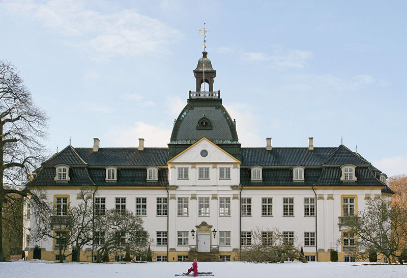
From road level, the first good look at Charlottenlund Palace comes after 0.25km as the road follows a gentle curve left. Named after Charlotte Amalie, sister of Christian VI, it was originally constructed in the Baroque style but remodelled in the French Renaissance style around a decade after it became home to Crown Prince Frederick - later to become Frederick VIII - and his bride Lovisa Josefina Eugenia of Sweden adopted it as their home (Lovisa sounds to have been rather a likable character - permitted to be herself by her remarkably liberal father Charles XV of Sweden rather than being trained to do what she was expected to do, she became a bit of tomboy and got up to all sorts of things that young ladies were not supposed to engage themselves with, for example - shock, horror - swimming. Her mother, though on the whole considering it important to behave as ladies should, was also a fan of the sport and between the two of them they made it a fashionable and acceptable thing for women to do, thus opening the way for women of their time to become involved not just in swimming but a range of other sports too). Though she was, a little surprisingly, very strict with her own children, she had little time for court and formalities; those who met her describing her as being funny, friendly and easy to get along with. She created a number of charities aimed at improving the lives of various groups in society and enjoyed enormous popularity among the public.
 |
Jacobson's influence spread far beyond Denmark. This, his
building for St. Catherine's College, is in Oxford.
(© Bbacambridge CC2.5) |
Charlottenlund, a town in its own right, has become one of the most affluent suburbs of Copenhagen and boasts many mansions and great buildings including several by the notable architect Arne Jacobson in the Danish Modernist style and considered of international importance. Having been influenced whilst still a student by the great Swiss architect Le Corbusier, Jacobson later traveled to Germany where he was exposed to the revolutionary work of Gropius, van der Rohe and the Bauhaus; incorporating their rationalist design philosophy into his own work. In 1929, he won first place in a competition to design the House of the Future, the design then being realised in full scale at the Forum København - which, incidentally, was also home to a six day annual bike race for the first few years of its history. The House was an immediate a enormous success, firmly establishing its designer as
the architect to go to for an ultra-modern house. However, his considerable talents didn't stop with architecture - he designed a wide range of furniture including four items that have became among the most iconic of the 20th Century: the Ant, Model 3107, Egg and Swan chairs, all heralded in the 1950s as perfect amalgamations of functionality and aesthetics and - as unlicensed copies at least - still available to this day when Jacobson, who had to flee by rowing boat to Sweden to escape deportation to a concentration camp under the Nazis due to his Jewish roots, is alongside the Finn Alvar Aalto widely considered to be one of the people responsible for forming the overall look of the last century.
After gentle left and right bends potentially made slippery by fallen leaves, the road heads straight for 0.46km until it reaches a 90 degree right turn onto Strandvejen by the Akvarium (55°44'54.56"N 12°35'14.13"E). To the left is Charlottenlund Fort, a coastal battery constructed during the 1880s to protect the northern sea approaches to Copenhagen. The road continues, straight but for a few unchallenging and gentle bends, for 2.6km south to a 90 degree right turn onto Ehlersvej. 1.23km before the turn is the Øregård Museum in the Hellerup district, housing a collection of more than 3000 paintings depicting Copenhagen and its environs and housed in a neoclassical mansion built in the early 19th Century by a rich merchant. Hellerup is also home to the headquarters of Saxobank. To the left as the riders approach the turn is a harbour and huge business park, home to the Tuborg brewery.
0.33km later, they take the easy left turn back onto the Ryvangs Allé, taking the left lane so as to avoid cyclists further down the start list heading in the opposite direction. After 1.3km, they turn probably the most dangerous corner on the parcours, an extremely tight left to enter Svanemøllevej. The road seems unusually wide for a residential street, the reason for this being that it was constructed to relieve heavy traffic on the nearby Strandvejen and, in the past, carried trams as well as cars and time trial bicycles. A very affluent area, each house is unique with some deserving special note: Number 3 was deliberately destroyed by an explosion during the Nazi occupation and was subsequently be a modern villa built in 1961 and Number 14 has a large hidden basement built underneath a normal, unconcealed basement, complete with a tunnel leading to a second section hidden below the garden. It's not known who built it, but it can be reliably dated to the Nazi occupation and evidence suggests it was used to covertly hide Jewish citizens until they could be transported to safety in Sweden. Several others are currently occupied by foreign embassies.
 |
The entrance to Strandboulevarden from Osterbrogade.
Note the trees in the centre - extreme caution will be
required to avoid hitting them if it's as wet as it is in
this photograph (© Leif Jørgensen CC3.0) |
Vangehusvej is 0.29km from the corner, with the riders turning right onto it. They then turn right again after 0.11km onto Strandvejen., one of Denmark's oldest roads and which heads in the opposite direction for 38km to Helsingør - better known to we English speakers as Elsinore, site of Hamlet's castle. Reaching the bridge over the railway 0.4km later, the riders pass onto Østerbrogade and once again remain in the left lane so as to avoid oncoming riders, doing the same 0.73km later after the tight right turn into Strandboulevarden.
Having traveled the opposite way around the same bend as earlier, they change after 1.4km to the right lane and join with Kristianiagade as it continues south, then south-west for 0.49km to a tricky left turn by the Østerport Station onto Oslo Plads before passing onto Grønningen. To the left is the 17th Century Kastellet (55°41'30.41"N 12°35'39.76"E), the best-preserved fortified citadel in Northern Europe.
 |
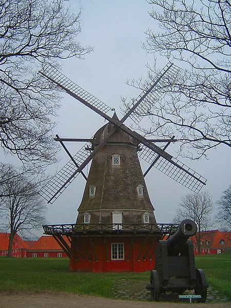
Being higher than the surrounding areas, the
ramparts were the ideal place to position
windmills. This one still stands inside the
Kastellets (CC1.0) |
With a history beginning in 1626, during the reign of Christian IV who was unable to realise his full plans for the site when finances ran out, the first noticeable thing about the Kastellet is its striking pentagram shape, not dissimilar to the fort at
Briançon we saw right back in July during Stage 18 of the Tour de France, a design intended to to provide 360 degree cover of the surrounding area and to leave no point or corner along the defensive walls unprotected. The second thing that those tourists who are paying attention notice is that the castle reveals Copenhagen was not always the content, happy and democratic place that it is today: the design is carefully laid out so as to be every bit as effective at protecting its occupants from the city as it is at protecting the city from sea-borne attack - all that would be required would be to turn the guns and point them in the opposite direction for any civil unrest to be rapidly quelled long before it could develop into revolution. Building began again under Frederick III (hence the official name
Citadellet Frederikshavn), Christian's successor, who employed the notable Dutch military architect Henrik Ruse to develop the site.
 |
| Copenhagen's fortifications in 1728 (public domain image) |
Ruse, having seen much active service in a number of different armies, had written a respected book on the subject of fortifications and whilst carrying out research had visited numerous ancient and modern defensive sites throughout Europe; distilling what he observed and learned down into a highly effective new set of techniques. The Kastallet's dual purpose as defender and oppressor was evidently not lost on locals, for Ruse received a number of death threats during his stay in Copenhagen. He was also charged with extending and developing the city's walls, leaving it with some of the most efficient, effective and up-to-date defenses anywhere in the world by the end of the 17th Century. However, military technology moved on rapidly and within less than a century suspicions began to arise that the walls wouldn't be up to the task of protecting against modern warfare. This proved to be the case in 1807 when they proved to be utterly useless in preventing the British - who feared Napoleon might invade Denmark and use the castle and navy to block British access to the Baltic Sea - from bombarding the city, destroying almost a third of its buildings and killing some 2000 civilians. The decision to decommission the fortifications was made in 1842 after two years of studies and deliberations - however, little happened other than attempts to strengthen some sections due to the Schleswig War of 1848. Today, the only remaining parts are the Kastellet and a section lying partially in a public park and partially in the unique Freetown Christiania.
 |
View from the top of the Marmorkirken, across Amalienborg
Slotsplads and towards the Opera House (public domain image) |
Having reached the end of Grønningen, the route turns left onto the much narrower Esplanaden ending with a very tight right after 0.22km onto Amaliegade, once the site of the city's General Hospital. After 0.41km, they arrive at Amalienborg Slotsplads, the Palace Square with a palace occupying each of the four corners. Once of Europe's finest public spaces, the Square offers excellent views north-west to the Marmorkirken (Marble Church) and south-east to the modern Opera House - a view the riders will be able to appreciate as they turn left and head in that direction between the easternmost palaces before turning right onto Toldbodgade; a turn that could prove extremely hazardous in the wet due to the slippery stripes of a pedestrian crossing sufficiently wide as to be unavoidable when exiting the Square.
Continuing south-west for 0.46km, the route arrives at Nyhavnsbroen Bridge and crosses onto Holbergsgade before keeping left around a bend 0.18km later to join Cort Adelers Gade as it leads south-west along the edge of the docks. After 0.31m, they arrive at a left turn onto Christian IV's Broen, bringing them onto Slotsholm, originally a a collection of tiny islets and, from 1167,
Bishop Absalom's castle; the construction of which is traditionally cited as the beginning of Copenhagen. They then pass under a fly-over onto Christian's Brygge before a right turn 34m later for Slotsholmengade, following the street for 0.28km and turning left into Rigsdagsgarden alongside the Christiansborg Palace shortly before it becomes Tøjhusgade (55°40'34.05"N 12°34'51.39"E).
The Palace houses the Folketing (pariament), Prime Minister's office and Supreme Court, thus making it the only building in the world to house all three branches of government (executive, legislative and judicial). The current building dates from the early 20th Century; having been constructed on the site of an earlier palace begun in 1803 - when completed 25 years later, King Frederick VI decided it wasn't up to his exacting standards and declined to move in, using it solely for entertaining guests. His successor, Frederick VII, lived in the palace for 11 years, leaving in 1863. 21 years later, all but a few sections were destroyed by fire. Prior to 1803, the same site was occupied by the original Palace; upon which construction began in 1733 - it too was eventually destroyed by fire just 61 years later. Before the first Palace, Copenhagen Castle stood here; as it had done since a few years after the original occupant, Absalom's castle, was destroyed at the hands of the Hanseatic League in 1369. Remodeled and modernised in the 1720s by Frederick VI, bad engineering meant that the newly-strengthened walls cracked under their own weight; leading to demolition in 1731 to free up space for the first Palace. Remains of Absalom's castle were unearthed during excavation work to create the foundations of the new Palace and are open to the public.
Having come to the end of Tøjhusgade, the riders cross Prinsens Broen and enter Ny Kongensgade; crossing Vester Voldgade and arriving at Hans Christian Andersen Blvd. after 0.26km. They turn right, once again taking care to avoid diesel patches, then enter the final section to the finish line at the City Hall 23.2km from the start.


No comments:
Post a Comment