Showing posts with label Didi Senft. Show all posts

Tuesday, 26 July 2011

What's with... The Tour Devil?

The Devil Rides Out!
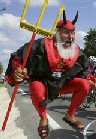
Surer than awful weather, surer than Cav getting points docked for "irregular sprinting" and surer than high-speed crashes and broken collar bones, he's there every year - the Tour de France Devil. He's become such an iconic symbol of the Tour than there are people with no interest in the sport yet watch the Tour just to be able to catch an occasional glimpse of him.

But who is this Dark Prince of Sandals and Beards, also known as Tourteufel and El Diablo?

He is 60-year-old Didier "Didi" Senft and, when not haunting the roadsides of the Tour and Giro d'Italia, he lives in Storkow, Germany, where his time is spent inventing record-breaking bikes and guitars and being a professional eccentric.

Didi has been into cycling for many decades, having been an amateur club cyclist in East Germany. He dreamed of being selected to the national team but never made it - becoming a professional sportsman was one of the few ways of getting out of the GDR to see the rest of the world in those days and he wanted to travel, so it wasn't long after the Wall fell that he started travelling around Europe to experience racing. However, Didi is not the sort of personality who would ever be content with remaining just another face in the crowd: after visiting the Tour for the first time in 1992 he decided he'd do something to help liven up the long stretches when spectators are waiting for the peloton to arrive. He says that the devil persona came about due to East German commentators: "They always called the final kilometre of a criterium the Red Devil's Lap. I never saw a red devil, so I became one."

So that was that sorted. Now he purchased a miniscule camper van and, after customising it in his own unique fashion, he set off for the Tour.

A large, bearded German dressed in skin-tight leggings, a cloak and fully-fitted with horns on his head was always going to be noticed fairly quickly, but Didi is one of the world's natural entertainers - he ran up the road after the riders, waved his pitchfork and clowned around, delighting the crowds. Unlike some of the other "characters" who appear along the roads during the Tour, the Devil never has any controversial message he attempts to get across and takes great care to neither endanger anyone nor do anything that might disrupt the race - which meant that very soon he even had a few fans among the riders themselves, who have traditionally taken a rather dim view of any spectator who feels the need to get in the road with them.

Didi takes the role, which has become a strange sort of career, very seriously: he's out and about on the Tour route before some riders are even training, scouting out the perfect places to install himself and the enormous bikes he tows around with him. He says that he would like to appear within the final kilometre - the Red Devil's Lap - but is not able to do so for safety reasons: this is usually the most crowded part of the race and his giant bike would be a danger to spectators.

Once there he parks up and begins painting the road, a custom far older than the Devil but one that he has made very much his own, taking some 50 litres of white emulsion to every Tour. If you see pitchforks, giant wheels and pictures of bikes painted on the tarmac, you can be certain that he's lurking somewhere nearby. Unlike many road painters, he never includes the names of riders in his designs - he's most certainly not the sort to cast aspersions, as are those who leave messages suggesting that a rider they dislike is doping, and aims to entertain while supporting the sport he loves as a whole rather than limiting himself to backing individual competitors.

What we don't get to see on television is that Didi has become an important part of the Caravan, the cavalcade of trucks and promotional floats that travels around with the Tour and drives each stage a few hours before the race, distributing free gifts such as pens, posters, t-shirts, bidons and baseball caps. He leaps on and off the vehicles, chasing the gift-throwing girls who pretend to be afraid and run away, but not so fast that he can't catch them - at which point, he gets covered in lipstick. It goes without saying that the companies involved in the Caravan love it, because he attracts attention and provides more publicity than the vehicles alone ever could.

Unlike many of the "characters" who clown around at the
Tour, the Devil has many fans among the riders. Among
them is Andy Schleck, seen here awarding him a medal.
Of course, not everyone has such a well-developed sense of humour as Didi's. There are those who don't like him - some of the riders cross to the other side of the road to avoid him. However, being the rather nice sort of devil that he is, he doesn't chase those that he knows find him a nuisance and lets them get on with the race. The majority of the riders welcome him though - Andy Schleck, known as one of the nicest people in the sport, even awarded him a medal for his services to cycling. One group of people famous for their total lack of a sense of humour is the Swiss Police who, during the 2006 Tour de Suisse fined him, threatened him with prison and made him remove a pitchfork he'd painted on the road.

If you've ever been fortunate enough to follow the Tour, you'll know that although it's unique among the world's largest sports events in that it can be watched for free, doing so nevertheless becomes very expensive - there's the cost of more than 3000km-worth of fuel and the food you'll need along the way for a start. Fortunately for the Devil, his celebrity has grown so much that he now receives small payments from various companies that sponsor him, including the car transmission manufacturer LUK whose corporate logo can be seen on his costume and campervan. Other fans at the races donate money to him, as do those who visit his museum at Storkow. Although he still gets around in a camper far smaller than the enormous ones you see parked throughout the Alpine stages (some of them looking more like trains),  he's moved up in the world - it's now a shiny, sponsored Volkswagen with a picture of himself on the side.

The Royal Wedding rickshaw, complete with William,
Kate - and a baby.
When not doing his bit to keep the crowds happy, Didi can sometimes be found in person at his museum which is home to more than 120 of the bikes and other things he has designed and built, some of them earning him official world records. Among them are the world's smallest tridem (a bike for three people), the world's biggest bicycle, the world's tallest bicycle, the world's longest two-wheeled scooter (18.28m), the world's longest bike (38m with 76 rear wheels), the world's longest pedal car and the world's largest movable, playable guitar. He has also built a 12.4m rickshaw which seats the passenger more than 6m off the ground and a remarkable tricycle that he rode at soccer's European Cup championships with wheels made of 88 footballs. Last year, he built a bizarre rickshaw to commemorate Prince William and Kate Middleton's wedding, with a bike's front wheel, the back end of a Trabant car and a cardboard cut-out of the happy couple and a baby seated within.

So all in all, you can't really explain what's with the Tour Devil because he's far too odd for most to understand; but one thing's for sure - cycling would be far poorer without him. Long may his reign continue!


Friday, 22 July 2011

Tour de France: Stage 19 Preview

A very short stage today at just 109.5km, but with more than enough climbing to keep even the most sadistic of fans entertained: for the second time this year the peloton will be tackling the mighty Galibier with its 16.7km Hors-Categorie grind up to 2556m. Of course, the team medics would be most unimpressed were their charges to attempt tackling that without a few warm-up exercises; so the organisers have thoughtfully thrown in an 11.9km Category 1 ascent of Col du Télégraphe within the first 30km. Oh, and there's a second HC climb of 13.8km reaching 1850m up to the summit of Alpe d'Huez at the end of the stage too, just to get the riders relaxed and ready for their beds.

The Savoyan flag
The stage begins in the heart of the Savoie region, part of the now-defunct nation of Savoy that once straddled the Franco-Swiss-Italian borders and which had the longest-surviving Royal dynasty in Europe; beginning with Humbert I in 1003 and still with us in somewhat reduced circumstances today. Savoy started as a poor and undeveloped area, but its ruling class became skilled at exercising tight control over what was transported through the high mountain passes and extracting money from those involved in such activities. Today, Savoy has a small separatist movement with surveys suggesting between 40 and 55% of the population support devolution from France and Italy and the re-establishment of their nation on its traditional territory. Thus, it's often possible to spot a few Savoyan flags (Savoyan if the official demonym; the more common Savoyard is informal and shouldn't be applied to the flag, though most people probably rightly wouldn't care) waving among the spectators when the Tour visits this region.

La Maison Penchée
Modane lies at the foot of a wide, green valley and is almost contiguous with Saint-André and Villabordin-Rogret to the west and east. Home to around 4000 people who have been Italian at various points in the town's history as well as French and Savoyard; belying the strategic importance of the area and explaining the large number of fortifications dating from medieval times to WW2 dotted around the town and high up into the surrounding mountains. The most famous of these is La Maison Penchée: a concrete bunker designed to house explosives should the Mont-Cenis tunnel need to be blown up if war broke out. Towards the end of WW2, the Nazis blew up the tunnel to hamper future Allied movements. The explosion blew the bunker - which remained intact - more than 30m and it ended up partially buried where it still stands today.

Things are very different in Europe since the EU and nowadays crossing borders between constituent states rarely even requires a passport, so Modane has grown wealthy from the tourists who base themselves here due to the easy access to the Alps of France and Italy - usefully providing employment for those residents who are not cut out for work in the particle physics research laboratories in the area. We leave the town along the D1006 heading west, a non-technical stretch of road sandwiched between the river to the north and railway tracks to the south with a large roundabout on the western perimeter. Another roundabout marks the little hamlet of Freney, home to 85 people, and the large industrial site stuck right next door - if there's one thing the French love, it's an industrial site placed slap in the middle of an area of great natural beauty. A third - insanely complex - roundabout with six exits and a fly-over carries the peloton onwards, the road sharing the river bank with the A43 and passing by a rocky gorge, more industry and a little village named La Praz - the site of the pretty and unmistakably alpine Villa Paul Héroult. Just to the south, Pointe de la Sandoniere reaches almost 2900m.

Saint-Michel-de-Maurienne, artfully cropped so as not to
show the aluminium works which bring prosperity and
ugliness in equal parts to the town.
Soon, we come to a section where the road tackles an artificial lake by way of a wide causeway before continuing crosswise over the dam and up a slipway leading into the long Tunnel d'Orelle, emerging some way on and travelling below the A43 for a while. Soon, it veers north and into Saint-Michel-de-Maurienne. The village is attractive enough, but tourists are a little dissuaded by the enormous aluminium works on the edge of town - even if the owners do provide funds for the doubtless fascinating museum devoted to the history of the metal which is located in the town.  However, we're disappointingly not going to see it today as after 14km the parcours turns south-west via a sharp but uncomplicated corner onto the D902 - a road also known, ominously, as the Rue du Galibier - taking us immediately into Saint-Martin d'Arc; passing through on a sweeping road as it begins to rise before reaching the next village, La Ravoire, where the first climb begins in earnest.

Fort du Telegraphe
The Col du Télégraphe, with an average gradient of 7.1% (maximum 10%) is climbed by means of 14 hairpin switchbacks on a road that visits several tiny and picturesque hamlets along the way before reaching a high ridge south of the Fort du Télégraphe which stands at almost 1600m and commands the valley roads far below. The site was originally occupied by an optical telegraphy station - a method by which a chain of towers are used to pass coded messages from one station to the next by means of symbols formed by articulated arms, similar to semaphore - which gave the Col its name, with the fort built between 1896 and 1890. As such, it lacks the charm of a medieval fortress but is nevertheless an imposing structure. The site has come full circle, for today the fort is topped by a collection of communications masts. The highest point comes 26.5km from the start.

The road follows the ridge for a while, offering views best described as stupendous, then reaches the tiny village called Le Col that has grown up chiefly on the money spent by the cyclists and motorcyclists who come up here and passes Les Granges, which consists largely of chalets for skiers but also has a tiny, picturesque chapel with a single bell. 4.5km onwards and over 100m downwards from the Col is Valloire which has grown to become the largest skiing resort in the Maurienne region, but unlike most ski centres the town has managed to retain much of its traditional alpine appearance and Savoyard character. There are, of course, many modern chalets; but there are much older buildings located about the town too, such as the Notre-Dame-de-l'Assomption which can be described as sumptuously decorated even by the standards of Baroque churches. There is also a ruined Chateau Saint-Pierre, but little remains of it.

As soon as Valloire is left behind, the parcours in on the slopes of the Col du Galibier; climbing today from the opposite direction to Andy Schleck's incredible winning ride yesterday and this side is rated considerably harder. The road travels south for a while, connecting an assortment of villages, before turning left and then right as it crosses a bridge over the rock-strewn stream. It then stays fairly level until a pair of hairpins take it up 20m or so, then begins to climb more rapidly on the approach to a small bridge near a barn where it turns south-east. A series of wide bends takes it between high cliffs which look a little like those along the Casse Deserte yesterday and towards a switchback combined with a bridge where the altitude reaches 2000m.

Col du Galibier
From here, the climbing really begins as a series of hairpins carries the road up to a ridge, which continues onwards and upwards. A final set of seven hairpins brings the Tour to the summit. Plenty of riders - especially the sprinters - will be wishing it was yesterday at this point: they may ridden much further to get here yesterday, but at least once they were here the stage was over. They'll take some comfort from the fact that they're going through the tunnel today, past the Henri Desgrange memorial where a wreath will be placed as it is every time the Tour comes this way, so they don't have to climb as high as yesterday. Those riders not so comfortable with fast descents will be wishing it was all over too because the road back down Galibier is steep and almost 40km long, twisting and turning about several tricky switchbacks as it picks its way precariously downwards to the junction with the D1091 - which we take - just east of an alpine plants botanic garden.

La Grave
The route heads west again, around two steep hairpins and into a long descent through the valley towards Villar-d'Arêne, 63.5km from the start line. More hairpins carry us downwards towards the tunnel which brings us out to La Grave which, with its 12th Century church and stunning location, has been voted as one of the beautiful villages in France and it truly is a stunning place with a perfect cafe that serves the best coffee in France - inhabited whilst I was there by three German goths whom, so far as I could gather, had driven in an ancient Mercedes from Frankfurt simply because of the village's name and were somewhat disappointed at the cheerful prettiness of the place. The excellence of the coffee, however, was sufficient to perk even them up.

The parcours continues downhill to the Lac du Chambon and passes through two tunnels on the northern shore before a sharp left hand corner takes it along the dam at the western side, then around an outcrop and down through the forest into Le Freney-d'Oisans, at which point there is 25.5km to go. The road out clings to the side of a near-vertical cliff, passing through a tunnel and past a look-out which offers stunning views up the valley before climbing up, around and back down a rocky promontory overlooking another artificial lake and Le Clapier, which is reached by means of a bridge over the dam's outflow. Immediately north of the village in the Alpe d-Huez, rising rapidy from the lake to over 2100m.

The 21 hairpins en route to the summit
of Alpe d'Huez.
After Le Clapier, the road becomes almost poker straight and level for a little over 3km and, were it not for the scenery and the fact that it's today's intermediate sprint, would be rather boring. This is a sprint that both Mark Cavendish and Jose Joaquin Rojas could really do with winning - it would go a long way to securing victory for Mark and could earn victory for Jose in the points competition - but chances of either man getting here in time to pick up any points at all are so marginal they may as well be ignored. It soon reaches a roundabout at Le Bourg-d'Oisans where the riders turn right onto the D211, beginning the ascent of Alpe d'Huez.

The Alpe acts as a stage finish this year for the first time since 2008, having been unusually absent on the schedule for the two years up until now, and makes a welcome return. Getting to the top takes in an incredible 21 hairpins, each named after riders who have won a stage there - though since 2001 it's become necessary to start adding the names of recent winners to those who gave their names to the lower bends in years gone by - that year, the lowest hairpin became known as the Coppi-Armstrong. As one of the most famous climbs in the Tour there is guaranteed to be vast crowds of spectators along this section, all hoping to see the rider who, upon winning this stage, may also win the Tour.

Cadel's turn to win today?
Predictions: This afternoon, another hairpin on the climb up Alpe d'Huez will be renamed - but will it be named in honour of Evans or a Schleck? In fact, Frank Schleck already has one named after him, since he won here in 2006 - is it possible that either he or Andy will give the family name to another? In Frank's case, it's actually quite likely - he had a relatively easy ride yesterday, sheltering behind Cadel and Voeckler while Andy was out at the front busying himself with winning the stage, then got into gear and scooted past them to take second place; so he's going to have a lot more left in him today than many other riders. For Andy, it's not so likely - he may be one of the greatest riders in of recent years, but mounting an attack 60km from the finish and then working it all the way up another two HC mountains is going to take a lot out of anyone, even him. But one thing we all learned yesterday is that nobody should ever write him off: the entire cycling press had given up on him for this Tour, and then he scored not just a stage win but one of the best stage wins since the days of Eddy Merckx.

Cadel worked hard yesterday, pulling himself and Thomas Voeckler all the way up Galibier; but he's a strong rider and looking better than ever this year which puts him in a better position than anyone else to defeat the Schlecks. His style is the complete opposite of theirs, brute strength to their almost balletic grace, but they are equally matched in terms of ability. As a wildcard, how about Contador? He's not going to be at all pleased about his ride yesterday, during which he appeared to crack and was unable to respond to his Luxembourger rival. But Contador has up days and down days - if he's having an up day today, there might not be anyone who can catch him.

Weather: Another nice day, by the looks of things - sunny and warm at the start (up to 23 degrees C) and manageable winds over most of the course. At the Col du Telegraphe it'll drop to about 10 degrees, but an east wind of no more than 10kmph will prevent it being too uncomfortable. Galibier is a different matter being so much higher, expect a north wind of 15-20kmph here which, with ambient temperatures of 9 degrees, will make it feel decidedly chilly. On the other side, the valleys will be much warmer with highs up to 26 degrees. Stronger winds up to 30kmph from the north-west may cause problems, acting as cross - and headwinds over some sections. Alpe d'Huez should be fine, plenty of sun and though temperatures are likely to be no more than 10 degrees at the summit. a 15kmph wind from the south-east will prevent it becoming too cold.

DEVIL WATCH: There's really no need for discussion today - he'll be on one of those hairpins going up Alpe d'Huez. Remember, all you goodly folk - if you see tridents painted on the road, the Devil lurketh somewhere nearby.

Thursday, 21 July 2011

Tour de France: Stage 18 Preview

If you want to demonstrate to someone what the Tour de France is - the horror, the pain, the beauty and the skill - then you could do far worse than show them today's stage. This is the Big One, the Queen, possibly even the Decider.

In this 200.5km stage, riders must tackle three Hors-Categorie mountains, the harshest test in what is a three-week series of challanges, the most deadly weapon in the Tour's well-stocked arsenal. Proceedings kick off in Pinerolo where Stage 16 came to a close, the Italian town acting as a stage town for the first time this year. The peloton leaves on the S589 as it heads from the city centre, passing some good new buildings before entering the flat countryside to the south. This first section is likely to encourage early breakaways as riders with no chance of picking up big points in the high mountains race ahead in an attempt to get to the intermediate sprint (starting today after 46.5km), meaning that we're likely to see a repeat of yesterday when various riders attempted to escape the pack right from the end of the neutral zone. It might be a short while before anyone meets with any success, but it'll come early so that those within the escape group can pick up whatever points they can.

The road is almost perfectly straight with the exception of a large roundabout at the junction with the SP161 which passes above on a fly-over - however, with the entrance and exit to the roundabout being slightly off-set to the left, negotiating the central island requires little deviation and other than spreading the pack out a little with have virtually no noticeable effect - and then heads on to another; this second one being trickier. Very soon it becomes possible to see the Castello di Osasco, standing at the north-western corner of a village. A little way on is a difficult roundabout with a kinked entrance that may trick some riders into taking the wrong line and subsequently losing time. Just past Garzigliani the road crosses two rivers before continuing south through a little hamlet named Casenuove and straight through a crossroads.

Rocca di Cavour.
The road is straight and untechnical as it enters Cavour, 9.5km from the start. This large town has grown up immediately north of the strange Rocca; an peculiar hill rising to 50m from the expansive flatlands all around a little like a miniature Mont Ventoux. Geological inspection of the Rocca reveals it to be a granite inselberg or monadnock - an isolated mountain - of which all but the visible tip has been buried by alluvial sediments. Archaeological survey reveals petroglyphs at various points about the rock and there are ruined fortifications. From here, the course heads south-west along more straight, flat roads to Bagnolo Piemonte which has an especially good-looking castle and views to the Alpine foothills rising just a few kilometres away. The road south leads to Barge, which marks 20km thus far travelled.

Castello di Envie.
Barge has in recent years become home to a vibrant Chinese community, which raises the prospect of an interesting fusion cuisine that would be ideal for a long-distance cyclist's needs. The great Lombardi San Giovanni Battista church is the town's most famous site, but with luck the weather will be clear enough for the camera operators to get some shots of the Rocca at Cavour, which looks particularly impressive from here. Taking the road east, the peloton heads around the forested hills which rise to over 1000m and onwards to Envie with a castle that was completely destroyed by Savoyard forces, then purchased and rebuilt in Romantic Gothic style by a Count Guasco Castelletto.

Saluzzo.
After 31.5km, the parcours reaches Revello which, with its many old and slightly unkempt buildings, looks like the location of every film Vittorio De Sica ever made. The route through town is tight with several corners, which may be difficult if wet, but the riders soon leave town and head east on the SP26 towards Saluzzo. Standing on a small rise and with many medieval towers and spires, Saluzzo is an impressive site when approached from the surrounding flat regions, though its better seen from the opposite angle to that from which the Tour arrives when it has the Alps as a backdrop. Highlight is the Casa Cavassa, once the stately home of the local lords but now put to far better use housing the town's museum and a beautiful synagogue, which still stands though the once vibrant Jewish community was all but wiped out in WW2, despite brave attempts by some locals to save them. In Saluzzo, the parcours changes onto the SR589 which looks to be a complicated process involving various roundabouts, corners and narrow urban streets - however, this does mean we'll get to see the attractive architecture throughout the town.

We then head south-east once more via Manta, site of another reconstructed castle - this one, a 14th Century stately home, stands on the sight of a 12th Century real castle - and on to the next town Verzuolo, separated from its neighbour by one field. Verzuolo would undoubtedly be a far more attractive place were it not for the large industrial plant on the eastern side of town but like the majority of Italian communities it has many other sights to recommend it. including one of the most beautiful castles along this stage and some ancient churches as pleasing to look at as they are interesting to explore. Verzulo marks today's intermediate sprint which, though uphill, climbs just 26m and as a result is likely to be hotly contested by any riders making up a breakaway group or - if no breakaway has formed - by the sprinters in the peloton who are going to have little chance to add to their successes for the remainder of the Tour.

On the southern edge of Verzuolo, the peloton turns south-west at a roundabout and travels toward Piasco, site of the world's only harp museum, and continues west around another roundabout to Venasca - the name, derived from an ancient word, is believed most likely to mean either "water" or "poison." As is often the case in Italy, this small town of around 1500 people has a church fit for a city - the Baroque Parrocchiale Maria Assunta was built in the 18th Century and has a richly decorated interior with what has been called the finest selection of marble sculpture and statues in Piedmont. The road skirts the town to the north, avoiding the narrow streets, but the church should be visible over the surroundings rooftops. The next town we pass through is Brossasco where the road turns north-west to reach the middle of the community, then south-west to carry us further along the SP8. This require two corners to be rounded, but they don't look as though they'll cause any problems.

After 63.5km, the parcours reaches Melle. This village, which a hundred years ago had a population of almost 2500 people but is now home to less than 400, is located in a narrow gap between the forested hills to the north and those that have been gradually closing in from the south for some kilometres now; leaving no doubt that we're heading into the mountains. It's still a long way to the summit, but along this stretch the Tour has begun the long and challenging climb to the summit of Col Agnel, the highest point of this year's race.

Casteldefino
Further west we come to Frassino, site of an avalanche in 1850 that destroyed the village along with two others and killed 80 people, then past Rore to Sampeyre on the banks of an artificial lake created by a dam. Sampeyre has become something of a mountain biking centre in recent years with the many trails leading down from the mountains - which rise to over 3000m - being especially popular among downhillers. The road through the town is straightforward, becoming the SP105 as it exits to the west before passing through Calchesio and then rises through four switchbacks to Caldane before continuing west towards Casteldefino, which marks 85.5km ridden. As the name suggests, there was a castle here but it's now ruined - there's much more to see along the narrow medieval streets, some of which have buildings with old murals painted on their exterior walls. The lower parts of the town are almost 100m below the higher parts, so passage through involves two switchbacks at the western and eastern ends before the road moves on to Rabioux as the assault on the summit really gets under way.

Pontechianale Lake in winter.
As the road approaches Castello it's possible to see the Frazione Castello dam which has created a large lake. Once, when it was dry land, there were buildings here including a church, the tower of which would until recently emerge from the waters when levels were low but it's now collapsed. The peloton will travel along the lake's northern shore for 2km until it reaches the remaining, dry part of Pontechianale where the road becomes the SP251 and passes into a stunningly beautiful valley, largely uninhabited until it reaches Chianale 5.5km further up.

Col Agnel
Chianale marks the beginning of the final section of the 23.7km climb. From here onwards we are officially at high altitude - high enough for oxyhaemoglobin levels in the blood to begin falling rapidly, bringing about altitude sickness. Somewhat surprisingly in view of its familiarity among cyclists and people who follow the sport and the incredible scenery in the region, Col Agnel is one of the less well-known Alpine passes which makes it possible to ride over without seeing a single car on a good day. Let's hope it remains that way. All surprising in view of the same fame among the cycling fraternity is that this is only the second time it's been featured in the Tour, the first time having been as recently as 2008 when it was climbed from the opposite side.

The summit is reached by no fewer than seventeen switchbacks, each one a challenge in its own right as the bends - where the road moves up a level - can be much steeper than the average gradient of the climb (6.5%). As the rider crest the mountain, they cross the border and are once more in France to begin the long, steep and very fast descent which extends for just over 20km, taking in another six switchbacks which at this speed are extremely hazardous, along the D205. They pass through the tiny village of Fontgillarde, past Chateau-Renard and Pierre-Grosse before reaching Molines-en-Queyras, at which point they will have travelled 121km, leaving almost 80km to go. The village has an interesting church, destroyed in the 16th Century, rebuilt in the 17th and renovated in the 21st. The low, square tower is topped by a wooden construction with open sides, leaving the bells fully visible, and looks very rustic - however, the interior is a complete contrast, being lavishly decorated with a bright blue ceiling adored with gold decorations. The peloton will have to negotiate another pair of switchbacks on the way into the village before changing onto the D5 at a simple junction by the church. The road then passes by La Rua and follows the course of a rock-strewn mountain stream before veering off into a wooded section and, via another switchback, down to La Casse, across the river and left around a roundabout to Château-Ville-Vieille and the feeding station where musettes stuffed with energy bars and suchlike will no doubt be very welcome after Col Agnel, and especially since there are two more high mountains still to be climbed. Nearby is the village Chateau-Queyras, and on a rocky outcrop stands 13th Century Fort Queyras which survived a Savoyard siege even though the village was destroyed.

Fort-Queyras
The road travels south-west, clinging to the mountainside above the river and becomes the D902 after 131.5km before turning north-west into a valley of alpine meadows leading towards Les Moulins and, after 3.5km, Arvieux at the start of the second Hors-Categorie climb to the 2360m summit of Col d'Izoard, 14.1km long with an average gradient of 7.3%.

To get up requires nine switchbacks and, once there, there's La Casse Déserte. This strange, lunar landscape, its name translating as The Broken Desert, has been called the most difficult section ever ridden in the Tour and is arguably more feared than Mont Ventoux. There are scrubby pine trees in the valley, but the steep slopes are pale and bare, giving the place an unearthly, lifeless appearance. It is undoubtedly one of the strangest places Nature has created anywhere in Europe. There's a monument up here, formed from a natural menhir, to Louison Bobet and Fausto Coppi, and a museum of Tour history - but very few cyclists ever make it here to visit.

La Casse Déserte
The parcours then descends via nine switchbacks into a green valley which, after the deathly La Casse Déserte, seems like the Garden of Eden. Another seventeen switchbacks take the road down almost 400m to Le Laus, where it once again becomes straight and comparatively level as it heads to Cervières where the river is directed through a sixteen-stepped "staircase," clearly visible as the riders pass to the south of the village before continuing the descent through the valley past another artificial lake and dam towards Briançon, a town we passed through yesterday, with the enormous and seemingly impregnable fortress that dominates the entire region.

Col du Galibier
Getting through Briançon is a reasonably simple process despite the corners and roundabouts because the town has been planned so as to permit the transport of heavy vehicles and goods such as cannon to the fort, meaning the roads are easy to get around by bike. We leave the town along the D1091 heading north-west towards La Salle-les-Alpes where the church of Saint Marcellin has some unusual and quite unsettling carvings in its stonework, then on to the spa town Le Monêtier-les-Bains which, with 22.5km to go, marks the beginning of the final climb: the 22.8km, 4.9% ascent to one of the most famous places in cycling, the Col du Galibier. This section may be made even more difficult by the weather - just two days ago, it snowed and there are likely to still be patches of slush in some places to catch the unwary and the tired. The summit is acting as the finish line for the very first time, though the mountain has been climbed by the Tour 31 times since its first appearance in 1947 and is the highest stage finish in the race's history. Whoever reaches the summit first is very likely to also reach the summit of the podium when the race ends in Paris following the next two stages.

Predictions: There's at least a 90% chance that today will be won by a Schleck, an Evans or a Contador. This is the sort of stage upon which Andy Schleck excels and after a not-especially-brilliant few stages, he's got a lot to prove. His form doesn't seem what it was last year, but let's not forget just how good a climber he is - provided the fast descents don't get the better of him, he's in with a good chance in this one; not least of all because he can keep going when others cannot. The same is true of Frank, but if he's to win Andy will first need to be in poor form and second admit to it, sacrificing his own race to help his brother win.

Cadel Evans is a favourite of many - he's been climbing spectacularly well this year and is much more comfortable when descending than the Schlecks. He's also not so worried when the weather turns bad, so if there's still snow on Galibier he'll be in a much better position to cope with it.

However, Contador has to be the top choice today. Following a lack-lustre performance on the earlier climbs, either due to sandbagging or genuine fatigue from the Giro d'Italia, he's really found his legs. Added encouragement comes from the fact that, with a large portion of the cycling world turned against him following his troubles with anti-doping measures, he arguably has even more to prove than Andy does: few things say "screw you guys" than winning this stage and then providing a crystal-clear testing record for the entire race would. Also, Contador has an extremely skillful assistant in Sammy Sanchez, an amazing climber in his won right, who has sworn his aid.

Weather: Looking good for the majority of the parcours with plenty of sun and winds no more than 10kph in the lowlands - however, maximum temperatures could reach 28 degrees C which is getting a bit too warm for comfort. Weather forecasting becomes much more difficult at altitude and conditions can change rapidly in the mountains, but at present it's also looking reasonable for Agnel and d'Izoard - though winds of up to 30kmph at the summits could cause problems. Galibier is a different matter - the summit is predicted to be misty and there are still some slushy patches following the snowfall two days ago. No new snow is predicted, but a 40kmph wind and 6 degrees C ambient temperature will make it feel very cold and could cause muscle aches and pains; especially for the climbers who have far lower levels of body fat than other cyclists.

DEVIL WATCH: As the old saying goes, the Devil is in the mountains. Oh alright, we may have got that a bit wrong - but when it comes to the Tour Devil, the pointy places are usually the best spots to find him as the peloton will be travelling more slowly and he gets a better opportunity to show himself to his admiring public. He could be on Agnel or the Col d'Izoard, but Galibier is probably more likely since it's the finish. We'll be expecting him somewhere around halfway up.

Tuesday, 19 July 2011

Tour de France: Stage 16 Preview

LATEST: A Tour official was found dead in a river near the finish line at Gap early this morning. An investigation has begun.

Following a much-needed rest day - involving such relaxing activities as transporting teams, bikes and the tons of equipment carried about France during the Tour over the 125km from Montpellier to Saint-Paul-Trois-Châteaux, no mean feat in itself - Stage 16 is aimed straight into the heart of the French Alps, considered by many riders and spectators to be the highlight of a Tour and the most likely location for the eventual victor to reveal himself. The parcours is highly representative of the next few days - starting at 99m above sea level, it begins to head skywards right from the start line and then continues to do, climbing all the way until it reaches the 1268m Col de Manse before plunging 524m in 11.5km to the finish at Gap. For those of us who take an interest in the sights and locations along the route of the Tour, this stage is of as much interest for its geology as its history and takes in a number of interesting features.

Saint-Paul-Trois-Châteaux, on the edge of the beautiful department of Drôme, is home to around 8200 people and acts as a stage town for the very first time today. Like the majority of towns in the region, recorded history begins with the Romans who named it Augusta Tricastrinorum, a Latinised version of Tricastin which was the name the Gallic tribes living here before the Romans arrived used. Saint-Paul was added at some point in the 4th Century and, later, Tricastinorum was mistranslated as "three castles," thus giving rise to the modern name. and the town's heraldic emblem featuring three castellated towers and a crown. The town was fortified in ancient times and remnants of the Roman walls can still be seen at some sites around the medieval town centre, which is clear on maps as a roughly circular shaped area inlcuding the catehdral, Notre-Dame de Saint-Paul-Trois-Chateaux which is today considered one of the finest examples of Provençal Romanesque architecture and is of particular interest to archaeologists for the large number of mason's marks still visible on its stonework. To the south is a small mountain rising to around 270m and offering excellent views of the region including towards the south-east-east and - or so I'm informed - cycling's holiest mountain Mont Ventoux.

Chances are that the stage will see an early breakaway, as has every stage thus far this year, but the first few attempts are probably prone to fail when inexperienced riders underestimate gradient leaving the start town and can't keep ahead while the peloton gathers momentum. Sooner or later, the gene pool will have been reduced, leaving only the more experienced super-domestiques attacking the peloton; at which point a breakaway has a chance of success - we'd expect it to build up a small gap and maintain it for a good part of the course today, at least until the halfway point. Their target will once again be the intermediate sprint, but since that doesn't come until three quarters of the way to Gap and it's uphill all the way, whether or not they can get there first is debatable. Since the stage follows a rest day, we think they probably will.

Château de Suze-la-Rousse
Leaving Saint-Paul-Trois-Chateaux, the D59 passes between more forested ridges as it heads south-east for 8km to Suze-la-Rousse. Standing on an outcrop at the north-western corner of the town is the remarkable château which, much modernised in the 16th Century, perfectly combines the aesthetic qualities of a medieval fortress with those of a fine Renaissance stately home. It now houses a university of wine and viticulture. Immediately to the west is the castle's park, known as La Garenne, which contains a 16th Century real tennis court and Neolithic remains, evidence of a local culture predating the castle by thousands of years. The view from here to Mont Ventoux is famous.

The road into Suze-la-Rousse isn't technical as it emerges from a plane-lined avenue and across a bridge, offering one of the best views of the chateau, but the negotiates a roundabout. Shortly after this, riders will cross the road before turning left onto the D94 which is straight and flat. Looking back - which the riders won't - this road provides a good opportunity to comprehend the sheer scale of the chateau just passed; while looking forward it's possible to try to comprehend the even more impressive scale of Ventoux, which looms above the horizon like the malevolent presence that it is - this the riders will do, and be thankful that they don't have to climb it this year. The road sweeps north-east via a simple junction and, 16km from the start, reaches Tulette. The road continues through the middle of the town, straight at first before a couple of right-hand bends that are sharp enough to cause problems if conditions are wet. It then heads east, where it's called the Avenue des Alpes, and past the enormous bottling plant (not far off 400m wide!) which has made Tulette wealthy. Having crossed another roundabout it enters Saint-Maurice-sur-Eygues, an important centre of wine making. Just to the south is the Drôme river - its course is wide as it splits into a number of rivulets flowing through the gorges cut into the rocks. Another large roundabout takes us out of town and onto another plane-lined avenue - still the D94 - north-east past the le Sagittaire leisure park.

34km from the start is a large junction leading south onto a bridge across the river, then onto the D539 which passes the large town of Nyons and follows the line of a ridge of hills past vineyards and woodland. Although the parcours doesn't pass through Nyons, it should be possible to see the 13th Century Tour Randonne, which is topped with an unusual tiered detail with a statue of Mary: the tower is believed to have originally been defensive - it certainly looks like it - but it was purchased in 1862 by a local pastor and converted into a chapel, this being the purpose it still serves. As we approach the eastern end of the town where ridges face on another across the river is the Pont Roman, a graceful single-arch bridge, still in use after a little over six centuries.

The road then becomes the D94 again and continues north-east, crossing the river before skirting Les Clots and following the banks to Aubres and its ruined castle, then makes a large inverted U  and travels east once more to Les Pilles which marks 42.5km travelled. Les Pilles is named after two rocks said to resemble pyramids. The road turns north, following a narrow strip of land between the ridge and the river, then north-east and after 8.5km reaches Sahune, the entry to the Gorges of Saint May, an area of great natural beauty, and the route twists around in all directions for the next 20km to follow their course.

Verclause is located 71km from the start, meaning that there are a further 91.5 to the finish line. A picturesque ruined tower, all that's left of the castle, stands on the rocks high above and a sort time after the peloton passes through the village the road becomes the D994, marking the point where they officially enter the Haute Alpes; the hills to the north becoming noticeably craggier as though to prove the point. As it approaches the village of Rosans (76km), the gradient becomes much steeper and soon reaches over 750m above sea level.


At a flatter section is Moydans, the location of the feeding station and the halfway point. This tiny village is home to just 50 people, so it's entirely possible that the entire population will be waiting on the short main street to see the Tour pass through. Soon, the terrain starts to rise again and by the time the riders pass south of Ribeyret they'll be around 820m up. After another 4.5km, they reach L'Épine in the Buëch Valley where an abbey building atop a small rise north of the village gives the impression of a miniature Glastonbury Tour, passing just to the south of the village. Montclus, at 81km, has the same population as  Moydans but packs them into a smaller physical area sandwiched between higher ground to the north and south. In the centre of the village is a ruined tower dating from the 11th Century and built to provide a look-out point so the locals could prepare for imminent raids by the bandits that in those days infested the area. In 1994, several houses in the village were damaged by a landslide. Just to the east of the village is a small but very beautiful waterfall which plunges down the cliff and through a culvert under to road, the a sort distance further on a sharp left then right-hand corner as the parcours travels over a bridge to the opposite side of the narrow valley.

3km from Montclus is Serres (left), apparently one of just five French towns with names that are palindromes (oh alright, that's not really relevant - but you never know when knowledge of this type might prove useful). Serres can guarantee a good turn-out of spectators because visitors to the Serres Jazz Festival, currently in full swing, will be looking for something to do during a one-day break from the party. If you happen to be in the area, you can see a programme by clicking this link and Klezmer Kaos (whom I've seen a couple of times) have the Cyclopunk Seal of Approval.

The road through Serres is straight and reasonably wide with no hazards other than a roundabout, which shouldn't cause problems, as it joins the D1075 clinging to the cliff alongside the river and heads out of town towards the north, crossing the river opposite a imposing 350m cliff. Soon, the route comes to a large roundabout by an airfield where it rejoins the D994 and heads north-east, passing by yet more gorges. It follows alongside a railway, soon reaching a large station at Veynes where the peloton will have to tackle two roundabouts in quick sucession. Veynes was a small and quiet town until the railway came, but has since become a centre for the development of solar energy. Until the 14th Century, it was home to a Jewish community of whom many worked in local tanneries (Jews in Medieval Europe were banned from working in many industries and had to find jobs in those that other people found distasteful - tanneries not being the most pleasant places in which to work). Sadly, they were exterminated during violent attacks that we would nowadays term pogroms after they were blamed for causing the plague - a common flaspoint for antisemitism at the time.

Today, Veynes is home to the intermediate sprint - organisers have found  quite a challenging stretch of road featuring a first roundabout and right-hand corner towards the end of the first thousand metres, another roundabout immediately after entering the second thousand metres and series of traffic calming devices for good measure, along with an upwards kick of about 24m towards the end. What happens here depends entirely on whether or not a breakaway has formed and if it's still going by this point - if it is, the top points will go to whoever is the fastest: Delaplace, Delage, perhaps Zandio or Uran are likely lead group members and would all be likely winners of the 20 points. If not, expect any of the fast sprinters who isn't too tired from getting here.

La Roche-des-Arnauds
A little way out of town the road turns dead east and enters a long and straight section, passing La Plaine before reaching La Roche-des-Arnauds where, in the middle of the town, it turns sharply right and heads off in another straight line to the south east. The road in and out has central reservations, but is at no point narrow enough to cause problems and, being so straight, will have no effect on riders' times no matter which way they go around them. At Saint-Andre, Berne and La Selle is a twisty section of road which connects the three hamlets in a long loop and from which there are excellent views across the large Gap valley.

5km further on is Gap itself, arrival being marked by a very large roundabout with four exits. The town is home to 45,000 people, making it the largest town in the Southern Alps and an important administrative centre. There are several theories attempting to explain the name with the most likely being that it was orginally named Vapincum by the Celts or pre-Celtic speakers of an Indo-European tongue, subsequently shortened to Vap and then modified by the Franks or Goths. The cathedral - Cathédrale Notre-Dame-et-Saint-Arnoux de Gap - is much younger than it at first looks, having been built between 1866 and 1905; the very successful neo-Gothic design making it appear to have stood since the Middle Ages, as did the genuine medieval cathedral it replaced and which itself stood on the spot of a Roman temple to Apollo. Gap hosts the finish line of the stage, but since only 139km have been covered so far there's obviously more riding to be done - and since the remainder includes the 1268m Col de Manse, quite a bit more.

The road into Gap features several obstacles including roundabouts and sharp bends which only require a little rain and a patch of spilled diesel to become deadly, especially to tired cyclists: the N85  through town, being a major urban route, is likely to be especially hazardous due to the buses which use it and the large number of trees depositing wet leaves on the tarmac during the current windy weather. There are excellent views across the town and valley as the road skirts the northern edge at an altitude of about 820m and a series of potentially hazardous switchbacks shortly before Les Bumats. Soon, the peloton turns off the N85 via a tight right-hander onto the D944 which leads up to and over the Category 2 Col, the summit rather disappointingly being dotted with farms and homes - this is not really one of the Haute-Alpes, but there'll be plenty of those in the coming days.

Just after the summit the parcours switches to the D14 which carries it back south towards La Rochette, a fast descent where the bravest riders - those willing to trust in their tyres whilst gravity drives their speed up and up - will do well, and possibly have the best chances of getting down in one piece, too: modern tyres are very good indeed and most crashes on wet roads are caused by braking rather than the tyres. It was near here in 2003 that Joseba Beloki, a rider with the ONCE team who had started his career with Euskaltel-Euskadi, crashed badly and broke his elbow, hip and wrist, forcing him to abandon the race and subsequently retire. Lance Armstrong had been right behind him at the time and, to avoid the crash, went for a spot of mountain biking across the field next to the road, rejoining the peloton on the other side; which has been featured in just about every "Greatest Tour de France Moments" compilation produced ever since. Beloki later returned to professional racing with BBox for a short time before a row over the drugs used to treat his asthma saw him depart for Saunier Duval-Prodir and then Astana, becoming embroiled in the notorious Puerto doping scandal which left Astana unable to compete in the 2006 Tour and finding himself without a team in 2007 when he retired for a second time.

A short way on from La Rochette is a very sharp right-hand bend onto the D314 which, as today is likely to be wet and the riders are going to be travelling at high speed on the descent will be perhaps one of the most dangerous points on the entire stage; and if that one claims no victims there's an even sharper left-hand bend coming up, followed by a right-hand bend only a little less challenging - in both cases, fields immediately due to the north and a few metres higher may see the rain wash mud onto the road, making the surface even more slippery.

Just outside Gap is Domaine de Charance is
dedicated to the study and conservation of
alpine plants.
Two switchbacks a few kilometres on in a wooded section are likely to be every bit - if not even more - of a hazard and the junction onto the N94 at Pont Sarrazin will come as a great relief to the riders at the end of a hairy descent, but it too is not without its dangers - a large lorry depot just outside Gap is another spot where diesel spills, as invisible as they are lethal to both cyclists and motorcyclist, are very likely and there's a big roundabout just next to a carpark as the road enters the town. The final kilometre runs along the straight Avenue de Marechal Foch, making this another finish ideal for sprinters - assuming can make it to the front of the peloton and have any energy left after the climb.

Predictions: Cadel Evans is obvious contender, a great climber and fast all-rounder who is looking to be a far more dangerous challenger to the Schlecks than Contador in the hills this year - and he's very fast on the flat too, which could see him defeat the Col and then light the afterburners for a blast back down into Gap. Sylvain Chavenel is also very fast, but he seems to have a particular talent for maintaining high speed in heavy rain when others reduce speed to cope with the slippery conditions and become demoralised. Then there's always the possibility that a chancer  will try his luck, like Jelle Vanendert did the other day: don't forget that long, straight final sprint to the finish at Gap's town centre park - any sprinter who can make it in good shape up, over and down Col de Manse will have a huge advantage over the climbers here.

Weather: Easily summed up today - horrible. There's a possibility that the final loop up and over the Col de Manse could even be cancelled as a result. St.-Paul-Trois-Châteaux is already looking pretty grim and it's raining in Saint-Maurice-sur-Eygues at the time of writing. It's apparently not raining at the present in Aubres, but heavy showers are forecast throughout the day. Verclause looks set to be much the same, but wind gusting at up to 27kmph from the east is going to mean a very unpleasant ride as it drives the rain straight into the faces of the riders as they battle their way into it. Moydans and Serres are no better, but conditions could become even worse around Veynes where a north-easterly wind is touching 37kmph at times - more than enough to cause problems and blow riders across the road. The fastest winds predicted today for Gap are a slightly more manageable 22kmph, but heavy rain is forecast throughout the day. It's not going to be a pleasant ride at all.

DEVIL WATCH: The Devil usually shows up un the upward slope of a climb approaching the finish, so Col de Manse is the most obvious place for him today. On the other hand, there are quite a few very pretty locations along the way - Moydans, situated on a small climb, is also a possibility.

Sunday, 17 July 2011

Tour de France: Stage 15 Preview

Well, that's it for the Pyrenees for 2011 - pity, as they always provide a great part of the Tour, but it's the Tour de France rather than a tour of the mountains and the climbers have had a chance to strut their stuff. It's only fair that the rest get an opportunity to play now, and today's that chance.

Our start town today is Limoux, home to around 10,000 people and acting as a stage town for the very first time. The region has been inhabited since prehistory, as is made evident by the Neolithic Menhir de la Pierre Droit and wealth of ancient tools discovered in the area. It became an important city for the Romans who called it Flacianum et Limosus and then began to grow larger at the start of the Medieval period with the establishment of the Abbey of Saint Hilaire. Today, the abbey is a quiet and serene place, but the fortifications prove to be more than architectural decoration on close inspection and leave no doubt that the Benedictine order to which it belonged had occasion to resist violent attacks in the past. Today, Limoux is famous for a white wine, Blanquette de Limoux, which is made using the champagne method and is pretty much indistinguishable from champagne as far as scumbags like us are concerned.

There are a couple of fairly technical-looking bends on the outskirts along the D104, just prior to the Basilique de Notre Dame de Marceille, a 14th Century church which fans of gothic architecture would feel gutted about were they to miss it, then a roundabout - however, the road is wide and there shouldn't be any problems even if the peloton is still all together. Pieusse, 1.5km along the road, has a castle which is of particular interest to historians as it wasn't modified or added to after being constructed, thus providing an excellent example of what a Cathar fort would have looked like in the 12th Century.

On the way out of town, the road enters a twisty section with 17 bends rising to a little over 300m before heading back downhill to Saint-Hilaire, through which the route passes. The road narrows and isn't straight, which has to potential to cause problems and riders will need to be wary of street furniture. Approximately 1km outside Saint-Hilaire is a ruined building in a field. It looks to have been a chapel or small church, but there's not enough left to tell for certain - perhaps too small to come to the attention of the cameras, but picturesque. Continuing north on the D104, we pass within a kilometre and a half of Pomas, a small town of around 700 inhabitants and one castle, about which little is known other than that it seems to have first been mentioned early in the 14th Century. As is so often the way in France, it's not too clear who owns and is responsible for the building which in Britain would no doubt have been converted into a tourist trap and so it stands there, locked up and a little uncared-for.

The route soon reaches Leuc, which also has a castle - this one is used as offices and also isn't open to visitors. A talented local trompe-l'œil has painted a number of objects on walls about town including an old man on a bench, a medieval water trough and, best of all, an extremely lifelike antique bicycle which looks for all the world as though someone has left it propped up against the wall upon which it's painted while they go into one of the nearby shops. Just to the east of Couffoulens - which is off the route unfortunately, as it's a very pretty village - we leave the D104 by way of an uncomplicated junction and join the D204 and head through Cavanac which is shown to be the home of many wealthy people by the large number of swimming pools evident on satellite photographs. We don't see much of the village as it's split into two main parts, the southern part a short way to the east of the road and the northern part to the west. Once out of the village, the parcours rejoins the D104.
Carcassone
After 26km, we come to the truly remarkable city of Carcassone, one of the most famous sights in France, and if you watch the Tour for the chateaux believe us when we say this one is going to leave you speechless. A World Heritage Site, the upper town - called Cité de Carcassonne - is an enormous walled fortress which looks exactly how the Romantic artists of the 19th Century pictured Camelot. Words cannot really do justice to the place; anyone visiting anywhere even vaguely nearby is recommended to find an excuse to see it for themselves, because it's so beautiful it's beyond description - and if you're ever lucky enough to be there, think how lucky we are that the place still exists: having been removed from the list of fortifications retaining military value during Napoleonic times, it fell into such a state of disrepair that by 1849 an edict was issued for it to be demolished. This, thankfully, met with strong opposition from prominent figures throughout France and instead the site was restored, perhaps not to its former glory as several details - such as the pointed turret roofs which wouldn't have been used this far south - are entirely incorrect but add to the beauty. The site has been fortified since at least 100BC when the Romans recognised its strategic value, but Neolithic tools found in the area prove that it was inhabited long before then. As if all that's not enough, it also has a spectacular basilica and cathedral.

Exiting via the D6113 and then take the D610 east via Marseillette and Puichéric and, once the riders have negotiated a sharp left-hand turn onto the D2610, to Homps which stands next to a large and roughly circular lake which is a popular place for wind-surfing (this region being subject to strong winds), this being the sort of thing the camera operators in the helicopters love. The riders will have to get through a series of tight corners in the town, avoiding tangles with street furniture, to get to the Avenue du Minervois bridge across the canal before the road turns straight, becomes the D910 and heads for Olonzac. We're now in the department of Hérault, which has been made famous by its rocky gorges. Herault is a very important site in the study of pre-human hominids - traces of the "Chopper Civilisation" (so-called because of their primitive tools, not their primitive 1970s Raleighs) found here date back to 1.57 million years ago.

After 70km, the route reaches Aigne; a small community famous for the Ruelle dans la Circulade which is a unique street formed by ancient houses arranged in a spiral centred on the church and once protected by a drawbridge and portcullis - if you visit Carcassone, it's well worth coming here too for the many ancient buildings which look more like the old parts of Jerusalem or an Arabic casbah than a French village. Getting through the village - and past the Ruelle - requires taking a series of bends beginning at a large roundabout on entering. A few kilometres out of the village, the riders will leave the D910 for the D907, taking a sharp right-hand turn on another roundabout and head through Aigues-Vives (joining the D20) and into Agel which stands in the crook of a sharp bend in the river, the road following its course. Agel has a 12th Century chateau, of which not much remains but what's there is worth seeing. A short way from the town, the road passes by a small but attractive waterfall.

Cessenon-sur-Orb
At the 82km ridden point is the stage's only climb, the Category 4 Côte de Villespassans which rises to 204m as the riders cross one of the ridges running across the landscape. This part of France is famous for its capitelles, small dry-stone huts used by shepherds - some are very old and, since most have fallen out of use, are in very poor condition. Next on the route is Saint-Chinian, birthplace of Charles Trenet - the singer of "Boum" fame. Entering town on the D20, there's a very sharp bend (under 45 degrees) onto the D612 which passes through the centre of the town and back onto the D20. 10.5km from here is the feeding station at Cessenon-sur-Orb, another fortified citadel with a very unusual history due to having been inhabited at various times by Romans, Visigoths and even Saracens, the latter having left several Muslim graves in the area. It was the home of people long before that too, as can be seen by the Neolithic dolmens and tumuli in the area. It also has a small suspension bridge, seen in the right of the photograph.

Puissalicon
On the eastern side of the town the parcours joins the D36 and heads through a gap in a ridge with some very impressive ruins at Réals, crossing the river and heading on to Murviel-les-Beziers where a ruined castle stands high on an outcrop above the circular medieval centre of the town. The parcours once again becomes technical here as the road leads around the centre, using the D19 and then turns onto the D16 which is poker straight for the first kilometre or so, then deviates sharply to the right before entering Saint-Geniès-de-Fontedit. In the centre of town, the road turns sharply right to a roundabout, then joins the D18 and heads east to another roundabout in an industrial area where the D18 joins the southbound D909, a wide dual-carriageway road which is likely to be mind-numblingly boring, so it's a good thing that the peloton will cover this section extremely rapidly and soon be on the much more pleasant D33 travelling east to Puissalicon which - can you believe it, history fans! - is yet another fortified citadel, this time with two castles. One dates from the 11th Century, the other from the 12th and is still inhabited. An even older tower in the town originally stood alone but was later incorporated into a church.

Since medieval town planners didn't consider 21st Century bicycle races when designing the layout of streets, getting through Puissalicon onto the D18 is quite a difficult process involving several sharp corners. Once on it, the peloton heads south east into Espondeilhan where the route turns north and then east onto the D33 which takes it into Coulobres and then to Abeilhan, a small town with medieval origins and some good buildings dating back to the 9th Century and more technical sections around the corners. Once out of town, the parcours soon joins the D13 to Pezenas, home to more than 30 buildings officially classified as protected historic monuments, several of them private mansions dating from the 16th Century. It's also the birthplace of Alain Robert who has found fame free-climbing skyscrapers, earning himself the nickname Spiderman and a lengthy criminal record in the process.

Alain Robert stops to
make a phonecall while
on his way up a
Hong Kong skyscraper.
The riders leave Pezenas on the D913 before negotiating two roundabouts onto the D613 into Montagnac which is the location of the intermediate sprint. After the last few mountain stages, several sprinters are likely to be in contention for this one - if, as is likely, a breakaway group is still leading the peloton by this point expect the fastest riders to get the lion's share of the points. Mark Cavendish, provided the mountains haven't done him too much damage, will probably be the first of the peloton to cross the line and pick up the best of whatever points are left.

The D5 leads the race to Villeveyrac, site of the Abbaye de Valmagne which was founded by the Cistercian order in 1138. Early on in its history, the abbey enjoyed a ong period of great wealth and fortune which made it very grand, so the buildings left today are impressive. However, parts were built from the poor-quality local stone and are as a result in bad condition despite the site having been classified as a protected monument as long ago as 1947. The route then heads along the D2, back onto another stretch of the D5 which is unconnected to the previous road with the same name (a sort of road enclave) and around a 90 degree left-hander in Montbazin to Cournonsec. Nearby is another Cistercian abbey, l'Abbaye de Vignogoul.

After 179.5km, the route reaches Lavérune, where the 18th Century Château de Lavérune stands on the site of a 16th Century house which in turn replaced a medieval castle. The existing building incorporated elements of both the earlier structures, leading to an interesting mixture of styles. The D5 continues through and out of the town, leading to a roundabout and the D132 which heads north t the D109 where the parcours swings east and into Montpellier. The last section contains many corners, traffic islands and other hazards before entering the final sprint.

Montpellier, home to 266,000 people and the 8th largest city in France, has been a Tour stage town 29 times before today. It's one of the few large French cities without a Roman history, dating from the Middle Ages when regular pirate raids persuaded the inhabitants of Maguelone to move their town further inland. Two villages were rapidly assimilated and the town grew sufficiently important to gain a castle and be fortified in the 10th Century. Montpellier became very wealthy due to its location, which made it a centre for the trading of goods from all around the Mediterranean - this also enriched its culture as it absorbed influence and people from all around the sea, soon developing vibrant Christian, Catholic, Jewish and Muslim communities who, united in their efforts to do business, co-existed in a manner highly unusual during past times and still very much a lesson to the modern world.

Montpellier remains a wealthy and vibrant city with a rich culture.
Predictions: With the exception of the climbing specialists, this stage could be just about anyone's. It's likely to be a top-name sprinter - probably one from the Isle of Man, in our opinion, due to the flat and perfectly straight final kilometre - but there's a high possibility that the strongest rider in a successful breakaway or even a chancer who feels he's got a chance at the end of the race could end up winning this one. Mikael Delage is a rider very likely to lead a breakaway and could try to take the stage, but we don't rate his chances at a victory.

Weather: The heavy rain earlier on has now cleared up, but strong winds are causing problems and may result in the climbers losing time.


DEVIL WATCH: With the absence of big climbs, it's very difficult to predict likely spots for devillish manifestations. The most likely point is probably the section through the ridge at Reals.