Showing posts with label preview. Show all posts

Sunday, 11 September 2011

Tour of Britain - Stage 2 Guide

STAGE CANCELLED DUE TO HIGH WINDS

Kendal, the Auld Grey Town (© Ally McGurk, CC2.0)
WEATHER REPORT: see the bottom of this article

Stage Map: click here
Stage Profile: click here
More Stage Guides: click here

Stage 2 is a considerably shorter ride than Stage 1 at 137.7km, but with a Category 2 climb in the first 10km it should have all but the fittest climbers feeling the burn early on. There are a pair of Cat 3s later on in the race, but a relatively flat section in between will allow the pack a chance to catch up, putting the pressure on the climbers in an effort to redress the balance and ensuring that everyone will be glad to see the finish line. However, since the finish line is marked by Blackpool's 158m tower, they're going to be able to see it while they still have a long way to go - and that saps will like nothing else when your legs are hurting and you've had enough; especially in the horrible weather predicted for today. As Geraint Thomas says, "May not be the strongest that wins today, simply the last man upright and pedalling. Can't wait!!"

Scafell Pike (© Ann Bowker)
The race starts today in the Auld Grey Town, Kendal in Cumbria's Lake District - 2292 square kilometres of lakes, moors and mountains (including England's highest, Scafell Pike), frequently included on lists of the world's most beautiful destinations. Designated a National Park in 1951 (the largest in England and Wales), all the land in England reaching an altitude greater than 914m (3000 feet) lies within its boundaries, as do the largest, longest and deepest lakes - which, with one single exception, are never termed lakes: other that Bassenthwaite Lake, they're either tarns, meres, reservoirs or waters.

In former times, Kendal was known as Kirkby Kendal - meaning a village with a church in the Kent Valley and derived from the ancient name Cherchbi, as recorded in the Domesday Book. Its nickname is derived from the grey limestone used to construct many of the buildings in the town. Today, it relies on tourism and IT as the basis of its economy, but in times past it was a centre of cloth manufacture - some manufacturing industry remains, including a pipe tobacco facility, a firm producing turbines and a baby food canning plant operated by the multinational Heinz company. The race begins, as ever, with a neutral zone; which today starts at approximately 10:30 in Abbot Hall Park and heads south along Dowker's Lane before two right turns lead onto the A6 Highgate. This carries the peloton north as far as Stricklandgate, where the riders turn right again onto Blackhall Road and over the bridge for Sandes Avenue and Station Road, following the bend and going straight ahead onto the A685 Appleby Road. After 4.2km, the neutral zone ends at Stocks Farm and the race proper gets underway (54°20'53.35"N 2°42'40.39"W).

Grayrigg (© Alexander P Kapp CC2.0)
Having passed Scalthwaiterigg, the Tour reaches Grayrigg after 4.6km, a small town that hit the headlines in 2007 following the Grayrigg Derailment, a train crash that left one person dead and thirty with serious injuries. Rescue was complicated by the isolated location with access limited to narrow, unsurfaced farm tracks; meaning that mountain rescue helicopters were used to ferry the worst-injured to hospital. The first climb of the stage, a Cat 2, begins 0.9km after Grayrigg as the peloton pass a gate on the left of the road (54°22'13.38"N  2°38'12.22"W). Whilst not too challenging for the initial sections, there are a few fairly steep parts before the road turns a medium 90 degree right 0.21km after a crossroads. It wouldn't usually be a particularly technical corner, but these narrow roads are used as droves by local farmers to move cattle and sheep from one field to another and as such can be very hazardous, especially after rain when the edges can be coated in a lethally slippery film of slurry (it's great for the roadside flowers, however).

Low Gill Viaduct (© David Ashcroft, CC2.0)
At 9.1km, the route takes a very sharp right - again, potentially slippery - onto the B6257. The summit is located 0.2km after the turning, parallel to a lay-by next to a small building among fields full of the slurry-making woolly devils (54°22'57.62"N  2°35'47.76"W). The initial half of the descent is fairly steep and - again due to the sheep and cattle - potentially hazardous despite the lack of tight corners. The underpass under the M6 motorway and railway just before Beck Foot, if used as a route between fields for livestock, could be very hazardous indeed as manure remains soft and slippery in the shade. Just south of the village, the road passes to the right of Low Gill Viaduct - a disused railway viaduct consisting of eleven arches, each 14m wide. The viaduct 190m from end to end and 30m high at the tallest point. A medium left turn lies 1.22km after the lane leading under the viaduct before the Tour reaches Firbank, 11.8km from the start of the race. It was here in 1652 that George Fox preached to a thousand people at a natural rock feature now known as Fox's Pulpit, one of many outdoor sermons he gave and among the most instrumental in bringing about the formation of the Quaker movement. The latter part of the descent is considerably less steep than the former.

Ingmire Hall (© Keith Wright, CC2.0)
After 16.6km, the route arrives at a T-junction with the A684, turning left and crossing a very narrow bridge 0.4km later. It's difficult to see just how narrow it is when approaching from the west, meaning that any rider who fails to study the parcours details sufficiently closely may find themselves running out of road and crashing into the left side railings. If too many riders attempt to cross at the same time, it will be the scene of a crash - as will the road just before it which is guaranteed to cause a pile-up if somebody doesn't brake quickly enough when arriving at the bottleneck where riders wait to cross. A medium right bend follows after 0.45km, before the race passes Ingmire Hall, a stately home of 15th Century origins but much remodeled in the years since - the house is a private residence and not open to the public; however, any spectator who fancies a closer look once the race has passed by can do so by walking along the public footpath that runs part of the way alongside the drive leading to the building.

The peloton arrives at Sedbergh after 18.6km (54°19'22.80"N 2°31'51.69"W), meaning that it is now in the Yorkshire Dales National Park. For many years, Sedbergh's economy has been based largely on its famous boarding school established in 1525 - however, the school was an addition to an already-established town rather than the town growing up around the school, as is made plain by the existence of a Saxon motte-and-bailey castle, the 12th Century parish church and a house dating to the 14th Century. It has also become known as a "book town," the six large independent bookshops and several book dealers bringing further income (and very pleasant employment opportunities) to the community. The stage's first intermediate sprint begins just before the town by a sign for Fairfield Mill (54°19'13.96"N 2°32'40.35"W). The route then takes a very tight right corner to join the A683 (Station Road). The road narrows in some sections before following the banks of the river for 100m and coming to a medium left - potential slurry again, being adjacent to a farm - 0.4km later. 0.55 from the corner is another narrow bridge over the River Lune. The bridge's exit, a slight right under overhanging trees, is also potentially hazardous due to slippery leaves, thorns etc. There is a Roman milestone, a pillar carved with Latin inscriptions, around 1.89km south of the bridge.

Easter Grotto, Ease Gill Caves
The road remains relatively level and free of difficult bends all the way to a bridge slightly narrower than the road in between Barbon and a golf course, then becomes unchallenging again all the way to Casterton located  32.3km from the start (54°12'39.54"N 2°34'40.14"W). Deep below the village are the Ease Gill Caves, until recent reclassification put them into second place behind the Welsh Ogof Draenen system (discovered in 1994 and yet to be fully explored) , the most extensive discovered in Britain. However, its 76km of passages, some of them flooded and thus accessible only to skilled cave divers (an activity that sounds about as fun as having your toenails ripped out with pliers to us), remain the country's most complex network.

Ruskin's View (CC3.0)
2.2km further south is the Devil's Bridge, one of the best-preserved medieval bridges in Britain and which - according the legend shared by many of the other bridges around the world with the same name - was built by the Devil after an old woman made a pact offering him the soul of the first person to cross it. Once he'd finished, the old lady outwitted him by throwing a piece of bread to the other side so that her dog chased after it, thus permitting the devil only the dog's soul. The same legend says that the Great Stone of Fourstones, deposited by an ice age glacier nearby, in fact fell from the Devil's purse as he carried the stones with which he built the bridge. We suspect that nowadays he prefers an Amex Black card. Every Sunday, the bridge becomes a meeting point for hundreds of motorcyclists and for the rest of the week scuba divers can be seen in the river below it. The stage's second intermediate sprint begins as the race passes the car park at the bridge and ends 100m later at the T-junction with the A65. If you're visiting, the little town of Kirkby Lonsdale on the opposite bank is well worth seeing - especially for the view from the churchyard at the northern end of the town, painted by Turner in 1816 and called "one of the loveliest views in England" by the art patron and social reformer John Ruskin: hence its modern name Ruskin's View.

Having turned left onto the much wider road, the peloton round a sweeping right bend and come to a junction and tight right turn leading back onto the A683, immediately crossing the border into Lancashire - in fact, there are sufficient points of reference here that with careful use of a GPS device or good old-fashioned map reading skill, it should be possible to locate a point here where a person would be in Lancashire, Cumbria and North Yorkshire simultaneously.

Thurland Castle (© Karl and Ali CC2.0)
A medium right-hander lies 2.17km south of the junction, then the race arrives at Nether Burrow followed by Tunstall 1.9km later. The landscape here is much flatter than the earlier parts of the stage. Just south of Tunstall and just visible from the route is Thurland Castle (54° 9'7.03"N 2°35'52.05"W). Built in the 14th Century, it fell in a siege in the middle of the 17th Century. It remained a ruin until 1809 when a limited restoration was carried out, full restoration taking place two decades later. Fifty years after restoration, it was left as a hollow shell by  a disastrous fire - only to be restored once again in the years that followed. In recent years it has been divided up and converted into doubtless horribly expensive apartments.

Wennington School (© J Scott CC2.0)
A very sharp right 0.45km after the turning for the castle leads to a tunnel under the railway into Melling, with a church dedicated to St. Wilfrid and often called the Cathedral of the Lune Valley (though it never was a cathedral in reality). It is believed to have started life as a chapel in the now-vanished bailey of the motte standing immediately behind it, one of many in the highest concentration of Norman castles anywhere in Britain other than the Welsh borders. The race turns left just before the church, following an unclassified road leading to a fork where the riders go right onto Lodge Lane, arriving at Wennington 44.1km from the start. Just north of the village is Wennington School, a boys' boarding school housed in a mid-19th Century stately home which, as a result of architectural trends of the time, looks very much how many of us would imagine the 14th Century house that originally stood here to have looked. Arriving at a T-junction with the B6480, the peloton turn sharply right to arrive shortly at Tatham and pass a bridge on the right; then, a short while later, enter the Forest of Bowland - the word forest is used here in its original English sense of meaning an expanse of land used for hunting rather than a large woodland. Two left/right Z-bends either side of a bridge start 1km south of the Tatham bridge, leading immediately into Wray.

Though a tiny rural village, Wray has three claims to fame: first, it has an advanced wireless broadband network offering not only internet but also high-definition television, maintained by Lancashire University; second, it's the Scarecrow capital of England; third, it hosts the not-quite-world-famous Annual Maggot Races. You know it's got to be a great place to live.

Hornby Castle (CC2.0)
The road narrows as it leaves the village, soon passing just south of Hornby at the 49.4km point. Hornby Castle, dating from the 13th Century but much altered over the years into a stately home, should be visible from several points along this road. It remains in private ownership, though now divided into several separate dwellings, and is not open to the public. Having passed over a crossroads, the peloton reach the drinks station 600m later at Lunesdale Court. 0.61km later, the race reaches a T-junction with the A683 and turns left, heading south to pass by Farleton and arrive at Claughton soon afterwards - the village has a large brickworks, thus increasing the probability of hazardous diesel spills on the road from the heavy trucks that deliver materials and take bricks away. Note the aerial ropeworks, a system similar to a cable car, that brings clay from Claughton Moor some distance away in enormous buckets to the brickworks.

Artle Beck (© Karl and Ali CC2.0)
Caton is around 2.89km from Claughton, not 8.1km as the road book suggests (this is apparently a mis-print as it lists points beyond Caton as being less than the 60km from the start listed for Caton). There's a truck repair garage on the eastern side of the village, increasing the potential for diesel spillages once again. Caton is known to have been a Roman town, as proved by the discovery of a millstone inscribed with the name of Emperor Hadrian in the nearby Artle Beck in 1803. The routes passes by the Ship Inn, standing near to a massive oak of great age which, according to local legend, was used by the local monks to display the fish they sold to villagers. The third intermediate sprint begins after 56.4km by the council offices in the town. The race takes the second exit to pass directly through the roundabout, then turns left 300m later onto Quernmore Road. There's a tight 90 degree right at Gresgarth Hall 1.2km from the previous corner - with extensive ornamental grounds open to the public, anyone with an interest on gardening or stately homes should consider a visit once the Tour has left, then an unchallenging wide left/roght Z-bend 0.61km later, followed by a medium left a short way ahead. A medium right on the far edge of a copse could prove slippery and leads to a medium left bend 135m before a medium left corner onto Postern Gate Road. With the exception of a few gentle bends, the route is straight for the next 3.1km to Quernmore, pronounced kwormur in that cunning way with which we Brits like to confuse foreigners.

Strickens Lane - if you're following the route, pay close
attention to your map through the Quernmore-Whittingham
section: there are several corners and junctions and the all
look much the same as this one! (© Tom Richardson CC2.0)
Having passed straight through one crossroads immediately south of the village to enter Bay Horse Road and another where Bay Horse Road crosses Proctor Moss Road, the race reaches a third crossroads 69.5km from the start (53°58'42.16"N 2°45'50.07"W) and turns left onto Delph Lane. The Category 3 climb begins as the race passes to the left of a house and farm (53°57'10.02"N 2°43'23.13"W) with a cattle grid coming 300m further along the road. Another one, 2km ahead, comes 290m before the summit (53°55'57.95"N 2°42'28.85"W). 1.2km ahead, having rounded the medium left around Oakenholme, the peloton turn a medium-sharp right onto Strickens Lane and immediately begin the next climb - the summit is 0.7km ahead (53°55'0.48"N 2°42'44.13"W), shortly before a lane leading up the hill on the right to Bank Farm. The descent isn't steep but due to the straight and undemanding roads should generate high speed.

A short way ahead, the road bends sharply left as a smaller road joins from the right, continuing on through Barnacre and past a turning onto Sullom Side Lane before becoming Sandholm Lane after 81.7km. At what appears to be a 90 degree right bend 0.52km later, the race continues straight ahead to remain on Sandholm Lane (following the apparent bend leads onto Ray Lane), past a farm on the right and onward to another crossroads. Turn left to remain on Smithy Lane, arriving presently at a junction with a potentially slippery left turn under overhanging trees onto Lodge Road running parallel to the M6 motorway and passing through some thick copses to a junction where left carries the race onto Ducketts Lane.

Inglewhite (© Chris Shaw CC2.0)
After 0.8km, the road takes a wide bend to the right and becomes Lydiate Lane, crossing the narrow Badger Bridge half a kilometre further on. At the T-junction 1.2km ahead, turn left onto Bilsborough Lane shortly before it becomes Bourne Brow and then Carron Lane. After 90 degree left, it changes back to Bilsborough Lane again and heads into Inglewhite, once the sight of a cafe housed in the old smithy that was popular with cyclists but has now closed. The village's name is believed to derive from the Gaelic term aingeal, meaning "fire" and referring to the willo-the-wisps which in former times were commonly observed upon the damp village green.

Passing straight through on Inglewhite Road, the peloton arrive at a crossroads while still in the village, travelling straight across and on towards a junction where a road joins from the right. The route goes straight ahead again here and a short way ahead when joined from the same direction by another road, arriving soon at a crossroads where Mill Lane and Syke House Lane join from right and left. They pass straight through once again and arrive at a 90 degree tight right 0.75km later, opposite a farm; travelling through an industrial site a short way ahead - as ever, potential for hazardous diesel spillages. Another crossroads marks the passing of Horns Lane, then a medium 90 degree left 0.37km ahead leads into a much wider right and a medium 90 degree right 0.61km later.

There are many Dun Cow legends in Britain. Most probably
recount fanciful tales of the extinct aurochs, wild cows
far larger and fiercer than the domesticated variety
The next section is unchallenging, though a medium left by the next farm could require some caution if wet. Ashley Lane leads off to the right 0.14km later while the race continues for another 0.79km to a tight 90 degree right onto Halfpenny Lane just before Longridge. A large rib hangs above the doorway of a farmhouse along Halfpenny Lane - according to legend, it belonged to a giant cow named the Dun Cow who roamed the area during a plague outbreak, curing people by giving them her milk. When she died of exhaustion after a witch milked her into a sieve rather than a bucket, she was buried - apart from the rib - under Cow Hill a short way from here. Nobody has ever taken a sample from the rib to ascertain what it comes from, but nowadays people tend to assume it belonged to either a whale or an aurochs, the vast and fierce wild cows which once roamed Europe.

Whittingham Hospital - once the largest mental asylum
in Great Britain (CC2.0)
At a T-junction 0.8km ahead, the race turns right onto the B5269 running straight and level into the parish of Whittingham at 99.1km from the start where the road suddenly takes a sweeping turn to the right preceding a very tight 100 degree left corner 0.29km ahead. As more houses begin to appear along the roadsides, the race reaches Whittingham's largest village Goosnargh. Work began on a mental asylum near the village in 1869, opening to provide treatment (or what passed for psychiatric treatment in the 1870s, at any rate) for 1000 patients four years later - bizarrely, the hospital incorporated a brewery in the early days. By 1939, it had grown to include a Catholic chapel, an Anglican church, a butcher, several farms, a telephone exchange, reservoirs, a gasworks and a post office and was home to more than 3500 patients - making it the largest mental hospital (as asylums had been renamed) in Great Britain.

Chingle Hall, scene of much spookiness
Finally, by 1960, the psychiatric establishment as a whole began to realise that mentally ill people required specialised, individual treatment rather than being herded into what was little more than a vast, grim prison. Allegations of cruelty made by patients against staff, both here and at other hospitals, forced the hospitals to open up to inspection and the findings were unfavourable. After almost a century, Whittingham's asylum began to be wound down, patients being reallocated to smaller units where they could be given the sort of help they needed. The last patients left the hospital - now offering modern treatments but located in buildings hopelessly outdated, in 1995. There are plans to convert the remaining buildings into apartments, but these have been held back by uncertainty over the future of the proposed Broughton bypass.

As would be expected, locals tell of all sorts of unearthly goings-on taking place in the hospital buildings at night. Just west of the village, 14th Century Chingle Hall, said to be the most haunted place in Lancashire. Tapping noises are supposedly heard coming from the known priest holes; regular claims that ghostly figures have been seen gliding around the house and grounds, including various monks around the hallway and stairs; a poltergeist is blamed for moving things around in the kitchen and orbs, mysterious lights, disembodied voices and other similar stuff is recorded whenever anyone gets permission from the house's owner to carry out an investigation (it's funny how ghost hunters never leave a property saying, "Nope, didn't find a thing," isn't it?)

Goosnargh. Looks normal, doesn't it? Ooooh no. It was
designed by Stephen King and Hieronymous Bosch. When
they were both on LSD. (© David Metcalfe CC2.0)
One strange story claims that, during the 1970s, one of the beams in the building's chapel mysteriously went up in flames before just as mysteriously going out again, leaving no signs of charring nor smell of smoke. That beam, and several others, have long been known to be carved with strange symbols; however, dendrochronological and chemical investigation has revealed that the timbers are firstly much older than the house and secondly have an unusually high salt content (as do those in the parish church), suggesting that they were recovered from a foundered ship - an not uncommon practice in the past and suggesting that the spooky carvings are nothing more weird than ancient ship builder's marks, an earlier variant of the marks still left on wood by craftsmen today. The spontaneous flames? Well, try to explain it if you wish. I don't feel the need to spend undue time thinking about it.

Oh, and as if giant cows, haunted houses and derelict mental asylums aren't enough weirdness for one rural English village, the parish was home between 1962 and 1991 to the UK Warning and Monitoring System which left a huge, then top-secret, nuclear bunker lying derelict many metres underground; a facility that would have been the Northern Britain Command Centre had the Cold War ever developed into an atomic war.

Mid-18th Century milestone in Broughton.
The symbol on top reveals it to be a point
where Ordnance Surveyors have
measured altitude above sea level
(© Trish Steel CC2.0)
After passing under the M6 motorway, the race reaches Broughton - and what a pleasure it is to find such a normal place, its only claims to fame being that it has the oldest primary school in Britain (established in 1590) and that it's the only parish in the country to have fire, ambulance and police stations within its boundaries. The race travels straight through a crossroads controlled by traffic lights in the town and onto Woodplumpton Lane, turning a medium 90 degree right 0.49km later and a medium 90 degree left 0.22km after that.

A bridge carries the road over the railway, then it arrives at Woodplumpton after 107.1km, missing the larger part of the village as it skirts around the northern side by continuing along the B5269. Local weirdness reappears here, because the village churchyard includes the grave of one Meg Shelton - otherwise known as "The Fylde Hag." Said to have had the ability to change into animal shape at will, she was apparently buried vertically with head pointing downwards and her grave covered by a heavy boulder after she refused to stay in it! She could also transform inanimate objects into apparently living creatures, as when she turned a bucket into a goose to disguise the fact that she was stealing milk - the farmer only caught her out when he saw milk dripping from the goose's beak and kicked it, at which point it turned back into a bucket.

After turning right at a T-junction near the village, the peloton come to a wide left bend followed by a narrow bridge over the Lancaster Ship Canal 0.16km later. The first 0.94km of the road into Inskip is straight, but there are several difficult bends and corners in the remaining stretch. The first is a medium right/left Z-bend at the junction with School Lane, followed by a medium-tight 90 degree left corner near a farm 0.22km - this one being made potentially more hazardous by overhanging trees. A tighter 90 degree right lies 0.1km ahead, leading into a 0.4km straight, then a medium left and a medium 90 degree right 77m later. Another medium left 0.27km further along leads to a 0.35km straight, then a medium right. All of these corners are made more hazardous due to their location on arable land, making diesel spills and slurry a possibility. The remaining road into Inskip is straightforward with one simple bend right before the village.

Inskip radio masts, now disused (© Keith Wright CC2.0)
Just south-west of Inskip are four 183m radio masts, once used to send and receive communications between submarines and the Royal Navy who owned the site (officially classified as HMS - "Her Majesty's Ship" - Nightjar) up until 2010. A medium 90 degree right lies 1.4km after the village, followed by a much tighter 90 degree left 0.2km later and a tight right leading into a gentle left-hand bend at Crossmoor. Having passed by a lane on the left, the race reaches another tight right-hander 0.4km later, then a tight 90 degree left 40m ahead to join Lodge Lane. A medium-difficulty left/right Z-bend lies 0.4km futher on before the road straightens out and arrives at Elswick, 116.1km from the start (53°50'17.61"N 2°52'48.63"W). The route passes straight through the village before coming to a pair of 90 degree bends, right/left, at the end and heading toward Thistleton, coming to a very tight 100 degree right at a T-junction 1.47km after Elswick and a T-junction with the A585 0.56km later. Turning right, the peloton cover a very short section before turning left and rejoining the B5269 81m ahead and, having turned right at the next junction, arriving at Singleton after 1.4km.

Poulton-le-Fylde market square. The stone "bench" is in
fact a fish slab, from which fresh fish was sold and the ball-
topped stone pillar is a whipping post, to which petty
criminals were tied before being lashed. Just out of shot
are the stocks (© Alexander P Kapp CC2.0)
The race turns right at a mini roundabout in the village, passing onto Lodge Lane leading north into the countryside - the first part has overhanging trees and thus could be slippery, but the road is wide and good quality. It joins the A566 after 1.36km at a junction in Little Singleton, the peloton travelling straight ahead - there's a small traffic island in the middle of the junction, positioned where it could form an obstacle for riders on the right of the pack if they attempt to get through en masse, but it shouldn't cause problems if the main group has spread out a little by this time (this, meanwhile, is unlikely on a stage such as this one). At a large roundabout north of Poulton-le-Fylde. This town, home to nearly 20,000 people has been inhabited for some 120 centuries, as made evident by the discovery of worked antler artifacts carbon dated to 10,000 BCE, had an unusual tradition in which the wealthy buried dead family members at night following a torch-lit procession through the streets - it died out in 1810 after the wind blew sparks from the torches and set fire to an entire row of buildings along the market square, destroying them. The riders take the second exit off the roundabout, the route to the left of the centre being the easiest and - marginally - shortest.

No.712, a double-decker tram at Blackpool
At a very similarly-sized roundabout 2km along Amounderness Way, the race takes the third exit (or second, for those who prefer to tackle it by taking the slightly shorter right path around the centre), continuing straight ahead to the next roundabout. At this one, on the very edge of Cleveleys and surrounded to the north and east by Thornton, the peloton take the second exit, turning a slight left into the town and towards the coast. 1.1km later, the arrive at a diffiicult left turn onto Crescent East - the corner itself isn't especially tight or wide, but Crescent East is separated from the parallel Crescent West by a central strip which could easily catch out any rider who takes the turn too fast to avoid it. They'll also need to exercise caution to avoid the tramlines, Blackpool being one of the very few places in Britain to retain an functioning tram network: now featuring 18km of tracks, construction began in 1885 - making it one of the first in the world and, today, one of the oldest still in operation. It's also one of a very small number around the world to use double-decker trams.

The Miners' Home (© Tom Richardson CC2.0)
After 0.8km, Crescent East becomes Kelso Avenue which in turn becomes Queen's Promenade as it emerges from the buildings at Anchorsholme Park before joining the seafront and continuing south past the Norbreck Castle Hotel - really not Blackpool's most attractive - and the grand Miners' Home, once a convalescent home for elderly, sick or injured miners since converted into highly-sought-after apartments. The race is now on The Promenade, the final section of the stage.

The tramlines run along their own fenced-off strip parallel to the road here, meaning they no longer pose any danger as the race arrives at North Pier and enters the famous Golden Mile - actually seven miles (11.27km) - and Britain's first seaside resort, having grown up to provide for the needs first for the wealthy and fashionable socialites of the 18th Century who came here to "take the cure" and, later, for the vast numbers of workers who flocked here from the industrial towns and mills of North-Eastern England in the latter part of the 19th Century. From here, it's a final flat, straight, high-speed sprint over 300m to the finish line at the Tower (53°48'56.98"N 3° 3'21.40"W).

Blackpool Tower (© Steve F CC2.0)
Grade 1 listed, 158m tall Blackpool Tower cost £290,000 to build in the last decade of the 19th Century with £2000 personally donated by Mayor John Bickerstaffe who had originally suggested the project after being inspired by the Eiffel Tower during a visit to Paris. Though the two towers appear superficially similar, they're actually completely different in many ways - for a start, the French tower is 166m taller and free-standing, whereas Blackpool's tower is anchored to a base disguised by a building occupied by the Tower Circus. Consisting of 2,993,000kg of metal and around 5,000,000 bricks, it was designed so that were it to ever fall it would fall into the sea rather than onto the dense town behind and to either side of it. Three years after completion, the top caught fire and could be seen from 80km away. Originally, the metal was not protected by paint and the structure became so badly corroded that by 1921 it looked as though it might have to be demolished. However, recognising its enormous ability to attract tourists, it was decided to save it and over the next three years all the metalwork was painstakingly replaced piece by piece.

Predictions: Well, we did fancy Jens Voigt for this stage - it looks like the sort of parcours that can be won by attacking hard all the way, and that's what Jens does best. However, as we all know, bad fortune struck LeopardTrek once again in Stage 1 and Jens was forced to abandon. Mark Cavendish was always going to be a favourite today - the course is reasonably flat for much of its length and end with a flat, straight sprint that suits the HTC-Highroad lead-out down to the ground. But, Cav has a very powerful enemy for today - Nature. With Hurricane Katia showing off out in the Atlantic, north and west Britain is being battered by strong winds. Heading up to the finish line, these are going to form blasting crosswinds smashing into the race from the right. That's enough to mess up even the most well-rehearsed tactics.

Weather: This is the Lake District. How do you think all those deep glacial valleys became full of water? The region has some of the highest average rainfall anywhere in Europe - it's looking at present like the wide band of rain expected to cross the region early in the morning will be followed by a dry period, but accurate forecasting in this part of the world is difficult even without a hurricane complicating matters. Temperatures will rise no higher than 17C and should fall no lower than 14C - but with the wind (and rain, if it does), it'll feel much colder. The wind is likely to cause problems - while there is no Met Office weather warning for the area currently, there's an official Yellow Alert (risk of disruption to transport and the possibility of damage to trees and stuctures) in place for  NW England  for the entire of Monday.

More Stage Guides: Click here

Saturday, 10 September 2011

Tour of Britain - Stage 1 Guide

Bridge over the Tweed, Peebles (CC3.0)

One of the many wonderful things about the Tour of Britain is that the organisers allow fans to download the full route details, which you can do so by clicking the relevant link above and thus - if you happen to be a really obsessive fan - follow the action in centimetre-by-centimetre detail. However, road books are primarily compiled with the interests of the riders themselves in mind and thus don't include details on interesting sights and locations along the route, which is why we'll be producing the same in-depth stage guides for this race as we did for the Tour de France and Vuelta a Espana; along with mentioning any points which appear potentially hazardous to our eyes and instincts that we feel the organisers may have missed. In addition, we'll be providing updates on our predictions for race success, comments on riders and incidents and weather conditions.

Monument to the men of Peebles who gave
their lives in the First World War
Stage 1 of the 2011 Tour begins on the High Street in Peebles, Scotland, at approximately 10:15 on the 11th of September. Like many towns in Scotland, Peebles is in touch with its ancient past - the name is thought to derive from the word pebyll, meaning tents and presumably denoting a temporary settlement used by nomadic people, in the Brythonic language (which still exists in the form of Welsh/y Gymraeg, Breton/Brezhoneg and the revived Cornish language Kernowek) that is believed spoken by the Pictish people living here log before arrival of the Gaels, chiefly from Ireland, who would amalgamate with the Picts and thus give rise to the Scottish and the development of the Scots Gaelic language. These pre-Christian roots are plainly seen in the town's annual Beltane celebrations, a festival which in Celtic times involved assorted rituals intended to ensure the fertility of both the populace and the land and to repel harmful spirits. The practice of lighting Beltane fires appears to have survived without interval only in one or two parts of Ireland, but with the rise of neo-paganism and modern interest in Celtic mythology, Beltane festivities now take place in many parts of Ireland, Scotland, Wales and other Celtic nations. In Peebles, these celebrations involved the appointment of a Beltane Queen, these days a girl chosen from one of the town's primary schools, who is crowned among her courtiers on the steps of the parish church - since old churches were frequently erected on the site of much older, pre-Christian places of worship, there's a reasonable possibility that the ceremony has been taking place in the same location for much longer than the church has stood.

The Old Parish Church, Peebles
Peebles became a Royal Burgh in 1152, during the reign of David I, thus giving it the right to representation in the Scottish parliament and to trade autonomously. This led to the establishment of a profitable market, attracting traders from a wide area and ensuring the town's relative wealth. From the Industrial Revolution right up until the latter half of the 20th Century, the woolen industry became hugely important to the town's economy and it was home to several mills, of which one still survives. From the middle of the 19th Century it also became a centre of health tourism based on the spa treatments made possible by the mineral water springs in the area. One spa survives, but most of the others have since been converted into hotels accommodating the many tourists who visit Peebles each year.

The wide, handsome High Street is lined with imposing buildings dating from various centuries, many of them occupied by shops selling shoes - the town has the highest number of shoe shops per capita in the United Kingdom - where the peloton will set out towards the Old Parish Church which, with construction beginning in 1885, is not quite as old as the name and Gothic styling suggests - the tower of St. Andrew's, standing alone in a graveyard since the church attached to it was ruined and its masonry recycled for use elsewhere, is far older. Arriving at a T-junction with a mini-roundabout around 130m after setting off, they turn right onto the A-72 and follow the road into Old Town and then the third turn on the right for Young Street, becoming Rossetta Street before another right turn onto March Street. Match Street narrows slightly towards the end, but not enough to cause problems unless anyone's still asleep and rides into the kerb which can be seen jutting into the road. A tight right turn at the end leads along the A703 Edinburgh Road which runs straight for 0.55km to a junction with the A72 Innerleithen Road.

Innerleithen: St. Ronan's Wells
Having ridden 4.6km, the peloton arrive at the end of the neutral zone by a left turning onto a road leading to Glentress - home of a mountain biking centre with trails including the famous Spooky Woods and Ewok's Village (a North Shore-style freeride trail with elevated tracks, see-saws and so on), considered some of the best trails in the world. The route passes by, into a sweeping right/left bend leading into a 1.72km straight section ending in a slightly technical right bend with an easy entrance, straight ascending middle section and kinked exit - however. the short climb at the end of the preceding straight should reduce speeds sufficiently to prevent problems. Another straight section follows along the banks of the river, ending at a wide left bend  leading into a 2.1km straight and another wide left around a hill topped by the remains of an Iron Age fort and heads into Innerleithen, 6.2km from the start. Almost immediately after entering the town, the route turns a very sharp right onto the B709 and reaches the first of three intermediate sprint at 7.2km, beginning by the cemetery gates.

Innerleithen is home to St. Ronan's Border Games, established in the middle of the 19th Century and today the oldest organised sporting event in Scotland and world class mountain bike trails, including a downhill course said to  be especially challenging by those who do that sort of thing, forming part of the famous "7 Stanes" trails along with Glentress. The road narrows considerably as it passes across a bridge over the River Tweed, leading to potential problems if high speeds from the sprint create a bottleneck with several riders attempting to squeeze through together - the road remains narrow on the other side. 

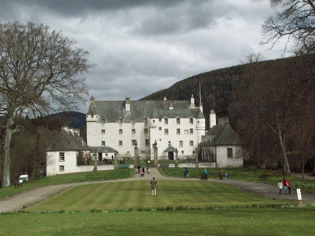
Traquair House, oldest continually inhabited house in
Scotland.
A tight right-hand bend lies 329m from the bridge, surrounded by trees and thus likely to be slippery if recent wind and rain have blown leaves onto the road (and since this is Scotland, they probably have done), before a 1km section starting with trees on the right of the road concealing Traquair House, believed to date from the 12th Cetury (though no surviving part can be dated before the 15th) and as such claimed to the oldest continually inhabited house in Scotland. Frequently used as an example of Scottish Baronial architecture, the House in fact predates the style and was a probable inspiration for it. The famous Bear Gates were closed in 1745 and have remained shut ever since, only to be reopened when a Stuart once again sits on the Scottish throne.

The B7062 becomes the B709 on the other side of a crossroads in the village, a road the race follows for the next 11.4km. The peloton climb as pass through Kirkhouse, reaching 200m just to the south between two farms. There's an easy left followed by a tight right 1.19km from the second farm before the road reaches 300m alongside a conifer plantation, climbing to approximately 360m before beginning to descend as we leave the plantation behind and travels across open moorland, passing by two ring-shaped enclosures 0.96km apart - it's impossible to say what they are from aerial photographs but they look to be of some antiquity. There are also two cattle grids - extremely hazardous unless hit at an angle very close to 90 degrees to the poles - located at 16 and 18.7km. After 20.5km, the route reaches a crossroads south-west of Montbenger and turns right at the Gordon Arms Hotel onto the A708 (there's an antique petrol pump set up in the carpark next to the hotel, if that sort of thing interests you). The road is straight and level all the way to St. Mary's Lake, following along the northern shore and arriving at Cappercleuch after 27.2km and a right turn onto a narrow unclassified road 160m after the orange "rumble strip" traffic-calming device immediately west of the village. It's an innocuous-looking road, but not without danger - 35-year-old David Stanners of Peebles CC was killed here after misjudging a bend and crashing into a wall on the 3rd of September 2011, just eight days before the Tour passes through. There are a further three cattle grids located at 30.2km, 35.9km and 38km, with the first climb of the race - Cat 3 Megget Hill - beginning at the third shortly after passing through Meggethead. The summit lies 0.4km after the start of the climb. There's a very steep descent - hazardous at 20% - 1km after the summit, the high speeds generated by it making a  sharp right-hand bend 0.8km later hazardous.

Tweedsmuir Parish Church (CC2.0)
The route turns north towards Talla Reservoir, the construction of which swelled the local churchyard for over 30 men - mostly Irish cheap imported labour - were killed whilst it was being built. Having passed along the edge of the water for around 1.63km, the road narrows slightly as it crosses a bridge. 2km later, the peloton turn a tight 90 degree left (by trees, hence possibly slippery) to pass along the dam, hitting an equally sharp right-hander 0.3km later. This road leads us to Tweedsmuir and a T-junction with A701, where the race turns left to head south-west. A short way away on the same road is the Crook Inn, made famous as the place where Rabbie Burns penned his poem Willie Wastle's Wife - not his best and somewhat questionable to modern tastes as it basically concludes Mrs. Wastle to be worthless as a human being due to her physical unattractiveness - and one of the many claimants to Oldest Pub in Scotland (there are many oldest pubs in Great Britain's constituent nations - I have personally been to four Oldest Pubs in England). 3.1km later, the race reaches the first drinks station - always a potential hazard as riders slow and grab the bidons (drinks bottles) held out to them by team employees. The next Cat 3 climb begins at 55km.

The Devil's Beef Tub (CC2.0)
The summit comes 4.5km later near the Devil's Beef Tub, a 150m deep hollow between four hills described by Sir Walter Scott as "a damned deep, black, blackguard-looking abyss of a hole" (it's actually quite attractive). The name comes from the hollow's use by the Johnstone clan, described by the farmers in the area upon whom they preyed  as devils, as a place to hide stolen cattle. The descent into Moffat, 70.1km from the start of the race, is undemanding in the dry; though as ever on a descent unpredictable factors such as punctures can rapidly become disastrous.

Moffat has been a tourist destination ever since the 17th Century when health benefits were first ascribed to the sulphurous waters that bubble up in the area - during the height of the spa's popularity, a special pipeline was built to carry the water from a well on the hills down to a bath house in the town and several hotels sprang up - one, The Star, was listed in the Guinness Book of Records as the narrowest hotel in the world at just 6m wide. The stage's second intermediate sprint begins at Moffat's town hall, housed in the old bath house on the A701 running west of the High Street. Reaching a short road connecting the two, the peloton turns a tight 90 degree left and right - this being in the middle of the town, there's the potential for diesel and puncture hazards on the road - heading out of town along the High Street and, having negotiated the tight left bend at the end, on the A708. After half a kilometre, the race turns right onto the Old Carlisle Road. Following the undemanding road until 80.1km leads to a junction and a sharp right into Newton. They pass over two bridges, one crossing a river and one a motorway, then turn left onto the B7076. The 1km long feed zone - another hazard as riders slow down and grab musettes (cloth bags filled with energy gel and the various things professional cyclists have to eat), domestiques loading up and ferrying the bags back to their teams.

The route remains level and straight until it reaches Johnstonebridge where the peloton turn a sharp right into the village which marks the approximate halfway point of the stage. At the next junction, they turn left and past a farm, riding through a small wood as the road climbs slightly before a short descent towards a difficult left-hand bend in woodland, caution being required in case of slippery leaves on the road and possibility of punctures. There's a very short but steep climb in the woods before the road begins to descend on the way out towards the crossroads, which the race travels straight across to arrive at a T-junction 0.39km later. They turn right here, heading towards St. Ann's, then a wide left bend takes the race through 180 degrees onto the A701 continuing through Parkgate at 98.5km, Amisfield, Locharbriggs and into Dumfries.

The Old Bridge, known to locals as Auld Brig, Dumfries (CC3.0)
Dumfries, the largest town we've yet seen on this stage. Like Peebles a Royal Burgh until the distinction was abolished, Dumfries was the site where in 1264 King Alexander III met with his knights to plan an invasion of the Isle of Man, once under Scottish rule but controlled by the Norwegian monarchy for almost two centuries. William Wallace and his rebels passed through in the latter years of the same century, chasing an English army who applied for protection at the now vanished Dumfries Castle but were refused, eventually being caught and slaughtered at Cockpool some kilometres to the south on the Solway Firth coast. The town has a long and bloody history - not only was it the scene of several vicious attacks and lootings at the hands of the English, it also executed ten "witches," the unfortunate women being tied to stakes and strangled before their bodies were burned. As late as 1868, it was the site of the last public hanging to take place in Scotland. Strangely, it has experienced two earthquakes on Boxing Day - one in 1979 and another in 2006. Its police force is the smallest in Scotland, but played a large role in one of the largest criminal investigations ever to take place - that following the bombing of Pan-Am 103 which fell on the nearby town of Lockerbie.

Remaining on the A701 through the town, the race takes the second exit of the first roundabout onto Edinburgh Road, doing the same at two more roundabouts until the road becomes Academy Street before negotiating Church Crescent and turning left before the bridge onto White Sands which, later on, will host the finish line of the stage. As the peloton crosses it. 0.5km from the corner, they begin the third intermediate sprint. Reaching the end of the road, the riders turn a sharp right onto St.Michael's Bridge leading to St. Micheal's Bridge Road becoming Pleasance Avenue. This leads them to a T-junction with the A710 where they turn left to head south towards the Solway Firth. 2.24km ahead, they reach a tight 90 degree right corner followed by an equally tight 90 degree left 0.38km later on the way through Islesteps. Another tight left lies 2.63km away; followed by a medium left bend left, tight 90 degree right and hump-backed bridge at New Abbey, with a medium left on the way out for good measure. New Abbey is the site of the not-very-new, ruined and delightfully named Sweetheart Abbey, founded in 1273 by Dervorguilla of Galloway in memory of her husband John Balliol, himself the founder of Balliol College at Oxford University.

The Solway Firth served as a backdrop to the fictional
Summerisle in the 1973 film The Wicker Man (CC2.0)
The road climbs and then descends gently over the next 7.8km to Kirkbean, the route consisting of long straights with no challenging bends. The village was the birthplace in 1747 of John Paul Jones who went on to found the United States Navy. In days gone by, thousands of people seeking a better life in America passed through here before setting sail on the ships that sailed from the inlet formed by the River Nith's estuary on the Solway Firth just to the east, but today it's a quiet place given over to nature. A nature reserve on the far bank is an important breeding place for several species of birds. The race continues through on the same road, reaching Caulkerbush and a slight left before taking a tight right 54m later onto the B793. The Cat 3 climb of Banks Hill begins 0.95km after the turning as the peloton pass a large house to the right of the road, just past a junction. It ends 1.5km later along the straight road, in between farm gates on the left and right,, almost precisely 140km from the start of the race.

Beeswing Kirk - a church converted
into a private home (CC2.0)
A medium left some distance ahead sees the road begin to descend again before arriving at a T-junction, turning an easy right before continuing to Edingham, site of an industrial complex and hence another potential spot for diesel spills. There are some large circular earthworks just right of the road as it passes the turn for the complex before arriving at a T-junction with the A711 where the peloton turn right. The road remains wide and unchallenging for 9km with exception of a slight climb towards the village of Beeswing.

Anywhere with a name such as Beeswing very obviously deserves a closer look - and an explanation of the strange name. Originally named Lochend, the village elected to rename itself after a famous thoroughbred mare, winner of 51 races during her short eleven-year life. The horse was neither from here nor ever visited, an indication of the high esteem in which she was held. There's a very steep descent 1.56km past Lochanhead, the road dropping more than 60m in around 0.7km, followed by a slight rise into Cargenbridge before the race reaches Dumfries 1.2km later. Having passes straight across two roundabouts and along Cassalands and Galloway Street, the peloton arrives at a bridge, crossing the river and turning a sharp left to enter White Sands. Following a final 300m sprint, the stage ends after traveling 170.3km from the start line.

Predictions: Now, we could be wrong because he'd plainly have far rather been at the Vuelta a Espana, but we can't see any reason why Thor Hushovd won't win this one easily. However, strange things happen in these smaller Tours - while the bog boys are all tuned to the three week Grand Tours, the lesser-known lads will go hell for leather caring not in the slightest if the quest for glory leads to an early burn-out.

Weather: Wet - and very wet. Rain is expected across many parts of Britain tomorrow, with the heaviest of all predicted for Western Scotland. That ought to be a fun start. Wind is a little tricky to predict at the moment due to Hurricane Katia lurking off Newfoundland over on the opposite side of the Atlantic - very strong wind is expected for the area in the next few days, but at present it looks as though it won't get too rough until Sunday night or Monday. The maximum temperature might climb to 18C, but probably not: 14 or 15C is more likely.

Friday, 9 September 2011

Tour of Britain - Stage 2 Guide

Kendal, the Auld Grey Town (© Ally McGurk, CC2.0)
Stage Map: click here
Stage Profile: click here
More Stage Guides: click here

Stage 2 is a considerably shorter ride than Stage 1 at 137.7km, but with a Category 2 climb in the first 10km it should have all but the fittest climbers feeling the burn early on. There are a pair of Cat 3s later on in the race, but a relatively flat section in between will allow the pack a chance to catch up, putting the pressure on the climbers in an effort to redress the balance and ensuring that everyone will be glad to see the finish line. However, since the finish line is marked by Blackpool's 158m tower, they're going to be able to see it while they still have a long way to go - and that saps will like nothing else when your legs are hurting and you've had enough.

Scafell Pike (© Ann Bowker)
The race starts today in the Auld Grey Town, Kendal in Cumbria's Lake District - 2292 square kilometres of lakes, moors and mountains (including England's highest, Scafell Pike), frequently included on lists of the world's most beautiful destinations. Designated a National Park in 1951 (the largest in England and Wales), all the land in England reaching an altitude greater than 914m (3000 feet) lies within its boundaries, as do the largest, longest and deepest lakes - which, with one single exception, are never termed lakes: other that Bassenthwaite Lake, they're either tarns, meres, reservoirs or waters.

In former times, Kendal was known as Kirkby Kendal - meaning a village with a church in the Kent Valley and derived from the ancient name Cherchbi, as recorded in the Domesday Book. Its nickname is derived from the grey limestone used to construct many of the buildings in the town. Today, it relies on tourism and IT as the basis of its economy, but in times past it was a centre of cloth manufacture - some manufacturing industry remains, including a pipe tobacco facility, a firm producing turbines and a baby food canning plant operated by the multinational Heinz company. The race begins, as ever, with a neutral zone; which today starts at approximately 10:30 in Abbot Hall Park and heads south along Dowker's Lane before two right turns lead onto the A6 Highgate. This carries the peloton north as far as Stricklandgate, where the riders turn right again onto Blackhall Road and over the bridge for Sandes Avenue and Station Road, following the bend and going straight ahead onto the A685 Appleby Road. After 4.2km, the neutral zone ends at Stocks Farm and the race proper gets underway (54°20'53.35"N 2°42'40.39"W).

Grayrigg (© Alexander P Kapp CC2.0)
Having passed Scalthwaiterigg, the Tour reaches Grayrigg after 4.6km, a small town that hit the headlines in 2007 following the Grayrigg Derailment, a train crash that left one person dead and thirty with serious injuries. Rescue was complicated by the isolated location with access limited to narrow, unsurfaced farm tracks; meaning that mountain rescue helicopters were used to ferry the worst-injured to hospital. The first climb of the stage, a Cat 2, begins 0.9km after Grayrigg as the peloton pass a gate on the left of the road (54°22'13.38"N  2°38'12.22"W). Whilst not too challenging for the initial sections, there are a few fairly steep parts before the road turns a medium 90 degree right 0.21km after a crossroads. It wouldn't usually be a particularly technical corner, but these narrow roads are used as droves by local farmers to move cattle and sheep from one field to another and as such can be very hazardous, especially after rain when the edges can be coated in a lethally slippery film of slurry (it's great for the roadside flowers, however).

Low Gill Viaduct (© David Ashcroft, CC2.0)
At 9.1km, the route takes a very sharp right - again, potentially slippery - onto the B6257. The summit is located 0.2km after the turning, parallel to a lay-by next to a small building among fields full of the slurry-making woolly devils (54°22'57.62"N  2°35'47.76"W). The initial half of the descent is fairly steep and - again due to the sheep and cattle - potentially hazardous despite the lack of tight corners. The underpass under the M6 motorway and railway just before Beck Foot, if used as a route between fields for livestock, could be very hazardous indeed as manure remains soft and slippery in the shade. Just south of the village, the road passes to the right of Low Gill Viaduct - a disused railway viaduct consisting of eleven arches, each 14m wide. The viaduct 190m from end to end and 30m high at the tallest point. A medium left turn lies 1.22km after the lane leading under the viaduct before the Tour reaches Firbank, 11.8km from the start of the race. It was here in 1652 that George Fox preached to a thousand people at a natural rock feature now known as Fox's Pulpit, one of many outdoor sermons he gave and among the most instrumental in bringing about the formation of the Quaker movement. The latter part of the descent is considerably less steep than the former.

Ingmire Hall (© Keith Wright, CC2.0)
After 16.6km, the route arrives at a T-junction with the A684, turning left and crossing a very narrow bridge 0.4km later. It's difficult to see just how narrow it is when approaching from the west, meaning that any rider who fails to study the parcours details sufficiently closely may find themselves running out of road and crashing into the left side railings. If too many riders attempt to cross at the same time, it will be the scene of a crash - as will the road just before it which is guaranteed to cause a pile-up if somebody doesn't brake quickly enough when arriving at the bottleneck where riders wait to cross. A medium right bend follows after 0.45km, before the race passes Ingmire Hall, a stately home of 15th Century origins but much remodeled in the years since - the house is a private residence and not open to the public; however, any spectator who fancies a closer look once the race has passed by can do so by walking along the public footpath that runs part of the way alongside the drive leading to the building.

The peloton arrives at Sedbergh after 18.6km (54°19'22.80"N 2°31'51.69"W), meaning that it is now in the Yorkshire Dales National Park. For many years, Sedbergh's economy has been based largely on its famous boarding school established in 1525 - however, the school was an addition to an already-established town rather than the town growing up around the school, as is made plain by the existence of a Saxon motte-and-bailey castle, the 12th Century parish church and a house dating to the 14th Century. It has also become known as a "book town," the six large independent bookshops and several book dealers bringing further income (and very pleasant employment opportunities) to the community. The stage's first intermediate sprint begins just before the town by a sign for Fairfield Mill (54°19'13.96"N 2°32'40.35"W). The route then takes a very tight right corner to join the A683 (Station Road). The road narrows in some sections before following the banks of the river for 100m and coming to a medium left - potential slurry again, being adjacent to a farm - 0.4km later. 0.55 from the corner is another narrow bridge over the River Lune. The bridge's exit, a slight right under overhanging trees, is also potentially hazardous due to slippery leaves, thorns etc. There is a Roman milestone, a pillar carved with Latin inscriptions, around 1.89km south of the bridge.

Easter Grotto, Ease Gill Caves
The road remains relatively level and free of difficult bends all the way to a bridge slightly narrower than the road in between Barbon and a golf course, then becomes unchallenging again all the way to Casterton located  32.3km from the start (54°12'39.54"N 2°34'40.14"W). Deep below the village are the Ease Gill Caves, until recent reclassification put them into second place behind the Welsh Ogof Draenen system (discovered in 1994 and yet to be fully explored) , the most extensive discovered in Britain. However, its 76km of passages, some of them flooded and thus accessible only to skilled cave divers (an activity that sounds about as fun as having your toenails ripped out with pliers to us), remain the country's most complex network.

Ruskin's View (CC3.0)
2.2km further south is the Devil's Bridge, one of the best-preserved medieval bridges in Britain and which - according the legend shared by many of the other bridges around the world with the same name - was built by the Devil after an old woman made a pact offering him the soul of the first person to cross it. Once he'd finished, the old lady outwitted him by throwing a piece of bread to the other side so that her dog chased after it, thus permitting the devil only the dog's soul. The same legend says that the Great Stone of Fourstones, deposited by an ice age glacier nearby, in fact fell from the Devil's purse as he carried the stones with which he built the bridge. We suspect that nowadays he prefers an Amex Black card. Every Sunday, the bridge becomes a meeting point for hundreds of motorcyclists and for the rest of the week scuba divers can be seen in the river below it. The stage's second intermediate sprint begins as the race passes the car park at the bridge and ends 100m later at the T-junction with the A65. If you're visiting, the little town of Kirkby Lonsdale on the opposite bank is well worth seeing - especially for the view from the churchyard at the northern end of the town, painted by Turner in 1816 and called "one of the loveliest views in England" by the art patron and social reformer John Ruskin: hence its modern name Ruskin's View.

Having turned left onto the much wider road, the peloton round a sweeping right bend and come to a junction and tight right turn leading back onto the A683, immediately crossing the border into Lancashire - in fact, there are sufficient points of reference here that with careful use of a GPS device or good old-fashioned map reading skill, it should be possible to locate a point here where a person would be in Lancashire, Cumbria and North Yorkshire simultaneously.

Thurland Castle (© Karl and Ali CC2.0)
A medium right-hander lies 2.17km south of the junction, then the race arrives at Nether Burrow followed by Tunstall 1.9km later. The landscape here is much flatter than the earlier parts of the stage. Just south of Tunstall and just visible from the route is Thurland Castle (54° 9'7.03"N 2°35'52.05"W). Built in the 14th Century, it fell in a siege in the middle of the 17th Century. It remained a ruin until 1809 when a limited restoration was carried out, full restoration taking place two decades later. Fifty years after restoration, it was left as a hollow shell by  a disastrous fire - only to be restored once again in the years that followed. In recent years it has been divided up and converted into doubtless horribly expensive apartments.

Wennington School (© J Scott CC2.0)
A very sharp right 0.45km after the turning for the castle leads to a tunnel under the railway into Melling, with a church dedicated to St. Wilfrid and often called the Cathedral of the Lune Valley (though it never was a cathedral in reality). It is believed to have started life as a chapel in the now-vanished bailey of the motte standing immediately behind it, one of many in the highest concentration of Norman castles anywhere in Britain other than the Welsh borders. The race turns left just before the church, following an unclassified road leading to a fork where the riders go right onto Lodge Lane, arriving at Wennington 44.1km from the start. Just north of the village is Wennington School, a boys' boarding school housed in a mid-19th Century stately home which, as a result of architectural trends of the time, looks very much how many of us would imagine the 14th Century house that originally stood here to have looked. Arriving at a T-junction with the B6480, the peloton turn sharply right to arrive shortly at Tatham and pass a bridge on the right; then, a short while later, enter the Forest of Bowland - the word forest is used here in its original English sense of meaning an expanse of land used for hunting rather than a large woodland. Two left/right Z-bends either side of a bridge start 1km south of the Tatham bridge, leading immediately into Wray.

Though a tiny rural village, Wray has three claims to fame: first, it has an advanced wireless broadband network offering not only internet but also high-definition television, maintained by Lancashire University; second, it's the Scarecrow capital of England; third, it hosts the not-quite-world-famous Annual Maggot Races. You know it's got to be a great place to live.

Hornby Castle (CC2.0)
The road narrows as it leaves the village, soon passing just south of Hornby at the 49.4km point. Hornby Castle, dating from the 13th Century but much altered over the years into a stately home, should be visible from several points along this road. It remains in private ownership, though now divided into several separate dwellings, and is not open to the public. Having passed over a crossroads, the peloton reach the drinks station 600m later at Lunesdale Court. 0.61km later, the race reaches a T-junction with the A683 and turns left, heading south to pass by Farleton and arrive at Claughton soon afterwards - the village has a large brickworks, thus increasing the probability of hazardous diesel spills on the road from the heavy trucks that deliver materials and take bricks away. Note the aerial ropeworks, a system similar to a cable car, that brings clay from Claughton Moor some distance away in enormous buckets to the brickworks.

Artle Beck (© Karl and Ali CC2.0)
Caton is around 2.89km from Claughton, not 8.1km as the road book suggests (this is apparently a mis-print as it lists points beyond Caton as being less than the 60km from the start listed for Caton). There's a truck repair garage on the eastern side of the village, increasing the potential for diesel spillages once again. Caton is known to have been a Roman town, as proved by the discovery of a millstone inscribed with the name of Emperor Hadrian in the nearby Artle Beck in 1803. The routes passes by the Ship Inn, standing near to a massive oak of great age which, according to local legend, was used by the local monks to display the fish they sold to villagers. The third intermediate sprint begins after 56.4km by the council offices in the town. The race takes the second exit to pass directly through the roundabout, then turns left 300m later onto Quernmore Road. There's a tight 90 degree right at Gresgarth Hall 1.2km from the previous corner - with extensive ornamental grounds open to the public, anyone with an interest on gardening or stately homes should consider a visit once the Tour has left, then an unchallenging wide left/roght Z-bend 0.61km later, followed by a medium left a short way ahead. A medium right on the far edge of a copse could prove slippery and leads to a medium left bend 135m before a medium left corner onto Postern Gate Road. With the exception of a few gentle bends, the route is straight for the next 3.1km to Quernmore, pronounced kwormur in that cunning way with which we Brits like to confuse foreigners.

Strickens Lane - if you're following the route, pay close
attention to your map through the Quernmore-Whittingham
section: there are several corners and junctions and the all
look much the same as this one! (© Tom Richardson CC2.0)
Having passed straight through one crossroads immediately south of the village to enter Bay Horse Road and another where Bay Horse Road crosses Proctor Moss Road, the race reaches a third crossroads 69.5km from the start (53°58'42.16"N 2°45'50.07"W) and turns left onto Delph Lane. The Category 3 climb begins as the race passes to the left of a house and farm (53°57'10.02"N 2°43'23.13"W) with a cattle grid coming 300m further along the road. Another one, 2km ahead, comes 290m before the summit (53°55'57.95"N 2°42'28.85"W). 1.2km ahead, having rounded the medium left around Oakenholme, the peloton turn a medium-sharp right onto Strickens Lane and immediately begin the next climb - the summit is 0.7km ahead (53°55'0.48"N 2°42'44.13"W), shortly before a lane leading up the hill on the right to Bank Farm. The descent isn't steep but due to the straight and undemanding roads should generate high speed.

A short way ahead, the road bends sharply left as a smaller road joins from the right, continuing on through Barnacre and past a turning onto Sullom Side Lane before becoming Sandholm Lane after 81.7km. At what appears to be a 90 degree right bend 0.52km later, the race continues straight ahead to remain on Sandholm Lane (following the apparent bend leads onto Ray Lane), past a farm on the right and onward to another crossroads. Turn left to remain on Smithy Lane, arriving presently at a junction with a potentially slippery left turn under overhanging trees onto Lodge Road running parallel to the M6 motorway and passing through some thick copses to a junction where left carries the race onto Ducketts Lane.

Inglewhite (© Chris Shaw CC2.0)
After 0.8km, the road takes a wide bend to the right and becomes Lydiate Lane, crossing the narrow Badger Bridge half a kilometre further on. At the T-junction 1.2km ahead, turn left onto Bilsborough Lane shortly before it becomes Bourne Brow and then Carron Lane. After 90 degree left, it changes back to Bilsborough Lane again and heads into Inglewhite, once the sight of a cafe housed in the old smithy that was popular with cyclists but has now closed. The village's name is believed to derive from the Gaelic term aingeal, meaning "fire" and referring to the willo-the-wisps which in former times were commonly observed upon the damp village green.

Passing straight through on Inglewhite Road, the peloton arrive at a crossroads while still in the village, travelling straight across and on towards a junction where a road joins from the right. The route goes straight ahead again here and a short way ahead when joined from the same direction by another road, arriving soon at a crossroads where Mill Lane and Syke House Lane join from right and left. They pass straight through once again and arrive at a 90 degree tight right 0.75km later, opposite a farm; travelling through an industrial site a short way ahead - as ever, potential for hazardous diesel spillages. Another crossroads marks the passing of Horns Lane, then a medium 90 degree left 0.37km ahead leads into a much wider right and a medium 90 degree right 0.61km later.

There are many Dun Cow legends in Britain. Most probably
recount fanciful tales of the extinct aurochs, wild cows
far larger and fiercer than the domesticated variety
The next section is unchallenging, though a medium left by the next farm could require some caution if wet. Ashley Lane leads off to the right 0.14km later while the race continues for another 0.79km to a tight 90 degree right onto Halfpenny Lane just before Longridge. A large rib hangs above the doorway of a farmhouse along Halfpenny Lane - according to legend, it belonged to a giant cow named the Dun Cow who roamed the area during a plague outbreak, curing people by giving them her milk. When she died of exhaustion after a witch milked her into a sieve rather than a bucket, she was buried - apart from the rib - under Cow Hill a short way from here. Nobody has ever taken a sample from the rib to ascertain what it comes from, but nowadays people tend to assume it belonged to either a whale or an aurochs, the vast and fierce wild cows which once roamed Europe.

Whittingham Hospital - once the largest mental asylum
in Great Britain (CC2.0)
At a T-junction 0.8km ahead, the race turns right onto the B5269 running straight and level into the parish of Whittingham at 99.1km from the start where the road suddenly takes a sweeping turn to the right preceding a very tight 100 degree left corner 0.29km ahead. As more houses begin to appear along the roadsides, the race reaches Whittingham's largest village Goosnargh. Work began on a mental asylum near the village in 1869, opening to provide treatment (or what passed for psychiatric treatment in the 1870s, at any rate) for 1000 patients four years later - bizarrely, the hospital incorporated a brewery in the early days. By 1939, it had grown to include a Catholic chapel, an Anglican church, a butcher, several farms, a telephone exchange, reservoirs, a gasworks and a post office and was home to more than 3500 patients - making it the largest mental hospital (as asylums had been renamed) in Great Britain.

Chingle Hall, scene of much spookiness
Finally, by 1960, the psychiatric establishment as a whole began to realise that mentally ill people required specialised, individual treatment rather than being herded into what was little more than a vast, grim prison. Allegations of cruelty made by patients against staff, both here and at other hospitals, forced the hospitals to open up to inspection and the findings were unfavourable. After almost a century, Whittingham's asylum began to be wound down, patients being reallocated to smaller units where they could be given the sort of help they needed. The last patients left the hospital - now offering modern treatments but located in buildings hopelessly outdated, in 1995. There are plans to convert the remaining buildings into apartments, but these have been held back by uncertainty over the future of the proposed Broughton bypass.

As would be expected, locals tell of all sorts of unearthly goings-on taking place in the hospital buildings at night. Just west of the village, 14th Century Chingle Hall, said to be the most haunted place in Lancashire. Tapping noises are supposedly heard coming from the known priest holes; regular claims that ghostly figures have been seen gliding around the house and grounds, including various monks around the hallway and stairs; a poltergeist is blamed for moving things around in the kitchen and orbs, mysterious lights, disembodied voices and other similar stuff is recorded whenever anyone gets permission from the house's owner to carry out an investigation (it's funny how ghost hunters never leave a property saying, "Nope, didn't find a thing," isn't it?)

Goosnargh. Looks normal, doesn't it? Ooooh no. It was
designed by Stephen King and Hieronymous Bosch. When
they were both on LSD. (© David Metcalfe CC2.0)
One strange story claims that, during the 1970s, one of the beams in the building's chapel mysteriously went up in flames before just as mysteriously going out again, leaving no signs of charring nor smell of smoke. That beam, and several others, have long been known to be carved with strange symbols; however, dendrochronological and chemical investigation has revealed that the timbers are firstly much older than the house and secondly have an unusually high salt content (as do those in the parish church), suggesting that they were recovered from a foundered ship - an not uncommon practice in the past and suggesting that the spooky carvings are nothing more weird than ancient ship builder's marks, an earlier variant of the marks still left on wood by craftsmen today. The spontaneous flames? Well, try to explain it if you wish. I don't feel the need to spend undue time thinking about it.

Oh, and as if giant cows, haunted houses and derelict mental asylums aren't enough weirdness for one rural English village, the parish was home between 1962 and 1991 to the UK Warning and Monitoring System which left a huge, then top-secret, nuclear bunker lying derelict many metres underground; a facility that would have been the Northern Britain Command Centre had the Cold War ever developed into an atomic war.

Mid-18th Century milestone in Broughton.
The symbol on top reveals it to be a point
where Ordnance Surveyors have
measured altitude above sea level
(© Trish Steel CC2.0)
After passing under the M6 motorway, the race reaches Broughton - and what a pleasure it is to find such a normal place, its only claims to fame being that it has the oldest primary school in Britain (established in 1590) and that it's the only parish in the country to have fire, ambulance and police stations within its boundaries. The race travels straight through a crossroads controlled by traffic lights in the town and onto Woodplumpton Lane, turning a medium 90 degree right 0.49km later and a medium 90 degree left 0.22km after that.

A bridge carries the road over the railway, then it arrives at Woodplumpton after 107.1km, missing the larger part of the village as it skirts around the northern side by continuing along the B5269. Local weirdness reappears here, because the village churchyard includes the grave of one Meg Shelton - otherwise known as "The Fylde Hag." Said to have had the ability to change into animal shape at will, she was apparently buried vertically with head pointing downwards and her grave covered by a heavy boulder after she refused to stay in it! She could also transform inanimate objects into apparently living creatures, as when she turned a bucket into a goose to disguise the fact that she was stealing milk - the farmer only caught her out when he saw milk dripping from the goose's beak and kicked it, at which point it turned back into a bucket.

After turning right at a T-junction near the village, the peloton come to a wide left bend followed by a narrow bridge over the Lancaster Ship Canal 0.16km later. The first 0.94km of the road into Inskip is straight, but there are several difficult bends and corners in the remaining stretch. The first is a medium right/left Z-bend at the junction with School Lane, followed by a medium-tight 90 degree left corner near a farm 0.22km - this one being made potentially more hazardous by overhanging trees. A tighter 90 degree right lies 0.1km ahead, leading into a 0.4km straight, then a medium left and a medium 90 degree right 77m later. Another medium left 0.27km further along leads to a 0.35km straight, then a medium right. All of these corners are made more hazardous due to their location on arable land, making diesel spills and slurry a possibility. The remaining road into Inskip is straightforward with one simple bend right before the village.

Inskip radio masts, now disused (© Keith Wright CC2.0)
Just south-west of Inskip are four 183m radio masts, once used to send and receive communications between submarines and the Royal Navy who owned the site (officially classified as HMS - "Her Majesty's Ship" - Nightjar) up until 2010. A medium 90 degree right lies 1.4km after the village, followed by a much tighter 90 degree left 0.2km later and a tight right leading into a gentle left-hand bend at Crossmoor. Having passed by a lane on the left, the race reaches another tight right-hander 0.4km later, then a tight 90 degree left 40m ahead to join Lodge Lane. A medium-difficulty left/right Z-bend lies 0.4km futher on before the road straightens out and arrives at Elswick, 116.1km from the start (53°50'17.61"N 2°52'48.63"W). The route passes straight through the village before coming to a pair of 90 degree bends, right/left, at the end and heading toward Thistleton, coming to a very tight 100 degree right at a T-junction 1.47km after Elswick and a T-junction with the A585 0.56km later. Turning right, the peloton cover a very short section before turning left and rejoining the B5269 81m ahead and, having turned right at the next junction, arriving at Singleton after 1.4km.

Poulton-le-Fylde market square. The stone "bench" is in
fact a fish slab, from which fresh fish was sold and the ball-
topped stone pillar is a whipping post, to which petty
criminals were tied before being lashed. Just out of shot
are the stocks (© Alexander P Kapp CC2.0)
The race turns right at a mini roundabout in the village, passing onto Lodge Lane leading north into the countryside - the first part has overhanging trees and thus could be slippery, but the road is wide and good quality. It joins the A566 after 1.36km at a junction in Little Singleton, the peloton travelling straight ahead - there's a small traffic island in the middle of the junction, positioned where it could form an obstacle for riders on the right of the pack if they attempt to get through en masse, but it shouldn't cause problems if the main group has spread out a little by this time (this, meanwhile, is unlikely on a stage such as this one). At a large roundabout north of Poulton-le-Fylde. This town, home to nearly 20,000 people has been inhabited for some 120 centuries, as made evident by the discovery of worked antler artifacts carbon dated to 10,000 BCE, had an unusual tradition in which the wealthy buried dead family members at night following a torch-lit procession through the streets - it died out in 1810 after the wind blew sparks from the torches and set fire to an entire row of buildings along the market square, destroying them. The riders take the second exit off the roundabout, the route to the left of the centre being the easiest and - marginally - shortest.

No.712, a double-decker tram at Blackpool
At a very similarly-sized roundabout 2km along Amounderness Way, the race takes the third exit (or second, for those who prefer to tackle it by taking the slightly shorter right path around the centre), continuing straight ahead to the next roundabout. At this one, on the very edge of Cleveleys and surrounded to the north and east by Thornton, the peloton take the second exit, turning a slight left into the town and towards the coast. 1.1km later, the arrive at a diffiicult left turn onto Crescent East - the corner itself isn't especially tight or wide, but Crescent East is separated from the parallel Crescent West by a central strip which could easily catch out any rider who takes the turn too fast to avoid it. They'll also need to exercise caution to avoid the tramlines, Blackpool being one of the very few places in Britain to retain an functioning tram network: now featuring 18km of tracks, construction began in 1885 - making it one of the first in the world and, today, one of the oldest still in operation. It's also one of a very small number around the world to use double-decker trams.

The Miners' Home (© Tom Richardson CC2.0)
After 0.8km, Crescent East becomes Kelso Avenue which in turn becomes Queen's Promenade as it emerges from the buildings at Anchorsholme Park before joining the seafront and continuing south past the Norbreck Castle Hotel - really not Blackpool's most attractive - and the grand Miners' Home, once a convalescent home for elderly, sick or injured miners since converted into highly-sought-after apartments. The race is now on The Promenade, the final section of the stage.

The tramlines run along their own fenced-off strip parallel to the road here, meaning they no longer pose any danger as the race arrives at North Pier and enters the famous Golden Mile - actually seven miles (11.27km) - and Britain's first seaside resort, having grown up to provide for the needs first for the wealthy and fashionable socialites of the 18th Century who came here to "take the cure" and, later, for the vast numbers of workers who flocked here from the industrial towns and mills of North-Eastern England in the latter part of the 19th Century. From here, it's a final flat, straight, high-speed sprint over 300m to the finish line at the Tower (53°48'56.98"N 3° 3'21.40"W).

Blackpool Tower (© Steve F CC2.0)
Grade 1 listed, 158m tall Blackpool Tower cost £290,000 to build in the last decade of the 19th Century with £2000 personally donated by Mayor John Bickerstaffe who had originally suggested the project after being inspired by the Eiffel Tower during a visit to Paris. Though the two towers appear superficially similar, they're actually completely different in many ways - for a start, the French tower is 166m taller and free-standing, whereas Blackpool's tower is anchored to a base disguised by a building occupied by the Tower Circus. Consisting of 2,993,000kg of metal and around 5,000,000 bricks, it was designed so that were it to ever fall it would fall into the sea rather than onto the dense town behind and to either side of it. Three years after completion, the top caught fire and could be seen from 80km away. Originally, the metal was not protected by paint and the structure became so badly corroded that by 1921 it looked as though it might have to be demolished. However, recognising its enormous ability to attract tourists, it was decided to save it and over the next three years all the metalwork was painstakingly replaced piece by piece.

Predictions: Well, we did fancy Jens Voigt for this stage - it looks like the sort of parcours that can be won by attacking hard all the way, and that's what Jens does best. However, as we all know, bad fortune struck LeopardTrek once again in Stage 1 and Jens was forced to abandon. Mark Cavendish was always going to be a favourite today - the course is reasonably flat for much of its length and end with a flat, straight sprint that suits the HTC-Highroad lead-out down to the ground. But, Cav has a very powerful enemy for today - Nature. With Hurricane Katia showing off out in the Atlantic, north and west Britain is being battered by strong winds. Heading up to the finish line, these are going to form blasting crosswinds smashing into the race from the right. That's enough to mess up even the most well-rehearsed tactics.

Weather: This is the Lake District. How do you think all those deep glacial valleys became full of water? The region has some of the highest average rainfall anywhere in Europe - it's looking at present like the wide band of rain expected to cross the region early in the morning will be followed by a dry period, but accurate forecasting in this part of the world is difficult even without a hurricane complicating matters. Temperatures will rise no higher than 17C and should fall no lower than 14C - but with the wind (and rain, if it does), it'll feel much colder. The wind is likely to cause problems - while there is no Met Office weather warning for the area currently, there's an official Yellow Alert (risk of disruption to transport and the possibility of damage to trees and stuctures) in place for Northern Ireland, Scotland and parts of Wales (all of which surround NW England)  for the entire of Monday. At present, there are no plans to cancel the stage.

More Stage Guides: Click here