|
| Alto de L'Angliru |
Stage Map: click here
Stage Profile: click here
More Previews: click here
"What do they want? Blood? They ask us to stay clean and avoid doping and then they make the riders tackle this kind of barbarity." (Vicente Belda)
Stage 15 is the one the riders have been dreading. The reason? Alto de L'Angliru. The stuff of nightmares, perhaps the most demanding climb in professional cycling.
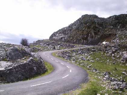
Angliru starts off relatively easy - the average gradient on the first 5km is 7.6%, enough to hurt but well within the realms of rideable for a professional. The sixth kilometre is easy, flattening for a while and even descending for a short way. From then on, it gets tough. Very tough. The average gradient for the last 6km is 13.1%, beginning to stretch the boundaries of what can be done - but, as if that wasn't harsh enough, there's the Cueña les Cabres 3km from the top with a gradient of 23.8%.
In the past, this climb has seen riders forced to ride to the summit with flat tyres after team cars stalled and were unable to follow them up. The mountain has not taken life, like Ventoux which inspired its inclusion in the race, but it could one day prove capable of doing so.
 |
| Centro Cultural Internacional Oscar Niemeyer, Avilés |
The start town today, Avilés, couldn't be more of a contrast; its located in the flattest part of Asturias. This is a region which has been inhabited by humans for a very long time, a fact proven by the discovery of the Trelles Axe discovered at the site of the present day Calle de La Cámara and subsequently sated to 100,000 years before the present. The city's name is believed to be derived from that of a Roman landowner, Abilius, but the settlement appears to have been just a village during his time and remained one right up until the 10th Century when it was granted permission to build a castle to defend itself against pirate raids. The village rapidly began to develop into a town and then, gaining a charter under Alfonso VI in 1085, becoming a city.
 |
| The port, source of much of the city's wealth |
Avilés grew wealthy through the storage and distribution of salt, an activity then managed as a monopoly by the Spanish crown, its large harbour making it an ideal place for trade in the mineral to take place. That same harbour permitted the development of the ship-building industry, bringing in more income. A disastrous fire destroyed many buildings in 1479, but such was the importance of the city that the monarchy granted large sums of cash to ensure that it was rebuilt - hence the many Renaissance buildings, well-thought-out structures to replace the medieval ones that didn't survive the fire.
 |
Calle Galliana, some of the Renaissance buildings dating from
redevelopment after the 1479 fire. |
During the 19th Century Avilés was occupied by French forces, but guerilla attacks carried out by underground resistance groups proved highly successful in bringing the city back to Spanish rule. Industrialisation brought yet more wealth, enormous weaving mills and iron smelting works springing up in the area. Heavy industry remained right up until the 1980s - in the second year of that decade, it was discovered to be the most polluted city in Spain with the highest number of asthmatics and the second most polluted in Europe, only Katowice in Poland being more contaminated. Today, there are many projects based in the locale which devote themselves to cleaning up the local environment and promoting sustainable industry and lifestyles.
The neutral zone begins at the Niemeyer Centre, a superb modernist complex housing assorted cultural institutions, then travel south-east and around a right corner to the Puente Azud. W reach a junction between the road we're on, the Av. Marqués de Suances and the Av. de Cervantes, turning right once again to take the latter road. The directions, as is often the case with the Vuelta road book, require a little interpretation at this time, for they list the next section as being the Calle de La Cámara - the trouble being that the Av. de Cervantes and C. de La Cámara do not at any point meet one another. The two most obvious connecting routes are to turn right onto the C. de la Marques and then left onto the C. del Rivero before a short section of the C. de San Francisco leads to the C. de La Cámara; or - probably the better and more likely route - continue along the Av. de Cervantes, right onto the C. Galliana and then either the C. de San Francisco or C. de Alfonso VII. Fortunately for the riders, crowd barriers and race organisers will be marking the route.
The peloton follows the C. de La Cámara all the way to its northern end before turning right to join the C, Pruneda and then left at the roundabout by the river for the Av. de Ludo, also known as the N-632, which carries on long and straight before turning west and reaching the end of the neutral zone after 3.8km. They soon come to a roundabout, taking the third exit past the salt works and onward to Piedras Blancas where they follow the road to the right, along the Av. de Eysines and onto the Av. de Galicia leading south-west towards Vegarrozadas. The route passes straight through the roundabout just outside the village, underneath the A-8 motorway and past a filling station then reaches a sweeping S-bend at Carcedo, from where there are good - if not particularly beautiful - views to the motorway viaduct carrying traffic far above the landscape. We pass under two more fly-overs either side of Folgueras, the the road turns west.
 |
| The bridge into Muros de Nalon |
The race soon reaches Soto del Barco, soon coming to a roundabout where we turn right to follow the N-632 - the right path around the centre is slightly shorter, the left much easier and possibly faster due to the less acute angles - then past the Hotel Palacio de la Magdalena, the kind of hotel that only professional football players can afford to stay in these days. A bend to the right leads onto a wide bridge across the Rio Nalón, where fishermen launch their tiny boats from spindly-legged wooden jetties. On the opposite bank, the road bends left and enters Muros de Nalón. During the 20th Century, Muros became an important port shipping coal from the rich mines further up the river. Nowadays, it relies for a large part of its economy on the eucalyptus trees that grow in great numbers on the surrounding hillsides. At the next roundabout, the peloton take the third exit on the left for the AS-352 then, 0.6km later, turn left at Somado onto the AS-224. When we reach the edge of the forest on the left a short while later, a large red villa with an unusual glazed gallery extending right around its first floor can be seen to the right - a so-called
casano del indiano, a mansion built by someone who had made a fortune in Spain's American colonies.
 |
| Santianes de Pravia |
The road travels on and into forest and around a series of potentially slippery bends, coming soon to Los Cabos and Bances, then Agones. Passing straight through one roundabout then turning left at the next, the peloton travels west for approximately one kilometre and coming to another roundabout where they leave the AS-224 behind and join the AS-225 leading into Pravia. Having skirted the northern edge of the town, they turn south to another roundabout and then left at another roundabout, across a bridge and onto what the road book calls the A-16, probably meaning the AS-16 since the A-16 was a motorway on the other side of the country subsequently renamed the C-32.
Having passed east of a forest, the route bypasses Forcinas and the road follows the banks of the Rio Narcea for a short while then travels under another fly-over and through a 200m tunnel to Veganas and Villanueva. After Palla, it follows the river again to Corias and Repolles, coming to a stretch of river by San Justo with higher ground either side - a very beautiful stretch of the race. It crosses the river south of Luerces and then, 40.3km from the start, reaches a roundabout near Cornellana. The riders turn left and climb 70m through the forest towards Villar, missing the turn-off into the village to continue on the N-634 east. The road isn't difficult, but does climb gradually; hitting 360m at Cabrunana. The stage's first intermediate sprint takes place on the gentle descent beyond the village. There is one hairpin and a roundabout - straight across, left and right routes are equal - just before Grado, but it's otherwise quite a non-technical section.
 |
| Penaflor from the air. |
We follow the N-634 right through the town, passing through a hazardous section with rubber traffic-calming devices embedded in the road - what the road book calls
tacos de goma "rubber feet" - and two roundabouts before a final right bend leads onto the Calle del Puente and over the river into San Pelayo (or Sampelayo, in the road book). The route passes straight over the next roundabout, the left path being the better one this time, and into Peñaflor before once again following the river - this is an even better section with an old, narrow bridge stretching across to the Casa Aurorina on the other side, an unusual house supported on stilts in the river. We travel by Anzo, Vega de Anzo, Valduno and Llera, then underneath the A-63 and after 0.8km turn left at a roundabout before climbing slightly to Fuejo. After 63km, we reach Bercio and then descend into Udrión, taking the road through to the river where the route passes by the bridge, changing onto the AS-228 as it leaves town through an industrial area, a possible hazard spot due to spilled diesel on the road.
More villages pass by, starting with Trubia. The feeding station is at San Andres, 71.5km from the start. The following section could prove hazardous - it's obvious now that we're heading back into the mountains because while the slopes along the sides of the road are not high, they're very steep and have rocky outcrops among the forest. This means that during and after heavy rain mud, leaves, thorns and stones wash down the slopes onto the road, leaving it slippery for a while and covered in assorted bits and pieces able to cause punctures - both things very capable of causing crashes. Tunon comes shortly after a 0.2km tunnel, then the parcours turns left onto the AS-360 0.3km before Villanueva. The first categorised climb, Cat 2 Alto de Tenebredo, starts at this point.
The road climbs rapidly and, without a guard rail, is potentially dangerous for the same reasons as the previous section. 300m is reached just around the first bend, then we enter a gentler section to Tenebredo village which is followed by a much steeper ramp gaining over 100m in 0.6km. The summit, 510m above sea level, is reached in between two forks in the road. The descent isn't challenging but has fewer trees, making the bends even more likely to be slippery due to mud following rain or dust following dry spells. We pass through Cotomonteros (Calmonteros in the road book) and Lavarejos, then arrive at a T-junction with the AS-322 and turn an acute right, climbing then descending again en route to Palomar. The road enters forest, emerging a short way ahead into much flatter terrain around El Polledo before reaching Soto de Ribera where the parcours crosses the river and turns 90 degrees right onto the N-630.
Once past Argame and Morcin, we enter a section featuring a series of unlit tunnels in quick sucession, one of the most hated of all hazards among cyclists. The first and second, 95km from the start, are 150m long; the third is 200m; the fourth 110m and the fifth 105m - expect the riders to be in filthy moods.
 |
| Palacio de Arriba, Mieres. |
We then enter an industrialised region, crossing over the A-66 motorway and following the same road around various roundabouts until we reach the roundabout junction with the AS-242 and take the fourth exit to the right for Mieres de Camino. The parcours follows the Calle de Onon and C. Teodoro Cuesta, then runs along the C. Ramón y Cajal for the stage's second intermediate sprint before joining the C. Fray Paulino Alvarez leading out of town.
Mieres grew around coal mining and the steel industry - the former now declining and employing a far smaller percentage of the population than it once did, the latter having all but vanished by the end of the 1970s. However, its history is much longer - there are several prehistoric forts nearby and the Romans found a town here when they arrived, but how important a town it was under their rule is unknown because with the declining industry there are insufficient funds available to finance archaeological research. It appears, meanwhile, to have been a small and little-known place throughout the Middle Ages; an irregular inclusion in documents until the 19th Century. Unsurprisingly, with a large population of labourers and mine workers, it became a stronghold of leftist politics during the Civil War, though workers' organisations took on a more Stalinist flavour here than in most other Spanish towns who tended overall to favour anarchistic thought. Anti-Falange activity, including guerilla attacks, continued even after Franco's regime held power.
 |
| From decaying eyesore to fine hotel: the Palacio de Figaredo |
We continue along the AS-242 through the town; leading us past old collieries and the modern university which is today one of the most profitable industries in the region with courses in mine technology and engineering attracting students from all around the world. As there is still much heavy industry nearby, all bends have a possibility of diesel spillages and are thus possibly hazardous. On the very southern tip, almost but not quite a part of Mieres, is a tiny village named Santullano with a sweeping bend again possibly with spilled diesel. The next village is Figaredo, site of the
Palacio de Figaredo - until recently a rather ugly, decaying brown edifice; now fully restored and converted into a very fine hotel, and much kudos to the owners for saving the old building and returning it to its former grandeur.
To the south of Figaredo the peloton reaches a complex interchange with the A-66, the main route into Mieres and thus once again subject to diesel spills, turning right crossing the bridge over the river to the southern tip of Las Vegas and then left to continue south. Presently, we reach Villallana, then La Vega and after 1.5km to a junction with the AS-231 where we turn right into a short tunnel under the railway and begin the Cat 1 Alto del Cordal climb which will see the peoloton ascend 510m in 5.3km. The first village on the climb is Munon Fondero which comes just before a 90 degree right bend into forest with an even tighter left into La Cuquera de Abajo. Two more 90 degree bends, one right and one left, lead into La Maderada and through more forest to a mining facility. At this point, the race encounters a series of four tight hairpin bends rising through 69m - the second looks to be the most technical, turning through more than 180 degrees. Four 90 degree bends then lead up to a junction with a road to the left, but the route passes by around another 90 degree right and almost immediately another turning left - the highest point, 790m above sea level, is halfway between the two.
 |
| Cuena les Cabres |
The first part of the descent, though fast, is not particularly testing; however, once through the first vertical 110m it reaches a section with four tight bends - two left and two right. A brief section at less of a gradient leads straight into a faster descent past Canto la Vera, then a twisty section travels through forest and around two easy hairpins. A relatively straight section leads into a tighter hairpin, then straight on to La Vega (not the same one we passed through before the climb). Halfway through the village, opposite a bus stop, the riders need to negotiate an extremely tight left corner to join the RI-2. After 0.3km, the final climb - Especial Category Alto de l'Angliru, highest point 1557m - begins.
The race proceeds up the wide valley, past the junctions with the RI-3 and RI-4 and around a wide and easy hairpin, then through two 90 degree rights - the first wide and sweeping, the second much tighter. There are two junctions for the RI-5 and the road book is once again a little unclear; however, there is little difference between either as the distance is much the same and they both lead to Viapara. We'll hope the travel past the first one and through Grandiella, meanwhile, because it's a very pretty little village with its low stone houses and narrow streets. From now on, we're on the final stretch, at the bottom of the mountain.
The road climbs gently, then descends for a short while until we turn 90 degrees left and head south, reaching 800m between two gentle left hand bends, then three hairpins in 0.6km take us up another 50m. A fourth hairpin a short way ahead brings us to 900m, then the terrain flattens out enough for the next 100m to be climbed along a long and straight road. At the end of the section is a very tight hairpin, turning through around 170 degrees before turning slightly left, at which point the parcours straightens out again to allow the next 150m to be climbed without bends.
The next hairpin is another tight one and, on the other side, it starts getting steep again with the following hairpin only a short way ahead. A longer section precedes two hairpins with only 30m between them, rising 22m, then another straight rises approximately 40m to one of the tightest hairpins yet. The next, slightly less tight, is just ahead and we reach 1500m just before the one after that. After one more and a 90 degree left where the road dips into a cleft in the mountainside, we reach the summit around a 90 degree right. Another 90 degree left begins the descent to the carpark and stage finish at 1557m, 142.2km from the start. What percentage of those riders to begin the stage complete it - within the maximum allotted time or at all - will be revealed here; all those who complete it, even outside the maximum time and being disqualified as a result, can take great pride in having survived what is probably the most difficult stage in any of the 2011 Grand Tours.
 |
| Alto de l'Angliru profile |
Prior to 1999, the high pass over Angliru was known only to local farmers and hikers. It was "discovered" by Marcel Prieto, a director of the ONCE team, in 1996; but his proposal that it be included in the race was ignored by the Vuelta's managers Unipublic who at that time favoured the climb to Lagos de Covadonga which had been used several times since first inclusion in 1983 (and was last climbed in 2010). However, two years later when organisers were looking for a test to equal the Col du Galibier in the Tour and Monte Zoncolan in the Giro, they looked again at the mountain and realised that they could not only equal those better-known challenges, but beat them by a long chalk. José María Jiménez was the first to the summit, emerging from thick mist to take what has become one of the great, legendary victories of cycling. Since then it has been included on another three occasions: in 2000 when Gilberto Simoni was first up; 2002 when it went to Roberto Heras; and 2008 when Alberto Contador took the honours. Note that these four riders are widely regarded as the strongest and most technically gifted climbers of the last two generations of professional cyclists, reflecting the severity of the mountain - it's simply too steep, too punishing to be won by lesser men.
Predictions: No sprinter, breakaway expert, puncheur or all-rounder can win this stage - with a mountain like Angliru looming over today's race like some vast, threatening presence it can only be the strongest of the climbers. The question is, who is that? We think that Rodriguez is the only candidate this year, though had the Schlecks and Contador been in the race we'd have seen an epic battle. However, nobody really wins a stage like this one - someone will be the first across the finish line, but Angliru will take more from them than they'll receive in return. Wiggins, having recently emerged as a handy climber, will stand a good chance of holding onto the red jersey or, if he loses it, at least leave himself a reasonable opportunity to win it back in the coming days.
Weather: Temperatures remain pleasantly cool again, ranging from highs of 19C down to 15C on the smaller mountains. Angliru will be chillier due to altitude, dropping as low as 10C. Skies will be overcast all the way but no rain is expected. The first 120km will experience changeable winds, varying between light crosswinds and tailwinds - we may see echelons on the flatter sections. Towards the end, as the race approaches Alto del Cordal, things change - as though that last killer climb isn't enough, the riders will fight headwinds all the way from here to the summit of Angliru. As if it wasn't hard enough!
More Previews: Click here
Video Links:
Angliru '08 (best watched with sound turned down to avoid the dreadful Eurohouse music)
Angliru '08 #2 (same again re. the music)
Descent of the Cuena les Cabres (on motorbikes)