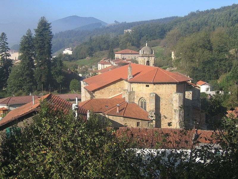
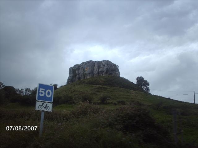
Showing posts with label Nojo. Show all posts

Thursday, 8 September 2011

Vuelta a España - Stage 19 Preview

Stage Map: click here
Stage Profile: click here
More Previews: click here

The Basque flag
It's been more than three decades, but finally the Vuelta returns to the Basque Country - home of the Euskaltel-Euskadi team which is partially sponsored by the autonomous Basque government and of Movistar. Love of cycling is in the blood of the Basques: Iban Mayo, Haimar Zubeldia, David Etxebarria and the great Miguel Indurain are all from Euskadi, the name of the country in the unique Basque language.

The beautiful landscape of Euskadi
Basque nationalism has a long history, having emerged as a political movement during the 19th Century. However, the Spanish government chose to ignore the region's calls for self-determination. The combination of political disenfranchisement and leftist opposition to Franco's fascist regime (which, it should be remembered, used techniques no better than those used by terrorist groups, including torture and murder of unarmed civilians) led quickly to the formation of groups willing to use violence in an effort to get their message across. The most infamous of those groups is, of course, Euskadi Ta Askatasuna, "Basque Homeland and Freedom." Formed in 1959 and deemed an illegal terrorist organisation by the European Union and United States, ETA's gudariak (Basque word for "warriors") waged a fierce war against the state and left a trail of death and destruction in their wake - at least 820 people, including 340 civilians (some of them children) have been killed by the group since it began growing strong towards the end of the 1960s. ETA - along with other groups such as Iparretarrak ("The Northerners"), Komando Autonomo Antikapitalistak ("Autonomous Anti-capitalist Commandos") and Kale Borroka ("Street Fighting," a loosely-organised group of leftist activists) - began to step up its activities in the late 1970s, with a particularly bloody year in 1980 when it was responsible for 92 killings, making it simply too dangerous to hold cycling events in the region.

Bilbao - largest city in Euskadi and one of Europe's finest
This was shown to be the case in 1992, when a car bomb expolded in an underground car park the day before the Tour de France was due to arrive, causing many of the riders to consider leaving the race (they were subsequently persuaded to continue). Then, in 2007, the Tour was directly attacked - two small bombs using ammonal, which ETA had the ability to manufacture and had used on numerous occasions, were detonated at the side of the road shortly after the Caravan had passed. Though the blasts were small and nobody was injured, investigation showed that the bombs had used 0.5-1kg of the explosive and had been disguised as discarded plastic food boxes, presumably with the intention of maiming spectators - the first ETA attack since a ceasefire declared in March of the previous year, not the first time the group had broken a declaration of peace. A third ceasefire was announced in September 2010, with the organisation stating that it intended to use peaceful, democratic means in its ongoing fight to achieve total independence from the Spanish government and, ideally, a restoration of Euskal Herria, the Greater Basque Country which includes territory in France. In January 2011, the ceasefire was declared permanent and, so far, it appears that ETA really have turned their backs on violence - thus, Unipublic have decided that the situation permits the Vuelta to return to the beautiful region. The Basque people will doubtless be overjoyed to see one of the greatest events in their most beloved sport once again take place in their nation. Expect a party!

Panoramic view of Santona and the National Park (CC2.5)
The stage begins with the usual neutral zone starting on the Calle Castrejón El Arenai in Noja, right next to the beach and at almost the same place Stage 18 drew to an end, and heads east for 60m to a roundabout and a right turn onto the Av. de los Ris which the peloton will follow for 1.24km before turning left onto the Av. de Santander. This will lead east to the Plaza Noja, with 90 degree left and right turns to follow for the Av. de Cantabria, joining with the Av. de Zent Mar at a roundabout. As the road curves and comes to the beach, it becomes the Paseo Trengandín leading out of town and becoming the CA-147. Having reached Helgueras, the road becomes known as the Paseo de Brusco for 0.49km section up to a roundabout where the route turns right onto what the race itinerary calls the Calle de las Igueras - our maps say it's the Calle de las Helgueras which, in view of the village's name, is more likely. Having followed this road for around 2km, the race reaches a junction with the CA-141 and turns left, reaching the end of the neutral zone 0.73km along the road at Copillo. Cerecedas is the first town, contiguous with Argoños where the peloton turn left at a roundabout to keep going along the CA-141, turning right at the next roundabout to follow the road over a bridge and past Berria before passing along a causeway through marshland (a National Park) into Santoña.

Fuerte de San Martin
Archaeology has shown that Santoña has been inhabited since Palaeolithic times with many discoveries dating from that period being found in the town and nearby, but it was under the Romans that it first became an important town - artifacts left by them, including a valuable hoard of coins unearthed at the Iglesia de Santa María de Puerto, suggest that it was a major settlement by the 1st Century. In common with most European towns, it declined following the demise of the Empire and by the Middle Ages was a small community centred on a monastery; the abbot - one Paterno - began a program very unusual for the day to reforest the area in 1038. From the 15th Century, the town began to grow very wealthy due to the development of a ship building industry. A boom period came in the early part of the 18th Century when the shipyards were given Royal status and a contract to build fifteen ships for the Spanish Navy. Ships are no longer built here, but the port and docks remain busy due to the extremely productive fishing fleet and canning plants. Santoña has much to offer the visitor, those who can tolerate the smell of the fish canneries, at any rate - including the church mentioned above, said to have been established by St. James in 37 CE but in fact of 13th Century construction, once part of the monastery; the 18th Century Palacio de Chiloeches which later served as a military hospital and a prison, nowadays back in private ownership but sadly in a poor state and far removed from its former grandeur; three forts (Fuerte de San Carlos, Fuerte de San Martin and Fuerte de Napoleón) and a monument to Luis Carrero Blanco - victim of an ETA assassination in 1973 and, as president of the ruling Falange and most likely figure to continue the fascist Franco regime following Franco's death, arguably no great loss to the world.

Palacio de Condestables
The Vuelta enters the town along the Calle de la Alameda, turning right at a roundabout topped with a sculpture of a human figure and moving onto the Calle de las Manzanedo and coming to another roundabout after 158m. Turning right again, the race enters the Calle de Baldomero Villegas and turns a 90 degree right onto the Calle de Marismas de Bengoa; then 90 degrees right again for the Carretera de Cicero - also known as the CA-241 - making its way via a series of bridges and causeways across the wide marshes and, 10.8km from the start of the race, dry land at a junction with the N-634. The parcours turns left and heads into Cicero, then left past a roundabout towards Treto and across a wide bridge for Colindres - this route offers excellent views of the new suspension bridge just to the south. The race moves into town along the Calle de la Mar, contiguous with the Calles de Sainz Ezquerra, de la Magdalena and Ramón Pelayo. The latter takes the race to a pair of roundabouts on the edge of town - the left route about the first is the better option as it will line up the riders for an easy route about the second and the correct exit along the N-634. Colindres is a town split into two: Colindres de arriba is the older part with more to interest the tourist and Colindres de abajo is the modern part, where many of the residents work.

Casa de Musica
The majority of people would list Palacio del Condestable as the finest building in Colindres, despite having lain in ruins ever since an attack by French pirates in 1639; but for us the modernist Casa de Musica is by far the better structure.

Laredo is reached 15.7km from the start and hosts the first of the stage's two intermediate sprints beginning on the Calle del Duque de la Ahumada as it heads into the Plaza Capuchinos followed by the Plaza de la Constitución which is contiguous with the Calles de Revellón and del Emperador. At the end, the road suddenly takes a 180 degree bend and becomes the Calle de las Escalerillas and taking in a sweeping left before a tight hairpin. Gentle right and left bends lead south-west to a junction with the A-8 motorway with the race turning right to continue on the N-634 and along a straight 1.24km stretch into Tarrueza. More unchallenging bends lead to Liendo and Iseca Vieja before the race reaches a pair of very wide 180 degree bends, one left and one right to form a giant S - while the bends aren't a problem, the road does climb quite steeply here and rises almost 60m in 0.64km: a gradient of just over 10%. It continues to rise - more gently now - into the forest and heading south-east to the A-8, then swooping north-east before an easy 90 degree right carries the peloton into a descent and across a fly-over. Having passed by a junction on the left, the road enters a twisty section featuring a medium 90 degree right, medium 90 degree left, gentle right before a 130m straight, then a tight 90 degree left, tight 110 degree right and and a final medium 90 degree left before leaving the forest behind. After following the river for a short way it turns an easy 90 degree left onto a high, slightly curving bridge and turns 90 degrees right onto the CA-151 to head through more forest to Rioseco 33km from the start.

Iglesia de San Vicente, Rioseco (from Sobre Cantabria)
This Rioseco, rather confusingly one of three villages in Cantabria and seven throughout Spain to bear the name, is famous for the 16th Century Iglesia de San Vicente de la Maza, considered to be one of the most beautiful churches in the province. Surrounded on all sides by trees, only the tower and upper part of the roof can be seen from a distance but it's well worth a closer look. Remaining ont he same road, the peloton will pass by the church before reaching Guriezo where they'll turn left at the roundabout for the CA-520. The first climb - Category 3 Puerto de la Granja with 370m of climbing in 7km - begins at this point.

A tight 90 degree right and medium-tight left at Francos lead into a short descent along the straight road to Balbacienta, the road sweeping right to avoid the village as the climb really begins. A 90 degree left lies just beyond the last house on the left, followed by an equally technical right 160m ahead. The first hairpin, a left, comes three-quarters of a kilometre later. A right comes 210m after that, then a left 170m after that and a final right 110m later. All of them are wide and not especially steep, making it a relatively unchallenging section. An easy left/right Z-bend follows, then the race passes straight across two crossroads either side of copse before heading into forest with a medium 90 degree right coming soon afterwards. Medium left/right bends follow before a short straight leading to a medium right/left combination and a straight section up to the next hairpin, another wide one which shouldn't prove testing. The altitude reaches 300m just beyond before a gentle left/right Z-bend. A gentle right as we leave the forest leads us to summit, 42km from the start and 390m above sea level according to the official Vuelta statistics (our ESA statistics reckon it's nearly 20m lower than that, but ho hum).

The first descending hairpin comes almost immediately and, other than slight caution needed to avoid gravel possibly spread over the road surface, shouldn't be hazardous unless it's raining when all hairpins become hazardous. Two sweeping left-handers carry the peloton down to the second hairpin, a left. This one is an entirely different beast altogether; tighter, steeper and right at the foot of a vertical rockface that might not only deposit gravel on the road but could also very painfully stop any rider who enters the bend too quickly for his brakes to prevent it. The third hairpin, 330m later is no challenge at all; then the road descends gently around easy bends to Montealegre, rounding a medium 180 degree bend as it reaches the village. It travels right through, becoming almost perfectly straight for 1.1km until a sweeping left leads directly into a medium 90 degree right and onto the approach towards Sámano.

Painted palm print, Cueva de la Lastrilla
(from Gobierno de Cantabria)
Sámano is another town in two halves. The north-eastern part is largely residential and almost contiguous with much larger Brazomar that will, eventually, swallow the town up; the south-western is mixed, increasingly industrial towards the edge of town. In the middle, the fields reach right to the sides of the road as though the town wears a belt - the Vuelta will approach from the west and travel through this central section before turning right and traveling onto the CA-522, leaving the town without seeing much of it. Today, the houses and industrial units are arranged along grid patterns, giving the place a modern look, but it's been inhabited for a very long time - there are palaeolithic rock paintings, especially in the Cueva de la Lastrilla, to attest to this. When the race reaches the roundabout south of the town, the peloton turn right and after a straight section pass through a 90 degree left, 180 degree right and 90 degree left as they enter Santullan. Having reached the CA-250, they turn right.

Category 3 Puerto de las Muñecas, with 290m of climbing in 4.9km, begins 54.6km from the start. A straight section of around 1.8km leads into Otanes, a village stretched out for 2km along the road. At the south-eastern end we pass by a junction with the CA-523 and head into the forest which covers the hill the race is about to climb. A medium right and left almost immediately brings us to a clearing with two buildings, then 1km later the road is crossed by a footbridge followed by a medium right, an easy left and an easy right. A medium-tight right lies 0.43km ahead, the altitude reaching 200m at the apex of the bend before dropping slightly and then climbing more steeply. Another medium 90 degree left 0.29m ahead precedes a sweeping right leading into a straight that reaches 300m at the far end before a 180 degree right. A tight left at the end of the next clearing leads into a medium left, then a tight right and the 390m summit in a clearing where two roads join from either side with 59.5km ridden so far. From this point, the road becomes the BI-3601.

Having been kept away by the violence
of ETA and other armed groups, the
Vuelta returns to the Basque Country
after 33 years.
The descent isn't particularly challenging, but as ever in forested regions bends may be slippery especially after rain - and coming off the road is always more dangerous when there are trees to hit, as was the case when Vinokourov crashed out of the Tour de France this year. There's a tight left/right Z-bend 0.3km from the summit, then an easy right followed by a tight 110 degree left and 180 degree right into Las Muñecas. A 90 degree right lies just beyond the village, leading into a tight right-hand hairpin and left-right Z-bend a short way ahead. A 90 degree right 0.3km precedes a very tight left-right Z-bend and 90 degree left immediately afterwards as the race passes back out into open countryside. A slight left and slight right take the peloton along the BI-3601 to Riojadillo before turning a sharp left at the end of the town to take the BI-2701; then right after 160m onto the BI-3261 leading into forest where it splits to become the BI-3634 and BI-3631, with the route taking the latter.

After an initial straight section through the trees, the road enters a gentle right followed by a sharper right; then reaches a section with tight ascending hairpins leading into San Esteban. The first is a tight left, not steep; the second, after 150m, tight right, not steep; third, after 290m, tight left, not steep; fourth, after 240m, medium right, not steep. A straight section leads into a gentle 90 degree left leads into a sweeping 120 degree right followed by a gentle left, then a straight up to sweeping left-right-left bends carrying the road back into forest. Once out of the trees, to continue on the same road requires turning a 180 degree left, leading to a 180 degree right and then following a wide bend into Txabarri (note the unmistakably Euskara place-names beginning to appear) before the BI-3634 joins from the right. However, if we ignore the 180 degree bend and continue straight ahead, we round a 90 degree left and head past Larrea before joining the BI-3631 a little further on. The first route is 2.4km, the second 2.13km - we suspect that, in view of the Vuelta's notoriously inaccurate road book itineraries, the second will prove to be the one taken. Just past the second junction, the road turns sharply left and then right for no apparent reason other than to add a little technicality to what would otherwise be a straight and unchallenging section.

Güeñes
A 90 degree left leads into a twisty section with a wide 180 degree right-hander leading into a medium right descending hairpin, not steep. Another tight left-right bend without any obvious reason for its existence could prove hazardous to anyone who enters it too quickly, since it would be easy to leave the road and end up among the trees on the apex. Finally, a 1.46km straight section leads along the valley floor towards Güeñes, 77.7km from the start of the race.

Güeñes forms part of a chain consisting of four towns - Zalla, Aranguren, Güeñes, Sologutxi - that have grown and become contiguous, forming an unbroken urban area almost 6km east to west but only 1.3km north to south at its deepest point. It's the largest town we've seen on this stage for some time and has a fine 16th Century church, Iglesia de Santa Maria. There is also an atmospheric ruined mansion, now in a state from which it could probably never be restored to its lost former glory. One of the oldest structures in the town is the Caserío Errekalde, a superb example of the gabled farmhouses traditional to the region in which two stone barn-like sections are joined by half-timbered living quarters occupying the first and second floors in between, leaving an open area below for the storage of hay (for images, click here). Once, it was also the site of the wonderfully-named Palacio de las Brujas - the Palace of the Witches - but it appears that this building vanished some time after 1848 when it was last recorded. The race enters town on the Enkarterri Kalea (Calle de Enkarterri), then turns left just past the town hall onto the Estarte Kalea which runs into the Lambarri Kalea and Ibarguen Kalea, with numerous speed humps along the way. Lambarri Kallea becomes the Artxube Kallea near Goikouria as a road joins from the right, then becomes the Mulikar Kalea as it approaches Sodupe. As we pass the town by, the road changes its name again and becomes the Lorgi Kalea, then the Olarbarrietta Kalea as it heads back into the countryside.

Don Diego López de Haro,
founder of Bilbao
The route follows the BI-3651 past La Quadra (La Cuadra in the road book, which uses Spanish names rather than Euskara) and over numerous speed humps as we travel by Zaramillo and Abuio, reaching the feeding station after 87.8km from the start. 1.9km after Alonsotegi, the road becomes the BI-3742 with several speed humps and level crossing as it enters Bilbao and joins the N-634, turning right at a roundabout to pass along it. A left leads onto the Gurtubai Kalea, then the Calle de Rafael Moreno and the San Mamés football ground; then a right leads onto the Calle de Felipe Serrate. At the end, the peloton turn left onto the Av. de Sabino Arana and need to be cautious of the tram lines as they approach the Monumento al Sagrado Corazón. Turning left onto the twin roundabouts and again avoiding the tram lines, the race takes the second exit to cross the wide Puente Euskalduna bridge which curves to the left as it approaches the opposite bank and joins the Euskalduna Zubia. At the next roundabout, the riders will take the first exit on the right and head onto the Morgan Kalea, progressing along the river until reaching the Paseo Campo de Volantínand up to another roundabout. Left carries them onto the Zumulakarregi Etorbidea, swooping around wide bends to a large complex junction with the Maurice Ravel Etorbidea. Right continues on the N-634, heading through a tunnel and out of the city to Galdakao 109.1km from the start of the race. The race turns left onto the Camino de Aperribai, left again onto the Camino de Ergoien and begins the Category 2 Alto El Vivero with 360m of climbing in 4.3km after 109.9km.

Palacio Chávarri, seat of the Civil Government
Having passed underneath the A-8 motorway, the road turns sharply right and then 90 degrees left into a short straight before another 90 degree left. The altitude reaches 200m just as the race enters forest, reaching a steep section as it rounds a sweeping left-hand bend before a very short slight descent into a 90 degree right bend at the end of the curve and reaches 300m shortly afterwards. It becomes steeper again as we pass Ganguren and hits the 410m summit just as the peloton reach the junction with the BI-3732 and turn left to head back into Bilbao. The descent is relatively simple, though a 90 degree right 0.7km after the junction could prove hazardous especially during or after rain. The long straight to follow, down to Aranoltzo San Antolin, is likely to encourage high speeds. After passing across a fly-over over the BI-631, the route turns left onto the BI-3741and then right onto the BI-631 leading into Bilbao and towards the Zumulakarregi Etorbidea and into the heart of the city. The second intermediate sprint takes place along the Alameda Recalde before the peloton turn right at the Plaza de Federico Moyua and onto the Gran Vía Don Diego López de Haro, at the end arriving once more at the Sagrado Corazón. They once again cross the Puente Euskalduna, embarking on a second circuit up and over Alto El Vivero, following the same route. Once back in the city, the race crosses the Puente de los Príncipes de España to pass again along the Alameda Recalde for 0.35km, passing by the stupendously good modernist Basque Health Department Offices, before turning right again at the Plaza Don Federico Moyua onto the Gran Vía Don Diego López de Haro for a final 0.65 straight sprint to the finish line after 158.5km.

Estación Bilbao-Concordia
As we said earlier, Bilbao is not just the finest city on Euskadi - it's one of the finest in Europe and the world. There is evidence of human inhabitation of the locale dating back to around 4000 BCE, but the city dates only from the beginning of the 14th Century; having been established by Diego López V of Haro on the 15th of June 1300. López, afforded certain legal powers in his status as Lord of Biscay, guaranteed his new city would enjoy a successful beginning by granting it certain rights and advantageous trading conditions; ensuring that his city grew rapidly in both size and importance. Two centuries later, in 1511, Bilbao was granted jurisdiction over the estuary that now shares its name, an excellent natural harbour that it began to develop and soon made one of the most important - and profitable - ports in Spain. By 1530, it was home to 65,000 people and less than a hundred years it became the regional capital. However, the following centuries saw the population fall dramatically; largely as a result of the four plague outbreaks between 1500 and 1600.

Torre Iberdrola. Bilbao does not rely on past
glories and is ready to meet an even more
glorious future
The city weathered the economic chaos that affected virtually everywhere else in the country during the 17th Century due to the presence of iron ore deposits in the region and its well-established trading links with the Netherlands and Britain. It continued to grow during the 18th and 19th Centuries, soon filling the geographical space between the higher land to the south-west and north-east and beginning to spread along the valleys occupied by the nearby villages it has now swallowed up. It survived no less than three sieges during the Carlist Wars and increased its population by 69,000 people during the last two decades of that century. As might be expected from the Marxist-Leninist leanings of ETA and other separatist groups, the region supported the left during the Civil War and suffered heavy bombing at the hands of both the Nationalists and their German Nazi supporters. It was besieged in 1937 and all bridges across the estuary were destroyed. The city's industries began to be developed once again after Falange had taken power, especially the iron ore mines which, as tends to be the case under fascist regimes, saw the working classes suffer greatly in the poorly-built and disease-ridden slums that grew up to house them - another powerful contributing factor in the decision of some to take up arms, plant bombs and commit bloody acts of violence.

We couldn't really have done this article without including a picture of one of the teams most loved by
fans and respected by opponents in the history of cycling, could we? Euskaltel-Euskadi have for many
years been home to some of the world's most talented riders. The sport would be far poorer without
the familiar orange phalanx in the peloton.
Following the fall of Falange, democratic elections were once again held in Spain and the Basques gave their support to left-wing nationalists. The Basque Country came into being as an autonomous region, with far-reaching rights to self-determination, in 1979 - just prior to industrial crisis caused by a combination of worldwide economic downturn, the gradual shift of European cities from industrial to service economies and ETA's decision to attack industrial targets. Yet Bilbao fared relatively well as the 1980s progressed, always managing to remain a few steps ahead of debilitating recession and by 1990 was well on its way to emerging as the modern and wealthy service city that it is today. This transition was helped enormously by the construction of the Guggenheim Museum, one of the most famous and iconic buildings in the world, in 1997 - this kick-started the so-called Guggenheim Effect in which cities lucky enough to have such a museum experience rapid gentrification and a sudden, pronounced up-turn in tourism. Today, the museum is visited by around one million people each year - many of them guests in the city, injecting their cash into the local economy. Today, with its healthy economy and multicultural population standing at around 350,000, Bilbao - and, with it, Euskadi - looks set to enjoy far greater growth during the coming decades than most other cities on the Iberian Peninsula. It may well be the case that the inhabitants of the Basque regions over the border in France look upon this success and begin to press their own government for the right to join them, leading to the eventual reappearance of Euskal Herria as a political and geographic entity.

The Guggenheim Museum, Bilbao - one of the most beautiful and iconic buildings in the world (CC3.0)
Predictions: This is it now - just today and tomorrow for the top riders to establish domination over the race. If they fail, it's going to be a vicious dogfight all the way through Madrid to the last lap about the Plaza de Cibeles, and after all this way nobody wants that. Sky have already said that they plan to attack all the way through the Basque Country, especially now that they find themselves with a potential favourite to win the General Classification - it's not who they thought it'd be, but a Froome's as good as a Wiggins (and there's till an outside change Wiggo could win, but he'd have to ride like the devil to pull that one off).

However, since this is the first time the Basque people's favourite sporting event has been seen on their soil for so long, it would seem highly likely that we can expect Euskaltel-Euskadi to pull out all the stops and go for a stage win. Fair play to them - they have our best wishes, even if it means the British-based team loses.

Weather: Warmer than it has been: 27C at the start line, then increasing gradually to a high of around 34C at Bilbao - more than enough to make extreme physical effort very uncomfortable indeed. A moderate headwind up to the 60km mark will be very unwelcome, especially over those first four climbs. The direction will remain the same but they'll become less strong towards the halfway point, then become gentle crosswinds for the remainder of the parcours. Once again, it's expected to be sunny with no rain over the entire route.

More Stage Previews: click here

Wednesday, 7 September 2011

Vuelta a España - Stage 18 Preview

Stage Map: click here
Stage Profile: click here
More Previews: click here

The high mountains are all ridden, but there's still plenty of climbing to be done in the 2011 Vuelta - a fair bit of it in today's Stage 18 with a total of 2110m of categorised ascending and plenty of extra uncategorised climbs to make sure everyone knows they've been working hard.

The people of Solares have evidently been hard at work praising the gods of cycling this year - they've been doubly blessed. Not only did they get to see an intermediate sprint on their streets yesterday, they also get to be the start town today.

With its light, airy buildings and wide avenues, Solares looks every inch the modern town: it could easily have been designed from scratch by a philanthropist architect in the 20th Century as an example of an ideal Utopian community, but this is as a result of good management - it's in fact much older, as proved by the existence of the early medieval period Pico Castillo, assorted private houses dating from the 12th Century, the 17th Century Palacio de los Marqueses de Valbuena and the vast early 19th Century spa, restored and modernised in recent years to form an up-to-date resort.

Juan Antonio de Saro y Galban
The stage begins at the bus station on the Calle de Calvo Sotelo before moving down the Av. de Oviedo and passing the Calle de los Mies del Corro. It's a short neutral zone today, ending after just 3km on the N-634 near San Vitores. The route passes La Herran and El Condado along the wide, unchallenging road before reaching Elguero after 5.3km, carrying on straight ahead a little way further on as it's joined by the A-8. After 9.5km, the race reaches Sarón and passes right through the town and under the A-8 to La Penilla. Sarón, like Solares, looks like a modern town - but in this case, it really is: the oldest structure here, built by Juan Antonio de Saro y Galbán, dates from 1876. Curiously, the town's name comes from de Saro's nickname - Sarón being a name apparently applied to tall men with beards in this part of the world.

A roundabout in the middle of La Penilla shouldn't cause problems as the peloton won't turn here, but it's slightly off the centreline of the entering and exiting roads and thus could conceivably clip the wheels of any rider either not quite awake yet of pushed onto it by the sheer weight of numbers still making up the pack at this early stage in the race. The next village, La Cueva, derives its name not from a cavern but from the Latin name of the Roman road that connected the Bay of Santander to the iron ore mines of Peña Cabarga. To leave the village, the route turns left and then right to get onto the N-634a leading to Villabáñez after 17.7km, passing by the beautiful Colegiata de la Santa Cruz at Socobio. There are five speed humps along the road traveling through, then easily the ugliest bridge we've seen so far in this year's Vuelta carries over the river and into Vargas. An very tight left at the roundabout in the middle of town leads south-east along the N-623, following the river for a while as it winds its way through the green landscape, then arrives at Puente Viesgo 22km from the start. This beautiful little town with a very fine church stands on a stretch of river that, with its white water rushing between rocks, surpasses everything man-made along its banks. We pass by one bridge, the Gran Hotel and a second bridge before leaving the town and continuing onward to Aes, negotiating a roundabout halfway between the two communities.

Entrambasmestas
The parcours continues sourth-east, through Corvera and past Cillero, Borlena, Villegar and San Vicente de Toranzo (appearing on some maps as Corvera de Toranzo) before arriving at Ontaneda. Despite appearing quite larger, it's a small community stretched out along the road and contiguous with Alceda, but rarely goes back more than three houses from the road. Prior to the 19th Century, Ontaneda was frequently known as el Corralón de Alceda, "Alceda's Yard," but today is has far outgrown its diminutive parent. La Escobosa is reached and passed, then we arrive at Entrambasmestas, nestling at the foot of a forested hill and with its narrow streets, little houses and square complete with pavement cafe perhaps the perfect embodiment of a little Cantabrian village. As the race arrives at the village, the route turns sharply to the left then bends right as it changes onto the CA-263 heading along the edge of the forest - thus making it potentially slippery - and past picturesque Candolias and onward to Vega de Pas, the capital town of the municipality and, with 311 inhabitants, its largest. The race turns left, heading into the village and around some tight corners to join the CA-262 and crossing a narrow bridge on the edge of town with 50.3km ridden; marking the beginning of the Category 3 Puerto de Braguia climb which will carry the peloton to 725m above sea level after ascending 365m in 5.9km.
Cantabria
A hairpin lies approximately 100m from the bridge, not especially steep by quite tight, and a second with much the same description coming after 0.89km. A fairly tight left bend leads up to a series of relatively unchallenging bends after 0.6km, then two wide bends - the first traveling around a ruined house - and a 90 degree right lead into a gently curved section of 1.4km and another 90 degree right taking us up to a forest. The road twists as it follows the contours at the forest's edge, reaching the highest point as it rounds the second bend.

The initial part of the descent is fast and, with fairly gentle curves, not too technical. However, it reaches hairpins very soon; the first arriving 1km after the forest is left behind and the second 0.4km futher on. Neither are especially steep, but both are tight with the second being the more difficult of the two and bending through more than 180 degrees before straightening out. A very tight left, around 100 degrees, lies 0.2km ahead; then there are 1.4km of gentle curves and fast descending to the next hairpins. The first is easy; the second drops 14m and is very tight - and is surrounded by trees, making it potentially slippery and very hazardous indeed: if it's raining or has rained in the past few hours, crashes can be virtually guaranteed at this point. One final hairpin comes after another 1.5km of high-speed downhilling - this one is much less steep than the last, but is tight and again surrounded by trees. Combine these factors with the high speeds at which riders will enter the section and crashes are very likely here too. There's a tight left after 0.3km, then we approach Selaya along a road almost perfectly straight with the exception of a slight left and a 45 degree right as we enter the town.

Selaya
Selaya, 64.3km from the start, is famous for its cubos del término municipal y rollo heráldico, 17th and 18th carved stone pillars acting as a combination of shrine, container for heraldic rolls and boundary marker. Having entered the village across the wide bridge, the race turns right onto the CA-264 and immediately begins the second climb, 840m Cat 2 Alto del Caracol featuring 600m of climbing in 10.8km. The first section of the road, though fairly steep, is unchallenging and the race should reach the small descent at 67km from the start very rapidly. The first hairpin - wide and not technical - comes immediately afterwards as the road begins to climb the main part of the mountain. A few bends through patches of trees could prove hazardous if conditions are wet, but will probable be problem-free. A wide left-hand bend leads into a gently twisting section of around 2.95km in length, climbing quite steeply up to 600m just before the next - also unchallenging - hairpin. A tight right-hand bend lies 0.4km ahead, then another gently twisting section rises to 700m and enters a 0.3km straight leading to the next hairpin, wide but - climbing 14m - steep. The next, 0.2km away, is much less steep and equally wide. Two left/right Z-bends, the first gentle and the second much tighter come within 0.25km of one another, the altitude reaching 800m just as we enter the second. The summit comes just as the race passes by a house standing alone on the left of the road and before reaching a rocky outcrop to the right. The descent is fast with a potential hazard coming just half a kilometre after the outcrop at a place where dirt tracks join the road, leading to dust, mud and grit on the road surface. Two tight left-hand bands lie a short way ahead, followed by the first descending hairpin which - coming after a steep section, being surrounded by trees and dropping 10m - is another potential hazard. Following 90 degree right/left/right/right turns in quick sucession, the race reaches a junction with the CA-260, turning through a tight 180 degrees to join it and ride into San Roque de Riomiera. The road turns a medium right followed by a medium left and another medium right as is passes through the town, arriving at a right-hand hairpin just around the following gentle left bend - it's a descending one, surrounded by trees in what looks to be a damp or even marshy area and as such is very likely to be slippery. A second and equally tight left hairpin lies 0.15km ahead, surrounded by trees once again but less steep and likely to be approached at a much slower speed. There is a narrow bridge 2.1km from the village and a sharp right turn to continue on the CA-260, the road ahead becoming the CA-642.

The route passes by the high, mountainous landscape to the east and travels by Ajanedo - site of the Cueva de El Salitre, a cave with paintings dating from the Upper Palaeolithic, a period lasting between 30,000 and 11,000 years before the present. The road ahead through a gorge, as the CA-641 joins from the left, may seem familiar - it's the same section with ten hairpins in half a kilometre that we passed by yesterday. The road joins the route which enters a deep gorge leading to Mirones and through another - perhaps even more impressive due to the greater height of the cliffs either side - gorge, and reaches Mortesante 185.5km from the start. A 90 degree left comes a little later, followed by straight sections towards Rubalcaba. A 90 degree left comes a little later, followed by straight sections towards Rubalcaba - a little village made famous by the la Casa de Miera-Rubalcaba, a house declared to be of Interés Cultural - Cultural Interest - in 1994. The road into Liérganes, a short way ahead, is extremely narrow en route for the centre of the village, potentially causing a pile-up and crashes, but then opens up again before leaving and heading towards a roundabout. The peloton turn right here onto a route that the road book says is the CA-640 but our maps call the CA-651, heading into Hermosa and including a hairpin along the way. There's a series of tricky bends on the way through the village, then the route straightens out as it approaches Valdecilla.

A cannon, cast in La Cavada, mounted on two pedestals
formed from blast furnace slag in the town's Parque de
Carlos III
When the peloton arrive, they turn left to pass along the Calle de Ramón Pelayo leading through Valdecilla and ending at the N-634a. They turn right and proceed to the Av. de Alisas as it becomes the CA-161, then pass through Ceceñas and come to a level crossing 3km after Solares. A right turn carries them south to La Cavada. The town, today home to just over a thousand people, grew up around an artillery factory established here in 1622 - prior to the factory's demise in the early half of the 19th Century, the town rang to the noise and choked on the fumes of four blast furnaces. Once the factory had closed, the locals - finding themselves without a source of income now that the locale's largest employer had vanished, looted the buildings for anything that could be sold or used to patch up their homes. Less than fifty years later, virtually no trace of the facility was left above ground. An old textile mill, built in 1847, may look familiar to some British viewers - it was designed to closely emulate those in Manchester with its large windows letting in plenty of light for the workers to see in the days before electricity was installed.

Panoramic view of Puerto Ailsas
One on the other side of town, the race passes along an almost perfectly straight section of 3.22km before arriving at Riotuerto and turning twistier as the Cat 1 ascent of Puerto de Alisas, featuring a 600m climb in 8.6km, gets under way. A 90 degree right among trees 0.3km from Riotuerto may prove hazardous if conditions are wet but should otherwise cause no issues. A wide right-hander follows around half a kilometre later followed by another 1.25km ahead at the foot of the rocky promontory to the left of the road. The first hairpin, a right, comes 1.9km later and is followed by a medium left bend bringing the altitude to 400m. Another 90 degree right just beyond the rocks leads into a medium left, followed by a straight half-kilometre to another hairpin. This one, a left, rises approximately 11m but isn't especially steep. The next, 0.4km ahead, climbs only 6m but is much tighter. Another 0.4km brings the race to La Calzadillas and 500m altitude, then we arrive at a very tight but not steep hairpin having traveled the same distance once again. A wider one lies 0.2km ahead and is followed 0.33km later by another, much tighter, leading into a sweeping 180 degree right-hand bend followed by a 90 degree right up to buildings. A line of trees conceals the layout of a right/left Z-bend, but it's not a technical one and shouldn't create problems. The next hairpin, 0.2km ahead, is medium tightness and not steep, then a straight 0.3km leads to a sharp right and left by farm buildings. The summit, 675m above sea level, lies just around the left bend by a little car-park/look-out offering views over the green hills to the Bay of Santander.

Iglesia Ruperstre de San Juan
The first 0.4km of descent is relatively flat but leads into a sharp right bend after which the road becomes steeper. An equally sharp left just ahead leads into a section with several bends, potentially hazardous, then a 90 degree right precedes a slight left/sweeping right bend into a tight right hairpin at the top of a very steep slope. A medium left just beyond carries the peloton onto a short straight coming to the next hairpin, a left-hander dropping around 8m. A sweeping right leads to a tight left 0.47km ahead, then 1.76 straight kilometres pass by before the next technical bend, a 90 degree right followed by another easy 1.5km. Two bends, medium tightness but at the foot of steep forested slopes, may prove hazardous due to grit, mud, or leaves on the surface; as might the tight right hairpin just after the second bend. The next, 0.5km further on, is in open country and should be simple, then the road flattens out considerably for the final stretch into Arredondo. Just out of sight around the high, rocky promontory south of the village is Socueva - the site of the remarkable Iglesia Rupestre de San Juan, a church built into a limestone cave during the early Middle Ages. Abandoned for many centuries following the decline of Moorish Spain, it's an eerie place today. Excavations in the cave have revealed that it's been used by humans for much longer than the church has been here, artifacts discovered here have been dated to the Palaeolithic period.

Having passed through the centre of Arredondo, the route rounds a medium left and 90 degree right on the edge of the town followed by a second medium left leading onto a straight section running along the perimeter of a forest. A medium right - potentially hazardous due to the trees - comes after 1.4km; then a medium right enters a poker straight section into Riba. The intermediate sprint begins here with 134.3km ridden since the end of the neutral zone, then the peloton turn a 90 degree left corner to join up with the CA-266. The Cat 3 Puerto de la Cruz Usaño climb with a 235m ascent in 3km begins here.

Landscape near Matienzo
A bridge carries the race over the Rio Ason and into a tight right bend leading to a sweeping left and then a right 0.2km later. Once out of the bend, the first hairpin is 0.22km ahead - it's a relatively easy one and leads towards a sweeping right bend followed by a junction as another road joins on the right. The second hairpin, a very easy one, lies 0.33km beyond the junction and the much tighter third 0.25km after that. Two simple bends lead to farm buildings and into the final section of the climb, the summit coming 0.68km after a barn at the left side of the road just as the parcours enters a sweeping right bend. A short forested section lies ahead, the road emerging very shortly into a open countryside dotted with small houses and farm buildings, turning a medium left at the edge of the trees. The following 2.9km into Matienzo consist of long straights and gentle bends, thus being very unlikely to constitute of hazard.

Matienzo, 138km from the start, is a place of very special interest to geologists. It sits in a large flat area surrounded on all sides by high crags, the flat land having been created by the process of clay decalcification over many millions of years. The mountains are limestone and riddled with caves. In many places, it's possible to see short streams emerge from the ground and run along the surface for a short distance before disappearing into deep holes dissolved into the limestone. Having left the village behind, the race passes to the right of Cueto and, after 5km, begins the final climb: Cat 3 Puerto de Fuente las Varas with 310m of climbing in 4.6km. A medium left in forest leads to a gentle right and the first hairpin, a wide right-hander with a 90 degree right 0.25km ahead. Two sweeping lefts lead to a medium right, then a medium left leads up to the second - also unchallenging - hairpin and a relatively straight 0.92km stretch ending at a medium right. The summit, 450m above sea level, lies at the junction with the S-550 1.1km later where we turn left.
Puerto de Fuente las Varas (from Foro-Ciudad)

The initial part of the descent is fast and non-technical until we reach El Portillo with a sharp 90 degree left, followed by another unchallenging stretch to just past Redolfo and a second 90 degree left. Both are surrounded by open land and so may prove very slippery due to mud on the road surface following rain. A sweeping right leads towards a junction with the CA-652 where the parcours continues straight ahead, arriving at what could be a very hazardous right-hander hairpin 0.56km later: the combination of high entry speed, tightness of the bend, steepness of descent (nearly 15m) and trees on a higher level than the exit will mean that extreme caution needs to be exercised here and crashes are very likely. The route follows the edge of the forest for a short while, turning 90 degrees left as it leaves the trees behind; turning three more similar bends in the next 0.6km. A gentle right leads onto a straight 3.1km run through Solorzano and into Hazas de Cesto 157.4km from the start. As we leave the village, the road becomes the CA-269.

You don't see this at Benidorm! The often deserted beaches
of Cantabria, such as this one at Noja, have a charm very
hard to find at the tourist traps
Having passed underneath the A-8 motorway, we reach Beranga and turn right onto the N-634 for all of 0.4km before coming to the CA-147 and turning left onto it. There are several bends en route to Castillo, but the road is wide and none of them are likely to cause any problems, though a roundabout just south of the town could prove hazardous in the case of fuel spillages. The race passes by the town, coming to another roundabout after 0.8km and turning right to head east towards Santoña on the CA-141. After 1.35km along the poker straight road, the route turns left again to Helgueras, then a medium left in the centre of the town followed by a left at the roundabout right next to the beach for the final section into Noja. The peloton turn left into the town, soon coming to a roundabout and a right turn onto the Calle de los Pinares and following it north to the Calle El Arenai leading onto the Calle Castrejón El Arenai. A slight rise in a 0.16km section leads to two medium lefts either side of a straight 0.45km, then a very gentle descent over 0.24km leads to the final straight and flat 0.16km sprint to the end; the race arriving after 174.6m.

Predictions: The last of the difficult stages are done, and this time on Tuesday night we pretty much all expected Juan Jose Cobo to have secured his overall GC victory with a ride up the Pena Carbarga as good as the one he managed up Angliru. However, a certain Chris Froome had other ideas, securing a remarkable stage win in which he showed the cunning of a ninja and the sneakiness of a ferret to slip past Geox's new hero with only metres to spare even as the commentators were announcing Cobo's victory and also ensuring that several riders have everything to play for as we move into the final stages of the race.

Cobo can still win - he remains race leader and has a respectable lead. However, Froome isn't very far behind and, if he can put in two or three of the sort of performances of which he's left us in doubt he's capable, he could just find himself on the top step of the podium in Madrid. On the other hand, his team captain Bradley Wiggins is also not too far behind - we don't think this year's Vuelta is Brad's, but it could happen. We'll be putting our money on Chris though.

In saying that, there are still a few decent climbs to go and there's still a possibility that a climber could take this one. Moncoutie, perhaps?


Weather: Much the same as the last few days - temperatures ranging from 22C at the start down to 18C at the highest points and up to 23C at the lowest. The wind will be changeable - expect a gentle tailwind for the first 40km, encouraging high speeds which could help prevent breakaway attempts. This will change to a gentle crosswind for the first pair of mountains, changing again to a headwind for the following 20km or so. A gentle tailwind will assist on the way up the third mountain before a headwind for the rest of the stage makes the final push to the finish line require that little bit more effort. Once again, no rain is expected anywhere on the parcours and it should remain sunny throughout.


More Previews: click here

Thursday, 1 September 2011

Vuelta a España - Stage 19 Preview

Stage Map: click here
Stage Profile: click here
More Previews: click here

The Basque flag
It's been more than three decades, but finally the Vuelta returns to the Basque Country - home of the Euskaltel-Euskadi team which is partially sponsored by the autonomous Basque government and of Movistar. Love of cycling is in the blood of the Basques: Iban Mayo, Haimar Zubeldia, David Etxebarria and the great Miguel Indurain are all from Euskadi, the name of the country in the unique Basque language.

The beautiful landscape of Euskadi
Basque nationalism has a long history, having emerged as a political movement during the 19th Century. However, the Spanish government chose to ignore the region's calls for self-determination. The combination of political disenfranchisement and leftist opposition to Franco's fascist regime (which, it should be remembered, used techniques no better than those used by terrorist groups, including torture and murder of unarmed civilians) led quickly to the formation of groups willing to use violence in an effort to get their message across. The most infamous of those groups is, of course, Euskadi Ta Askatasuna, "Basque Homeland and Freedom." Formed in 1959 and deemed an illegal terrorist organisation by the European Union and United States, ETA's gudariak (Basque word for "warriors") waged a fierce war against the state and left a trail of death and destruction in their wake - at least 820 people, including 340 civilians (some of them children) have been killed by the group since it began growing strong towards the end of the 1960s. ETA - along with other groups such as Iparretarrak ("The Northerners"), Komando Autonomo Antikapitalistak ("Autonomous Anti-capitalist Commandos") and Kale Borroka ("Street Fighting," a loosely-organised group of leftist activists) - began to step up its activities in the late 1970s, with a particularly bloody year in 1980 when it was responsible for 92 killings, making it simply too dangerous to hold cycling events in the region.

Bilbao - largest city in Euskadi and one of Europe's finest
This was shown to be the case in 1992, when a car bomb expolded in an underground car park the day before the Tour de France was due to arrive, causing many of the riders to consider leaving the race (they were subsequently persuaded to continue). Then, in 2007, the Tour was directly attacked - two small bombs using ammonal, which ETA had the ability to manufacture and had used on numerous occasions, were detonated at the side of the road shortly after the Caravan had passed. Though the blasts were small and nobody was injured, investigation showed that the bombs had used 0.5-1kg of the explosive and had been disguised as discarded plastic food boxes, presumably with the intention of maiming spectators - the first ETA attack since a ceasefire declared in March of the previous year, not the first time the group had broken a declaration of peace. A third ceasefire was announced in September 2010, with the organisation stating that it intended to use peaceful, democratic means in its ongoing fight to achieve total independence from the Spanish government and, ideally, a restoration of Euskal Herria, the Greater Basque Country which includes territory in France. In January 2011, the ceasefire was declared permanent and, so far, it appears that ETA really have turned their backs on violence - thus, Unipublic have decided that the situation permits the Vuelta to return to the beautiful region. The Basque people will doubtless be overjoyed to see one of the greatest events in their most beloved sport once again take place in their nation. Expect a party!

Panoramic view of Santona and the National Park (CC2.5)
The stage begins with the usual neutral zone starting on the Calle Castrejón El Arenai in Noja, right next to the beach and at almost the same place Stage 18 drew to an end, and heads east for 60m to a roundabout and a right turn onto the Av. de los Ris which the peloton will follow for 1.24km before turning left onto the Av. de Santander. This will lead east to the Plaza Noja, with 90 degree left and right turns to follow for the Av. de Cantabria, joining with the Av. de Zent Mar at a roundabout. As the road curves and comes to the beach, it becomes the Paseo Trengandín leading out of town and becoming the CA-147. Having reached Helgueras, the road becomes known as the Paseo de Brusco for 0.49km section up to a roundabout where the route turns right onto what the race itinerary calls the Calle de las Igueras - our maps say it's the Calle de las Helgueras which, in view of the village's name, is more likely. Having followed this road for around 2km, the race reaches a junction with the CA-141 and turns left, reaching the end of the neutral zone 0.73km along the road at Copillo. Cerecedas is the first town, contiguous with Argoños where the peloton turn left at a roundabout to keep going along the CA-141, turning right at the next roundabout to follow the road over a bridge and past Berria before passing along a causeway through marshland (a National Park) into Santoña.

Fuerte de San Martin
Archaeology has shown that Santoña has been inhabited since Palaeolithic times with many discoveries dating from that period being found in the town and nearby, but it was under the Romans that it first became an important town - artifacts left by them, including a valuable hoard of coins unearthed at the Iglesia de Santa María de Puerto, suggest that it was a major settlement by the 1st Century. In common with most European towns, it declined following the demise of the Empire and by the Middle Ages was a small community centred on a monastery; the abbot - one Paterno - began a program very unusual for the day to reforest the area in 1038. From the 15th Century, the town began to grow very wealthy due to the development of a ship building industry. A boom period came in the early part of the 18th Century when the shipyards were given Royal status and a contract to build fifteen ships for the Spanish Navy. Ships are no longer built here, but the port and docks remain busy due to the extremely productive fishing fleet and canning plants. Santoña has much to offer the visitor, those who can tolerate the smell of the fish canneries, at any rate - including the church mentioned above, said to have been established by St. James in 37 CE but in fact of 13th Century construction, once part of the monastery; the 18th Century Palacio de Chiloeches which later served as a military hospital and a prison, nowadays back in private ownership but sadly in a poor state and far removed from its former grandeur; three forts (Fuerte de San Carlos, Fuerte de San Martin and Fuerte de Napoleón) and a monument to Luis Carrero Blanco - victim of an ETA assassination in 1973 and, as president of the ruling Falange and most likely figure to continue the fascist Franco regime following Franco's death, arguably no great loss to the world.

Palacio de Condestables
The Vuelta enters the town along the Calle de la Alameda, turning right at a roundabout topped with a sculpture of a human figure and moving onto the Calle de las Manzanedo and coming to another roundabout after 158m. Turning right again, the race enters the Calle de Baldomero Villegas and turns a 90 degree right onto the Calle de Marismas de Bengoa; then 90 degrees right again for the Carretera de Cicero - also known as the CA-241 - making its way via a series of bridges and causeways across the wide marshes and, 10.8km from the start of the race, dry land at a junction with the N-634. The parcours turns left and heads into Cicero, then left past a roundabout towards Treto and across a wide bridge for Colindres - this route offers excellent views of the new suspension bridge just to the south. The race moves into town along the Calle de la Mar, contiguous with the Calles de Sainz Ezquerra, de la Magdalena and Ramón Pelayo. The latter takes the race to a pair of roundabouts on the edge of town - the left route about the first is the better option as it will line up the riders for an easy route about the second and the correct exit along the N-634. Colindres is a town split into two: Colindres de arriba is the older part with more to interest the tourist and Colindres de abajo is the modern part, where many of the residents work.

Casa de Musica
The majority of people would list Palacio del Condestable as the finest building in Colindres, despite having lain in ruins ever since an attack by French pirates in 1639; but for us the modernist Casa de Musica is by far the better structure.

Laredo is reached 15.7km from the start and hosts the first of the stage's two intermediate sprints beginning on the Calle del Duque de la Ahumada as it heads into the Plaza Capuchinos followed by the Plaza de la Constitución which is contiguous with the Calles de Revellón and del Emperador. At the end, the road suddenly takes a 180 degree bend and becomes the Calle de las Escalerillas and taking in a sweeping left before a tight hairpin. Gentle right and left bends lead south-west to a junction with the A-8 motorway with the race turning right to continue on the N-634 and along a straight 1.24km stretch into Tarrueza. More unchallenging bends lead to Liendo and Iseca Vieja before the race reaches a pair of very wide 180 degree bends, one left and one right to form a giant S - while the bends aren't a problem, the road does climb quite steeply here and rises almost 60m in 0.64km: a gradient of just over 10%. It continues to rise - more gently now - into the forest and heading south-east to the A-8, then swooping north-east before an easy 90 degree right carries the peloton into a descent and across a fly-over. Having passed by a junction on the left, the road enters a twisty section featuring a medium 90 degree right, medium 90 degree left, gentle right before a 130m straight, then a tight 90 degree left, tight 110 degree right and and a final medium 90 degree left before leaving the forest behind. After following the river for a short way it turns an easy 90 degree left onto a high, slightly curving bridge and turns 90 degrees right onto the CA-151 to head through more forest to Rioseco 33km from the start.

Iglesia de San Vicente, Rioseco (from Sobre Cantabria)
This Rioseco, rather confusingly one of three villages in Cantabria and seven throughout Spain to bear the name, is famous for the 16th Century Iglesia de San Vicente de la Maza, considered to be one of the most beautiful churches in the province. Surrounded on all sides by trees, only the tower and upper part of the roof can be seen from a distance but it's well worth a closer look. Remaining ont he same road, the peloton will pass by the church before reaching Guriezo where they'll turn left at the roundabout for the CA-520. The first climb - Category 3 Puerto de la Granja with 370m of climbing in 7km - begins at this point.

A tight 90 degree right and medium-tight left at Francos lead into a short descent along the straight road to Balbacienta, the road sweeping right to avoid the village as the climb really begins. A 90 degree left lies just beyond the last house on the left, followed by an equally technical right 160m ahead. The first hairpin, a left, comes three-quarters of a kilometre later. A right comes 210m after that, then a left 170m after that and a final right 110m later. All of them are wide and not especially steep, making it a relatively unchallenging section. An easy left/right Z-bend follows, then the race passes straight across two crossroads either side of copse before heading into forest with a medium 90 degree right coming soon afterwards. Medium left/right bends follow before a short straight leading to a medium right/left combination and a straight section up to the next hairpin, another wide one which shouldn't prove testing. The altitude reaches 300m just beyond before a gentle left/right Z-bend. A gentle right as we leave the forest leads us to summit, 42km from the start and 390m above sea level according to the official Vuelta statistics (our ESA statistics reckon it's nearly 20m lower than that, but ho hum).

The first descending hairpin comes almost immediately and, other than slight caution needed to avoid gravel possibly spread over the road surface, shouldn't be hazardous unless it's raining when all hairpins become hazardous. Two sweeping left-handers carry the peloton down to the second hairpin, a left. This one is an entirely different beast altogether; tighter, steeper and right at the foot of a vertical rockface that might not only deposit gravel on the road but could also very painfully stop any rider who enters the bend too quickly for his brakes to prevent it. The third hairpin, 330m later is no challenge at all; then the road descends gently around easy bends to Montealegre, rounding a medium 180 degree bend as it reaches the village. It travels right through, becoming almost perfectly straight for 1.1km until a sweeping left leads directly into a medium 90 degree right and onto the approach towards Sámano.

Painted palm print, Cueva de la Lastrilla
(from Gobierno de Cantabria)
Sámano is another town in two halves. The north-eastern part is largely residential and almost contiguous with much larger Brazomar that will, eventually, swallow the town up; the south-western is mixed, increasingly industrial towards the edge of town. In the middle, the fields reach right to the sides of the road as though the town wears a belt - the Vuelta will approach from the west and travel through this central section before turning right and traveling onto the CA-522, leaving the town without seeing much of it. Today, the houses and industrial units are arranged along grid patterns, giving the place a modern look, but it's been inhabited for a very long time - there are palaeolithic rock paintings, especially in the Cueva de la Lastrilla, to attest to this. When the race reaches the roundabout south of the town, the peloton turn right and after a straight section pass through a 90 degree left, 180 degree right and 90 degree left as they enter Santullan. Having reached the CA-250, they turn right.

Category 3 Puerto de las Muñecas, with 290m of climbing in 4.9km, begins 54.6km from the start. A straight section of around 1.8km leads into Otanes, a village stretched out for 2km along the road. At the south-eastern end we pass by a junction with the CA-523 and head into the forest which covers the hill the race is about to climb. A medium right and left almost immediately brings us to a clearing with two buildings, then 1km later the road is crossed by a footbridge followed by a medium right, an easy left and an easy right. A medium-tight right lies 0.43km ahead, the altitude reaching 200m at the apex of the bend before dropping slightly and then climbing more steeply. Another medium 90 degree left 0.29m ahead precedes a sweeping right leading into a straight that reaches 300m at the far end before a 180 degree right. A tight left at the end of the next clearing leads into a medium left, then a tight right and the 390m summit in a clearing where two roads join from either side with 59.5km ridden so far. From this point, the road becomes the BI-3601.

Having been kept away by the violence
of ETA and other armed groups, the
Vuelta returns to the Basque Country
after 33 years.
The descent isn't particularly challenging, but as ever in forested regions bends may be slippery especially after rain - and coming off the road is always more dangerous when there are trees to hit, as was the case when Vinokourov crashed out of the Tour de France this year. There's a tight left/right Z-bend 0.3km from the summit, then an easy right followed by a tight 110 degree left and 180 degree right into Las Muñecas. A 90 degree right lies just beyond the village, leading into a tight right-hand hairpin and left-right Z-bend a short way ahead. A 90 degree right 0.3km precedes a very tight left-right Z-bend and 90 degree left immediately afterwards as the race passes back out into open countryside. A slight left and slight right take the peloton along the BI-3601 to Riojadillo before turning a sharp left at the end of the town to take the BI-2701; then right after 160m onto the BI-3261 leading into forest where it splits to become the BI-3634 and BI-3631, with the route taking the latter.

After an initial straight section through the trees, the road enters a gentle right followed by a sharper right; then reaches a section with tight ascending hairpins leading into San Esteban. The first is a tight left, not steep; the second, after 150m, tight right, not steep; third, after 290m, tight left, not steep; fourth, after 240m, medium right, not steep. A straight section leads into a gentle 90 degree left leads into a sweeping 120 degree right followed by a gentle left, then a straight up to sweeping left-right-left bends carrying the road back into forest. Once out of the trees, to continue on the same road requires turning a 180 degree left, leading to a 180 degree right and then following a wide bend into Txabarri (note the unmistakably Euskara place-names beginning to appear) before the BI-3634 joins from the right. However, if we ignore the 180 degree bend and continue straight ahead, we round a 90 degree left and head past Larrea before joining the BI-3631 a little further on. The first route is 2.4km, the second 2.13km - we suspect that, in view of the Vuelta's notoriously inaccurate road book itineraries, the second will prove to be the one taken. Just past the second junction, the road turns sharply left and then right for no apparent reason other than to add a little technicality to what would otherwise be a straight and unchallenging section.

Güeñes
A 90 degree left leads into a twisty section with a wide 180 degree right-hander leading into a medium right descending hairpin, not steep. Another tight left-right bend without any obvious reason for its existence could prove hazardous to anyone who enters it too quickly, since it would be easy to leave the road and end up among the trees on the apex. Finally, a 1.46km straight section leads along the valley floor towards Güeñes, 77.7km from the start of the race.

Güeñes forms part of a chain consisting of four towns - Zalla, Aranguren, Güeñes, Sologutxi - that have grown and become contiguous, forming an unbroken urban area almost 6km east to west but only 1.3km north to south at its deepest point. It's the largest town we've seen on this stage for some time and has a fine 16th Century church, Iglesia de Santa Maria. There is also an atmospheric ruined mansion, now in a state from which it could probably never be restored to its lost former glory. One of the oldest structures in the town is the Caserío Errekalde, a superb example of the gabled farmhouses traditional to the region in which two stone barn-like sections are joined by half-timbered living quarters occupying the first and second floors in between, leaving an open area below for the storage of hay (for images, click here). Once, it was also the site of the wonderfully-named Palacio de las Brujas - the Palace of the Witches - but it appears that this building vanished some time after 1848 when it was last recorded. The race enters town on the Enkarterri Kalea (Calle de Enkarterri), then turns left just past the town hall onto the Estarte Kalea which runs into the Lambarri Kalea and Ibarguen Kalea, with numerous speed humps along the way. Lambarri Kallea becomes the Artxube Kallea near Goikouria as a road joins from the right, then becomes the Mulikar Kalea as it approaches Sodupe. As we pass the town by, the road changes its name again and becomes the Lorgi Kalea, then the Olarbarrietta Kalea as it heads back into the countryside.

Don Diego López de Haro,
founder of Bilbao
The route follows the BI-3651 past La Quadra (La Cuadra in the road book, which uses Spanish names rather than Euskara) and over numerous speed humps as we travel by Zaramillo and Abuio, reaching the feeding station after 87.8km from the start. 1.9km after Alonsotegi, the road becomes the BI-3742 with several speed humps and level crossing as it enters Bilbao and joins the N-634, turning right at a roundabout to pass along it. A left leads onto the Gurtubai Kalea, then the Calle de Rafael Moreno and the San Mamés football ground; then a right leads onto the Calle de Felipe Serrate. At the end, the peloton turn left onto the Av. de Sabino Arana and need to be cautious of the tram lines as they approach the Monumento al Sagrado Corazón. Turning left onto the twin roundabouts and again avoiding the tram lines, the race takes the second exit to cross the wide Puente Euskalduna bridge which curves to the left as it approaches the opposite bank and joins the Euskalduna Zubia. At the next roundabout, the riders will take the first exit on the right and head onto the Morgan Kalea, progressing along the river until reaching the Paseo Campo de Volantínand up to another roundabout. Left carries them onto the Zumulakarregi Etorbidea, swooping around wide bends to a large complex junction with the Maurice Ravel Etorbidea. Right continues on the N-634, heading through a tunnel and out of the city to Galdakao 109.1km from the start of the race. The race turns left onto the Camino de Aperribai, left again onto the Camino de Ergoien and begins the Category 2 Alto El Vivero with 360m of climbing in 4.3km after 109.9km.

Palacio Chávarri, seat of the Civil Government
Having passed underneath the A-8 motorway, the road turns sharply right and then 90 degrees left into a short straight before another 90 degree left. The altitude reaches 200m just as the race enters forest, reaching a steep section as it rounds a sweeping left-hand bend before a very short slight descent into a 90 degree right bend at the end of the curve and reaches 300m shortly afterwards. It becomes steeper again as we pass Ganguren and hits the 410m summit just as the peloton reach the junction with the BI-3732 and turn left to head back into Bilbao. The descent is relatively simple, though a 90 degree right 0.7km after the junction could prove hazardous especially during or after rain. The long straight to follow, down to Aranoltzo San Antolin, is likely to encourage high speeds. After passing across a fly-over over the BI-631, the route turns left onto the BI-3741and then right onto the BI-631 leading into Bilbao and towards the Zumulakarregi Etorbidea and into the heart of the city. The second intermediate sprint takes place along the Alameda Recalde before the peloton turn right at the Plaza de Federico Moyua and onto the Gran Vía Don Diego López de Haro, at the end arriving once more at the Sagrado Corazón. They once again cross the Puente Euskalduna, embarking on a second circuit up and over Alto El Vivero, following the same route. Once back in the city, the race crosses the Puente de los Príncipes de España to pass again along the Alameda Recalde for 0.35km, passing by the stupendously good modernist Basque Health Department Offices, before turning right again at the Plaza Don Federico Moyua onto the Gran Vía Don Diego López de Haro for a final 0.65 straight sprint to the finish line after 158.5km.

Estación Bilbao-Concordia
As we said earlier, Bilbao is not just the finest city on Euskadi - it's one of the finest in Europe and the world. There is evidence of human inhabitation of the locale dating back to around 4000 BCE, but the city dates only from the beginning of the 14th Century; having been established by Diego López V of Haro on the 15th of June 1300. López, afforded certain legal powers in his status as Lord of Biscay, guaranteed his new city would enjoy a successful beginning by granting it certain rights and advantageous trading conditions; ensuring that his city grew rapidly in both size and importance. Two centuries later, in 1511, Bilbao was granted jurisdiction over the estuary that now shares its name, an excellent natural harbour that it began to develop and soon made one of the most important - and profitable - ports in Spain. By 1530, it was home to 65,000 people and less than a hundred years it became the regional capital. However, the following centuries saw the population fall dramatically; largely as a result of the four plague outbreaks between 1500 and 1600.

Torre Iberdrola. Bilbao does not rely on past
glories and is ready to meet an even more
glorious future
The city weathered the economic chaos that affected virtually everywhere else in the country during the 17th Century due to the presence of iron ore deposits in the region and its well-established trading links with the Netherlands and Britain. It continued to grow during the 18th and 19th Centuries, soon filling the geographical space between the higher land to the south-west and north-east and beginning to spread along the valleys occupied by the nearby villages it has now swallowed up. It survived no less than three sieges during the Carlist Wars and increased its population by 69,000 people during the last two decades of that century. As might be expected from the Marxist-Leninist leanings of ETA and other separatist groups, the region supported the left during the Civil War and suffered heavy bombing at the hands of both the Nationalists and their German Nazi supporters. It was besieged in 1937 and all bridges across the estuary were destroyed. The city's industries began to be developed once again after Falange had taken power, especially the iron ore mines which, as tends to be the case under fascist regimes, saw the working classes suffer greatly in the poorly-built and disease-ridden slums that grew up to house them - another powerful contributing factor in the decision of some to take up arms, plant bombs and commit bloody acts of violence.

We couldn't really have done this article without including a picture of one of the teams most loved by
fans and respected by opponents in the history of cycling, could we? Euskaltel-Euskadi have for many
years been home to some of the world's most talented riders. The sport would be far poorer without
the familiar orange phalanx in the peloton.
Following the fall of Falange, democratic elections were once again held in Spain and the Basques gave their support to left-wing nationalists. The Basque Country came into being as an autonomous region, with far-reaching rights to self-determination, in 1979 - just prior to industrial crisis caused by a combination of worldwide economic downturn, the gradual shift of European cities from industrial to service economies and ETA's decision to attack industrial targets. Yet Bilbao fared relatively well as the 1980s progressed, always managing to remain a few steps ahead of debilitating recession and by 1990 was well on its way to emerging as the modern and wealthy service city that it is today. This transition was helped enormously by the construction of the Guggenheim Museum, one of the most famous and iconic buildings in the world, in 1997 - this kick-started the so-called Guggenheim Effect in which cities lucky enough to have such a museum experience rapid gentrification and a sudden, pronounced up-turn in tourism. Today, the museum is visited by around one million people each year - many of them guests in the city, injecting their cash into the local economy. Today, with its healthy economy and multicultural population standing at around 350,000, Bilbao - and, with it, Euskadi - looks set to enjoy far greater growth during the coming decades than most other cities on the Iberian Peninsula. It may well be the case that the inhabitants of the Basque regions over the border in France look upon this success and begin to press their own government for the right to join them, leading to the eventual reappearance of Euskal Herria as a political and geographic entity.

The Guggenheim Museum, Bilbao - one of the most beautiful and iconic buildings in the world (CC3.0)
Predictions: This is it now - just today and tomorrow for the top riders to establish domination over the race. If they fail, it's going to be a vicious dogfight all the way through Madrid to the last lap about the Plaza de Cibeles, and after all this way nobody wants that. Sky have already said that they plan to attack all the way through the Basque Country, especially now that they find themselves with a potential favourite to win the General Classification - it's not who they thought it'd be, but a Froome's as good as a Wiggins (and there's till an outside change Wiggo could win, but he'd have to ride like the devil to pull that one off).

However, since this is the first time the Basque people's favourite sporting event has been seen on their soil for so long, it would seem highly likely that we can expect Euskaltel-Euskadi to pull out all the stops and go for a stage win. Fair play to them - they have our best wishes, even if it means the British-based team loses.

Weather: Warmer than it has been: 27C at the start line, then increasing gradually to a high of around 34C at Bilbao - more than enough to make extreme physical effort very uncomfortable indeed. A moderate headwind up to the 60km mark will be very unwelcome, especially over those first four climbs. The direction will remain the same but they'll become less strong towards the halfway point, then become gentle crosswinds for the remainder of the parcours. Once again, it's expected to be sunny with no rain over the entire route.

More Stage Previews: click here