Saturday 10 September 2011

Tour of Britain - Stage 1 Guide

Bridge over the Tweed, Peebles (CC3.0)

One of the many wonderful things about the Tour of Britain is that the organisers allow fans to download the full route details, which you can do so by clicking the relevant link above and thus - if you happen to be a really obsessive fan - follow the action in centimetre-by-centimetre detail. However, road books are primarily compiled with the interests of the riders themselves in mind and thus don't include details on interesting sights and locations along the route, which is why we'll be producing the same in-depth stage guides for this race as we did for the Tour de France and Vuelta a Espana; along with mentioning any points which appear potentially hazardous to our eyes and instincts that we feel the organisers may have missed. In addition, we'll be providing updates on our predictions for race success, comments on riders and incidents and weather conditions.

Monument to the men of Peebles who gave
their lives in the First World War
Stage 1 of the 2011 Tour begins on the High Street in Peebles, Scotland, at approximately 10:15 on the 11th of September. Like many towns in Scotland, Peebles is in touch with its ancient past - the name is thought to derive from the word pebyll, meaning tents and presumably denoting a temporary settlement used by nomadic people, in the Brythonic language (which still exists in the form of Welsh/y Gymraeg, Breton/Brezhoneg and the revived Cornish language Kernowek) that is believed spoken by the Pictish people living here log before arrival of the Gaels, chiefly from Ireland, who would amalgamate with the Picts and thus give rise to the Scottish and the development of the Scots Gaelic language. These pre-Christian roots are plainly seen in the town's annual Beltane celebrations, a festival which in Celtic times involved assorted rituals intended to ensure the fertility of both the populace and the land and to repel harmful spirits. The practice of lighting Beltane fires appears to have survived without interval only in one or two parts of Ireland, but with the rise of neo-paganism and modern interest in Celtic mythology, Beltane festivities now take place in many parts of Ireland, Scotland, Wales and other Celtic nations. In Peebles, these celebrations involved the appointment of a Beltane Queen, these days a girl chosen from one of the town's primary schools, who is crowned among her courtiers on the steps of the parish church - since old churches were frequently erected on the site of much older, pre-Christian places of worship, there's a reasonable possibility that the ceremony has been taking place in the same location for much longer than the church has stood.

The Old Parish Church, Peebles
Peebles became a Royal Burgh in 1152, during the reign of David I, thus giving it the right to representation in the Scottish parliament and to trade autonomously. This led to the establishment of a profitable market, attracting traders from a wide area and ensuring the town's relative wealth. From the Industrial Revolution right up until the latter half of the 20th Century, the woolen industry became hugely important to the town's economy and it was home to several mills, of which one still survives. From the middle of the 19th Century it also became a centre of health tourism based on the spa treatments made possible by the mineral water springs in the area. One spa survives, but most of the others have since been converted into hotels accommodating the many tourists who visit Peebles each year.

The wide, handsome High Street is lined with imposing buildings dating from various centuries, many of them occupied by shops selling shoes - the town has the highest number of shoe shops per capita in the United Kingdom - where the peloton will set out towards the Old Parish Church which, with construction beginning in 1885, is not quite as old as the name and Gothic styling suggests - the tower of St. Andrew's, standing alone in a graveyard since the church attached to it was ruined and its masonry recycled for use elsewhere, is far older. Arriving at a T-junction with a mini-roundabout around 130m after setting off, they turn right onto the A-72 and follow the road into Old Town and then the third turn on the right for Young Street, becoming Rossetta Street before another right turn onto March Street. Match Street narrows slightly towards the end, but not enough to cause problems unless anyone's still asleep and rides into the kerb which can be seen jutting into the road. A tight right turn at the end leads along the A703 Edinburgh Road which runs straight for 0.55km to a junction with the A72 Innerleithen Road.

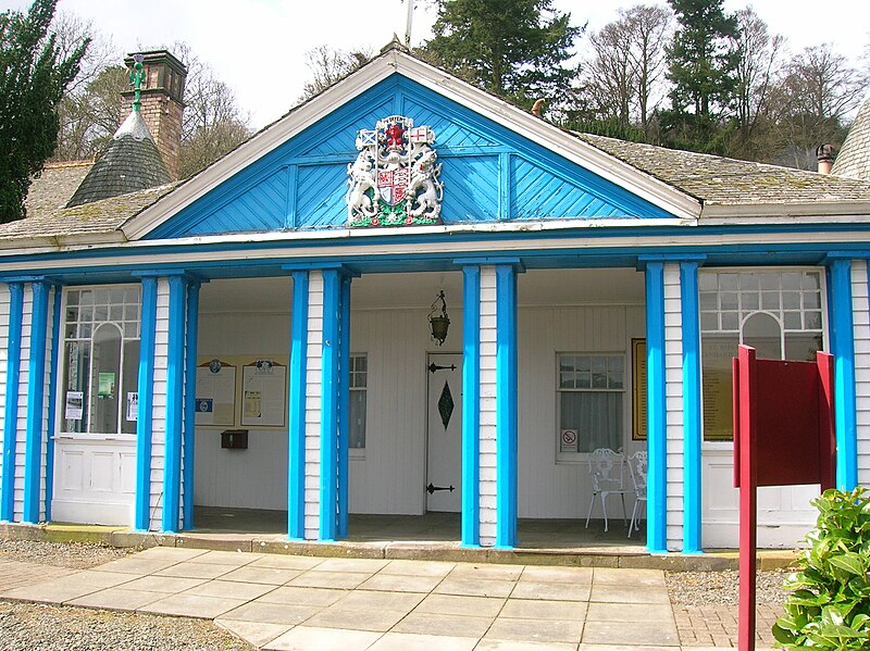
Innerleithen: St. Ronan's Wells
Having ridden 4.6km, the peloton arrive at the end of the neutral zone by a left turning onto a road leading to Glentress - home of a mountain biking centre with trails including the famous Spooky Woods and Ewok's Village (a North Shore-style freeride trail with elevated tracks, see-saws and so on), considered some of the best trails in the world. The route passes by, into a sweeping right/left bend leading into a 1.72km straight section ending in a slightly technical right bend with an easy entrance, straight ascending middle section and kinked exit - however. the short climb at the end of the preceding straight should reduce speeds sufficiently to prevent problems. Another straight section follows along the banks of the river, ending at a wide left bend  leading into a 2.1km straight and another wide left around a hill topped by the remains of an Iron Age fort and heads into Innerleithen, 6.2km from the start. Almost immediately after entering the town, the route turns a very sharp right onto the B709 and reaches the first of three intermediate sprint at 7.2km, beginning by the cemetery gates.

Innerleithen is home to St. Ronan's Border Games, established in the middle of the 19th Century and today the oldest organised sporting event in Scotland and world class mountain bike trails, including a downhill course said to  be especially challenging by those who do that sort of thing, forming part of the famous "7 Stanes" trails along with Glentress. The road narrows considerably as it passes across a bridge over the River Tweed, leading to potential problems if high speeds from the sprint create a bottleneck with several riders attempting to squeeze through together - the road remains narrow on the other side. 

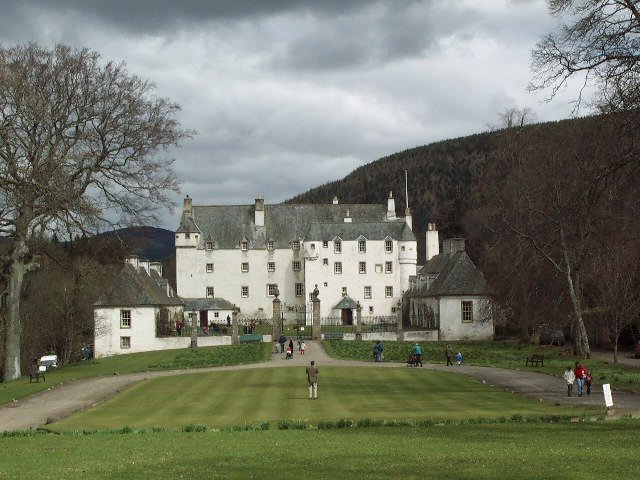
Traquair House, oldest continually inhabited house in
Scotland.
A tight right-hand bend lies 329m from the bridge, surrounded by trees and thus likely to be slippery if recent wind and rain have blown leaves onto the road (and since this is Scotland, they probably have done), before a 1km section starting with trees on the right of the road concealing Traquair House, believed to date from the 12th Cetury (though no surviving part can be dated before the 15th) and as such claimed to the oldest continually inhabited house in Scotland. Frequently used as an example of Scottish Baronial architecture, the House in fact predates the style and was a probable inspiration for it. The famous Bear Gates were closed in 1745 and have remained shut ever since, only to be reopened when a Stuart once again sits on the Scottish throne.

The B7062 becomes the B709 on the other side of a crossroads in the village, a road the race follows for the next 11.4km. The peloton climb as pass through Kirkhouse, reaching 200m just to the south between two farms. There's an easy left followed by a tight right 1.19km from the second farm before the road reaches 300m alongside a conifer plantation, climbing to approximately 360m before beginning to descend as we leave the plantation behind and travels across open moorland, passing by two ring-shaped enclosures 0.96km apart - it's impossible to say what they are from aerial photographs but they look to be of some antiquity. There are also two cattle grids - extremely hazardous unless hit at an angle very close to 90 degrees to the poles - located at 16 and 18.7km. After 20.5km, the route reaches a crossroads south-west of Montbenger and turns right at the Gordon Arms Hotel onto the A708 (there's an antique petrol pump set up in the carpark next to the hotel, if that sort of thing interests you). The road is straight and level all the way to St. Mary's Lake, following along the northern shore and arriving at Cappercleuch after 27.2km and a right turn onto a narrow unclassified road 160m after the orange "rumble strip" traffic-calming device immediately west of the village. It's an innocuous-looking road, but not without danger - 35-year-old David Stanners of Peebles CC was killed here after misjudging a bend and crashing into a wall on the 3rd of September 2011, just eight days before the Tour passes through. There are a further three cattle grids located at 30.2km, 35.9km and 38km, with the first climb of the race - Cat 3 Megget Hill - beginning at the third shortly after passing through Meggethead. The summit lies 0.4km after the start of the climb. There's a very steep descent - hazardous at 20% - 1km after the summit, the high speeds generated by it making a  sharp right-hand bend 0.8km later hazardous.

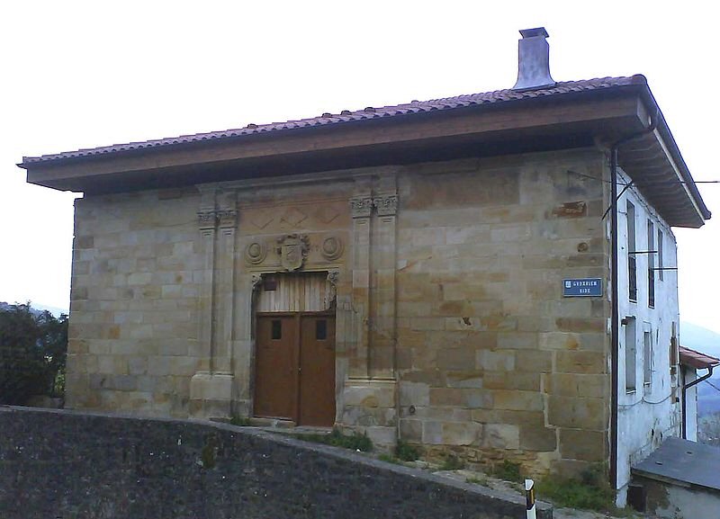
Tweedsmuir Parish Church (CC2.0)
The route turns north towards Talla Reservoir, the construction of which swelled the local churchyard for over 30 men - mostly Irish cheap imported labour - were killed whilst it was being built. Having passed along the edge of the water for around 1.63km, the road narrows slightly as it crosses a bridge. 2km later, the peloton turn a tight 90 degree left (by trees, hence possibly slippery) to pass along the dam, hitting an equally sharp right-hander 0.3km later. This road leads us to Tweedsmuir and a T-junction with A701, where the race turns left to head south-west. A short way away on the same road is the Crook Inn, made famous as the place where Rabbie Burns penned his poem Willie Wastle's Wife - not his best and somewhat questionable to modern tastes as it basically concludes Mrs. Wastle to be worthless as a human being due to her physical unattractiveness - and one of the many claimants to Oldest Pub in Scotland (there are many oldest pubs in Great Britain's constituent nations - I have personally been to four Oldest Pubs in England). 3.1km later, the race reaches the first drinks station - always a potential hazard as riders slow and grab the bidons (drinks bottles) held out to them by team employees. The next Cat 3 climb begins at 55km.

The Devil's Beef Tub (CC2.0)
The summit comes 4.5km later near the Devil's Beef Tub, a 150m deep hollow between four hills described by Sir Walter Scott as "a damned deep, black, blackguard-looking abyss of a hole" (it's actually quite attractive). The name comes from the hollow's use by the Johnstone clan, described by the farmers in the area upon whom they preyed  as devils, as a place to hide stolen cattle. The descent into Moffat, 70.1km from the start of the race, is undemanding in the dry; though as ever on a descent unpredictable factors such as punctures can rapidly become disastrous.

Moffat has been a tourist destination ever since the 17th Century when health benefits were first ascribed to the sulphurous waters that bubble up in the area - during the height of the spa's popularity, a special pipeline was built to carry the water from a well on the hills down to a bath house in the town and several hotels sprang up - one, The Star, was listed in the Guinness Book of Records as the narrowest hotel in the world at just 6m wide. The stage's second intermediate sprint begins at Moffat's town hall, housed in the old bath house on the A701 running west of the High Street. Reaching a short road connecting the two, the peloton turns a tight 90 degree left and right - this being in the middle of the town, there's the potential for diesel and puncture hazards on the road - heading out of town along the High Street and, having negotiated the tight left bend at the end, on the A708. After half a kilometre, the race turns right onto the Old Carlisle Road. Following the undemanding road until 80.1km leads to a junction and a sharp right into Newton. They pass over two bridges, one crossing a river and one a motorway, then turn left onto the B7076. The 1km long feed zone - another hazard as riders slow down and grab musettes (cloth bags filled with energy gel and the various things professional cyclists have to eat), domestiques loading up and ferrying the bags back to their teams.

The route remains level and straight until it reaches Johnstonebridge where the peloton turn a sharp right into the village which marks the approximate halfway point of the stage. At the next junction, they turn left and past a farm, riding through a small wood as the road climbs slightly before a short descent towards a difficult left-hand bend in woodland, caution being required in case of slippery leaves on the road and possibility of punctures. There's a very short but steep climb in the woods before the road begins to descend on the way out towards the crossroads, which the race travels straight across to arrive at a T-junction 0.39km later. They turn right here, heading towards St. Ann's, then a wide left bend takes the race through 180 degrees onto the A701 continuing through Parkgate at 98.5km, Amisfield, Locharbriggs and into Dumfries.

The Old Bridge, known to locals as Auld Brig, Dumfries (CC3.0)
Dumfries, the largest town we've yet seen on this stage. Like Peebles a Royal Burgh until the distinction was abolished, Dumfries was the site where in 1264 King Alexander III met with his knights to plan an invasion of the Isle of Man, once under Scottish rule but controlled by the Norwegian monarchy for almost two centuries. William Wallace and his rebels passed through in the latter years of the same century, chasing an English army who applied for protection at the now vanished Dumfries Castle but were refused, eventually being caught and slaughtered at Cockpool some kilometres to the south on the Solway Firth coast. The town has a long and bloody history - not only was it the scene of several vicious attacks and lootings at the hands of the English, it also executed ten "witches," the unfortunate women being tied to stakes and strangled before their bodies were burned. As late as 1868, it was the site of the last public hanging to take place in Scotland. Strangely, it has experienced two earthquakes on Boxing Day - one in 1979 and another in 2006. Its police force is the smallest in Scotland, but played a large role in one of the largest criminal investigations ever to take place - that following the bombing of Pan-Am 103 which fell on the nearby town of Lockerbie.

Remaining on the A701 through the town, the race takes the second exit of the first roundabout onto Edinburgh Road, doing the same at two more roundabouts until the road becomes Academy Street before negotiating Church Crescent and turning left before the bridge onto White Sands which, later on, will host the finish line of the stage. As the peloton crosses it. 0.5km from the corner, they begin the third intermediate sprint. Reaching the end of the road, the riders turn a sharp right onto St.Michael's Bridge leading to St. Micheal's Bridge Road becoming Pleasance Avenue. This leads them to a T-junction with the A710 where they turn left to head south towards the Solway Firth. 2.24km ahead, they reach a tight 90 degree right corner followed by an equally tight 90 degree left 0.38km later on the way through Islesteps. Another tight left lies 2.63km away; followed by a medium left bend left, tight 90 degree right and hump-backed bridge at New Abbey, with a medium left on the way out for good measure. New Abbey is the site of the not-very-new, ruined and delightfully named Sweetheart Abbey, founded in 1273 by Dervorguilla of Galloway in memory of her husband John Balliol, himself the founder of Balliol College at Oxford University.

The Solway Firth served as a backdrop to the fictional
Summerisle in the 1973 film The Wicker Man (CC2.0)
The road climbs and then descends gently over the next 7.8km to Kirkbean, the route consisting of long straights with no challenging bends. The village was the birthplace in 1747 of John Paul Jones who went on to found the United States Navy. In days gone by, thousands of people seeking a better life in America passed through here before setting sail on the ships that sailed from the inlet formed by the River Nith's estuary on the Solway Firth just to the east, but today it's a quiet place given over to nature. A nature reserve on the far bank is an important breeding place for several species of birds. The race continues through on the same road, reaching Caulkerbush and a slight left before taking a tight right 54m later onto the B793. The Cat 3 climb of Banks Hill begins 0.95km after the turning as the peloton pass a large house to the right of the road, just past a junction. It ends 1.5km later along the straight road, in between farm gates on the left and right,, almost precisely 140km from the start of the race.

Beeswing Kirk - a church converted
into a private home (CC2.0)
A medium left some distance ahead sees the road begin to descend again before arriving at a T-junction, turning an easy right before continuing to Edingham, site of an industrial complex and hence another potential spot for diesel spills. There are some large circular earthworks just right of the road as it passes the turn for the complex before arriving at a T-junction with the A711 where the peloton turn right. The road remains wide and unchallenging for 9km with exception of a slight climb towards the village of Beeswing.

Anywhere with a name such as Beeswing very obviously deserves a closer look - and an explanation of the strange name. Originally named Lochend, the village elected to rename itself after a famous thoroughbred mare, winner of 51 races during her short eleven-year life. The horse was neither from here nor ever visited, an indication of the high esteem in which she was held. There's a very steep descent 1.56km past Lochanhead, the road dropping more than 60m in around 0.7km, followed by a slight rise into Cargenbridge before the race reaches Dumfries 1.2km later. Having passes straight across two roundabouts and along Cassalands and Galloway Street, the peloton arrives at a bridge, crossing the river and turning a sharp left to enter White Sands. Following a final 300m sprint, the stage ends after traveling 170.3km from the start line.

Predictions: Now, we could be wrong because he'd plainly have far rather been at the Vuelta a Espana, but we can't see any reason why Thor Hushovd won't win this one easily. However, strange things happen in these smaller Tours - while the bog boys are all tuned to the three week Grand Tours, the lesser-known lads will go hell for leather caring not in the slightest if the quest for glory leads to an early burn-out.

Weather: Wet - and very wet. Rain is expected across many parts of Britain tomorrow, with the heaviest of all predicted for Western Scotland. That ought to be a fun start. Wind is a little tricky to predict at the moment due to Hurricane Katia lurking off Newfoundland over on the opposite side of the Atlantic - very strong wind is expected for the area in the next few days, but at present it looks as though it won't get too rough until Sunday night or Monday. The maximum temperature might climb to 18C, but probably not: 14 or 15C is more likely.

Vuelta a España - Stage 21 Guide

Jarama Circuit, final start line of the 2011 Vuelta
Stage Map: click here
Stage Profile: click here
More Previews: click here

After yesterday's 185km journey from Bilbao to Vitoria, today is the short (95.6km), flat and partially ceremonial final run into Madrid and the winner's podium, thus ending the 66th Vuelta a España - the last of the 2011 Grand Tours. What a classic it's been: the organisers pulled out all the stops this year in an effort to ensure their race would no longer be considered the boring cousin to the Tour and Giro, making it one of the most challenging events we've seen in many years. We've seen many of a very beautiful country's most beautiful places and we've seen some of the most testing landscapes. We've seen riders abandoning due to the sheer difficulty of the parcours, we've seen relative unknowns ride through the pack and score incredible victories. Chapeau to Unipublic - viva la Vuelta!

Madrid's Royal Palace and Catedral de la Almudena (CC3.0)
The stage begins at the hallowed Jarama Circuit which, before modern Formula 1 rules deemed it to narrow for future races, hosted nine Spanish Grands Prix and no less than fifteen rounds of the World Motorcycle Championships. Designed by the legendary John Hugenholtz, the circuit was built in 1967 and in its current layout is 3.85km in length - the peloton will complete one lap to begin the neutral zone, exiting via the tunnel onto the road network and arriving at the start of the race proper after 5.2km. Heading south-west along the wide road, the riders turn right onto the Av. de Europa with numerous speed humps and reach San Sebastián de los Reyes after 9.6km. Reaching a roundabout, they turn 90 degrees right and left to access the Calle de Real, passing along it for 1.23km until a right turn onto the Av. de Espana leads into Alcobendas. Passing by  the Plaza Mayor and city hall, the race crosses two more roundabouts and arrives at the football ground in the Parque de Navarra, turning left just past it onto the Paseo de la Chopera and continuing for 0.88km until the Carretera de Madrid- Irún and turning right again.

Gran Via
The race is now on the Autovia del Norte, one of the primary routes into Madrid. After 6.2km - having now covered 20.3km from the start - they arrive at Salida 10B, an exit off the road, and take a complex route through the interchange onto the Av. Manuel Azaña and travelling west onto the M-30. This route leads to another interchange where the peloton will turn left to join the Paseo de la Castellana, travelling through 0.5km illuminated tunnel and reaching the Plaza de San Juan de Cruz 2.6km later. Continuing south leads to the Plaza de Doctor Marañón and onward to the Glorieta Emilio Castelar and, 1.6km further, the Paseo Recoletos.

La Plaza de Cibeles hosts the finish of the Vuelta (CC2.0)
0.4km later, the riders arrive at the Plaza de Cibeles and turn right at the roundabout for the Calle de Alcalá, then a slight tight after 0.43km onto the Calle Gran Via. Once at the Plaza de Callao, the peloton turns through 180 degrees and travels back along the Gran Via to the Calle de Alcalá and Plaza de Cibeles where they turn a sharp right onto the Paseo del Prado. Following the road for 1.4km leads to the Glorieta del Emperador Carlos V. Then, having turned 180 degrees left around it, they head back to the Plaza de Cibeles. This 5.7km circuit is repeated a further ten times, with the third and eighth circuits of the eleven forming the two intermediate sprints and the end of the 2011 Vuelta a España coming after 95.6km, when the surviving riders will have covered a total of 3330.1km since the race began more than three weeks ago in Benidorm.

We don't really need to include much of a history of Madrid here and it'd be practically impossible to do without running into many thousands of words: the city is a world capital, home to 3.25 million people and has been inhabited since prehistoric times. Instead, here are a few facts (and if you subsequently win your local pub quiz, you owe us a pint):

Despite Spain's recent financial crisis, Madrid remains an
important centre of banking, technology and trade (CC3.0)
Madrid's Royal Palace, official residence of the king but wholly owned and used by the nation for state functions, is the largest royal palace in Europe. It covers 135,000 square metres and contains 2800 rooms, hosuign works of art by - among many others - Goya, Velázquez and Caravaggio.

The city has put in a bid to host the 2020 Olympic Games.

The Museo del Prado on the Paseo del Prado has a collection of art considered by some experts to be the finest ever assembled. As a result, it's one of the most visited museums in the world. It houses 7,600 paintings, 1,000 sculptures, 4,800 prints, 8,200 drawings and a vast collection of historical documents. The Museo Nacional Centro de Arte Reina Sofía, a short walk from the Prado, contains one of the world's most famous and dramatic works of art - Picasso's Guernica.

Madrid is around 300km from the coast. However, it still has a beach - the man-made Urban Beach on the banks of the Manzanares River.

The oldest church in the city is San Nicolas de los Servitas. The 13th Century bell tower is believed to have originally been the minaret of a Moorish mosque.

CaixaForum, Madrid's most unusual building (and our favourite) (CC2.0)
Madrid is located 650m above sea level, making it the highest capital city in Europe

Perhaps the most unusual structure in Madrid, the bizarre and fascinating CaixaForum art gallery can be found near the Paseo del Prado. The ground floor is glass-walled, open and modern. The first and second floors are a far older industrial building, the internal walls removed to form an airy open space. The third and fourth floors are made from rusted steel plates, contrasting with a wall of living plants standing next to the gallery.

It's been the capital of Spain since the 17th Century.

The city's flag and coat of arms features a bear standing on its hind legs to reach berries on a tree. It's believed that Madrid was called Ursaria, "land of bears," in ancient times due to the large numbers of bears that then lived in the area.

Whilst regular readers will be well aware of our views on bullfighting, Madrid's Museo Taurino is worth a visit to see the costume worn by the famous matador Manolete as he attempted to kill his fifth bull in a single day. However, that time the bull got the upper hand and gored him to death. Hurrah!

Tourists tend to assume Madrid is hot and sunny all year round. It's one of the sunniest places in Europe with approximately 250 clear days per annum, but due to its altitude it can become very cold in winter and snow isn't unknown. The record low was -10C.

Plaza Mayor
Madrid's underground metro system is the second largest in Western Europe - only the London Underground is larger. It's the sixth largest in the world after London (largest), New York, Moscow, Seoul and Shanghai. However, since the city is the 50th most populous in the world, the system is unusually clean and pleasant, even at rush hour.

In 2010, Madrid's population was 3,273,049. They're joined by around six million tourists each year.


Now, how in the world are Unipublic going to top this in 2012...?

Predictions: With no change in the GC leaders' placings at the end of Stage 20, Cobo and Froome remain separated by 13 seconds. Traditionally, race leads are not contested in the final stage of a Grand Tour - but that most definitely doesn't mean they can't be. Anything could happen today, all depending on the sort of race it turns out to be - will it be gentlemanly good sportsmanship or will we see pedal-to-the-metal, teeth-and-nails alleycat warfare?

Weather: Hot. Starting at a horrible 27C, it'll get even hotter as the stage progresses to reach 29 or 30C at the end. Winds will be very light to non-existent - headwinds for the first half and crosswinds for the remainder, but not strong enough to make any difference. Once again, no rain is expected anywhere along the parcours and it should remain sunny throughout.

Latest Confirmed Tour Of Britain Roster

An Post-Sean Kelly Cycling Team
Sam Bennett (Ireland)
Andrew Fenn (Great Britain)
Pieter Ghyllebert (Belgium)
Ronan McLaughlin (Ireland)
Gediminas Bagdonas (Lithuania)
Mark McNally (Great Britain)

Endura Racing
Jack Bauer (New Zealand)
Rene Mandri (Estonia)
Alex Wetherall (Sweden)
Ian Wilkinson (Great Britain)
Paul Voss (Germany)
Iker Camano (Spain)

Europcar
Yukiya Arashiro (Japan)
Damien Gaudin (France)
Yohann Gene (France)
Alexandre Pichot (France)
Franck Bouyer (France)
Anthony Charteau (France)

Garmin-Cervelo
Gabriel Rasch (Norway) (last minute replacement for David Millar)
Daniel Lloyd (Great Britain)
Martijn Maaskant (Netherlands)
Thor Hushovd (Norway)
Julian Dean (New Zealand)
Roger Hammond (Great Britain)

HTC-Highroad
Matt Brammeier (Ireland)
Alex Rasmussen (Denmark)
Mark Cavendish (Great Britain)
Bernhard Eisel (Austria)
Lars Bak (Denmark)
Mark Renshaw (Australia)

Leopard-Trek
Jens Voigt (Germany)
Giacomo Nizzolo (Italy)
Will Clarke (Australia)
Linus Gerdemann (Germany)
Dominic Klemme (Germany)
Martin Pedersen (Denmark)

Motorpoint
Will Bjergfelt (Great Britain)
Tobyn Horton (Great Britain)
Ian Bibby (Great Britain)
Marcin Bialoblocki (Poland)
Johnny McEvoy (Great Britain)
Peter Williams (Great Britain)

NetApp
Daryl Impey (RSA)
Leopold König (Czech Republic)
Bartosz Huzarski (Poland)
Timon Seubert (Germany)
Jan Barta (Czech Republic)
Cesare Benedetti (Italy)

Rabobank
Lars Boom (Netherlands)
Michael Matthews (Australia)
Bram Tankink (Netherlands)
Theo Bos (Netherlands)
Rick Flens (Netherlands)
Coen Vermeltfoort (Netherlands)

Raleigh
Richard Handley (Great Britain)
Liam Holohan (Great Britain)
Dan Fleeman (Great Britain)
Jeroen Janssen (Netherlands)
Gael Le Bellec (France)
Jamie Sparling (Canada)

Rapha Condor Sharp
Graham Briggs (Great Britain)
Jonathan Tiernan-Locke (Great Britain)
Andy Tennant (Great Britain)
Dan Craven (Namibia)
Zak Dempster (Australia)
Kristian House (Great Britain)

Sigma Sport-Specialized
Tom Last (Great Britain)
Tom Murray (Great Britain)
Wouter Sybrandy (Netherlands)
Russell Hampton (Great Britain)
Steve Lampier (Great Britain)
Simon Richardson (Great Britain)

Sky Pro Cycling
Steve Cummings (Great Britain)
Alex Dowsett (Great Britain)
Mathew Hayman (Australia)
Michael Rogers (Australia)
Ben Swift (Great Britain)
Geraint Thomas (Great Britain)

Topsport Vlaanderen-Mercator
Dominique Cornu (Belgium)
Kenny De Ketele (Belgium)
Stijn Neirynck (Belgium)
Jarl Salomein (Belgium)
Preben Van Hecke (Belgium)
Jelle Wallays (Belgium)

UnitedHealthcare Pro Cycling
Robert Förster (Germany)
Rory Sutherland (Australia)
Scott Zwizanski (USA)
Chris Jones (USA)
Karl Menzies (Australia)
Boy van Poppel (Netherlands)

Vacansoleil-DCM
Thomas De Gendt (Belgium)
Maxim Belkov (Russia)
Jan-Bert Lindeman (Netherlands)
Barry Markus (Netherlands)
Willem Wauters (Belgium)
Lieuwe Westra (Netherlands)

Wanna be cool...?

Remember that animated .gif we posted recently of the Coolest Little Girl In The World(TM) effortlessy pulling off a flawless drift, and how we said that no matter how cool you are you'll never be as cool as her?

Well, cool-seekers, do we have some great news for you!

All you need is some method of getting to the mid-1960s USA (hey, better not go if you're black!) and probably not very many dollars and you can be the proud and infinitely cool owner of the...


You still won't be as cool as Drift Girl, but you could be as cool as this kid!

Friday 9 September 2011

Vuelta a España - Stage 20 Preview

Stage Map: click here
Stage Profile: click here
More Previews: click here

Well, this is it folks. We've been to Cordoba, Burgos and Aviles. We've seen the arid semi-desert in the south and centre of the country and we've seen the lush, green fields of the north-west. We've even been up Alto de l'Angliru, perhaps the most challenging feature of any Grand Tour. Now we're on Stage 20, the last of the "proper" stages before the more-or-less ceremonial short trip into Madrid and the winners' podium.

But this is the Vuelta, and while we've seen all the challenges listed above and many, many more, there was no way Stage 20 was going to be easy. It's 185km long - far from the longest, but a serious test after nearly three weeks' of racing and 3050km, but the organisers have decided that's not enough of an ordeal so they've included some fair old mountains along the way too. The first, a Cat 2, is no Galibier but will certainly leave the riders on no doubt that their suffering is not yet over; the second is a Cat 1 with 555m of climbing in 7km; the third's a Cat 3 positioned perfectly to sap all but the very last grams of strength before the final Cat 1, a 505m wall. Lovely!

Bilbao is stunning by night (and thus presumably not at
all popular with nearby astronomers). There's much more
information on the city in the Stage 19 Preview.
The stage begins where Stage 18 left off, in the fine Basque city of Bilbao. Setting out from Botikazar Erribera (or Botica Vieja, as the Spanish language road book prefers it) no the northern bank of the river, the riders travel east for 0.22km before turning right at the roundabout and along the Puente Euskalduna, the bridge they crossed twice in the opposite direction yesterday. They then arrive at the Sagrado Corazón, taking the opposite exit onto the On Diego Lopez Haroko Kale Nagusia (Gran Vía Don Diego López) before a left turn at the Plaza Don Federico Moyua to enter the Alameda Recalde. Having crossed the Puente de Salve, the race follows the first slip road on the right down onto the Maurice Ravel Etorbidea and progresses eastwards towards the tunnel separating it from the Zumalakarregi Etorbidea, following the route round a wide left-hand bend and onto the N-634. The neutral zone comes to an end 9km from Botikazar Erribea, roughly halfway between Kukullaga and Agirre-Aperribai.

The peloton continue through Galdakao, the wide and smooth road offering up no hazards en route. The town - home to almost 30,000 people and the birthplace of cyclists Ramon Gonzalez Arrieta, winner of the 1995 Classique de Alpes (which ran for fourteen years until 2004, living on since 2007 as a juniors' competition), and Igor Antón,  who is racing today with local team Euskaltel-Euskadi - is unsurprisingly rather overlooked due to its more famous neighbour. However, it predates Bilbao; having been first mentioned as a town in a document connected to its official application to become part of the city during the 14th Century. The application was successful, permitting it to enjoy the same privileges and thus grow rapidly up until 1630 when it once again became a separate community. The Industrial Revolution, for all the pollution and suffering it cause, was good to Galdakao - quarries, mines, forges, a dynamite factory and, in 1882, the railway saw the city grow rich.

Idolo de Mikeldi and Cruz de Kurutziaga, Durango
Having passed underneath the A-8 motorway, the race travels by various communities including Elexalde and Gumuzio before reaching countryside followed all too rapidly by industrualised areas. The road swings back and forth across the motorway before a slip road leaves on the left, curving around to the right and swooping under both the N-634 and A-8 into Amorebieta-Etxano. Turning left at the upcoming junction carries the peloton along the San Miguel Kalea or BI-3334. Straight ahead at the roundabout on the edge of the town leads towards a large B-shaped intersection, with the BI-3334 merging back into the N-634 before it travels east past more industry and comes to Arriandi - a town given over almost entirely to industry - with 21.4km ridden from the start of the race. Durango comes next; the town made famous by the discovery of the prehistoric Ídolo de Mikeldi, a four-legged animal roughly the size and shape of a boar. Its purpose remains a mystery, but the most likely explanation would be an object of worship among the ancient pre-Roman tribes who lived here thousands of years ago (it can be seen in the Museum of Archaeology, Ethnography and History in Bilbau). The Cruz de Kurutziaga, a heavily-carved Gothic cross and the only one of its kind on Europe, attracts more visitors to the town that any other feature - the one outdoors is in fact a replica (an identical replica stands in the same museum as the Ídolo de Mikeldi), the original having been moved inside the Ermita Cercana de la Veracruz nearby following a vandal attack in 1981. Though the majority of the figures represented upon it are recognisably characters from the Bible, the presence of various suspiciously pagan-looking symbols has led to much speculation as to who carved it and why.

Palacio de Berriz
The first climb - uncategorised, hence no points - begins just outside Durango before the race continues along the N-634 past Trana-Matiena and on to Berriz, 30.2km from the start. Zaldibar lies 2km ahead. The peloton turn left, passing under the A-8 once more and entering the small community on the Bilbao Etorbidea. Just a few kilometres away to the north-east is Mallabia, the home of the Orbea bicycle firm - producers of some of the most desirable bikes in the world, including those ridden by the Euskaltel-Euskadi team. The route joins the San Andres Etorbidea in the middle of the town, leading out to a wide 90 degree right shirtly before a wide, unchallenging hairpin located 1.55km after the motorway underpass. The summit, at 310m, comes at the second of the two sweeping left-handers soon after the hairpin; then the race reaches an industrial unit with a truck depot making it a potential spot for hazardous diesel spills on the road. 310m is reached several more times before the easy descent into Ermua. Ermua, though inhabited since at least the bronze age, grew up as it became a dormitory town for the local industry, with many of the inhabitants employed in the metal working factories. However, unlike many towns of its type, which apparently exist solely as a place in which to store a workforce overnight, it's a place with a unique character of its own and several fine buildings. Among them are the 16th Century Palacio Lobiano, considered one of the best examples of Renaissance architecture in the region, and the 18th Century Baroque Palacio de Valdespina. The town has also produced two professional cyclists - Pedro Horrillo, wingman to Oscar Freire until a horrific accident in Stage 8 of the 2009 in which he plunged over a 60m cliff and was left with multiple fractures and a punctured lung, ending his career; and Igor Astarloa, who paid tribute to the town when announcing his decision to retire after doping allegations in 2010.

Continuing along the N-634, the route reaches Gipuzkoa and then Eibar. According to the Vuelta itinerary, the race progresses along the Calle Iruri and Calle Juan Guisasola - however, there is no road called Iruri in the town - we think they mean the Calle de Isasi (or Isasi Kalea as we prefer to call it, since we favour the Basque names). Secondly, the Calle Juan Guisasola comes after, not before, the right-hand turn and is also known as the GI-2639 - they are not separate roads as the race details suggest. This leads to some confusion as to the precise location of the stage's first intermediate sprint - it's either on the N-634/Isasi Kalea before the turn, or on the GI-2639 afterwards. The first climb, Cat 2 Alto de Karabieta with 425m of climbing in 6.8km, begins immediately after the sprint.

"Torre" de Urrapain
Having passed to the left of Eibar's bullring and football stadium (football being another sport beloved by the Basques, bullfighting being an atrocity sadly endemic throughout Spain), the route crosses the A-8 on a fly-over. There are a few bends on the way up - though no hairpins - but due to the lower speeds during climbs they shouldn't cause problems. The summit, 560m above sea level, comes shortly after the peloton emerge from forest by some buildings. The descent is similarly easy, though a long, thin traffic island just as the race enters Elgeta could prove hazardous to the unwary. Elgeta has an immediately noticeable different character to the towns north of the climb the race has just completed, being predominantly rural in nature - the name is derived from the Basque term elke, meaning "cultivated field." The town looks modern, partially as a result of heavy bombing right up until 1937 during the Civil War. It retains a handful of older structures, however, including the Iglesia Sra. de la Asunción, dating from the 14th Century but much re-modelled in the 16th; the Torre de Urrupain, not actually a torre at all and more fittingly also known as the Casa Abidrío, with an impressive Baroque facade; and the ruined 13th Century Ermita de Uriarte.

Ubera. The year? 1970. (From kzgunea)
The road book itinerary takes a little departure from reality again in Elgeta, instructing us to turn left onto the GI-2631 - unfortunately, the GI-2631 is quite a long way away to the east and doesn't go to the next village Ubera. The GI-2632, meanwhile, not only goes there, it also runs through Elgeta; making it seem by far the more likely to be correct. After turning a tight - and potentially slippery - left onto this road, the peloton encounter right-hander, wide but steep hairpin 0.73km later. The final descent into Ubera is fast but not technical with the exception of a final right-hand hairpin on the entry into Ubera. Preceded by a sweeping 90 degree left, it will be approached at high speed and riders who haven't studied the route could very easily find themselves taking the section too fast and crashing into the trees on the left side of the road. Add to this the rural nature of the surroundings and there's an added hazard posed by the possibility of mud on the the road.

If you blink, you'll miss Ubera - it's a tiny village with few buildings, plus the race passes straight through. Following a few unchallenging bends right after the village, the road becomes straight for a 1.1km descending section likely to encourage high speed, followed by a tricky medium right/tight 90 degree left/medium 90 degree right combination before passing under the AP-1 and GI-627 into Bergara where the peloton turn right at the first roundabout onto the Calle de Amillaga. There are a number of speed humps from this point until we leave the village behind. At the end of the road they turn a tight left onto another section of the Calle de Amillaga, passing right across a roundabout and ahead onto the Calle de Leiziriako San Lorentzo. This becomes the Calle Mugerza and, after a short narrow section where the road is constricted by a building on the right, onto the Calle Zubieta which follows the banks of the river for a short distance before disappearing behind houses and becoming the Calle Mahasterreka. The Cat 1 ascent of Alto de Elosua with 555m of climbing in 7.3km begins with 57km ridden since the start of the race.

Torre Moyua, Bergara
Though Bergara - called Vergara in Spanish - has a fine selection of interesting features (especially the megalithic monuments including dolmens and long barrows in the surrounding hill) it experiences very little tourism, both as a result of and resulting in the town's reliance of heavy industry and metal working. It's very much a town where people live and work rather than holiday, but a tourist in the area could spend a day or two without getting bored. Highlights include the Casa Arrese, dating from the 16th Century and a superb example of a Renaissance urban palace; the Torre Gabiria, constructed during the 15th Century with various features added during the 16th, prior to to a fire in 1719 and subsequent rebuilding; the Torre Moyua, more palace than defensive tower, though it incorporates various decorative elements based on defensive architecture; and the Hórreo de Agarre, a large granary held together entirely by dove-tailing with no nails used in its construction.

A footbridge crosses the road on the eastern perimeter of the town, then two sweeping left-hand bends lead into a right-handed, tight and steep hairpin before the road leads right and right again into trees and a short descent. An easy 90 degree left leads past houses, followed by an untechnical section up to the second hairpin - a left, not too tight and less steep than the previous; then a similar one turning right 0.56km ahead. A long straight section leads up to the fourth, left, wide and not steep; the the road passes among trees and emerges near the fifth, right, wide and medium steepness, bringing the road up to 600m. The final section takes place along the following straight section, the summit reached at a crossroads on the edge of forest. There's a wide 90 degree left bend just as the road leaves the trees behind.

Elosua (CC3.0)
The initial part of the descent to Elosua shouldn't be particularly demanding unless the weather's wet, though there are some potential trouble spots further down. The most evident are the series  very sharp bends starting 0.33km after the junction with the GI-3742 as the road follows the contours of the mountain; a section which, with fast entry speeds, descending altitude and trees, have all the ingredients necessary for a few crashes. Having left the forest and entered open countryside, the route negotiates a medium 90 degree left leading past a building, then enters a very tight 90 degree right. Two smoother rights lead into a straighter section, followed by a sweeping left-hand bend and another very tight 90 degree right back among trees. Once exited, a final straight leads to a junction with the GI-631 where the race turns right. Though this road features many bends, it's slightly uphill and will thus reduce speeds becoming less dangerous as a result. It's crossed several times by footbridges, each of which are likely to be packed with spectators - none of them stupid enough to try dropping anything onto the riders as they pass below, we hope. Police may prevent them from tying banners, flags and suchlike to the bridge to prevent this risk. Presently, the peloton come to a tiny village strung out along the road in a narrow, forested valley - Aizpurutxo, 79.3km from the start of the race. It's a poor, ramshackle, rather dirty and utterly charming little place.

The road away from Aizpurutxo has many bends, but each is wide and as the road climbs slightly speeds will remain low enough to avoid crashes. However, one potentially dangerous point comes after 3.1km, in a place where the mountainside right of the road has been stripped bear of trees, allowing the topsoil to wash away. This has left bare rock, leading to a very high likelihood of gravel on the road which can easily cause loss of traction - and unpleasant crashes as a result, since crashes on gravel often result in gravel having to be picked out of the skin. Just after this section is a series of tight bends: 90 degree left/90 degree right/90 degree very tight right/90 degree left/90 degree left/very tight 130 degree right. Houses and other buildings begin to appear along the roadsides and then - having added another 7.4km to the total ridden - the race arrives at Zumarraga and a series of tunnels. All are illuminated, the first being 0.13km, the second 0.1km and the third 0.17km, resurfacing just south of a roundabout and almost immediately merging into the GI-632.

Zumarraga
Until the late 15th Century, Zumarraga was a scattered collection of tiny hamlets and isolated farmsteads, a place apparently hardly even noticed with the first documentary evidence of its existence as a community only a hundred years previously. Gradually, an urban centre began to form and in the 16th Century the parish authorities applied for the right to relocate the parish church from its original site in the mountains to this new town. From this point, it developed rapidly; growing much larger during the 19th Century and becoming the fine and pleasant town that it is today during the early part of the 20th Century. By 1977, the population was almost 13,000; though this has fallen to around 10,000 today.

The peloton leave the southbound GI-632, curving back up to the roundabout they passed beneath and turning left for the westbound section, a road that will take the race all the way back to Bergara. An uncategorised mountain - hence no points, even for a rider who climbs it like a squirrel on EPO climbs a tree - begins as soon as the race leaves the town, the summit coming after 4.9km among farm buildings just after a series of wide, sweeping bends. A very tight pair of right/left hairpins form a S-shaped section 0.55km after the bus stops near the summit: they're steep, tight, surrounded by trees and lead straight into a tight left and medium right. Add all this together and mix in the high entry speed after half a kilometre of descent and we have the perfect recipe for some hairy near-misses if not a few actual crashes.

Another tight, steep right-hand hairpin follows after 0.34km with a medium left-hand bend in another 0.44km and a very tight right-hander - almost a hairpin - 0.2km after that before the road straightens out for the final stretch before Antzuola, with a slightly tricky section involving a central reservation and a strange roundabout. The descending road immediately after the village may also be hazardous, especially after rain when leaves from the thick forest either side of the road could lead to very slippery conditions. The same applies to two corners at the end of the section, one wide left and the next a tighter right. Having emerged from the forest, the road splits into two with the race taking the left path to travel through the 0.34km illuminated Zubiaurre  tunnel passing underneath an entire suburb on the south side of Bergara. The feeding station is nearby.

Postcard dated 1923 from Bizkaia
Once out of the tunnel, the peloton arrive after 1.55km at a pair of roundabouts. Turning right at the first and left at the seconds takes them onto the GI-637 heading south and, a short way along the road, passing underneath the AP-1 motorway and crossing the river twice in within a kilometre. The route follows the road out of the next roundabout and heads to the left. At the large and complicated interchange just beyond the upcoming bends, the race turns right to travel along the GI-632. Category 3 Alto de Kanpazar with 273m of climbing in 5.4km begins at the 106.6km point.

Having climbed to 385m, the route passes by a house and enters a medium right-hand bend as the road becomes the BI-632. The 460m summit comes 1.1km after the bend by a recreation ground just over the border in Bizkaia Province. There a number of technical sections on the descent: the first is a tricky medium left situated 0.58km after the building at the recreation ground, a bend that wouldn't be at all difficult were it not for the preceding descent and surrounding trees; a tight right 0.85km later; a very tight (90 degrees +) 0.33km after that; a sweeping right 0.91km further on and a medium hairpin 0.32 after that to finish - it's an unusual one in that the entry and exit are roughly level, but the apex of the bend dips several metres lower.

Arriving at a junction shortly before Elorrio, the route turns right onto the Av. del Arrasate which becomes the Elizaburu Kalea following the junction with the BI-2632. At the end of the road, the road book itinerary instructs us to turn left onto the Calle San Pio, by which we think they probably mean the Calle de San Pio X or San Pio X Kalea. This leads onto what the Vuelta calls the Calle San Justo, in this case apparently meaning the Calle de San Fausto or San Fausto Kalea, location of the stage's second intermediate sprint. This route leads, as the road book says it should, to the BI-636 heading into Atxondo.

Portal de Don Tello
Despite Elorrio's reliance on heavy industry and the large number of industrial plants in the vicinity, the town is famous for its splendid architectural heritage and has a range of grand palaces and religious buildings. Among them are the Palacio de Estéibar-Arauna, the Palacio de Arabio and the Portal de Don Tello. The latter - the last remnant of the town's medieval wall - is still equipped with a cannon. Also not to be missed are the Iglesia de la Purísima Concepción, considered one of the finest Renaissance churches in the Basque Country but in fact of 15th Century Gothic origin, and the  Necrópolis de Argiñeta - one of the oldest Christian burial sites in the region. It's also the birthplace of José Antonio Ardanza, CEO of Euskaltel - the sponsors of everybody's favourite orange-clad Basque cycling team,.

Torre de Muntsaratz
Atxondo (if you're using a Spanish map, look for Axpe Achondo) is located 122.5km from the start of the race. The race just clips the northern edge of the town before heading on towards Abadiño 2km further up the road. The town's most famous building is the ancient Torre de Muntsaratz, dating from the 9th Century as a defensive feature before restoration and conversion in the 15th Century to a country stately home by and for the aristocratic Muntsaratz family. There are more than sufficient other mansions to keep a visitor going for two or three days' stay in the town.

The race passes through Abadiño along the Alfredo Baeschilla Etorbidea, heading into the industrial Astola neighbourhood and around a roundabout into Durango. A quarter of a kilometre further up the road are two more roundabouts where the race turn left onto the Montorreta Kalea. The second left turning then leads along the Larrasoloeta Kalea, with numerous speed humps before it becomes the Santikurutz Kalea, then the Barrio de Santa Cruz which ends with a roundabout. Here, will pass right around and take the second left leading to the BI-623 and another left turn towards Izurtza. The road passes to the left of a large quarry - hence likelihood of hazardous diesel spillages on the road - and onward into Mañaria.

Manaria
Mañaria may only have a population of some 500 people, but it's produced no fewer than three professional cyclists - namely, Julián Gorospe, winner of two Vuelta a Espana stages and one in the Tour de France prior to retirement in 1994; his younger brother Rubén who became assistant director of Euskaltel-Euskadi following his own retirement in the same year; and Unai Uribarri, a domestique with Euskaltel-Euskadi. This is, without any shadow a doubt, a town in love with the sport - expect the entire population to be out to cheer the Vuelta on, with an especially warm welcome for the riders wearing orange.

The race passes straight over a roundabout just beyond the town, reaching the first hairpins 0.37km later - two, a left and a right, in very close succession. Neither are particularly steep, but both are very tight. Coincidentally, have a look to the right of the road if you get the opportunity just as the riders enter the hairpins - our maps say there's nothing there, while Google Earth has blacked it out in the way they sometimes do when a government has asked them to keep something quiet. Whatever could it be? Should you be physically following the Vuelta, we suggest you don't go for a quick stroll over the fields to have a closer look because getting arrested by the Spanish secret services probably really sucks. The next hairpin is 0.35km ahead, a tight left, not steep and the next 100m further on, tight right, not steep. A tight 100 degree left lies in wait 0.47km up the road, followed immediately by a sweeping right; then there are two more hairpins starting after a quarter of a kilometre. The first - left, medium, quite steep - comes 77m before the second - right, tight, quite steep; leading into a long straight through forest and climbing to 570m, finished off with a sweeping right past a large building with a stunning backdrop formed by high peaks. A tight left comes up 0.12km later, followed by a medium right hairpin, fairly steep, 0.15km ahead and a medium right bend soon afterwards, at which point the road reaches 600m and passes another building. A medium left can be seen up ahead, leading into a large U-shaped bend - the entry is easy, the exit much tighter. The summit comes at a crossroads 138.6km from the start line.

Mari, depicted in her "Woman of Fire"
guise (with squiggly bits) (CC2.5)
Nearby, and easily seen from the crossroads, is the Santuario de San Antonio. One of the largest and most revered shrines in the region, it occupies a site believed to have been the home of Mari, the greatest deity in the pre-Christian Basque religion. There is a tradition involving suspiciously pagan, pseudo-Freudian imagery that a young woman can increase her chances of finding a male partner by sticking pins in a cloth kept in the church - a white-headed pin will bring her a blonde man, a black-headed pin a dark-haired man.

The descent is neither challenging nor steep, consisting of long straights broken up by wide, sweeping bends all the way to the Urunagako Urtegia lakes where, after 153.6km, the race joins the N-240. We continue southwards past Legutiano and over a bridge crossing one arm of the lakes, then arrive 2.4km later at a junction on the left with the A-3006. This leads us to a junction with the A-267 2km away, where the race turns left under the AP-1 motorway. After another 2km, it reaches Landa, entered by way of a right turn onto a much narrower road, then right again a few metres later for the A-3002. 4.2km later, it reaches Ullibarri-Gamboa - a village that feels as though it's on the coast, standing on the banks of a vast lake named after the community - before the route follows the banks of the lake all the way to the wide dam that created it, continuing south into the countryside. A wide right/left U-shaped bend 0.2km after the dam leads to a crossroads, then onward to a medium 90 degree right 0.46km before entering Arroiabe.

Iglesia de Arroiabe (CC3.0)
Arroiabe's population has doubled since 2000, turning it into the present day sprawling metropolis home to 62 people. The village's pretty church stands on the southern edge, maintaining an air of serene separation from the earthly activities of those who live nearby - it's an impressive sight. 1.5km later the race arrives at Mendibil before skirting past Arazua-Ubarrundia and traveling underneath the E-5 motorway to Gasteiz (Vitoria on Spanish language maps). At the next roundabout, the race turns left and continues to the Zurbanoko Atea with several speed humps, turning left and then right for the Hezeguneen Ibilbidea. Left again at the next roundabout leads up to the Bulevar de Salburua and under the railway, the left again at the next roundabout (a long, elongated version) carries the race along the Calle Venta de la Estrella and, having negotiated another roundabout, the Itturitxu Kalea before it becomes the Zumabide Kalea running up to yet another roundabout and the Maite Zúñiga Kalea. Left at the following roundabout exits along the Martin Fixz Kalea, which becomes the Tanis Agirrebengoa Kalea before a tight right turn onto the Gaztelako Atea.

Gasteiz (CC3.0)
A final left leads along the Gasteizko Hiriburua and the final section, a straight and flat 700m sprint with the finish line at 185km.

Gasteiz, home to almost a quarter of a million people, is Euskadi's second largest city. Tradition states that it was founded by Visigoth king Liuvigild in the 6th Century as an attempt to emulate the grand Roman cities left behind with the fall of the Empire. Should this be true, his choice of location proved wise - the community was ideally placed to act as a hub of trade and communication between the Spanish central plateau and the north-western European nations, ensuring rapid growth in size, importance and wealth. As a port, it benefited early on from a multicultural society, with people from all around the Mediterranean, Europe and the wider world adding their skills and knowledge to the culture. The Jewish Quarter was one of the most important in Spain, a centre of learning and philosophy, prior to the Expulsion in the 15th Century. Long after they had been pushed out or forced on pain of death to convert to Christianity, Gasteiz did not forget its Jews - the old Jewish cemetery is preserved as a park, with a monument commemorating their contributions to the city. Gasteizit earned city status in 1431. It was the site of the decisive Battle of Vitoria in 1813 when the combined Spanish, Portuguese and British armies defeated the French, effectively bringing French control of the nation to an end.

As has been the case in Bilbao, the Basques demonstrate their seemingly effortless ability to combine centuries-old and cutting-edge contemporary architecture in a harmonious whole in Gasteiz - there's nowhere else in the world where venerable palaces and churches sit side-by-side with shining towers of glass and steel quite so successfully as they do in Euskadi. Among the churches are the Catedral de Santa María (the Old Cathedral), itself an expression of that Basque skill as it combines elements from the 13th Century to the present, and the Catedral de María Inmaculada (the New Cathedral), which looks medieval but is in fact a product of the Gothic Revival during the early part of the 20th Century and is unique for its Art Nouveau interior decorations. Among ancient architecture, highlights include the remnants of the medieval defensive wall, once 900m in length and completely encompassing the city as it stood when the wall was constructed; the early 13th Century Torre de Doña Otxanda, a superb example of medieval defensive architecture now put to excellent use as a museum of and centre of research in natural sciences which counts the oldest specimen of a butterfly ever discovered among its exhibits; the Museum of Fine Arts, housed in one of the best examples of a Renaissance palace; and, nearby, the 13th Century Torre de Mendoza - no decorative stately home, this one, designed solely with strength and ability to withstand attack in mind, could perhaps best be described as looking "purposeful." It currently houses a museum of heraldry.

Bibat - the seamless combination of ancient and modern into a harmonious whole.
Could there be anywhere else that symbolises the Basque Country quite so well?
For those who appreciate the modern, the ARTIUM is as good a place the start as any. This stunning white structure, built in 2001/2002, houses the Basque Centre-Museum of Contemporary Art and includes works by many of the greatest names in 20th and 21st Century art including Picasso, Miró, Jake and Dinos Chapman, Muñoz and Dali. Also not to be missed is the remarkable Museum of Archaeology, somehow looking as though it was always meant to stand next to the Museo Fournier de Naipes (the playing card museum) despite being separated by several centuries and an ocean of architectural difference: the former is housed in a strikingly contemporary building, the latter in a fortified medieval mansion. The amorphous whole, known as Bibat, is highly symbolic of both Gasteiz and Euskadi; an embodiment of that Basque tendency to remember what was good in the past while always striving for a better future.

Predictions: Yesterday proved an amazing day for the Basques - not only did the Vuelta return to their nation for the first time in more than three decades, the Basque rider Igor Anton achieved a superb stage victory; everything they and the legions of Euskaltel-Euskadi fans around the world hoped for. Now, can they do the same today? Or will Bradley Wiggins, now that a GC triumph appears to be out of his grasp, cut his losses and try to at least win a stage? Whatever happens, there's a good chance we'll see Chris Froome make one last effort to grab back those 13 seconds and catch Cobo.

Weather: A little cooler than Stage 19, starting out at around 25C before shifting up and down the scale between this figure and a low of 20C as the altitude changes during the first 140km. Following that, it's be warmer - rising from 27 to 28C - in the final 45km. Light crosswinds are expected up to 112km, then a light tailiwind for the remainder. No rain is expected anywhere on the parcours, but clouds in the latter half mean there's an outside chance of a few drops.

More Stage Previews: click here.

Tour of Britain - Stage 2 Guide

Kendal, the Auld Grey Town (© Ally McGurk, CC2.0)
Stage Map: click here
Stage Profile: click here
More Stage Guides: click here

Stage 2 is a considerably shorter ride than Stage 1 at 137.7km, but with a Category 2 climb in the first 10km it should have all but the fittest climbers feeling the burn early on. There are a pair of Cat 3s later on in the race, but a relatively flat section in between will allow the pack a chance to catch up, putting the pressure on the climbers in an effort to redress the balance and ensuring that everyone will be glad to see the finish line. However, since the finish line is marked by Blackpool's 158m tower, they're going to be able to see it while they still have a long way to go - and that saps will like nothing else when your legs are hurting and you've had enough.

Scafell Pike (© Ann Bowker)
The race starts today in the Auld Grey Town, Kendal in Cumbria's Lake District - 2292 square kilometres of lakes, moors and mountains (including England's highest, Scafell Pike), frequently included on lists of the world's most beautiful destinations. Designated a National Park in 1951 (the largest in England and Wales), all the land in England reaching an altitude greater than 914m (3000 feet) lies within its boundaries, as do the largest, longest and deepest lakes - which, with one single exception, are never termed lakes: other that Bassenthwaite Lake, they're either tarns, meres, reservoirs or waters.

In former times, Kendal was known as Kirkby Kendal - meaning a village with a church in the Kent Valley and derived from the ancient name Cherchbi, as recorded in the Domesday Book. Its nickname is derived from the grey limestone used to construct many of the buildings in the town. Today, it relies on tourism and IT as the basis of its economy, but in times past it was a centre of cloth manufacture - some manufacturing industry remains, including a pipe tobacco facility, a firm producing turbines and a baby food canning plant operated by the multinational Heinz company. The race begins, as ever, with a neutral zone; which today starts at approximately 10:30 in Abbot Hall Park and heads south along Dowker's Lane before two right turns lead onto the A6 Highgate. This carries the peloton north as far as Stricklandgate, where the riders turn right again onto Blackhall Road and over the bridge for Sandes Avenue and Station Road, following the bend and going straight ahead onto the A685 Appleby Road. After 4.2km, the neutral zone ends at Stocks Farm and the race proper gets underway (54°20'53.35"N 2°42'40.39"W).

Grayrigg (© Alexander P Kapp CC2.0)
Having passed Scalthwaiterigg, the Tour reaches Grayrigg after 4.6km, a small town that hit the headlines in 2007 following the Grayrigg Derailment, a train crash that left one person dead and thirty with serious injuries. Rescue was complicated by the isolated location with access limited to narrow, unsurfaced farm tracks; meaning that mountain rescue helicopters were used to ferry the worst-injured to hospital. The first climb of the stage, a Cat 2, begins 0.9km after Grayrigg as the peloton pass a gate on the left of the road (54°22'13.38"N  2°38'12.22"W). Whilst not too challenging for the initial sections, there are a few fairly steep parts before the road turns a medium 90 degree right 0.21km after a crossroads. It wouldn't usually be a particularly technical corner, but these narrow roads are used as droves by local farmers to move cattle and sheep from one field to another and as such can be very hazardous, especially after rain when the edges can be coated in a lethally slippery film of slurry (it's great for the roadside flowers, however).

Low Gill Viaduct (© David Ashcroft, CC2.0)
At 9.1km, the route takes a very sharp right - again, potentially slippery - onto the B6257. The summit is located 0.2km after the turning, parallel to a lay-by next to a small building among fields full of the slurry-making woolly devils (54°22'57.62"N  2°35'47.76"W). The initial half of the descent is fairly steep and - again due to the sheep and cattle - potentially hazardous despite the lack of tight corners. The underpass under the M6 motorway and railway just before Beck Foot, if used as a route between fields for livestock, could be very hazardous indeed as manure remains soft and slippery in the shade. Just south of the village, the road passes to the right of Low Gill Viaduct - a disused railway viaduct consisting of eleven arches, each 14m wide. The viaduct 190m from end to end and 30m high at the tallest point. A medium left turn lies 1.22km after the lane leading under the viaduct before the Tour reaches Firbank, 11.8km from the start of the race. It was here in 1652 that George Fox preached to a thousand people at a natural rock feature now known as Fox's Pulpit, one of many outdoor sermons he gave and among the most instrumental in bringing about the formation of the Quaker movement. The latter part of the descent is considerably less steep than the former.

Ingmire Hall (© Keith Wright, CC2.0)
After 16.6km, the route arrives at a T-junction with the A684, turning left and crossing a very narrow bridge 0.4km later. It's difficult to see just how narrow it is when approaching from the west, meaning that any rider who fails to study the parcours details sufficiently closely may find themselves running out of road and crashing into the left side railings. If too many riders attempt to cross at the same time, it will be the scene of a crash - as will the road just before it which is guaranteed to cause a pile-up if somebody doesn't brake quickly enough when arriving at the bottleneck where riders wait to cross. A medium right bend follows after 0.45km, before the race passes Ingmire Hall, a stately home of 15th Century origins but much remodeled in the years since - the house is a private residence and not open to the public; however, any spectator who fancies a closer look once the race has passed by can do so by walking along the public footpath that runs part of the way alongside the drive leading to the building.

The peloton arrives at Sedbergh after 18.6km (54°19'22.80"N 2°31'51.69"W), meaning that it is now in the Yorkshire Dales National Park. For many years, Sedbergh's economy has been based largely on its famous boarding school established in 1525 - however, the school was an addition to an already-established town rather than the town growing up around the school, as is made plain by the existence of a Saxon motte-and-bailey castle, the 12th Century parish church and a house dating to the 14th Century. It has also become known as a "book town," the six large independent bookshops and several book dealers bringing further income (and very pleasant employment opportunities) to the community. The stage's first intermediate sprint begins just before the town by a sign for Fairfield Mill (54°19'13.96"N 2°32'40.35"W). The route then takes a very tight right corner to join the A683 (Station Road). The road narrows in some sections before following the banks of the river for 100m and coming to a medium left - potential slurry again, being adjacent to a farm - 0.4km later. 0.55 from the corner is another narrow bridge over the River Lune. The bridge's exit, a slight right under overhanging trees, is also potentially hazardous due to slippery leaves, thorns etc. There is a Roman milestone, a pillar carved with Latin inscriptions, around 1.89km south of the bridge.

Easter Grotto, Ease Gill Caves
The road remains relatively level and free of difficult bends all the way to a bridge slightly narrower than the road in between Barbon and a golf course, then becomes unchallenging again all the way to Casterton located  32.3km from the start (54°12'39.54"N 2°34'40.14"W). Deep below the village are the Ease Gill Caves, until recent reclassification put them into second place behind the Welsh Ogof Draenen system (discovered in 1994 and yet to be fully explored) , the most extensive discovered in Britain. However, its 76km of passages, some of them flooded and thus accessible only to skilled cave divers (an activity that sounds about as fun as having your toenails ripped out with pliers to us), remain the country's most complex network.

Ruskin's View (CC3.0)
2.2km further south is the Devil's Bridge, one of the best-preserved medieval bridges in Britain and which - according the legend shared by many of the other bridges around the world with the same name - was built by the Devil after an old woman made a pact offering him the soul of the first person to cross it. Once he'd finished, the old lady outwitted him by throwing a piece of bread to the other side so that her dog chased after it, thus permitting the devil only the dog's soul. The same legend says that the Great Stone of Fourstones, deposited by an ice age glacier nearby, in fact fell from the Devil's purse as he carried the stones with which he built the bridge. We suspect that nowadays he prefers an Amex Black card. Every Sunday, the bridge becomes a meeting point for hundreds of motorcyclists and for the rest of the week scuba divers can be seen in the river below it. The stage's second intermediate sprint begins as the race passes the car park at the bridge and ends 100m later at the T-junction with the A65. If you're visiting, the little town of Kirkby Lonsdale on the opposite bank is well worth seeing - especially for the view from the churchyard at the northern end of the town, painted by Turner in 1816 and called "one of the loveliest views in England" by the art patron and social reformer John Ruskin: hence its modern name Ruskin's View.

Having turned left onto the much wider road, the peloton round a sweeping right bend and come to a junction and tight right turn leading back onto the A683, immediately crossing the border into Lancashire - in fact, there are sufficient points of reference here that with careful use of a GPS device or good old-fashioned map reading skill, it should be possible to locate a point here where a person would be in Lancashire, Cumbria and North Yorkshire simultaneously.

Thurland Castle (© Karl and Ali CC2.0)
A medium right-hander lies 2.17km south of the junction, then the race arrives at Nether Burrow followed by Tunstall 1.9km later. The landscape here is much flatter than the earlier parts of the stage. Just south of Tunstall and just visible from the route is Thurland Castle (54° 9'7.03"N 2°35'52.05"W). Built in the 14th Century, it fell in a siege in the middle of the 17th Century. It remained a ruin until 1809 when a limited restoration was carried out, full restoration taking place two decades later. Fifty years after restoration, it was left as a hollow shell by  a disastrous fire - only to be restored once again in the years that followed. In recent years it has been divided up and converted into doubtless horribly expensive apartments.

Wennington School (© J Scott CC2.0)
A very sharp right 0.45km after the turning for the castle leads to a tunnel under the railway into Melling, with a church dedicated to St. Wilfrid and often called the Cathedral of the Lune Valley (though it never was a cathedral in reality). It is believed to have started life as a chapel in the now-vanished bailey of the motte standing immediately behind it, one of many in the highest concentration of Norman castles anywhere in Britain other than the Welsh borders. The race turns left just before the church, following an unclassified road leading to a fork where the riders go right onto Lodge Lane, arriving at Wennington 44.1km from the start. Just north of the village is Wennington School, a boys' boarding school housed in a mid-19th Century stately home which, as a result of architectural trends of the time, looks very much how many of us would imagine the 14th Century house that originally stood here to have looked. Arriving at a T-junction with the B6480, the peloton turn sharply right to arrive shortly at Tatham and pass a bridge on the right; then, a short while later, enter the Forest of Bowland - the word forest is used here in its original English sense of meaning an expanse of land used for hunting rather than a large woodland. Two left/right Z-bends either side of a bridge start 1km south of the Tatham bridge, leading immediately into Wray.

Though a tiny rural village, Wray has three claims to fame: first, it has an advanced wireless broadband network offering not only internet but also high-definition television, maintained by Lancashire University; second, it's the Scarecrow capital of England; third, it hosts the not-quite-world-famous Annual Maggot Races. You know it's got to be a great place to live.

Hornby Castle (CC2.0)
The road narrows as it leaves the village, soon passing just south of Hornby at the 49.4km point. Hornby Castle, dating from the 13th Century but much altered over the years into a stately home, should be visible from several points along this road. It remains in private ownership, though now divided into several separate dwellings, and is not open to the public. Having passed over a crossroads, the peloton reach the drinks station 600m later at Lunesdale Court. 0.61km later, the race reaches a T-junction with the A683 and turns left, heading south to pass by Farleton and arrive at Claughton soon afterwards - the village has a large brickworks, thus increasing the probability of hazardous diesel spills on the road from the heavy trucks that deliver materials and take bricks away. Note the aerial ropeworks, a system similar to a cable car, that brings clay from Claughton Moor some distance away in enormous buckets to the brickworks.

Artle Beck (© Karl and Ali CC2.0)
Caton is around 2.89km from Claughton, not 8.1km as the road book suggests (this is apparently a mis-print as it lists points beyond Caton as being less than the 60km from the start listed for Caton). There's a truck repair garage on the eastern side of the village, increasing the potential for diesel spillages once again. Caton is known to have been a Roman town, as proved by the discovery of a millstone inscribed with the name of Emperor Hadrian in the nearby Artle Beck in 1803. The routes passes by the Ship Inn, standing near to a massive oak of great age which, according to local legend, was used by the local monks to display the fish they sold to villagers. The third intermediate sprint begins after 56.4km by the council offices in the town. The race takes the second exit to pass directly through the roundabout, then turns left 300m later onto Quernmore Road. There's a tight 90 degree right at Gresgarth Hall 1.2km from the previous corner - with extensive ornamental grounds open to the public, anyone with an interest on gardening or stately homes should consider a visit once the Tour has left, then an unchallenging wide left/roght Z-bend 0.61km later, followed by a medium left a short way ahead. A medium right on the far edge of a copse could prove slippery and leads to a medium left bend 135m before a medium left corner onto Postern Gate Road. With the exception of a few gentle bends, the route is straight for the next 3.1km to Quernmore, pronounced kwormur in that cunning way with which we Brits like to confuse foreigners.

Strickens Lane - if you're following the route, pay close
attention to your map through the Quernmore-Whittingham
section: there are several corners and junctions and the all
look much the same as this one! (© Tom Richardson CC2.0)
Having passed straight through one crossroads immediately south of the village to enter Bay Horse Road and another where Bay Horse Road crosses Proctor Moss Road, the race reaches a third crossroads 69.5km from the start (53°58'42.16"N 2°45'50.07"W) and turns left onto Delph Lane. The Category 3 climb begins as the race passes to the left of a house and farm (53°57'10.02"N 2°43'23.13"W) with a cattle grid coming 300m further along the road. Another one, 2km ahead, comes 290m before the summit (53°55'57.95"N 2°42'28.85"W). 1.2km ahead, having rounded the medium left around Oakenholme, the peloton turn a medium-sharp right onto Strickens Lane and immediately begin the next climb - the summit is 0.7km ahead (53°55'0.48"N 2°42'44.13"W), shortly before a lane leading up the hill on the right to Bank Farm. The descent isn't steep but due to the straight and undemanding roads should generate high speed.

A short way ahead, the road bends sharply left as a smaller road joins from the right, continuing on through Barnacre and past a turning onto Sullom Side Lane before becoming Sandholm Lane after 81.7km. At what appears to be a 90 degree right bend 0.52km later, the race continues straight ahead to remain on Sandholm Lane (following the apparent bend leads onto Ray Lane), past a farm on the right and onward to another crossroads. Turn left to remain on Smithy Lane, arriving presently at a junction with a potentially slippery left turn under overhanging trees onto Lodge Road running parallel to the M6 motorway and passing through some thick copses to a junction where left carries the race onto Ducketts Lane.

Inglewhite (© Chris Shaw CC2.0)
After 0.8km, the road takes a wide bend to the right and becomes Lydiate Lane, crossing the narrow Badger Bridge half a kilometre further on. At the T-junction 1.2km ahead, turn left onto Bilsborough Lane shortly before it becomes Bourne Brow and then Carron Lane. After 90 degree left, it changes back to Bilsborough Lane again and heads into Inglewhite, once the sight of a cafe housed in the old smithy that was popular with cyclists but has now closed. The village's name is believed to derive from the Gaelic term aingeal, meaning "fire" and referring to the willo-the-wisps which in former times were commonly observed upon the damp village green.

Passing straight through on Inglewhite Road, the peloton arrive at a crossroads while still in the village, travelling straight across and on towards a junction where a road joins from the right. The route goes straight ahead again here and a short way ahead when joined from the same direction by another road, arriving soon at a crossroads where Mill Lane and Syke House Lane join from right and left. They pass straight through once again and arrive at a 90 degree tight right 0.75km later, opposite a farm; travelling through an industrial site a short way ahead - as ever, potential for hazardous diesel spillages. Another crossroads marks the passing of Horns Lane, then a medium 90 degree left 0.37km ahead leads into a much wider right and a medium 90 degree right 0.61km later.

There are many Dun Cow legends in Britain. Most probably
recount fanciful tales of the extinct aurochs, wild cows
far larger and fiercer than the domesticated variety
The next section is unchallenging, though a medium left by the next farm could require some caution if wet. Ashley Lane leads off to the right 0.14km later while the race continues for another 0.79km to a tight 90 degree right onto Halfpenny Lane just before Longridge. A large rib hangs above the doorway of a farmhouse along Halfpenny Lane - according to legend, it belonged to a giant cow named the Dun Cow who roamed the area during a plague outbreak, curing people by giving them her milk. When she died of exhaustion after a witch milked her into a sieve rather than a bucket, she was buried - apart from the rib - under Cow Hill a short way from here. Nobody has ever taken a sample from the rib to ascertain what it comes from, but nowadays people tend to assume it belonged to either a whale or an aurochs, the vast and fierce wild cows which once roamed Europe.

Whittingham Hospital - once the largest mental asylum
in Great Britain (CC2.0)
At a T-junction 0.8km ahead, the race turns right onto the B5269 running straight and level into the parish of Whittingham at 99.1km from the start where the road suddenly takes a sweeping turn to the right preceding a very tight 100 degree left corner 0.29km ahead. As more houses begin to appear along the roadsides, the race reaches Whittingham's largest village Goosnargh. Work began on a mental asylum near the village in 1869, opening to provide treatment (or what passed for psychiatric treatment in the 1870s, at any rate) for 1000 patients four years later - bizarrely, the hospital incorporated a brewery in the early days. By 1939, it had grown to include a Catholic chapel, an Anglican church, a butcher, several farms, a telephone exchange, reservoirs, a gasworks and a post office and was home to more than 3500 patients - making it the largest mental hospital (as asylums had been renamed) in Great Britain.

Chingle Hall, scene of much spookiness
Finally, by 1960, the psychiatric establishment as a whole began to realise that mentally ill people required specialised, individual treatment rather than being herded into what was little more than a vast, grim prison. Allegations of cruelty made by patients against staff, both here and at other hospitals, forced the hospitals to open up to inspection and the findings were unfavourable. After almost a century, Whittingham's asylum began to be wound down, patients being reallocated to smaller units where they could be given the sort of help they needed. The last patients left the hospital - now offering modern treatments but located in buildings hopelessly outdated, in 1995. There are plans to convert the remaining buildings into apartments, but these have been held back by uncertainty over the future of the proposed Broughton bypass.

As would be expected, locals tell of all sorts of unearthly goings-on taking place in the hospital buildings at night. Just west of the village, 14th Century Chingle Hall, said to be the most haunted place in Lancashire. Tapping noises are supposedly heard coming from the known priest holes; regular claims that ghostly figures have been seen gliding around the house and grounds, including various monks around the hallway and stairs; a poltergeist is blamed for moving things around in the kitchen and orbs, mysterious lights, disembodied voices and other similar stuff is recorded whenever anyone gets permission from the house's owner to carry out an investigation (it's funny how ghost hunters never leave a property saying, "Nope, didn't find a thing," isn't it?)

Goosnargh. Looks normal, doesn't it? Ooooh no. It was
designed by Stephen King and Hieronymous Bosch. When
they were both on LSD. (© David Metcalfe CC2.0)
One strange story claims that, during the 1970s, one of the beams in the building's chapel mysteriously went up in flames before just as mysteriously going out again, leaving no signs of charring nor smell of smoke. That beam, and several others, have long been known to be carved with strange symbols; however, dendrochronological and chemical investigation has revealed that the timbers are firstly much older than the house and secondly have an unusually high salt content (as do those in the parish church), suggesting that they were recovered from a foundered ship - an not uncommon practice in the past and suggesting that the spooky carvings are nothing more weird than ancient ship builder's marks, an earlier variant of the marks still left on wood by craftsmen today. The spontaneous flames? Well, try to explain it if you wish. I don't feel the need to spend undue time thinking about it.

Oh, and as if giant cows, haunted houses and derelict mental asylums aren't enough weirdness for one rural English village, the parish was home between 1962 and 1991 to the UK Warning and Monitoring System which left a huge, then top-secret, nuclear bunker lying derelict many metres underground; a facility that would have been the Northern Britain Command Centre had the Cold War ever developed into an atomic war.

Mid-18th Century milestone in Broughton.
The symbol on top reveals it to be a point
where Ordnance Surveyors have
measured altitude above sea level
(© Trish Steel CC2.0)
After passing under the M6 motorway, the race reaches Broughton - and what a pleasure it is to find such a normal place, its only claims to fame being that it has the oldest primary school in Britain (established in 1590) and that it's the only parish in the country to have fire, ambulance and police stations within its boundaries. The race travels straight through a crossroads controlled by traffic lights in the town and onto Woodplumpton Lane, turning a medium 90 degree right 0.49km later and a medium 90 degree left 0.22km after that.

A bridge carries the road over the railway, then it arrives at Woodplumpton after 107.1km, missing the larger part of the village as it skirts around the northern side by continuing along the B5269. Local weirdness reappears here, because the village churchyard includes the grave of one Meg Shelton - otherwise known as "The Fylde Hag." Said to have had the ability to change into animal shape at will, she was apparently buried vertically with head pointing downwards and her grave covered by a heavy boulder after she refused to stay in it! She could also transform inanimate objects into apparently living creatures, as when she turned a bucket into a goose to disguise the fact that she was stealing milk - the farmer only caught her out when he saw milk dripping from the goose's beak and kicked it, at which point it turned back into a bucket.

After turning right at a T-junction near the village, the peloton come to a wide left bend followed by a narrow bridge over the Lancaster Ship Canal 0.16km later. The first 0.94km of the road into Inskip is straight, but there are several difficult bends and corners in the remaining stretch. The first is a medium right/left Z-bend at the junction with School Lane, followed by a medium-tight 90 degree left corner near a farm 0.22km - this one being made potentially more hazardous by overhanging trees. A tighter 90 degree right lies 0.1km ahead, leading into a 0.4km straight, then a medium left and a medium 90 degree right 77m later. Another medium left 0.27km further along leads to a 0.35km straight, then a medium right. All of these corners are made more hazardous due to their location on arable land, making diesel spills and slurry a possibility. The remaining road into Inskip is straightforward with one simple bend right before the village.

Inskip radio masts, now disused (© Keith Wright CC2.0)
Just south-west of Inskip are four 183m radio masts, once used to send and receive communications between submarines and the Royal Navy who owned the site (officially classified as HMS - "Her Majesty's Ship" - Nightjar) up until 2010. A medium 90 degree right lies 1.4km after the village, followed by a much tighter 90 degree left 0.2km later and a tight right leading into a gentle left-hand bend at Crossmoor. Having passed by a lane on the left, the race reaches another tight right-hander 0.4km later, then a tight 90 degree left 40m ahead to join Lodge Lane. A medium-difficulty left/right Z-bend lies 0.4km futher on before the road straightens out and arrives at Elswick, 116.1km from the start (53°50'17.61"N 2°52'48.63"W). The route passes straight through the village before coming to a pair of 90 degree bends, right/left, at the end and heading toward Thistleton, coming to a very tight 100 degree right at a T-junction 1.47km after Elswick and a T-junction with the A585 0.56km later. Turning right, the peloton cover a very short section before turning left and rejoining the B5269 81m ahead and, having turned right at the next junction, arriving at Singleton after 1.4km.

Poulton-le-Fylde market square. The stone "bench" is in
fact a fish slab, from which fresh fish was sold and the ball-
topped stone pillar is a whipping post, to which petty
criminals were tied before being lashed. Just out of shot
are the stocks (© Alexander P Kapp CC2.0)
The race turns right at a mini roundabout in the village, passing onto Lodge Lane leading north into the countryside - the first part has overhanging trees and thus could be slippery, but the road is wide and good quality. It joins the A566 after 1.36km at a junction in Little Singleton, the peloton travelling straight ahead - there's a small traffic island in the middle of the junction, positioned where it could form an obstacle for riders on the right of the pack if they attempt to get through en masse, but it shouldn't cause problems if the main group has spread out a little by this time (this, meanwhile, is unlikely on a stage such as this one). At a large roundabout north of Poulton-le-Fylde. This town, home to nearly 20,000 people has been inhabited for some 120 centuries, as made evident by the discovery of worked antler artifacts carbon dated to 10,000 BCE, had an unusual tradition in which the wealthy buried dead family members at night following a torch-lit procession through the streets - it died out in 1810 after the wind blew sparks from the torches and set fire to an entire row of buildings along the market square, destroying them. The riders take the second exit off the roundabout, the route to the left of the centre being the easiest and - marginally - shortest.

No.712, a double-decker tram at Blackpool
At a very similarly-sized roundabout 2km along Amounderness Way, the race takes the third exit (or second, for those who prefer to tackle it by taking the slightly shorter right path around the centre), continuing straight ahead to the next roundabout. At this one, on the very edge of Cleveleys and surrounded to the north and east by Thornton, the peloton take the second exit, turning a slight left into the town and towards the coast. 1.1km later, the arrive at a diffiicult left turn onto Crescent East - the corner itself isn't especially tight or wide, but Crescent East is separated from the parallel Crescent West by a central strip which could easily catch out any rider who takes the turn too fast to avoid it. They'll also need to exercise caution to avoid the tramlines, Blackpool being one of the very few places in Britain to retain an functioning tram network: now featuring 18km of tracks, construction began in 1885 - making it one of the first in the world and, today, one of the oldest still in operation. It's also one of a very small number around the world to use double-decker trams.

The Miners' Home (© Tom Richardson CC2.0)
After 0.8km, Crescent East becomes Kelso Avenue which in turn becomes Queen's Promenade as it emerges from the buildings at Anchorsholme Park before joining the seafront and continuing south past the Norbreck Castle Hotel - really not Blackpool's most attractive - and the grand Miners' Home, once a convalescent home for elderly, sick or injured miners since converted into highly-sought-after apartments. The race is now on The Promenade, the final section of the stage.

The tramlines run along their own fenced-off strip parallel to the road here, meaning they no longer pose any danger as the race arrives at North Pier and enters the famous Golden Mile - actually seven miles (11.27km) - and Britain's first seaside resort, having grown up to provide for the needs first for the wealthy and fashionable socialites of the 18th Century who came here to "take the cure" and, later, for the vast numbers of workers who flocked here from the industrial towns and mills of North-Eastern England in the latter part of the 19th Century. From here, it's a final flat, straight, high-speed sprint over 300m to the finish line at the Tower (53°48'56.98"N 3° 3'21.40"W).

Blackpool Tower (© Steve F CC2.0)
Grade 1 listed, 158m tall Blackpool Tower cost £290,000 to build in the last decade of the 19th Century with £2000 personally donated by Mayor John Bickerstaffe who had originally suggested the project after being inspired by the Eiffel Tower during a visit to Paris. Though the two towers appear superficially similar, they're actually completely different in many ways - for a start, the French tower is 166m taller and free-standing, whereas Blackpool's tower is anchored to a base disguised by a building occupied by the Tower Circus. Consisting of 2,993,000kg of metal and around 5,000,000 bricks, it was designed so that were it to ever fall it would fall into the sea rather than onto the dense town behind and to either side of it. Three years after completion, the top caught fire and could be seen from 80km away. Originally, the metal was not protected by paint and the structure became so badly corroded that by 1921 it looked as though it might have to be demolished. However, recognising its enormous ability to attract tourists, it was decided to save it and over the next three years all the metalwork was painstakingly replaced piece by piece.

Predictions: Well, we did fancy Jens Voigt for this stage - it looks like the sort of parcours that can be won by attacking hard all the way, and that's what Jens does best. However, as we all know, bad fortune struck LeopardTrek once again in Stage 1 and Jens was forced to abandon. Mark Cavendish was always going to be a favourite today - the course is reasonably flat for much of its length and end with a flat, straight sprint that suits the HTC-Highroad lead-out down to the ground. But, Cav has a very powerful enemy for today - Nature. With Hurricane Katia showing off out in the Atlantic, north and west Britain is being battered by strong winds. Heading up to the finish line, these are going to form blasting crosswinds smashing into the race from the right. That's enough to mess up even the most well-rehearsed tactics.

Weather: This is the Lake District. How do you think all those deep glacial valleys became full of water? The region has some of the highest average rainfall anywhere in Europe - it's looking at present like the wide band of rain expected to cross the region early in the morning will be followed by a dry period, but accurate forecasting in this part of the world is difficult even without a hurricane complicating matters. Temperatures will rise no higher than 17C and should fall no lower than 14C - but with the wind (and rain, if it does), it'll feel much colder. The wind is likely to cause problems - while there is no Met Office weather warning for the area currently, there's an official Yellow Alert (risk of disruption to transport and the possibility of damage to trees and stuctures) in place for Northern Ireland, Scotland and parts of Wales (all of which surround NW England)  for the entire of Monday. At present, there are no plans to cancel the stage.

More Stage Guides: Click here