 |
| Gaudi's Episcopal Palace and the Roman walls, Astorga |
Stage Map: click here
Stage Profile: click here
More Previews: click here
What a funny sort of stage this one is. It's virtually plain all the way up to the 100km with no climbs any larger than 350m - though much of it's over 1000m; so what climbs there are will feel more difficult due to the effects of altitude, which begins to take an effect at that height. Then it suddenly heads skywards in a Category 2 ascent up to 1590m, climbing 310m in a little over 6km, before plunging rapidly down to 490m - not much more than half the altitude of the start. Then it's back up again again, this time a Cat 1 to 1350m; before another plunge and the final grind all the way to the finish line, 1750m up at La Farrapona in the stunning Parque Natural de Somiedo. It's going to be a good one, folks.
 |
| Catedral de Santa Maria, Astorga. |
Start town Astorga began life as an organised community with a Roman garrison during the 1st Century CE, a civilian community soon growing up around it. The subsequent discovery of rich mineral veins brought prosperity in the early part of the city's history but, once they'd been exhausted and the Empire had declined, it was largely destroyed - despite the 3rd Century defensive walls, large sections of which still stand - and became a rural backwater; remaining so until the 11th Century when its position along the Camino de Santiago brought new prosperity which lasted until the next economic and cultural recession beginning in 1465. It suffered a thirty day siege during the War of Independence, but fared relatively well overall during the Napoleonic invasions when it was ear-marked as a future regional capital. The latter part of the 19th Century brought a revivial of good fortune, the railway ensuring prosperity. Today, Astorga retains economic health; its industry based largely on tourists who come both to see the city itself and as part of the restored popularity of the pilgrimage to Santiago de Compostela. Agriculture, communications, finance and trade are also important contributors to the region's annual income.
There are many sights around the city, but the most spectacular are the medieval cathedral and - perhaps greater still - the Palacio Episcopal, designed by the great Catalan Modernist Antoni Gaudi and completed in 1915 to replace an earlier building destroyed by fire. Though his neo-Gothic creations are not as well-known as his later, more fantastical works such as the Parque Guell, Casa Batlló and of course La Sagrada Familia, the characteristic Gaudi signatures are all present; coming together to form a whole that looks like a castle dreamed up by Disney - if only Disney had such good taste.
 |
| The 3rd C. Roman walls at Astorga. A 3km section remains. |
The neutral zone begins at the Plaza Eduardo de Castro, right in the heart of the city and very close to the Episcopal Palace, then progresses along the Calle de Sitios to the Calle de Lorenzo Segura, the Plaza Santocildes and Plaza España, then along the Calle la Bañeza and turns right to join the Calle del Postigo. This leads to the Calle Corredera Alta, Calle Minerva and Calle del Perpetuo Socorro, then to the Calle Cristo. The Calle Cristo joins the Carretera Pondaorado, also known as the LE-451 and leading north out of the city. The end of the neutral zone comes after 5.6km on the same road, just before a junction with the CV-193-10 which joins the route from the south-east.
The initial section of the road to La Carrera de Otero and through the following villages is unchallenging; wide, straight and flat with the exception of a very small but equally steep ramp at Fontoria de Cepeda. Quintana de Fon comes soon after, the crossroads at the centre of the village potentially hazardous due to the presence of a slightly raised, possibly slippery section just to the north. Cogorderos, scene of the 1811 battle of the same name in which the Spanish defeated the French, is the next village; then Villamejil and after 10.5km Castrillo de Cepeda. Sueros de Cepeda, 4km further on, is the largest town since we left Astorga. Today, in common with so many of Spain's small towns and villages, it suffers badly from ongoing depopulation as young people move away to seek work or merely more excitement and as a result it has something of a shabby appearance. The church, built in the 18th Century, appears older at first glance due to having been constructed of much older stones recovered from a demolished church in the abandoned village of San Pedro nearby. Leaving the village, the peloton take a gentle Z-bend that was built to replace the much sharper bends of the old route which can still be seen. From this point until the last bend towards Abano, the road remains perfectly arrow-straight and, extending as it does between wide open fields with little cover, could prove difficult in the case of crosswinds.
Abano looks set to suffer the same fate as San Pedro; being full of dilapidated, derelict and rather picturesque (and, at night, probably very spooky) buildings, many of them well on their way to becoming ruins. The peloton travel straight through a crossroads just beyond the village and come presently to Quintana de Cepeda, just clipping the easternmost edge of this village split into two halves. Having passed through an easy Z-bend, the peloton round a smooth 90 degree left-hand bend and enter a twisty section as the road begins to climb more noticeably on the approach to San Feliz de las Lavanderas. The last section before the village is straight but climbs gradually, reaching 1200m just into the bend skirting around to the north. There are some large exposed rocks, site of a little public park with benches, immediately to the right entering into the bend - the park must be a very pleasant place to sit with its tranquil views of the valley to the south and the higher ground to the north, but the high number of derelict buildings suggests that all is not well here either.
 |
Puente Ingeniero Carlos Fernandez Casado. The Vuelta's route can be seen
passing below the bridge on the right. |
The road descends past Escuredo, taking in various bends which shouldn't cause issues, then comes to a junction with the LE-460 where the peloton turn left and soon reach a wide, curving bridge leading to a steep forested slope on the left. At this point, the road book states that the race should follow the LE-451 to Reillo. However, the LE-451 ends at the junction the peloton have just been through and does not go to Reillo. The most likely route appears to be continuing past Trascastro de Luna along the CV-128-19 to Lavelilla, then on to Reillo where the race turns right onto the LE-493 heading through Oterico towards Soto y Amío. The stage map appears to confirm this route, suggested a misprint in the route details, but we'll be monitoring the available information and altering this preview if necessary.
 |
| Sena de Luna |
The riders reach Soto y Amío 50.2km from the start. Taking the road to the right at a fork allows them to side-swipe Quintanilla and progress onwards through Canales, turning left at La Magdalena onto the CL-623 and continuing north to Mora de Luna 5.3km along the road. They pass by Los Barrios de Luna and along the shores of the artificial lake, an unlit 100m tunnel along the way winning the race organisers no friends among the peloton, cyclists being known for a great hatred of hazards such as this. Once through the tunnel, the race soon reaches Mirantes de Luna; the home of the sailing club who use the lake and site of a ruined church. The route then continues to follow the shores, crossing a couple of bridges and passing under the AP-66 as it crosses the lake on the Puente Ingeniero Carlos Fernández Casado suspension bridge and arriving soon at two bends at the foot of a steep and rocky cliff before passing Pobladura de Luna an attractive village in an even more attractive setting just west of the lake with the mountain rearing to almost 1700m to the north.
 |
| Torrebarrio |
Pobladura is also the beginning of the stage's first intermediate sprint, run along the perfectly straight road immediately west of the village leading to Sena de Luna - it climbs very slightly in the first half, then descends. Almost immediately at the end, 89.2km from the start, is the feeding station. Shortly afterwards they travel by Rabanal de Luna, another attractive village set among rocky outcrops, and then the Ermita de Pruneda perched on the mountainside. Having passed by Villafeliz, the route reaches a fork in the road and takes the right-hand path, the obviously-Roman LE-481 leading to the villages of San Emiliano with a beautiful little church topped by a red tiled roof; Candemuela with excellent views to the mountains north-east, some almost 2400m high; and Torrebarrio with its church on the eastern end of a rock-topped outcrop 20m above the village, looking as though it's been built on the end of a dragon's tail. The reason for the church's position away from the village is that it was once located within the walls of a castle, the "torre" in Torrebarrio, which has since vanished.
Cat 2 Puerto de la Ventana begins 104.4km from the start, the road beginning climb shortly after Torrebarrio as the race approaches a bridge. The first hairpin comes at 1350m with two more - one easy, one tight - around 0.35km later near a parking place with excellent views. There are those who watch cycling races for bovine reasons, and this is an ideal place to see the cows grazing on the mountain pastures. Another hairpin over a bridge points us east and then, as we round a bend clinging to the steep mountain side which drops away to the right, we reach the highest point at 1590m, 111.1km from the start.
 |
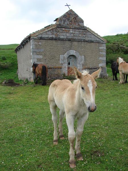
Ermita de Nostra Senora de Trobaniello. Is
it just me or does the foal look a bit like
Andy Schleck...?
(image from Descubreaturias.com) |
Just around the bend is a fork where the peloton turn left to race along the AS-228. We enter a forested section to start the long descent with its many hairpins and challenging bends, the first of which comes in a clearing by the Ermita de Nostra Señora de Trobaniello, a chapel visited more often by horses and cows than humans these days.
There are more tight bends hidden among the trees, all of them potential trouble spots due to leaves, moss and the various other slippery stuff encountered in forests. There is all the likelihood of punctures due to thorns, flat tyres on fast descents frequently proving disastrous and making for a nerve-wracking section; so it's quite a relief to emerge back into open pasture and round the next hairpin. There are three more a little way further ahead, then the peloton enters the last section before reaching Paramo situated 120km from the start. It's an attractive village and although some houses are a little ramshackle, the overall effect is of a community considerably more wealthy than its neighbours.
Leaving the village behind, we climb into a narrow, rocky valley - one of the most beautiful sections of the stage, though the riders aren't going to like it due to the presence of another unlit tunnel, this one slightly longer than the last at 0.11km. Still - could have been worse, chaps: if Zomegnan had designed this parcours, the tunnel would have been 11km and on fire. On the other side, we ignore the TE-5 heading into Fresneu - a pity, as the village looks well-worth a visit - and continue on the AS-228 and through San Salvador de Duio, Riello and Las Vegas until we reach Samartin and the junction with the AS-225. We turn left, travelling east towards Villanueva and immediately beginning Cat 1 Puerto de San Lorenzo.
The climb is 10.1km long and ascends through 860m, making it the second longest - though not the second highest - on the stage. Along the way, we skirt past La Plaza, Quintanal and Villanueva de Cangas; hitting the first hairpin shortly afterwards. Since it enters a short descent and is surrounded by trees, there's a chance this one might be slippery. The next takes us over 1000m; the one after that is at Braña de Tuiza which cannot really claim to be a village at all, more a collection of cottages and outhouses - some very picturesque, especially those with thatched roofs. There's another one - with parking space and thus a likely point for a village of campervans to swell the local population - just to the north; at which point the road swings south and then west as it approaches the next pair. The summit, 1350m above sea level, comes at a bend in the road 142.1km from the start. The descent is steep, fast and technical with several challenging bends and two hairpins shortly before Orderias.
 |
| Landscape typical of Somiedo. |
After a few more kilometres, we reach a junction with a connecting road joining the AS-265 to the AS-227. That might sound a simple enough matter - only to achieve it, the connection needs to descend through 145m in 0.3km, and that takes four very tight, very steep hairpins. At the bottom is La Riera de Somiedo where the race turns south. Just out of the village, it reaches a road on the right that features eleven hairpins in 0.13km; the riders will be glad we're not going that way today. Castro, passed on the right, marks the beginning of the second intermediate sprint and the start of a section featuring three unlit tunnels - two of 50m and one of 25m. We turn left at the following junction onto the SD-1, almost immediately entering an unlit tunnel 150m long, and begin the final climb: Especial Category (equivalent to the Tour de France's Hors-Categorie) and 1010m to La Farrapona. There's another unlit tunnel, this time 80m long, a little over a kilometre before Veigas and two 90 degree bends with a bridge in the middle shortly before Villarán, but the road is wide and shouldn't cause problems other than the physical stress of the climb.
Having left the village behind, the route takes two hairpins past Arbeyales and enters a flatter section leading to Endriga, then onwards to Saliencia. From this point, there are 7.3km to the end of the stage and 615m still to climb; the road begins to get much steeper from now on. A left-hand bend by a large industrial building on the edge of the village could prove hazardous. The next section, despite the climb, is once again unchallenging; being made up of long straights and gentle bends. Soon we reach the first hairpin and reach 1500m around the bends that follow, then come to another pair of hairpins with a non-technical stretch in between and reach 1600m shortly afterwards. A third hairpin - entered via a bridge narrower than the road - is a short way ahead. We reach 1700m on the next straight which leads straight into the carpark at the highest point, the stage finish 175.8km from the start.
 |
| Parque Natural de Someido. In the foreground, a teito. |
The Parque Natural de Somiedo covers almost 40,000 hectares and includes some of the most beautiful natural scenery in Europe. Declared a protected national park in 1988, it was later granted Biosphere Reserve status by UNESCO in 2000 which require all farming activity taking place within the region to be carefully managed and sustainable so as to have zero detrimental impact upon the environment. Roughly 25% of the park is forested, the habitat of the Cantabrian brown bear - around 30 are believed to live here. Golden eagles, capercaillies, pine martens, genets, wolves, wild boar and the strange Iberian desman also survive here. Human life in the park is every bit as interesting as the animal life, for it's home to a nomadic and distinct ethnic group known as the
Vaqueiros de Alzada; their unique folklore and mythology of very great interest to ethnologists and other branches of anthropology, and still very evident today despite many centuries of discrimination at the hands of the church. The Park is also famous for its
teito, small huts similar to the
pallozas we saw yesterday, some dating from the 12th Century - many can be rented by tourists.
 |
Part of a traditional Vaqueiros de Alzada wedding ceremony, in which a pair
of oxen haul the bride and groom's bed to their new home. |
Predictions: Like yesterday, the outcome of this stage is all but impossible to predict. The obvious choice at the betting shop would be a sprinter who can also climb; but those are a very rare breed. A rider who can mount a successful breakaway and keep up the pace all the way to the first mountain, thus creating a sufficient advantage to keep his lead in the climbs, could do well - the most likely bet is a climber who can keep up the pace on the flat sections. There is one man who excels in that category, but unfortunately he's not in the Vuelta this year as he awaits the decision over the Clenbuterol he consumed in a contaminated steak at last year's Tour de France. Chavanel, then.
Weather: Pleasantly cool again - it was actually quite a bit hotter here at Cyclopunk Towers in Cambridge today than it was anywhere along the race's route. Expect a high of 21C at the startline, dropping to no lower than 19C until the high slopes of Puerto de la Ventana where it's likely to be around 15C. It'll rise back to about 19C in the valley beyond, dropping again to the same low at the top of Puerto de la San Lorenzo, then rise back up to 19C as the altitude decreases. Higher up in Lagos de Somiedo, it might turn quite chilly - perhaps as low as 11C at the summit finish. Echelons will be the order of the day once again, with gentle to moderate crosswinds expected throughout the course. There will become stronger at altitude, verging on moderate to strong at the peaks. No rain is predicted anywhere along the stage, but early sun will soon turn to cloud after the first 20km or so, becoming thicker towards the end.
More Stage Previews: click here


No comments:
Post a Comment