Tuesday, 9 August 2011

Vuelta a España - Stage 6 Preview

Stage Map: click here
Stage Profile: click here
More Stage Previews: click here

Stage 6 is another plain stage, but as those of you who either read our preview yesterday or are fortunate enough to live somewhere with live television footage will be aware, "plain stage" does not mean "easy" in the language of the Vuelta. Today is no different - while there are none of the mountains that appeared in the "plain" Stage 5, the organisers have gone all out to include as many difficult sections as possible.

Ubeda with snow, showing some of its many historical
treasures. The church in the background is the Sacra
Capilla del Salvador.
Following an overnight transfer, the stage begins in a little park in the centre of Ubeda within sight of the Sacra Capilla del Salvador which, despite the name (capilla means chapel), is a vast 16th Century church larger than many cathedrals and ranked among the finest examples of Spanish Renaissance architecture. Among Ubeda's 48 other sites declared of national cultural or historic interest are the medieval Casa de las Torres and the Palacio del Deán Ortega. In fact, there is so much to be seen that the city has given rise to a Spanish phrase, andar por los cerros de Úbeda, "to walk around the hills of Ubeda," meaning to go off on a tangent. With so much history and so many historical buildings, it's easy to see how anyone attempting to give a tour would indeed go off on several tangents. We don't yet know the exact route the race will take out of the Ubeda, but the most likely will be via the Calle del Obispo Pobos and the Av. de Cristo Rey leading past the Hospital de Santiago and the bullring, where a fight will hopefully not be in progress so we don't have to have our enjoyment of a beautiful and heroic sport ruined by the sight of an animal being slowly tortured to death.

Baeza
The Av. de Cristo Rey is wide and free of hazards, but leads onto two roundabouts on the western edge of the city, the peloton going straight over both and onto the A-316. Three more roundabouts mark turn-offs into industrial sites before the parcours leaves for a narrower road, then a sweeping left-hand bend turns south and south-west towards the end of the neutral zone just outside Baeza.

Like its neighbour Ubeda, Baeza was declared a World Heritage Site in 2003. We owe the city's beauty not to wise decisions to preserve old buildings in days gone by, but to economic hardship and recession: while the city flourished under Moorish rule and became home to 50,000 (three times the current population, the collapse of the Caliphate and return to Christian rule brought financial disaster and, like many Spanish cities, Baeza entered a long period of decline. This, combined with eventual economic collapse in the 17th Century, meant that new structures were too expensive to build and the population had to make-do-and-mend with what they already had. It must have been horrendously tough at the time, but those long-dead residents would hopefully take some comfort in knowing that their descendants are now beginning to grow wealthy from the tourists attracted by the ancient buildings. It is, nevertheless, fortunate that anything is left - the Great Lisbon Earthquake of 1755 caused widespread damage. Sights include the Palacio de Jabalquinto, the Catedral de la Natividad de Nuestra Señora de Baeza, the former university dating from the 16th Century and the buildings around the Plaza del Pópulo. There was once a vast fortress located on a hill within the town, containing a castle and palaces and said to have been as beautiful as it was impregnable. It was destroyed during the 15th Century on the orders of Queen Isabel to prevent rebellions by local aristocrats and the masonry used in the construction of new buildings; leaving very little to see at ground level today.

Medieval streets, Baeza.
Having reached the end of the tree-lined Av. del Alcalde de Puché Pardo, the peloton turns right into the Avenida de Andalucia and passes a wooded park. There are at least eight raised speed humps along this road, which becomes the A-6101 and heads north-west to Ibros, encountering nothing else likely to present a hazard along the way. Once inside the town, the parcours travels along the Av. Joaquin Padilla which permits little opportunity to see the very few interesting and/or historical structures in the town before embarking on a 9km section leading to the roundabout junction with the N-322 carrying the race past the Estacion Linares-Baeza. Linares is some 2.5km further ahead, where the peloton leaves the road and turns south at a roundabout onto the A-302.

The parcours continues south-west, passing through a lush green area which stands in stark and welcome contrast to the surrounding landscape and the tragically semi-derelict Castillo-Palacio Tobaruela, of which it looks as though nothing will be left within another two decades unless someone fabulously wealthy rock star takes a shine to it and restores the old walls. Though imposing, it's not an especially attractive place and looks too spooky for many. Marilyn Manson, we have a job for you.

The N-323 leads to roundabout next to an industrial estate as the race reaches Mengibar, leading to the possibility of diesel spills which can be both lethal and virtually invisible especially in rain, where the peloton turns right onto the Av. de España which has a wide central reservation lying in wait to catch out any rider who ill-advisably picks this point to look around for team-mates. The Vuelta road book also warns of "steep gullies" here. Five roads lead off from the end, the parcours takes the fourth to pass along the C. Santa Amalia which leads straight on to the Carretera Espelliy and Carretera Espeluy, then the JA-3413 leading away from the town.

Iberian bronze, discovered at Mengibar.
Though Mengibar is today home to a little under 10,000 people, there is historical and archaeological evidence supporting the current theory that the great city of Iliturgi once stood here before it was razed to the ground and the population slaughtered by the Romans due to their constant trouble-making and refusal to pay taxes. Unfortunately, looters long ago discovered that valuable artifacts could be had by carrying out unauthorised treasure hunts in the vicinity, meaning there is precious little left for archaeologists to study and prove or disprove the theory once and for all. The JA-3413 is untechnical and soon leads to Cazalilla, 51km from the start line. The peloton enter town along the long Av. de Andalucia, taking a sharp left onto the C. Poeta Abendarrach, then an equally tricky left onto the C. Anch before reaching the Av. de la Constitución, then left again to travel along the Ctra. de Espluy through the centre of town. At the end, a narrow passage to access the C. de las Cuevas will pack a lot of riders into a small space, creating a hazard for those unwilling to fall back and wait. The JA-3410 takes us north-west away from the town and, after 3.5km, across a bridge into Villanueva de la Reina.

Villanueva de la Reina
Villanueva has a beautiful location, situated on the fertile lowland banks of the Guadalquivir river, and has been a stop-off point for travellers ever since the Romans first built a town here. Whilst it may lack the grand buildings seen elsewhere along this stage, there is much to appreciate and the town centre streets are wide and well-kept. Seven raised speed humps carry the peloton south of the centre and onto the JA-3409 as it heads west, back into the countryside. Some way on, having turned south-west, the road enters a twisty section which may prove dusty and slippery. 8km from Villanueva is Lahiguera, where a left hand corner as soon as the peloton enters the town takes the riders south to the C. de la Cruz del Pozuelo which has several speed bumps and a tight left onto the JA-3404 heading south. The road crosses one narrow bridge and features one sweeping hairpin rising through 30m, but it otherwise free of likely hazards until reaching Arjona, a town known as Urgavo to the Romans. It was an important place under their rule, as is made evident by the archaeological traces of large structures - possibly temples - found within the town. Under Moorish rule it became Arjuna Qal'at, which was gradually modified to the present form after the fall of the Caliphate.

The road narrows considerably as it becomes the C. del Matadero, then turns right onto the C. Pozo del Llano and C. del Tejar before a bend onto the C. Alcantarilla and C. Cañuelo. A sweeping bend leads to the C. Felix Rodriguez de la Fuente and right onto the A-321shortly before it becomes the A-305. After 2km, the parcours comes to a fork where the peloton will take the left path onto the A-6176 to reach Arjonilla, 77.4km from the start. The C. de Arjona into town is technical with a lot of street furniture and raised humps but should allow glimpses of the castle before the C. de los Molinos and C. Doctor Garcia Mazuelo carry the riders into the centre of town. A sharp left corner then takes them south along the JA-4401 and out of town.

After some kilometres, the JA-4401 reaches the JA-5400 just south of Santiago. The parcours turns right on the potentially dusty junction before heading west towards Lopera, located 94.6km from the start. Lopera's castle is extremely well-preserved and looks precisely how a medieval castle is supposed to look, with high walls and enough turrets and battlements to keep even the most imaginative of Gothic novel-writers happy for years. There are far more modern defensive structures in the town, too - it became on of the most important sites along the Andalusian Front during the Civil War and saw one of the most important battles, leaving many gun emplacements, shelters and other features in the town and surrounding countryside. However, we shan't see much of it today because the peloton turn south onto the A-6175 almost as soon as the enter the town. Just north of Porcuna, the riders turn right onto the A-306 and head towards Cañete de las Torres.

The road passes over a bridge, but as this is a main arterial route it should be as wide as the road and create no problems, though cross-winds could be high if conditions are right. On the outskirts, the peloton turns left into Cañete de las Torres along the C. Federico Lorca which joins the C. Menendez Pidal. A left corner takes them to the Av. de Jaén, then the C. Antonio Mauro, C.del Molino and C. de la Glorieta - a route taking us around many of the medieval streets - lead back to the A-306 heading for Bujalance.

Bujalance
Bujalance's peculiar name derives from the Arabic Bury al-Hans, which became Burialhanç and went through  Burialhançe, Buxalançe, Buxalanze and Buxalance during the post-Moorish era before finally settling on its modern form. However, there has been a settlement here since at least Iberian times - a sculpture known as the Iberian Lion of Bujalance dating the the 5th Century BCE was found here; the fertile location attracting representatives of every ethnic group to have made Andalusia their home. It appears that the shift to Moorish rule was relatively peaceful with the existing population seemingly not too concerned about their new lords nor their religion and, as was the case in many parts of the country, they benefited greatly from it for the town soon acquired a castle - still standing but not in a very good state of repair and crowded on all sides by ugly modern buildings - and several markets. It also gained a fine mosque, but it has long since vanished - Ferdinand III, having conquered the town and returned it to Christian rule in 1227, ordered the mosque to be "purified" (a term very much reflecting the odious religious intolerance of the times) and converted into a church. The site is now occupied by the Parroquia de Nuestra Señora de la Asunción, famous for its remarkable Gothic altarpiece and leaning tower. Following difficult times marked by riots and plague, the 17th Century brought prosperity to Bujalance when it became a centre of cloth-making and there are many impressive buildings dating from this period. In 1630, it was granted city status. The industry lasted into the 20th Century, when the factories' large workforce placed the town firmly on the side of the leftists in the Civil War so that the city soon became one of the centres of the anti-fascist struggle; Madrid's La Estampa newspaper called it the Mecca of anarchism.

Villafranca de Cordoba's surprisingly
modern-looking convent.
The ringroad leads to a roundabout where the peloton turn right and rejoin the A-306 leading north-west, becoming the N-IV at El Carpio - unfortunately, we'll see little of this town and its solidly imposing Torre de Garci Méndez as the parcours skirts around the eastern and northern edges before it joins the A-421 and crosses a narrow bowstring arch bridge over the Guadalquivir and enters Villafranca de Cordoba 142.7km from the start. Very unusually for this part of the world, Villafranca doesn't have a castle - it appears to have enjoyed a relatively peaceful existence and has never really needed one, having been a fairly unimportant place until the last century when it became home to a number of kitchen furniture manufacturers and as such began trading with cities around the world. The peloton soon reaches a small roundabout with a little rock garden, where they turn left and then left again onto the CO-3103 and begin the first intermediate sprint of the stage. This should be straightforward as the road is untechnical and without potential hazards other than a slightly narrowed section where it crosses a bridge over a stream, so it's probably a safe bet to say that any breakaway group to have formed earlier in the day will get the points here.

After 151km, the road sweeps around a right bend before passing under the motorway and then turns sharply left onto a narrow bridge. This combination of high-speed bend, technical corner, constriction and possible slippery road surface due to the surrounding trees makes this seem the most likely spot for crashes on the stage as the peloton will need to sharply reduce speed and form some sort of order to get across, since the bridge looks able to take no more than three or four abreast - and even that would be pushing things. Once off the bridge, another tight left takes them back onto the road, back under the motorway and onward. North-east of the narrow bridge is an enormous dam, holding back the Embalse San Rafael de Navallana lake which, though located at an altitude of around 150m, has a distinctly Haute-Alpine look. The road then follows the Guadalquivir for a short stretch, passing south of a large mansion, then joins with the N-IVa heading west into Cordoba.

Cordoba, "the jewel of the world": inside the cathedral
Following a series of junctions, the route turns right onto the Av. de Carlos III, which is long and straight and has tended to attract large crowds whenever the Vuelta has passed this way before. A roundabout marks the end, where the peloton turns left before rounding a fountain and passing onto the Av de al-Nasir where the second intermediate sprint begins. Once done, the riders turn right onto the Av. del Brillante and right again onto the Av. del Calasancio which joins the Av. de San José de Calasanz after a short while. The route leaves the city and heads out into the countryside on the CO-3408. The land is arid for a while, but the peloton soon starts climbing into a greener area, ascending almost 300m between Cordoba and the junction with the CO-3404 which climbs higher, topping out at 580m after a Cat 2 climb which, in the steepest section, has a gradient of 14%.

Medina Azahara
The parcours passes through more forested areas, climbing and descending, before reaching the CO-3402. The descent from here is fast and twisty with many hairpins - there were once many more, but one especially snaky section has been replaced with a sweeping curve.

This route carries the race just east of Medina Azahara, one of the most astounding archaeological sites in Europe and the entire world. Once a city of palaces, work began here in the 10th Century to build the ultimate expression of the Caliphate's power, wealth and superiority over its enemies - which has led to a common modern description, "the Versailles of the Middle Ages." However, anybody with even the most rudimentary of imaginations cannot doubt that, at its height, this place easily surpassed Versailles. That height was a very short period of time - having been equipped with fortifications, palacial residences, mosques, bathhouses and aqueducts to bring water for the inhabitants, gardens and fountains, it was looted and suffered much damage in a civil war in 1010, less than a hundred years after building began, and was then subsequently abandoned to fall into ruin for nine centuries until attempts to study and preserve it began in 1910. In the following century, only around 12% of the entire site has been excavated but this already includes two palaces, two mansions, guard houses, administrative buildings, gardens and a vast reception hall.

Once the CO-3402 flattens out and once again travels through arid landscapes, it's not long before the peloton reach a roundabout on the outskirts of Cordoba. They turn left here, soon coming to another roundabout which they cross to join the Av. de la Azufarrilla (Azufarilla in the Vuelta details, Arruzafilla on maps). This leads over a roundabout with a spectacular fountain - best seen at night, when it's lit by coloured lights, and don't miss the small section of Roman aqueduct just before the roundabout - before turning right to join the Av. del Brillante leading south to the Av de al-Nasir where, after 196.8km, the stage comes to an end.

Cordoba at night
Cordoba has a population today of around 328,000 - less than a third of its population a thousand years ago when, according to some estimates (with archaeological evidence), it was home to a million people; roughly 1/265th of all the human beings then alive, making it the most populous city in the world and the European centre of science, literature, finance, art and philosophy (thanks almost entirely to its Moorish Caliphate rulers, one of whom granted the city the world's largest public library with between 400,000 and a million books , part of the same Islamic culture that certain people like to try to claim have contributed nothing to the world - although since Arabs were the first to come up with the mathematical concept of zero, there's some ironic truth to that)*. In the 12th Century, it was the home of Maimonides, perhaps the most important of all rabbis, whose Mishneh Torah remains the most valuable guide to the interpretation of Torah to this day and is a vital part of the daily study carried out by almost all observant Jewish people worldwide. The Renaissance, when cities throughout Europe began to grow, had a strangely opposite effect on Cordoba; by the 18th Century the population had fallen to under 20,000, not recovering until the 20th.

The Roman Bridge and the Mosque-Cathedral, Cordoba.
As would be expected, Cordoba offers far more to see than we can list here. However, among its many jewels are the numerous Roman remains including a near-perfectly preserved mausoleum in the Jardines de la Victoria, the 14th Century synagogue that was restored and reopened in 1985 to commorate the 850th anniversary of Maimondies' birth, the Torre de la Calahorra fortified gatehouse, the ancient watermills on the Guadalquivir river, the many palaces, the Mosque-Cathedral which began life as a pagan temple and the Roman bridge. It is not a place than can be seen in a day.
* Estimates range from 500,000 to a million - assume somewhere roughly halfway between is probably reasonably accurate.


Predictions: Could today be Bradley's day? We think it could. However, if he wants it he's going to have to beat Sylvain Chavanel; because this is the ideal stage for breakaway specialist Mimosa


Weather: Moderate headwinds all the way today and hot, too - so it's lucky the riders have the Jewel of the World to look forward to, otherwise they probably wouldn't bother. We can expect 31C at the start, rising to 33C by 20km and up until 140km when it could be a degree warmer. It'll drop three degrees or so at the top of the Cat 2 climb before Cordoba, then rise to 34C again in the city.

More Stage Previews: click here

Vuelta a España - Stage 5 Preview

For those of you unfamiliar with the
breed, this is a Unimog - the most "go
anywhere" of 4x4 vehicles.
Stage Map: click here
Stage Profile: click here
More Stage Previews: click here

The Vuelta organisers call this a plain stage, which does rather raise the possibility that some of the mountain stages this year are going to need to be completed in Mercedes Unimogs rather than on bicycles - one uncategorised climb, one Cat 3, a Cat 2 climbed twice and two sections with 23% and 27% gradients isn't exactly the dictionary definition of "flat."

The fun begins right where we left off yesterday at the Sierra Nevada ski resort, with the neutral zone coming to an end just outside Granada. Granada is unusual for a city in this part of the world due to there being no evidence of a settlement here during Classical times - in fact, though there have been many discoveries showing towns and villages nearby date from the Bronze Age and earlier, there is no trace of Granada before the 7th Century CE, merely tiny villages where it now stands. Then, having got going, it appears to have been largely abandoned during the 8th Century. The Moors adopted it early in the 11th Century, establishing a city they called Madinat Garnata around the base of what remained of the 7th Century fortress. By the end of the century, they had created a large urban area and it was becoming one of the most important cities in the region.

Though besieged by Christian forces as the end of the Moorish period, Granada's defences and fortifications proved too strong and the city did not fall to them, passing into Christian ownership only as part of capitulations made by the Moors following overall defeat elsewhere. At first, Granada's Muslims were treated extraordinarily fairly by their new rulers, being permitted religious freedom and Islamic courts - even the first archbishop, Hernando de Talavera, was possessed of an attitude that seems strikingly modern: he apparently believed that Christians and Muslims were equal, held Islam in very high esteem and even learned Arabic, though he did so at least partially to assist him in his attempts to convert Moors to Catholicism. That respect, of course, could not last long in the viciously intolerant Middle Ages, and just seven years later a programme of forced conversions, conversion of mosques into the churches and widespread burning of Islamic holy texts began. The Moors were understandably not best pleased about this and riots broke out across the city, those involved being violently and bloodily suppressed and the entire Moorish community harshly punished. In 1502, they were banished from the city they had themselves created and then from all Spain 107 years later.

It may not have stood for as long as many Spanish cities, but Granada has packed a very great deal of history into its centuries. It was already famous for its many fine buildings during the 16th Century and kings of the time put vast financial resources into maintaining its splendour, this being the reason that so much still survives. Among its many jewels are the Catedral y Capilla Real, begun in 1518; the Monasterio de San Jerónimo, begun in 1504and the Palacio de Carlos V with its enormous circular central courtyard. There is, however, one structure in Granada that attracts more tourists than all the rest combined, possibly more than all the other buildings in Spain combined - the Alhambra, so famous that it's become a symbol of the nation. Moorish poets called it "a pearl set among emeralds," inspired by the forests that surround it on its perch above the city and it remains to this day the finest example of medieval Muslim architecture in Europe, despite the modifications made under Christian rule and the damage done accidentally, neglectfully and deliberately during the long period that it was but forgotten before being rediscovered in the 19th Century.

The Alhambra
The first historical reference to the site occurs late in the 9th Century, when a small group of Moors took refuge in a small castle. However, the castle proved weak and they were soon over-run by their enemy, so it once again fell out of use for over a hundred years until a small Jewish community living on the hill was permitted by the Moors to restore it in an effort to protect themselves. Restoration did not improve its defensive capabilities and the castle fell again - but not before the strategic potential of the site had been recognised; during the 13th Century under the reign of Ibn Nasr it was havily developed and gained no fewer than six palaces, massive walls, gardens, mosques, bath-houses and everything its fortunate residents might ever require.

Two large roundabouts on the N-432 just after the end of the neutral zone may cause problems as the peloton will still be large and tightly-packed. There are a few others nearer Atarfe, but the road shouldn't cause any issues.

Atarfe, north-west of Granada, is far smaller; but it too has much to see including a contemporary Temple to the Sun, resembling a modernistic reinterpretation of Stonehenge, and a park named in honour of Pink Floyd. It goes without saying that the hippy movement remains popular in Atarfe. The parcours then follows the N-432, taking it past the foot of  dramatic Monte El Piorno that looms 500m above the road before entering Pinos Puente 10km from the start line. The road out crosses a flat region, offering excellent views of the mountains, arriving in Venta Algarra after another 10km and Puerto Lope - "The Gate of Wolves" - after 14km, where picturesque ruined watchtowers stand on high outcrops. Once the town is left behind, the peloton face a 20km section through the arid fields which would support few plants were it not for the extensive irrigation projects which allow groves of fruit trees, the basis of the economy throughout this part of Spain. The road is wide and untechnical, but dust may make the tighter bends slippery as it heads towards Alcala la Real.

Alcala la Real
Leaving the N-432, the route turns right onto the Carretera de Granada which in turn leads to the Av. de Andalucia from which it's possible to see the fortified citadel known as La Mota above the town. There are twelve watchtowers - from an original 15 - dotted around the town, reflecting the enormous strategic importance in times past when several trade routes passed through, one of them being located at La Mota. These towers were constructed  during the 10th Century as a defence against the Vikings who would sail all the way from Scandinavia, such was the wealth of this region. The road into the town is not especially demanding, though there's a roundabout shortly before a tight right turn into the Calle de Miguel Hernandez, then a sharp left onto the Av. de Europa which leads onto the Calle de la Carrera de la Mercedes (with even better views of La Mota across a small park). As soon as the riders reach the Calle de las Tejuelas, they're on the N-432A which, after another tight left, leads out of town.

Traces of ancient dwellings on the Cabeza Baja de
Encina Hermosa.
The altitude descends as far as a junction with the JA-4304, then begins to rise again through a pair of easy Z-bends. It reaches 940m just as a hairpin carries the road around the mountain, its summit 300m higher, with excellent views over the Cabeza Baja de Encina Hermosa, a steep-sided wide plateau where many archaeologically important artifacts have been discovered. As this is an uncategorised climb, there are no points to be won. During the descent, the peloton doubles back on itself at a fork in the road and takes the A-6050 towards Castillo de Locubín; entry to the town requiring several fast bends. The road through is wide and uncomplicated, with the potential exception of four bends roughly in the middle of town, three more on the northern edge and one just outside.

"Locubin" comes from the Moorish name for the town, Hisn al-Uqbin; translated variously as the castle of the eagles or the castle of the caves; the latter seeming more likely due to the many caves in the surrounding mountains, where decorated pottery was left by shepherds 2400 years ago. The castle itself, topped by decorative palm trees and looking more Arabic than plenty of Middle Eastern fortresses, has rather ugly modern houses built right up against its walls yet still manages to be imposing. As soon as they've left the town behind, the riders begin the ascent of Cat 2 Alto de Valdepeñas.

Los Villares, seen from high in the surrounding mountains.
After rounding a series of very simple sweeping hairpins, the peloton pass by some small wooded patches before the road climbs more steeply, then heads onto a slightly gentler climb up to the the summit - 1090m - 67km from the start. The descent into Valdepeñas de Jaén is fast and technical with particular hazards on the bends just before and after the first forested section after the summit where the road travels beside a ravine, a hairpin approximately 0.5km further on and a right-hand bend 1km before Valdepeñas de Jaén's outskirts. The route through town makes use of the Calle del Obispo and Calle del Vilches, with sections rated at gradients 12, 15 and 23% before the intermediate sprint. Once back out into the open countryside, a series of hairpins carries the road up to almost 1180m before the parcours begins to drop downwards through more hairpins. This is another very beautiful section with superb views to the villages in the valleys, but it's technical with some demanding stretches around bends and through wooded parts so the riders will need to concentrate on the road rather than admire the scenery. Los Villares is approached from the south, the A-6050 carrying the peloton straight through before a difficult right bend - near industrial units, hence the possibility of diesel and other hazards on the road - and towards Jaén, 9km away and 103.5km from the start.

After a few kilometres, the road enters a section where it clings precariously to a mountainside. On the left, the mountain rises to almost 1300m, on the right it drops 30m. An apparently abandoned tunnel, barricaded off with armco, leads into the mountain. Mountains can be seen up ahead as the riders pass by Vadillos and Jabalcuz before turning east and, after a short distance, coming to a roundabout where they take the left exit to enter Jaén along the Ctra Javalcruz. The Ctra. de Circunvalación ring road takes them to the JA-303.

Jaen, with the castle to the left and the cathedral to the right.
With 117,000 residents, Jaén is a reasonably-sized city full of steep streets that give it an attractive and medieval air in parts. The origins of the name are uncertain, but it may come from the Latin gaien, meaning "green," but it may also come from the Ladino (the language of the Sephardic Jewish people, like Yiddish an early international language) variant of the Hebrew "Dayan," the name given to a rabbi highly skilled in Jewish law and thus qualified to preside over a beit din court - the city was home to a very famous beit din known as Hasdai ibn Shaprut (after its founder) in the 10th Century. The city's history extends far back into prehistoric times with many Neolithic and Iberian finds in the area, along with Classical discoveries including Roman mosaics and the Roman origins of the Arabic Baths. However, the city was not under Roman control until the time of Vespasian, at various other times in the ownership of Carthaginians - including Hannibal, who built fortifications here.

The Cathedral at Jaen.
Following the decline of the Roman Empire, the city passed into the hands of the Visigoths - however, their forces were never particularly strong in the region, perhaps because they appear not to have considered it of especial importance despite the wealth and strategic value of the city; leading to frequent rebellions organised by the Hispano-Roman nobles. The Moors, meanwhile, recognised it as a prize worth having immediately, and began to develop and improve it as soon as they'd conquered Spain, building numerous mosques, the castle and canals to irrigate the surrounding land. A period of conflict saw it pass into Christian hands during the 13th Century. After the 15th Century, Jaén entered a long period of decline. It was invaded and conquered by French troops during the War of Independence, which saw the castle converted into a garrison and many of the city's remaining treasures sacked, then experienced some of the worst horrors of the Civil War including mass executions and bombing by Nazi aircraft. Finally, in the middle of the 20th Century once democracy took hold in Spain, things started to look up.

Jewish Quarter, Jaen.
Among the many historical sites in the city are the ancient Jewish quarter, known as the Barrio de Santa Cruz, where there is the wonderfully-named el Callejón del Gato ("Cat-Faced Alley"), the Iglesia de San Andrés which was originally a synagogue and a superb street lamp in the shape of a menorah; the medieval walls; the castle, known as Santa Catalina and the 13th Century Basílica de San Ildefonso. There is also much impressive modern architecture including the regional headquarters of the Ministry of the Environment, Caja de Jaén, El Corte Inglés and several fine buildings on the University campus.

The peloton leave the city along the JA-3303, which involves numerous raised traffic-calming bumps and roundabouts before reaching a bridge over and junction with the A-316 which heads west, taking the race past Torredelcampo and on to towards a large junction with a sharp left corner and a roundabout where the riders join the JA-3309 heading south into Jamilena. The Calle Virgen de Estrella leads to a right turn, potentially hazardous, into the Av. de Andalucia and the Calle María Axuliadora. A bend to the right on the southern edge of the town is another potential hazard. Jamilena is home to la Capilla de Nuestro Padre Jesús Nazareno where a beautiful painting of Christ, dated to 1883 and a copy of an earlier work, was discovered. It subsequently vanished during the Civil War and hasn't been seen since, presumably being added to someone's spoils and now locked away in a private collection.

Martos. The ruined castle can just be seen atop The
Rock, especially if you click on the image to
get the larger version :-)
There are impressive views south-east to the steep-sided mountains and a quarry along the JA-3309, which has few hazards other than some gentle bends and a tight left into the town, at which point the ruined castle standing almost 1000m above sea level on The Rock can best be seen. Martos has what is possibly one of the most complicated road networks anywhere in Europe, so it's fortunate that the Vuelta's route along the Av. de Jaén, Calle Santa Lucia, Callede Dolores Escobedo and Av. de la Fuente de la Villa is relatively straight-forward, though not without technical sections created by corners - especially that onto the Av. de la Fuente de la Villa - along with several speed bumps, a roundabout and a narrow passage along the Calle del Teniente General Chamorro Martinez. The peloton passes the bullring, with which Martos like many Spanish towns mars its beauty with blood and suffering, heading south-west to the junction with the A-316.

Torre del Homenaje
The castle, Castillo de la Peña de Martos, is of 14th Century construction and was built upon the ruins of a Moorish fortress, itself built on top of ancient Iberian ruins - it can only be reached on foot and then only with difficulty, locals recommending tourists allow at least 40 minutes either way; which demonstrates how difficult getting anywhere near it would have been in the days when attempting to do so meant avoiding arrows and other missiles. According to legend, it was here that the Brothers Carvajales, charged with treachery that had cost King Fernando IV an important battle. He sentenced the brothers to be enclosed within a spike-lined iron cage which would then be thrown off The Rock. However, the brothers continued to proclaim their innocence and, just before their execution was due, informed all present that the King would be summoned to appear before G-d to answer to his actions within the next 30 days. Fernando died on the 7th of September 1312, precisely 30 days after the brothers. The Castillo de la Villa de Martos, located in the town, is one of many other medieval defensive buildings in the town, including the Torre del Homenaje, the Torre Albarrana, the Torre Almedina and the remains of the city walls which once connected them.

Alcaudete
The A-316 is largely straight as it heads south-west, really not the most interesting of roads as it passes through the monotonous landscape. Fortunately, it's not long before the peloton turns left onto the A-6051 and heads towards Venta de Pantalones - a town with a name that those English-speakers with a knowledge of Spanish will already be wondering about - where the second intermediate sprint begins. Two hairpins and a bend take the race 30m higher before the road climbs up through a twisty section towards Alcaudete with a population of 11,000, mainly employed in the farming and processing of olives. Every town and city through which the parcours travels in this stage seems to have a castle, but few are as impressive as Alcaudete's Castillo-Palacio with its 40m-tall tower. Built in the 12th Century, recreated as a palace in the 16th and then partially destroyed by an earthquake in the 18th after being used for some years as a hospital, the building later became the property of the family that stills owns it and who have spent much money and effort preserving it. Below the castle are several tunnels, leading down to the town. That this was a wealthy town can be seen also in the splendour of Iglesia de Santa María la Mayor de Alcaudete .

Inglesia de Santa Maria, Alcaudete.
The Av. de Andalucia around Alcaudete's centre is wide and simple, but ends in a roundabout where the peloton will turn right to travel along the N-432 which has four speed bumps. This road takes them south-west towards Ventas de Carrizal, where they turn left onto the JA-4306 heading east through the village and into a landscape far greener than we've seen for some time. This route heads back the way we came, passing by Castillo de Locubín and up over the Alto de Valdepeñas, finishing in Valdepeñas de Jaén.

Predictions: A puncheur - someone who can ride well on any terrain and keep on plugging away for as long as it takes. Hmm... are you listening, Bradley?


Weather: It's a hot one again, ranging from 30-34C across the entire route. Moderately strong crosswinds in the first quarter of the race won't cheer anyone up, but a moderate tailwind up the Alto de Valdepenas and on towards Valdepuenas de Jaen will be welcome. The lower terrain between the two climbs will be much hotter, though the tailwind up until 127.8km will help. After that, with the race changing direction, it'll become a headwind of moderate strength for the next 40km or so before the route once again changes direction and a tailwind assists on the second ascent. The entire route will be dry.

More Stage Previews: click here

Vuelta a España - Stage 4 Preview

Dama de Baza
Stage Map: click here
Stage Profile: click here
More Stage Previews: click here

Stage 4 takes in 170.2km and brings the first of the 2011 Vuelta's proper mountains, the Category 1 Alto de Filabres, Cat 3 Puerto de los Blancares, the final ascent to Sierra Nevada at 2130m and a whole host of smaller uncategorised climbs along the way just in case anyone doesn't find the stage challenging enough already. Baza - known to its Iberian founders and the Romans who took it over and developed it as Basti, becoming Bastha once it progressed to Moorish ownership - is a town of 21,000 residents where due to the surrounding mountains it's regularly possible to see a strange contrast: olive groves and snow. Though snow is unlikely, the region experiences frequent short-lived-yet-heavy summer storms from late August. Three kilometres from the centre of the modern town lie the remains of the Iberian-Roman town, at its height one of the most important of all Iberian towns and heavily fortified as a result. It was here in 1972 that archaeologists unearthed the Dama de Baza, considered one of the finest examples of Iberian art ever discovered and now displayed on her stone throne in the Museo Arqueológico Nacional in Madrid. The ruined castle, Castillo de Benzalema, has decayed to such a state that unless a window or other geometric feature can be seen it looks like a natural part of the rocks upon which it sits.

The peloton leaves town on the A-334, an uncomplicated road without corners, heading south-east in the direction of Caniles. However, the right turn into Caniles is sharp and with many industrial units along the road just traveled there may be patches of diesel on the road surface, creating a hazard. The town's name is frequently translated as "kennels," but in fact derives from the Latin "canalis," referring to the irrigation channels which have since ancient times allowed the farming of fruit and which remains the backbone of the local economy. Neolithic finds in the area show that it had been inhabited for many thousands of years before the Romans showed up and there is also evidence of a Phoenician presence. In the 20th Century, when a railways was built to connect the town with larger communities, farmers began to grow sugar in the region, enjoying a few boom years before the Civil War began an exodus to the cities from which Caniles has never fully recovered.

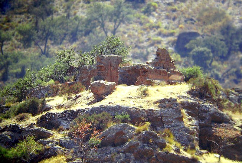
Ruins at Caniles
The Calle Rambla - with a roundabout at the start - takes the peloton directly into the centre of town, coming to an end at the Plaza España by the Iglesia de Santa María y San Pedro and Casa señorial barroca, two of Caniles' architectural highlights. The Calle de la Nueva de las Angustias then continues in the same direction, leading to the Travesia de San Sebastian and out of town on the Calle Alcalde Felipe which becomes narrow before the intersection with the GR-8101.

This intersection appears to be regularly used by agricultural traffic, meaning there may be a build-up of mud on the road surface - as such, it's likely to be hazardous due to dust in dry weather and mud in wet weather. The day's first climb begins here, the long and mostly straight road allowing riders to see what lies ahead - which does no good at all to the morale of the sprinters. Once onto the mountain proper, it begins to snake around in order to make use of the topography and several unsurfaced tracks leading off into the scrubby forest provide further slippery hazards. The first hairpin comes at 1718m, carrying the road 10m upwards a few kilometres before a picturesque rock formation rises up from the trees. The 2030m summit comes a little way further onwards just as the peloton emerges from the trees and enters an open area, where there are stunning views across the valleys.

Abrucena's castle - or what remains of it, anyway.
The descent is fast with twelve hairpins before a 90 degree turn carries the riders towards Abla, crossing a narrow bridge across a railway and passing north of Abrucena. Abrucena has a Moorish castle, even more ruined than the one at Baza so that it's difficult to spot among the rocks. Once the peloton is on the A-1176 the Ermita de San Antón soon comes into view standing on a low hill as Fiñana approaches - where there are various Roman and Moorish sites so poorly maintained that they'll have vanished within a generation or two and which we shan't see as we pass by the town on the road to the south. The parcours passes under the A-92 motorway and past a colourfully-painted milestone before becoming the A-4103 after 69km from the start line. Soon afterwards, it veers away from the motorway and enters arid scrublands before reaching Huéneja and the first intermediate sprint.
Castillo de la Calahorra, Spain's first Renaissance building
An uncomplicated but potentially slippery junction carries the riders onto the A-92 heading west, disappointingly missing Dólar - where the houses cluster about a central hill topped with a castle - 1.3km to the south. There are good views to the mountains here and, sometimes, lenticular clouds can be seen forming above the peaks. The road is straight until a sweeping right hand bend from which it's possible to see the Castillo de la Calahorra, of 16th Century construction and the first building in Spain in the Renaissance style. When built, it would have appeared quite different; having been coloured red by dust from the nearby minds over the subsequent centuries. Soon, the parcours leaves the motorway along a sliproad leading to a roundabout where the riders turn sharply left onto the A-4102 and ride through a forested section into Alcudia de Guadix, located 89.4km from the start.

Iglesia de La Anunciación, Alcudia de Guadix
A small town in a fertile valley, Alcudia has been a wealthy place since its foundation in the 8th Century - hence, the large and very grand church, Iglesia de La Anunciación. There are lots of raised traffic-calming humps on the way in and through the town on the way to curiously-named Exfiliana, a short distance away to the north. Exfiliana was founded as a Christian community in 306 CE, when it was named Ex-Julia. It became Xustar under the Moors who soon made up almost the entire population, leaving the town virtually deserted after the Expulsion until a group of Christian families moved it and renamed it Yxfilyana, from which the modern name derives.

Guadix
Having left Exfiliana, the peloton joins the A-4101 and heads into Guadix, 99km from the start. One of the oldest human inhabitations anywhere on the Iberian peninsula and home at some point to every ethnic and invading group to have ever made a home in Spain, Guadix's name comes from the Arabic Wadi Ash. Correctly - though rarely - pronounced "gwa dij," even the locals tend to say "gwa dix" or "gwa dis" nowadays. Under the Moors, the city became a medina, a walled and fortified place of enormous importance - the citadel, much modified over the years with buildings in numerous styles, remains. The cathedral, which occupies the site of the old mosque which itself stood upon the site of an earlier Visigoth church, was begun in the middle of the 16th Century and finally completed in the middle of the 18th, thus it too has a variety of styles including Gothic, Baroque and Renaissance. There is much more architectural heritage to see; from the Calle de la Concepción which began as a Moorish souk and later became popular with wealthy people who built the many fine homes still standing along the street to, at the other end of the scale, the cave dwellings of the Barrio de las Cuevas, some still inhabited by local people and others converted into luxurious tourist accommodation. The peloton enters town along the Av. Medina Olmos where there is much street furniture, then arrives at the Plaza de los Naranjos where it passes straight through and onto the A-4100 (Carretera de Granada) and out of town over a roundabout.

After another 5km, the riders reach Purullena with its medieval towers and more cave dwellings - these ones remaining large unspoiled as the tourist industry is on a far smaller scale here. The A-4100 is wide and straight as it continues into and through the town, but there are several raised humps before the sharp left turn onto the  GR-4101 on the western edge of town, a road which winds its way south-west and though the village of Los Baños. It climbs gently until it reaches a narrow tunnel hewn into the rock - far too narrow for the pack to pass through en masse, so likely to spread it across a longer section of road - when it begins to descend into La Peza which can be seen clearly as the route follows the edge of a steep slope, before a wide hairpin drops it 20m.

Almost immediately upon entering town, the peloton turns right and progresses along the A-3201; the junction marking the start of the stage's penultimate climb, the Cat 3 Puerto de los Blancares. This route allows picturesque views through the narrow streets to the hill on the western edge of town, topped by the ruined remnants of the castle. Being located at the crossroads of two important medieval trading routes, la Peza was formerly a place of great importance and had many mosques during the Moorish period. According to legend, a monk named Marcos Criado - since made a saint - was sent to the town to preach Christianity to the Moors and persuade them to give up their Islamic faith; to which the Moors - quite understandably - took offence. The monk was tied to a tree and left for three days, after which his chest was cut open and his heart torn out. Held aloft so that all those watching the event - this sort of thing was what they had instead of soap operas in medieval times - couldn't possibly ignore the warning, it was seen to bear the letters chi and rho which began to glow, soon increasing to such brightness that all around were blinded. Though this has been declared a miracle, those of us of no religion or non-Christian faiths might consider that Marcus probably would have preferred his miracle to have taken place three days previously, perhaps involving supernaturally-weakened ropes and a speedy departure.

Embalse de Quentar.
The road heads west away from the town, soon entering a forested section and climbing more rapidly before flattening out for a while. It then enters a steeper section, reaching the 1300m summit after around 6km just before the road forks and the peloton turns right onto a narrower road. There are a couple of fairly easy hairpins and a left turn soon after the summit before the road follows the banks of the Embalse de Quentar, a large reservoir where it's possible to canoe into partially-flooded caves.

The parcours skirts around Quentar, takes in another hairpin and continues past Dudar as it makes its way along the valley. Soon, it reaches a junction with the A-4026, involving an extremely sharp left turn. As the junction is surrounded by trees and with upward slopes all around, it has the potential to be very slippery indeed when wet. The riders pass just south of a ruined factory, doubtless considerably more aesthetically pleasing now that nature is claiming it back than it was when it was still in operation, then enters Pinos Genil. The second intermediate sprint and the final climb both start on the outskirts of town as the A-4026 crosses a bridge and passes to the south before the gradient really begins, the road needing two hairpins to get it up to the junction with the A-395 heading east - and upwards.

Embalse de Canales
Soon, the peloton come to a hairpin at the top of a steep drop down to the Embalse de Canales, another artificial lake, and the vast dam that holds it back - the damn being covered in loose rock, giving it the apperance of a natural, if somewhat oddly regular, skree slope. As the lake is left behind, the road enters a section most certainly not suited to those who are afraid of heights as it picks a precarious way forward perched halfway up a steep mountainside, the summit approximately 150m above on the right and the valley floor roughly the same distance down on the left. It continues to climb through trees before emerging into what could prove to be one of the most beautiful sections of this year's race, passing the Hotel el Guerra at 1580m on a road with stunning views to both sides as well as forward and back.

At another hairpin the A-4025 heads east, but the peloton continues on the A-395 and reaches 2000m after another few kilometres, reaching the Sierra Nevada ski resort at 2300m after 170.2km.

Predictions: We're not too sure about this one. It'll be a climber, but the race is still too young to decide which one.

Weather: With two high mountains on the stage, riders will experience a lot of variation today. At present, forecasters predict 33C and sun at the start line with a light headwind. That will increase to a moderate headwind at the summit of the first climb, the temperature dropping to 21C and a chance of cloud. The wind, though still a headwind, should remain light right until the last climb with temperatures fluctuating between 30-34C depending on altitude and sunny. The final climb will see a stronger wind at the summit, temperatures down to 20C and possible rain at the top.


More Stage Previews: click here

Vuelta a España - Stage 3 Preview

Stage Map: click here
Stage Profile: click here
More Stage Previews: click here

Stage 3 is, at 163km, among the shortest of this year's race. It features two categorised climbs - Cat 3 Alto del Barro and Alto de la Santa, located 117km and 150km from the start line. Overall, the parcours is once again relatively flat so with that long build-up to the mountain we can expect an early breakaway as those riders with little or no chance of a General Classification win hunt for points. A mass sprint at the end is also on the cards, but not guaranteed - the climbs aren't big enough to halt a breakaway if they make it that far.

Castillo de Petrer
The route begins at Petrer, home to around 220 shoe manufacturing companies and known unofficially as Petrel. However, Petrer's history goes back much further - there are traces of Neolithic, Bronze Age and Iberian villages nearby. It became a town under the Romans who called it Villa Petrarium, then gained importance during Moorish times. It was the Moors who built the imposing and very well-preserved Castillo de Petrer in the 12th Century; it stands on a hill to the north-east and has been given the 3D buildings treatment on Google Earth, viewable at 38°29'2.73"N 0°46'3.62"W. The local population was primarily Moorish by the 16th Century, meaning the town lost a great deal of its citizens and workforce during the Expulsion and required around a hundred families to be relocated from elsewhere, but the local economy suffered. It was not until the 18th Century, after Petrer had been fortunate enough to back the winning side in the War of Succession and was granted various privileges as a result, that it really began to recover. Today, Petrer is home to the lowest number of foreigners of all the major towns in the Alicante region, just 3.34%; the majority of them from Latin America. Whilst this means it hasn't benefited from the economic advantages brought by immigration (are you listening, Tories?), it does mean it's kept its Spanish factory town character and offers a far more genuine - if less picturesque - Spanish experience.

We leave town along the CV-835 heading south-west, soon coming to a large and unchallenging roundabout, until it joins the CV-83 which turns west to bypass Monovar before becoming the CV-836 at Pinoso. There's a big roundabout on the way in which might be hazardous in the wet, but as we've entered a semi-arid region rain is excessively unlikely, then a sharp left-right-left route through town before continuing south.

After 25.8km, the peloton reaches Rodriguillo, then passes through a gap in a ridge before the road becomes the C-3223. After a few more kilometres, the riders pass through another ridge - forested along the lower slopes but bare rock at the top, it rises to almost 100m above the road. If it's hot - which it probably will be - this is going to be a very testing section of the stage, involving 23 flat kilometres through the arid landscape. If there are winds from the south, east or west, it'll be even worse.

The parcours reaches Los Baños de Fortuna - a village (Los Baños) and a town (Fortuna) separated by fields and fruit groves - after 50km. There is very little in Los Baños, but the dusty little community is not without its charm - it looks precisely how a rural Spanish village should look. Fortuna is a different matter entirely - as a spa town with almost 10,000 inhabitants, it has much to offer including important Roman remains at la Cueva Negra and the Iglesia Parroquial de la Purísima Concepción, an 18th Century church sympathetically restored to its original Baroque splendour. The narrow streets, following a grid pattern around town, are picturesquely run-down. Despite this, getting through the town is a simple process thanks to the Av. de Narcirso Yepes and Av. Salcillo which sweep past the geographic centre in a long curve, turning right into the Av. de Vincente Medina which becomes the RM-411 heading away from the town towards Fenazar which is located 7km to the west. Fenazar has a very attractive white-painted church and little else, which makes it seem odd that the population of 300 are regularly the hosts of 700 tourists during any one week in the summer - however, the views from the village to the mountains explain everything.

River Segura near Archena.
A few kilometres out of town, the road follows a wide bend around a farm and then deviates 90 degrees to the right, heading west. It passes alongside fruit groves then across a straight irrigation channel before coming to the complicated junction with the A-30 motorway, passing under an elevated section and around a roundabout to join the MU-554 and onwards to Archena. Home to 18,000 people, Archena hit the headlines in 1963 when a military arsenal, about 1.5km from the town, exploded; which caused a "rain of rocks" to fall upon the buildings and cause much damage, the blast being felt as far as 20km away. The fact that nobody in the town was killed is celebrated each September in the Fiesta del Polvorín. The peloton enters the town via three roundabouts, going straight across the first two and then taking the second exit on the next which leads onto the Av. de Mario Spreafico before crossing a narrow bridge over the Segura river. Parts of the town could be at best described as higgledy-piggledy and at worst as resembling a slum, but there are some fine buildings here. The Av. de Mario Spreafico joins the Av. del Carril which curves through the town centre. The peloton tales a tight left onto the MU-530 Av. de Daniel Ayala and then left again at a roundabout onto the Av. de Antoñete Gálvez, a long and straight road without obvious hazards towards the outskirts of town where the parcours reaches another roundabout. The road is almost perfectly straight all the way to Yechar, passing through a variety of arid and arable areas - the latter being criss-crossed by irrigation channels - en route.

Just past Yechar, the road makes another 90 degree deviation and travels south-east for while before switching south-west again. It passes through an industrial complex and over two roundabouts, turning right at a third onto the C-415A and heading west to Mula. South of the road is a viaduct and a mansion topped by a Baroque construction similar to a belfry.

The fake castle above Mula...
Mula's aesthetic qualities are assisted to great extent by its castle, perched dramatically upon rocks above the town. In fact, it all seems just a little too dramatic -  a delve into the structure's history will reveal the truth: though there are traces of a real, defensive castle built by Moors here, the current building has stood only since the 16th Century, a fact much at odds with its early medieval appearance. It was never supposed to withstand attack or protect its occupants from anything more deadly than rain, having been built for no reason other than to give Mula the aristocratic air that the town thought it deserved.

...and its real counterpart at Pliego.
The parcours then continues through Mula, taking the Av. Juan Antonio Perea until a sharp left brings the peloton out onto a roundabout, from which point they join the C-3315 to Pliego. There's another Moorish castle here, but this one has remained unchanged - except for the gradual decay caused by nature - since the 16th Century, when its four-century military history came to an end. The riders follow the Av. de la Mula into town and, on the way out, the Av. de la Alhamba. On the south-eastern edge of town the route climbs into a forested area and reaches the intermediate sprint, 97.8km from the start. This is an especially beautiful section of the race, the rolling contours of the hills standing in stark contrast to the geometrical shapes of the irrigation ponds dotting the landscape.

After 109.2km and a long, straight stretch is a very sharp right-hand turn onto the C-25 heading south-west, quite possibly a hazard due to being situated among open fields. This can cause the road surface to be covered in dust which, if the front tyre hits a deep section - ie. in a pothole - can be almost as dangerous as a patch of ice. Various unsurfaced tracks lead off into the hills and forests as the route veers left and right before entering a hairpin and climbs up to El Berro, spread out across the hillside and, in parts, attractive. A large, gleaming white statue of Jesus looks over the town from higher up the hill. Nearby are the spooky ruins of the Sanatorio de Tuberculosos de Sierra Espuña, in use between 1917 and 1962. In the 1980s, one wing was restored and converted into a youth hostel but the scheme soon folded and the building has been abandoned ever since. Access to the site is strictly forbidden as the uncared-for structure is beginning to collapse. However, locals - primarily teenagers from nearby Alhama de Murcia - do occasionally visit; many of them reporting that they have experienced terrifying supernatural phenomena in and around the remaining buildings including a shadowy and emaciated female figure seen by many people and murmured voices which were sufficient to scare off the youth hostel's caretaker who gave up his job and never returned.

The road leaves town heading east, picking a winding route around the stepped fields as the Category 3 climb of Alto del Berro; entering more forest and negotiating three hairpins, one of which takes the peloton round the burned-out Casa Forestal los Quemados. After a left-hand bend comes a fork in the road where the riders will take an unlisted route east, which gently descends for a few kilometres before entering a series of nine hairpins where the road drops 75 vertical metres in 0.2km. It then takes a long, straight and gradually descending path down to a Z-bend, then turns right at a roundabout to join the C-3315 which travels south-east before another Z-bend and a tight right bend take it south-west, traversing a forested hillside with excellent views north across the orange groves. We then travel south, then east and along a straight road into Alhama de Murcia.

Castillo de Alhama de Murcia
Archaeologists have discovered Neolithic remains in Alhama, but it didn't become an important town until the 1st Century when the hot springs guaranteed Roman attention and development. The Moors also made good use of this natural feature, naming the town Al-Hamma - "thermal bath." Located in a fertile valley, Alhama was always going to be highly desired by invaders. The Moors built the castle in the 11th Century and remained there for three hundred years, after which it became a Christian fortress. In the 16th Century it passed into the ownership of the Marqués de Los Vélez who converted it into a stately home, but this was to be temporary new lease of life because in the next century it was abandoned and partially ruined. Fortunately it was saved during the 20th Century and the remaining parts made good. Restoration work is still in progress, ensuring its survival for future generations. Standing high above the community it once variously protected and controlled, it remains an imposing sight. Other highlights of the town include the Iglesia de San Lázaro Obispo, a 14th Century church built on the site and incorporating into its structure parts of an older mosque and the now-ruined ancient towers built by those long-ago Moorish inhabitants.

The passage into Alhama is straight-forward along the Av. Sierra Espuña which is wide and has little in the way of street furniture, but the sharp right corner onto the Rambla de Don Diego could cause problems especially if there are any patches of diesel or other oily substances left by cars and trucks coming to and from the town centre. When they reach the roundabout, the peloton will turn sharp left before coming to another roundabout and then right to join the N-340A. The road is flat and almost perfectly straight, the roundabout with a fountain featuring three figures coming as something of a relief just before Totana at 141km from the start. The stage's second intermediate sprint is here. Near to the town is La Bastida de Totana, in times long past a fortified town with as many as 300 households. One of the earliest and most important Argaric culture towns yet discovered, it's currently the subject of much research and within a year or two should have gained a visitor's centre.

The road into Totana's centre is hazardous due to a number of raised traffic-calming sections, various street furniture and a tricky entrance to a roundabout. The route takes us to the  the Calle de Sol, then along Plaza de la Constitución past the town hall and across a bridge heading north before taking a relatively simple route through town to Camino de los Molinos and out of town until, 146km from the start, the parcours reaches the second Category 3 climb of the day; the summit coming a little over 4km further on. The route passes near another statue of Jesus, an ideal spot for those riders who are so inclined (eg; all the Italian and Spanish ones) to cross themselves in preparation for the descent, for which caution is advised on the Vuelta roadbook due to the gradient and series of tricky bends. The race returns to Totana once again via the N-340A, joining the Av. de Lorca where we'll hopefully be permitted a chance to see the fortified church and coming to the end of the stage.

Predictions: More information closer to the date

Weather: More information closer to the date


More Stage Previews: click here