
 |
| Dama de Baza |
Stage Profile: click here
More Stage Previews: click here
Stage 4 takes in 170.2km and brings the first of the 2011 Vuelta's proper mountains, the Category 1 Alto de Filabres, Cat 3 Puerto de los Blancares, the final ascent to Sierra Nevada at 2130m and a whole host of smaller uncategorised climbs along the way just in case anyone doesn't find the stage challenging enough already. Baza - known to its Iberian founders and the Romans who took it over and developed it as Basti, becoming Bastha once it progressed to Moorish ownership - is a town of 21,000 residents where due to the surrounding mountains it's regularly possible to see a strange contrast: olive groves and snow. Though snow is unlikely, the region experiences frequent short-lived-yet-heavy summer storms from late August. Three kilometres from the centre of the modern town lie the remains of the Iberian-Roman town, at its height one of the most important of all Iberian towns and heavily fortified as a result. It was here in 1972 that archaeologists unearthed the Dama de Baza, considered one of the finest examples of Iberian art ever discovered and now displayed on her stone throne in the Museo Arqueológico Nacional in Madrid. The ruined castle, Castillo de Benzalema, has decayed to such a state that unless a window or other geometric feature can be seen it looks like a natural part of the rocks upon which it sits.
The peloton leaves town on the A-334, an uncomplicated road without corners, heading south-east in the direction of Caniles. However, the right turn into Caniles is sharp and with many industrial units along the road just traveled there may be patches of diesel on the road surface, creating a hazard. The town's name is frequently translated as "kennels," but in fact derives from the Latin "canalis," referring to the irrigation channels which have since ancient times allowed the farming of fruit and which remains the backbone of the local economy. Neolithic finds in the area show that it had been inhabited for many thousands of years before the Romans showed up and there is also evidence of a Phoenician presence. In the 20th Century, when a railways was built to connect the town with larger communities, farmers began to grow sugar in the region, enjoying a few boom years before the Civil War began an exodus to the cities from which Caniles has never fully recovered.
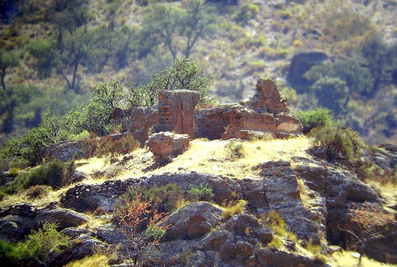
 |
| Ruins at Caniles |
This intersection appears to be regularly used by agricultural traffic, meaning there may be a build-up of mud on the road surface - as such, it's likely to be hazardous due to dust in dry weather and mud in wet weather. The day's first climb begins here, the long and mostly straight road allowing riders to see what lies ahead - which does no good at all to the morale of the sprinters. Once onto the mountain proper, it begins to snake around in order to make use of the topography and several unsurfaced tracks leading off into the scrubby forest provide further slippery hazards. The first hairpin comes at 1718m, carrying the road 10m upwards a few kilometres before a picturesque rock formation rises up from the trees. The 2030m summit comes a little way further onwards just as the peloton emerges from the trees and enters an open area, where there are stunning views across the valleys.
 |
| Abrucena's castle - or what remains of it, anyway. |
 |
| Castillo de la Calahorra, Spain's first Renaissance building |
 |
| Iglesia de La Anunciación, Alcudia de Guadix |
 |
| Guadix |
After another 5km, the riders reach Purullena with its medieval towers and more cave dwellings - these ones remaining large unspoiled as the tourist industry is on a far smaller scale here. The A-4100 is wide and straight as it continues into and through the town, but there are several raised humps before the sharp left turn onto the GR-4101 on the western edge of town, a road which winds its way south-west and though the village of Los Baños. It climbs gently until it reaches a narrow tunnel hewn into the rock - far too narrow for the pack to pass through en masse, so likely to spread it across a longer section of road - when it begins to descend into La Peza which can be seen clearly as the route follows the edge of a steep slope, before a wide hairpin drops it 20m.
Almost immediately upon entering town, the peloton turns right and progresses along the A-3201; the junction marking the start of the stage's penultimate climb, the Cat 3 Puerto de los Blancares. This route allows picturesque views through the narrow streets to the hill on the western edge of town, topped by the ruined remnants of the castle. Being located at the crossroads of two important medieval trading routes, la Peza was formerly a place of great importance and had many mosques during the Moorish period. According to legend, a monk named Marcos Criado - since made a saint - was sent to the town to preach Christianity to the Moors and persuade them to give up their Islamic faith; to which the Moors - quite understandably - took offence. The monk was tied to a tree and left for three days, after which his chest was cut open and his heart torn out. Held aloft so that all those watching the event - this sort of thing was what they had instead of soap operas in medieval times - couldn't possibly ignore the warning, it was seen to bear the letters chi and rho which began to glow, soon increasing to such brightness that all around were blinded. Though this has been declared a miracle, those of us of no religion or non-Christian faiths might consider that Marcus probably would have preferred his miracle to have taken place three days previously, perhaps involving supernaturally-weakened ropes and a speedy departure.
 |
| Embalse de Quentar. |
The parcours skirts around Quentar, takes in another hairpin and continues past Dudar as it makes its way along the valley. Soon, it reaches a junction with the A-4026, involving an extremely sharp left turn. As the junction is surrounded by trees and with upward slopes all around, it has the potential to be very slippery indeed when wet. The riders pass just south of a ruined factory, doubtless considerably more aesthetically pleasing now that nature is claiming it back than it was when it was still in operation, then enters Pinos Genil. The second intermediate sprint and the final climb both start on the outskirts of town as the A-4026 crosses a bridge and passes to the south before the gradient really begins, the road needing two hairpins to get it up to the junction with the A-395 heading east - and upwards.
 |
| Embalse de Canales |
At another hairpin the A-4025 heads east, but the peloton continues on the A-395 and reaches 2000m after another few kilometres, reaching the Sierra Nevada ski resort at 2300m after 170.2km.
Predictions: We're not too sure about this one. It'll be a climber, but the race is still too young to decide which one.
Weather: With two high mountains on the stage, riders will experience a lot of variation today. At present, forecasters predict 33C and sun at the start line with a light headwind. That will increase to a moderate headwind at the summit of the first climb, the temperature dropping to 21C and a chance of cloud. The wind, though still a headwind, should remain light right until the last climb with temperatures fluctuating between 30-34C depending on altitude and sunny. The final climb will see a stronger wind at the summit, temperatures down to 20C and possible rain at the top.
More Stage Previews: click here
No comments:
Post a Comment