 |
| Oion |
Stage Map: click here
Stage Profile: click here
More Previews: click here
Stage 17, at 211km, is the longest of this year's Vuelta - and as if that wasn't enough, it features two climbs that whilst not particularly harsh in comparison to some of those encountered in earlier stages are nevertheless a challenge, especially after two and a half weeks and very nearly 2500km of racing. Oh - and Peña Cabarga right at the end.
That one's a challenge whichever way you look at it.
The first categorised climb - there's an uncategorised lump just after 50km, too - is the Cat 3 Portillo de Bustos staring at 76.3km. The actual ascent is only 215m in 5.3km, not especially testing, but the 1000m summit is just high enough for the effects of altitude to begin having an effect and make the climb harder. The second is Cat 2 Portillo de Lunada, altogether a more formidable obstacle with an ascent of 475m in 8.5km and some very steep sections on the way up to the 1330m summit. Peña Cabarga, coming right at the end of the stage, is the real killer however. The top may only be 565m above sea level, but the climb starts at 20m and gets to the summit in 6.1km - to achieve that, there's some very steep bits along the way including a ramp at 19%; explaining how it is that this relatively small climb, more a hill than a mountain, came to be categorised as Especial.
 |
| This is where the magic happens: Rioja vineyards near Oion |
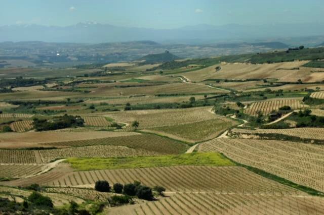
Our start town today is known to its Basque population as Oion, though it frequently appears on maps under the Spanish language name Oyón, derived from the Euskara word meaning "thick forest." There are no traces of the forest that the ancient Basques must have been talking about to be seen nowadays, though, as the land for miles around has long since been turned over to viticulture, an activity that began here before the Roman period - with the emphasis on the finest of all the region's exports, Rioja. One of the best-known of all Riojas is the world-famous Faustino V, a wine which we will heartily recommend, produced since 1861 by the venerable Familia Martínez Zabala who have today provided one of their seven vast wine warehouses to serve as the start of the neutral zone.
 |
| Parque del Ebro |
Having left the warehouse, the race travels directly south to join the N-111a, turning right towards Logroño. Three roundabouts - straight, slight left, straight - lead onto the Calle de Puente, a wide bridge that won't cause any problems. There's another roundabout just off the bridge and a right turn onto the Calle de San Gregorio. The road passes under a fly-over and becomes the Calle de Norte, curving gently to the left between two pedestrian crossings as it runs alongside the Parque del Ebro, past the Iglesia de Santiago El Real and arrives at another roundabout with a fountain. Right takes the peloton along the Calle del Marqués de Murrieta with a slightly tricky bend around an oval central section at a junction with the Av. de la Gran Via Rey Carlos Juan I. The grand Consevatorio de Musica is passed by on the right as the road becomes the LR-541 leading out through the suburbs and around a roundabout with a striking modern sculpture formed of tall iron ribs, then onward to the LO-20 and A-12 where the race begins.
 |
| Puente Mantible |
Logroño, a city of more than 150,000 people, is full of impressive sights dating to various times in a history that - according to legend - goes back to the days of Tubal, grandson of Noah, whom local myth says was the founder of the city. In reality, it is probably of Roman origin. That the Romans were here is in no doubt due to the many artifacts discovered around the city but what was here before them is little known - though the majority of Roman cities grew up on the sites of earlier Celtic/Iberian communities. The remains of a Roman bridge known as the Puente Mantible can still be seen. The city's jewel is the Concatedral de Santa María de la Redonda, of 9th Century origins but much remodeled over the centuries, standing by the Plaza de Mercado where on the 8th of November 1610 six women accused of being witches were burnt to death by the Inquisition.
 |
| Torre de Torremontalbo |
The route turns right onto the A-12, coming soon to a truck depot - a likely spot for diesel spillages, which are almost impossible to spot on the road surface and extremely slippery. After 5km, it becomes the N-232 and changes from motorway to two-lane highway, narrowing considerably. After 8km the peloton reaches Fuenmayor, entering the town along the Calle de Victor Romanos before turning left onto the Av. de la Ciudad de Cenicero and leading back to the N-232. There are more industrial sites to the west of the town, but as the road is poker straight for large stretches with wide bends elsewhere slippery patches shouldn't cause problems. Presently, the race reaches Cenicero, the site of a terrible rail accident in 1903 that left 43 people dead and more than 80 injured. After 21.5km we reach Torrementalbo, a village with seventeen inhabitants, one medieval tower and a palace.
 |
| Ermita de San Andres |
After passing straight through a large junction and by La Estrella with its monastery, we reach Briones and the Museo de la Cultura del Vino. As the town sits atop an 80m hill we'll have been able to see it for a while now, but it deserves a closer look - having been inhabited since at least the Bronze Age, it has much of interest. The 18th Century Palacio de Marqués de San Nicolás, currently doing service as the town hall, is of particular note; but the churches are the town's finest points. Among them are the Iglesia de Nuestra Señora de la Asunción, the Ermita del Cristo de los Remedios and Ermita de Santa Lucía - but perhaps the most picturesque of them all is the tiny, ruined Ermita de San Andres. After 35km from the start, just beyond the little village of Gimilio, the road splits as the N-232 heads south.
The race continues straight ahead along the N-124 and, less than two kilometres later reaches Haro where yesterday's Stage 16 came to an end. It passes alongside an industrial area, soon reaching a roundabout and turning left onto the Av. Logroño. Once over the next roundabout, the road becomes the Av. Juan Carlos I leading into the Plaza Manuel Bartolomé Carrio. A right corner brings the peloton to the Calle de los Castañares de Rioja, the second corner on the left turns onto the Av. Bretón de los Herreros or LR-202 with several speed humps leading out of the city and, 5km ahead, to Anguciana - a route that seems rather familiar, because it's the same one as yesterday but in reverse.
 |
| Castle, Pancorbo |
With 63.2km ridden, the riders reach a junction and turn right to rejoin the N-232 as it heads north-west to Pancorbo; a town famous primarily for the natural beauty of its surroundings, lying in a gorge running through a forested ridge of craggy rocks. However, it's known also for its castle, El Castillo de Santa Marta. Built to take advantage of the natural defensive opportunities offered by the rocks upon which it stood, the castle now lies in ruins and from a distance is all but indistinguishable from them - close up, the remains add an interesting aspect to the already fascinating landscape. For those with an interest in more modern military history, the late 18th Century Fortaleza de Santa Engracia lies on the opposite side of the gap to guard the route should a feared invasion by the Revolutionary Army of France materialise. Having turned right at a large roundabout south of the town, the race reaches a junction and turns left - rather a pity, as the N1 road leading north-east through the gorge is widely considered one of the most beautiful highways in Spain (
which you can see if you click here). After approximately 300m, the parcours turns left again onto the N1 heading north-west to Santa María Rivarredonda, passing straight through and on past Cubo de Bureba and Fuentebureba until reaching a junction after 76.3km at which the peloton briefly join the BU-521; almost immediately leaving it when they turn right onto the BU-504. The first climb, 315m to the 1000m summit of Cat 3 Portillo de Bustos, begins at the turning.
To get there, the race must first pass Busto de Bureba and, having arrived back at the N-232, turn left and travel along it for 200m to a right turning onto the BU-520. The first section is straight, then a series of wide bends rise to first 800 and then 900m before the road turns north-west and heads into forest, reaching the summit as it merges from the trees. A dirt track joins from the right, raising the possibility of mud on the road if it's used by the local farmers and 4x4 enthusiasts. A short way ahead is a bend of medium difficulty leading into a twisty section just before a pair of hairpins - the second, being tighter and dropping 16m, is the trickier of the two. A final right-hand bend leads to a crossroads at La Aldea del Portillo de Busto, where the peloton turn a sharp left to join the BU-V-5203. The parcours becomes straight and easy again as the race approaches Barcina de los Montes, 88.8km from the start, though there's one fairly tight left-hand bend just inside the village.
Having left Barcina behind, the race enters a wide and thickly forested canyon leading to Penches, then Oña around a kilometre further ahead. On the very edge of the village the peloton turns right, then right again to rejoin the N-232 - both corners are sharp and potentially hazardous due to the very steep rockface to the east which may result in mud and gravel on the road surface. The route how passes through another area known for its great beauty.
Just over a kilometre ahead are three tunnels: the first is short and bends to the left, the next two are approximately 100m long. The stage details do not state whether or not they're lit, meaning it's likely that they are. With 102km ridden, the N-629 joins from the right, running parallel to the N-232 for a short while. At the junction, the riders turn through 180 degrees and double back on themselves before it bends off to the north. The feeding station lies on this road, not far from the Cueva de los Portugueses - dwellings built into caves, believed to have been inhabited between the 8th and 10th Centuries and then temporarily providing homes for workers digging the canal at Trespaderne in the 20th Century.
 |
| Convento de las Clarisas, Nofuente |
Trespaderne - Trespader
me in Vuelta road-bookese - has a castle, originally built by the Romans and then rebuilt with contemporary improvements during the early Medieval period, making it the oldest in Spain according to most guides. There are traces of far older communities, dating into the Middle Palaeolithic, in the rocky valleys nearby - unguided visits are strongly discouraged, tours guided by experts can be arranged at the town hall. The race enters the town across a narrow bridge, a possible trouble spot of too many riders attempt to cross at the same time or fail to brake in time for the bottleneck that may potentially form immediately before it, then takes a very tight left turn followed by a 90 degree right into the centre. The route is straight, climbing slightly to Nofuentes where the Convento de las Clarisas combines elements of typically Spanish and North European ecclesiastical architecture, demonstrating that the race is passing through an area that has been a part of Spain as a political entity only since comparatively recent times.
 |
| Alcázar de los Condestables de Castilla |
A series of small villages - Moneo, Bustillo de Villarcayo, Villacomparada - pass by, then the route comes to Medina de Pomar. When the Arabic term "medina" - meaning a walled city - appears in a place name, potential visitors can be certain that the town bearing it is worth seeing - it denotes a strong Moorish presence in times gone by, and if there's one thing we've learned so far during this Vuelta it's that the Moors contributed some of the most beautiful and impressive architectural, artistic and cultural heritage to Spain. Today, little trace of the Moors is left, but the the statement regarding medinas is rarely more true than it is in this stupendously attractive and intriguing town of a little over 6000 people - for a start, it has what must surely be one of the most imposing castles anywhere in Europe in the 14th Century (and therefore post-Moorish) Alcázar de los Condestables de Castilla. There is also the Monasterio de Santa Clara, an enormous complex established in the same century as the castle and today inhabited by a community of Poor Clares; the Ermita de Nuestra Señora del Salcinar y del Rosario with what is said to be the most beautiful graveyard in Burgos and the Arco de la Judería, an ancient gate leading into the narrow medieval streets that once formed the town's Jewish Quarter. It's also the hometown of Ángel Castresana, professional cyclist from 1998 (including three years with Euskaltel-Euskadi) until retirement in 2007.
 |
| Palacio de Chiloaches |
When it arrives at Medina de Pomar, the Vuelta is on the wrong side of the river. It crosses at the second of three bridges, leading directly onto the Av. de Burgos into the town centre before becoming the Av. de Bilbao leading back out again. It passes through the western end of the strung-out village of Quintanilla de Pienza before arriving at Revilla de Pienza after riding 135.2km and Barcenillas de Ribero and El Ribero shortly afterwards. At El Crucero, a vast roundabout where several roads come together, the peloton turn left onto the BU-542 and bypass Loma de Montija, encountering a level crossing - always potentially hazardous and a likely spot for punctures - 0.7km before Espinosa de los Monteros, entered along the Calle de Progreso leading to the straight but slightly uphill Calle del Sol and the first of the stage's intermediate sprints. Espinosa is one of the many little towns scattered about the Spanish countryside that has been overlooked by tourists, but there is a great deal to see here - as would be expected in a town that can trace its history back to 800 BCE. In fact, it's difficult to pick a building to serve as the town's best - should it be the medieval Torre Ilustre, looking in need or urgent care; the 12th Century Torre Berrueza which has been more fortunate and, fully restored, now houses a hotel; the fortified 16th Century Palacio de los Fernández-Villa; the grand Renaissance Palacio de Chiloeches which spent time as a garrison for Napoleon's troops or the 14th Century Torre de los Monteros? And that's only a few of the interesting sites about town.
Just north of the town, once the road has become the BU-570, is a spot offering some of the finest views in Spain - the wide-open vistas of the mountains are breath-taking. There's also a snow plough, fitted with an enormous rotor that has no obvious use on the back, rusting away on a concrete plinth next to the road. The race passes through Bárcenas and reaches a 90 degree left turn leading onto a narrow bridge as it enters Las Machorras. Shortly afterwards the peloton reach a right turn onto the BU-572. Another narrow bridge comes after 0.3km, also marking the beginning of the Cat 2 Portillo de Lunada with 475m of climbing up to 1330m.
The climb is made up of long, straight sections until reaching La Lusa, at which point it becomes twistier and climbs more rapidly to reach the highest point just as the road becomes the CA-643 which the race follows for more than 14km as it loops back and forth to find its way back down the mountain. There's only one hairpin of any note but it's a tricky one, very tight and dropping 15m - however, ignore the riders here and concentrate on the view: not to be missed. Having negotiated a 90 degree left bend, the road traverses a near-vertical cliff - a spot where the riders will be taking very great care not to crash, not do anything else that might cause them to come off the road because it's a very long way down. The next hairpin is less challenging but leads into a steep descent to below 1000m, followed by a tighter one, a 90 degree left and a long curve into a twisty section. With 176.5km ridden, the peloton change onto the CA-260 at the foot of a steep and craggy cliff just before San Roque de Riomiera and after 2.1km, another narrow bridge.
 |
| La Casa de Miera-Rubalcaba. |
After another few kilometres, the CA-641 becomes visible on the left just as it enters a section featuring ten very tight hairpins in 0.5km - the riders will be glad they're not on that road, the spectators will hope it's included in a future stage. It joins the route which enters a deep gorge leading to Mirones and through another - perhaps even more impressive due to the greater height of the cliffs either side - gorge, and reaches Mortesante 185.5km from the start. A 90 degree left comes a little later, followed by straight sections towards Rubalcaba - a little village made famous by the la Casa de Miera-Rubalcaba, a house declared to be of Interés Cultural - Cultural Interest - in 1994. The road into Liérganes, a short way ahead, is extremely narrow en route for the centre of the village, potentially causing a pile-up and crashes, but then opens up again before leaving and heading towards a roundabout. The peloton turn right here onto a route that the road book says is the CA-640 but our maps call the CA-651, heading into Hermosa and including a hairpin along the way. There's a series of tricky bends on the way through the village, then the route straightens out as it approaches Valdecilla. Following a very tight left - another hazardous point - the peloton turn right at a roundabout to travel along the N-635 or Av. de Santander - the location of the second intermediate sprint.
 |
| Peña Cabarga |
After passing under the A-8 motorway and turning left at a roundabout to travel west and along the top of a dam, the race enters Heras, passing stright through on the wide and easy road. It then enters an industrialised area - hence possibility of diesel on the road again.
At this point, the road book becomes a little vague once again. The directions state to use the CA-412 after traveling 2.6km from the dam, then turn off to the left after 0.9km - however, doing so would bring the race to Socabarga which has no connecting road to the top of Peña Cabarga other than that already traveled and travels further than 2.6km. There are various turn-offs along the CA-412, leading into a network of narrow roads winding about the various hamlets and farms between the motorway and mountain but none seem to bear much resemblance to the directions and, while some do extend onto the mountain, they turn into tracks and don't reach the correct altitude. Since Vuelta itineraries and directions sometimes require - how shall we put this? - a little "creative interpretation," we think that the route is more likely to pass through Heras on the N-635 leading to the CA-412, then turning left at the first roundabout rather than the second - this measures out at 2.6km, but isn't the CA-412 according to either of our maps or Google Earth. It also takes the race along the road that does lead to the top of the mountain and thus seems to be the correct route.
A left turn just before Santiago leads into a sweeping 180 degree bend, then to a fork. The right-hand option leads to a straight road through forest and rising approximately 100m, followed by a 90 degree right onto another slightly less straight section rising approximately 95m. A series of bends - 90 degrees left, 80 degrees right, slight right followed by a 90 degree right and 90 degree left within a few metres of one another - lead around buildings, then a slight right leads up to four hairpins prededed by a tight 90 degree right. The first, left, rises 9m; the second, right, 7m; the third, left, 7m and the fourth, right, 6m - and is much wider and approximately 90m away from the earlier three which come in close succession. In 300m, the riders come to a tight but unchallenging right-left Z-bend; then enter the final section with gentle bends right and left and a steep ramp to the finish, 565m above sea level and 211km from the start of the race.
The mountain is topped by a huge camera obscura in which an image created with light gathered via the lenses at the top of a tall tower are projected onto the walls of a circular room below, creating a 360 degree panoramic image of the surrounding landscape which includes the Bay of Santander and the higher mountains to the sourth-east.
Video: Vuelta '10
Predictions: Peña Cabarga was last climbed in Stage 14 of the 2010 Vuelta and won by Joaquin Rodriguez - who will be wanting to regain some of the success he enjoyed in earlier stages of the race... or at least, that's what we thought when we wrote this article. Since then, Cobo managed to climb Angliru without even running out of breath - for that reason, we'll spread out bets between Rodriguez, Cobo and Moncoutie. We'll be expecting Wiggo to do well as well today - he was always a superb all-rounder, but with his recent transformation he could make a valuable move back towards GC leadership over this parcours.
 |
Stage 14 2010 (yellow) and Stage 17 2011 (pink) overlaid for comparison.
Stage 14 was 32.2km shorter, 178.8km compared to 211km. |
Weather: Temperatures should be a little cooler than they were in Stage 16, though not as cool as some of the last few stages. Expect around 22C at the start, rising to a high of 25C at the bottom of the far slope of that first climb. The lowest temperature anywhere on the parcours, at the summit of Portillo de Lunada, should be no lower than 18C. It'll rise to around 23C as we drop down to near sea level beyond the descent. Gentle crosswinds are likely for the first 70km, so all those echelon fans will probably get a treat. However, they'll change to gentle headwinds for the remainder of the stage. Once again, no rain is expected anywhere along the route and it should be sunny from start to finish.
More Stage Previews: click here


No comments:
Post a Comment